Cloud Structure In Satellite Images
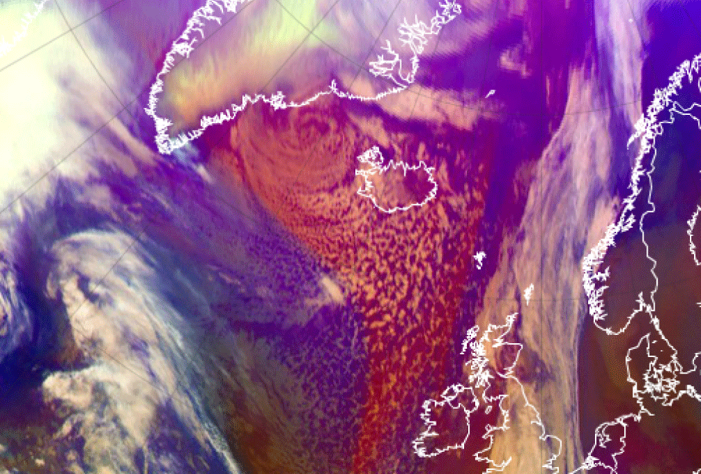
Piteraqs occur in a certain synoptical environment: a low pressure between Iceland and Greenland is moving westward.The low pressure can be an occluded cyclone, a polar low or a large and intense comma. Polar lows and commas occur within cold polar or arctic air masses, whereas occluded cyclones are situated within a very dry and cold airmass originated from the lowest layer of stratosphere. The Meteosat Airmass RGB image from 16 Feb 2015 below shows not only the clouds, but also the cold air mass. The very cold and dry stratospheric air is seen reddish within blue polar air.
|
16 February 2015/12 UTC - Meteosat Airmass combination
|
|
|
|
Appearance in high resolution images
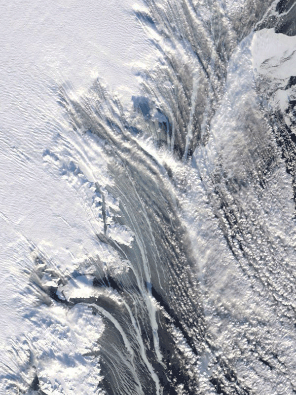
Cold, dry katabatic winds cannot be seen as such in satellite images. They can be sometimes detected, however, in very high resolution visual images as white tendrils of drifting snow over the dark sea, or as trails of foam on the crest of the waves.
|
16 February 2015 - Modis image: snow and foam on the sea near Tasiilaq
|
|