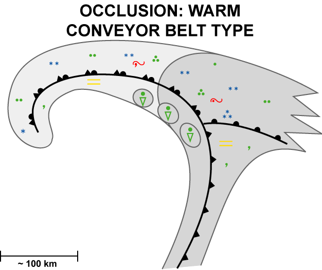
Weather Events
| Parameter | Description |
| Precipitation |
|
| Temperature |
|
| Wind (incl. gusts) |
|
| Other relevant information |
|
|
|
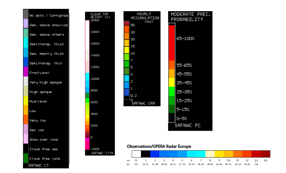
Legend:
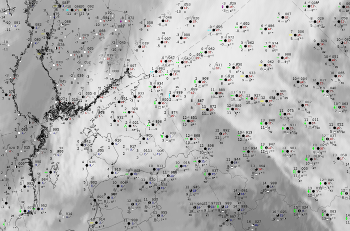
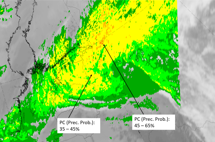
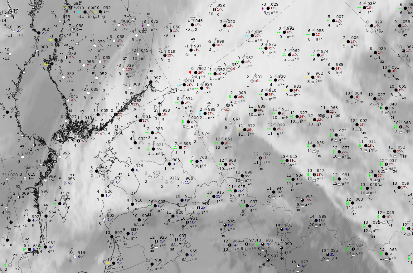
5 November 2019 at 12UTC: IR + synoptic measurements (above) + probability of moderate rain (Precipitting clouds PC - NWCSAF).
Note: for a larger SYNOP image click this link.
The cloud band of the WCB occlusion shows wide spread precipitation, Cb and shower reports from synoptic measurements. The probability of moderate rain from the NWCSAF analysis is widespread - up to 45 % (which can, according to the NWCSAF analyses evaluations, already be connected with precipitation). Smaller areas and spots with higher analysis probabilities are connected to corresponding Cb and even to thunderstorm reports.
|
|
|
|
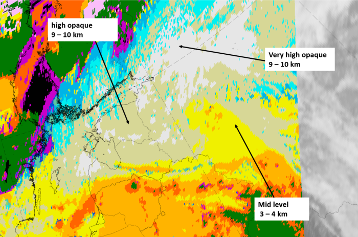
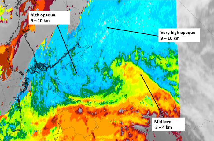
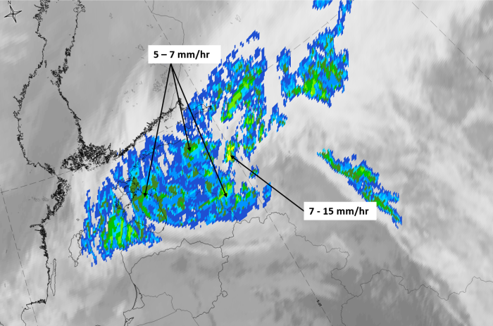
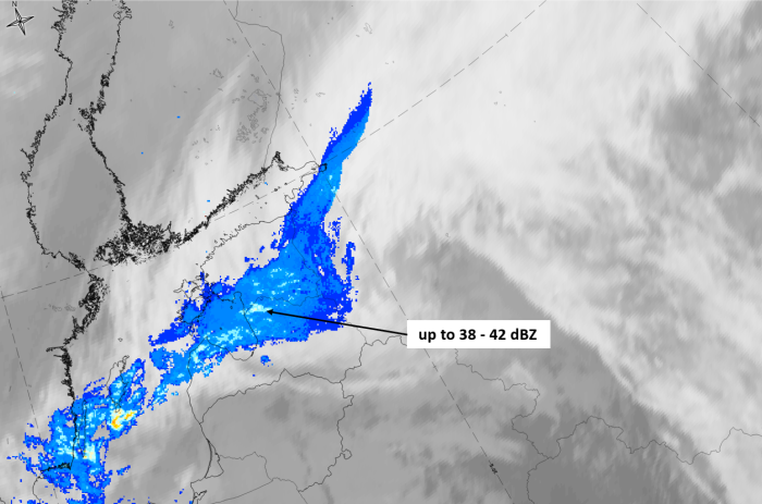
5 November 2019 at 12 UTC
1st row: Cloud Type (CT NWCSAF) (above) + Cloud Top Height (CTTH - NWCSAF) (below); 2nd row: Convective Rainfall Rate (CRR NWCSAF) (above) + Radar intensities from Opera radar system (east part lies outside of the Opera area) (below).
For identifying values for Cloud type (CT), Cloud type height (CTTH), precipitating clouds (PC), and Opera radar for any pixel in the images look into the legends. (link).