Key Parameters
- Absolute topography at 500 and 1000 hPa:
The absolute topography at 1000 hPa is characterized by a low in the height field in the centre of the cloud spiral. In the initial stage the absolute topography at 500 hPa shows already a very pronounced upper level trough which very soon develops into a closed circulation. This is a main difference from the Occlusion of the Cold Conveyor Belt Type (see Occlusion: Cold Conveyor Belt Type - Key parameters ). - Equivalent thickness:
A prominent feature is the ridge of the equivalent thickness which is the consequence of the lifted warm air. In the case of well developed deep lows even a spiral structure of the ridge can be observed. But there are also situations which deviate from the distinct ridge structure. Well developed forms of Warm Front Occlusions and Cold Front Occlusions may lead to a more pronounced thickness gradient in the area of the Occlusion. This can be observed much better in the vertical cross section (see Typical appearance in vertical cross section). - Thermal front parameter (TFP):
The thermal front parameter mostly can be found close to the rear area of the cloud spiral. But the very existence of a front parameter depends on the existence of a pronounced temperature gradient. - Temperature advection:
The whole cloudiness of the Occlusion is under the influence of warm advection. The warm advection maximum can be found in the centre of the cloud spiral, mostly close to the point of the Occlusion. The zero line of the temperature advection follows the rearward edge of the Occlusion cloud spiral - Zero line of the shear vorticity at 300 hPa:
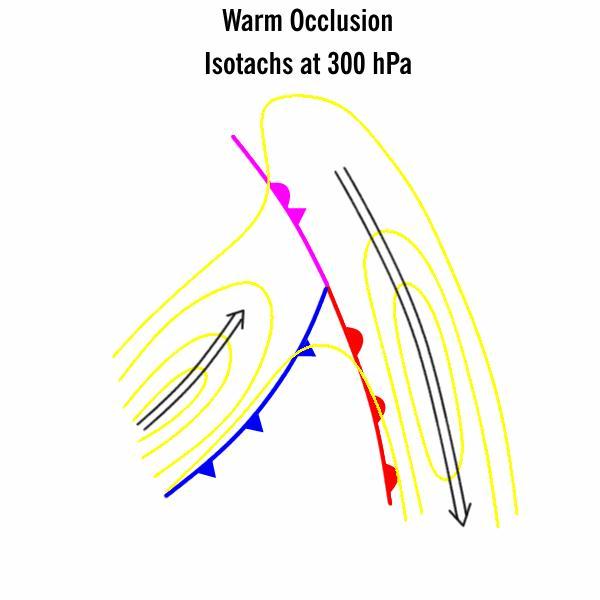
The zero line of the shear vorticity, which also indicates the jet axis, follows the edge of the cloud spiral. - Isotachs at 300 hPa:
As the jet stream does not cross the Occlusion cloud band, the isotachs show a minimum of wind speed in the area of the point of the Occlusion. Typically, two pronounced jet streaks can be found parallel to the rear cloud edge of the cold front as well as to the leading cloud edge of the Warm Front. - Vorticity advection at 500 hPa and 300 hPa:
The cloud spiral of the Occlusion is in general superimposed by PVA in the mid-levels of the troposphere. The maximum values can be found very close to the rear cloud edge (see Meteorological physical background and Weather events).
The case of 19 February 1998 shows a rather untypical upper level field with a small scale trough. The case of 21 October 1996 shows the more typical configuration.
|
19 February 1998/12.00 UTC - Meteosat IR image; magenta: height contours 1000 hPa, cyan: height contours 500 hPa
|
|
|
|
|
21 October 1996/12.00 UTC - Meteosat IR image; magenta: height contours 1000 hPa, cyan: height contours 500 hPa
|
|
Equivalent thickness and TFP
|
19 February 1998/12.00 UTC - Meteosat IR image; blue: thermal front parameter 500/850 hPa, green: equivalent thickness 500/850 hPa
|
|
|
|
Temperature Advection at 700 hPa
|
19 February 1998/12.00 UTC - Meteosat IR image; blue: thermal front parameter 500/850 hPa, red: warm advection 500/1000 hPa
|
|
|
|
Vorticity advection at 500 hPa
|
19 February 1998/12.00 UTC - Meteosat IR image; green: positive vorticity advection (PVA) 500 hPa
|
|
|
|
|
19 February 1998/12.00 UTC - Meteosat IR image; yellow: isotachs 300 hPa, black: zero line of shear vorticity 300 hPa, red: positive vorticity advection (PVA) 300 hPa
|
|
|
|
Zero line of the shear vorticity at 300 hPa
|
19 February 1998/12.00 UTC - Meteosat IR image; blue: shear vorticity 300 hPa, brown: curvature vorticity 300 hPa
|
|
|
|
In literature several sub-types of Occlusions according to the Norwegian model can be found. They refer to mature development stages and their discrimination cannot be based on cloudiness in satellite imagery but on useful numerical key parameters. The following summary of such sub-types ismainly based on work carried out at the Finnish Meteorological Service (FMI).
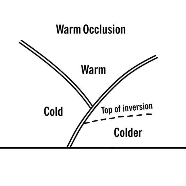
Warm Occlusion Type
Warm Occlusion types are characterized by a Warm Front - like crowding zone of isentropes in low layers. They are typical for western Europe and Scandinavia especially in winter.
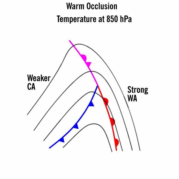
|
The temperature gradient is strongest in front of the Warm Front and the Occlusion.
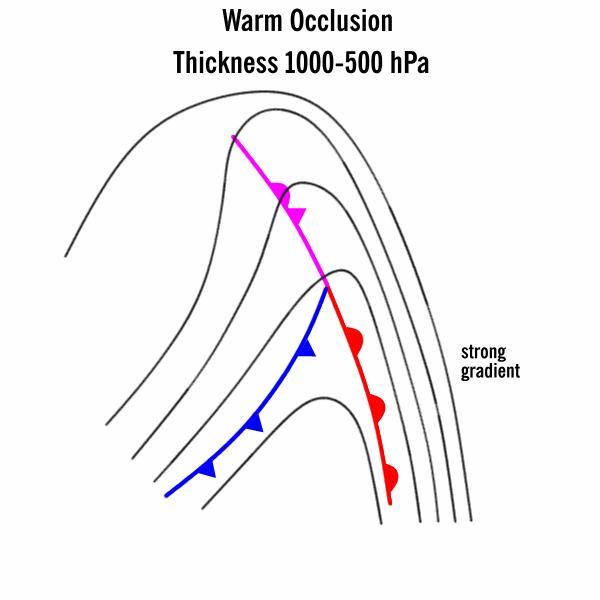
|
The thickness gradient is stronger in front of the Warm Front and the Occlusion.
|
The jet stream is weakening over the Occlusion and there is a uniform jet stream in front of the Warm Front and the Occlusion.
|
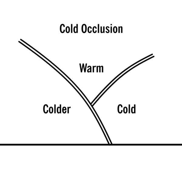
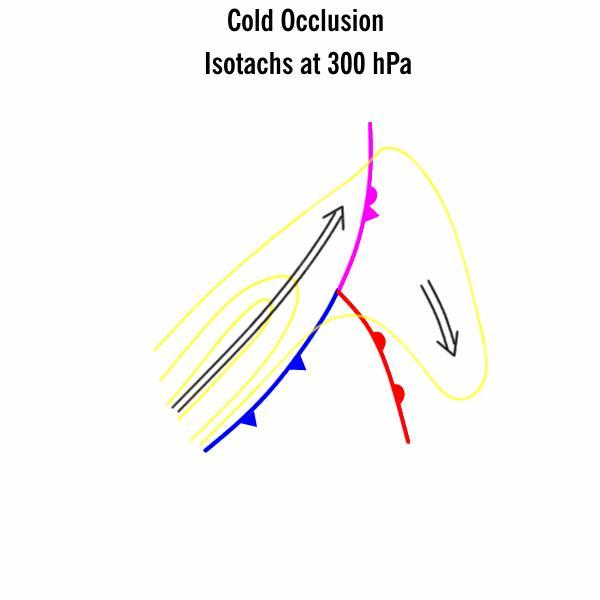
Cold Occlusion Type
Cold Occlusion types are characterized by a Cold Front like crowding zone of isentropes in low layers. They occur mainly in the eastern parts of large continents such as North America and Asia, especially during cold seasons. In Europe Cold Occlusions often can occur during warm seasons when colder air propagates from sea over warm continent.
|
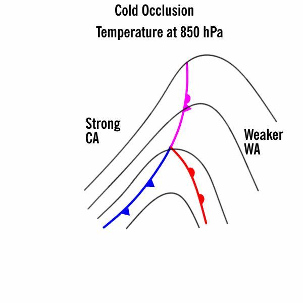
The temperature gradient is strongest in the rear of the Cold Front and the Occlusion.
|
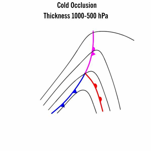
The thickness gradient is stronger in the rear of the Cold Front and the Occlusion.
|
The jet stream is weakening over the Occlusion. A separate weaker jet stream is only in front of the warm front. The jet stream in connection with the Cold Front turns in the rear of the Occlusion towards the cyclone centre.
|
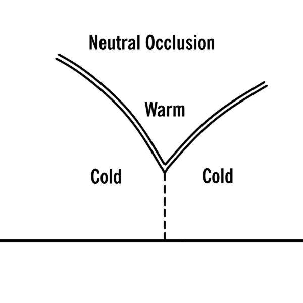
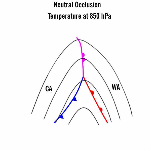
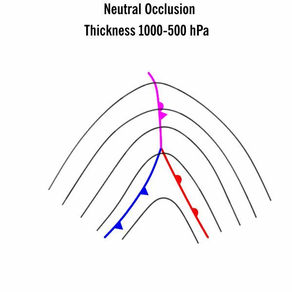
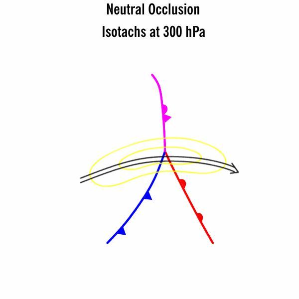
Neutral Occlusion Type
Neutral Occlusions are only upper level features. They are not so common.
|
The temperature gradient is equal on both sides of the Occlusion.
|
The thickness gradient is equal on both sides of the Occlusion.
|
The jet crosses the cloud band at the Occlusion point.
|