Cloud Structure In Satellite Images
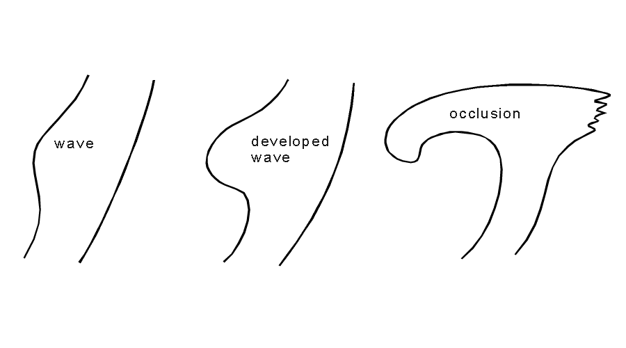
As already mentioned in the general remarks, the cloud band of the occlusion described in this chapter is the result of a classical wave development (see Wave) represented by a growing multilayered cloud spiral.
Appearance in the basic channels:
At the fully developed stage the following points can be summarized:
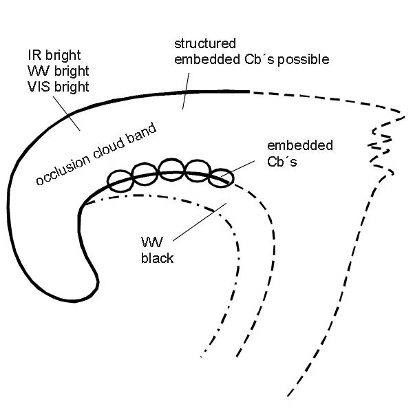
- The IR, WV and VIS images show a cyclonically-curved synoptic-scale cloud spiral, which originates from its genesis connected with the cloud band of the cold and the warm front.
- In the VIS image the cloud spiral is white indicating cloudiness with high albedo.
- In the IR image the grey shades can vary between grey and white with the brightest cloud tops in the transitional area between the cloud band of the cold front and the occlusion, where the point of occlusion can be found. Often, grey shades become continuously darker downstream towards the centre of the spiral. This is due to the already descending conveyor belts within the mid- and upper levels of the troposphere (see Meteorological physical background). In most cases the cloud tops within the cloud spiral are characterised by a structured appearance.
- The WV image is characterised by high pixel values (white) within the frontal cloudiness. The rear cloud edge of the cloud spiral is characterised by a sharp gradient from white to black, caused by dry descending air within the relative stream of the dry intrusion (see Meteorological physical background).
- Convective cells and even Cb clouds may be embedded within rearward cloud edge of the cloud spiral. This is a preferred area for Cb development, because of a potentially unstable stratification of the troposphere caused by the different relative streams (see Meteorological physical background and Weather events).
Appearance in the basic RGBs:
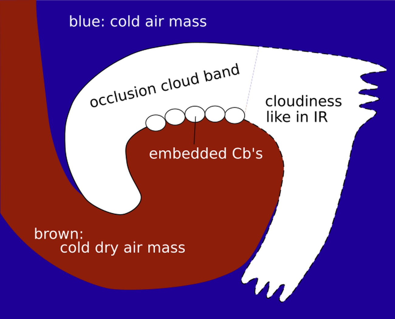
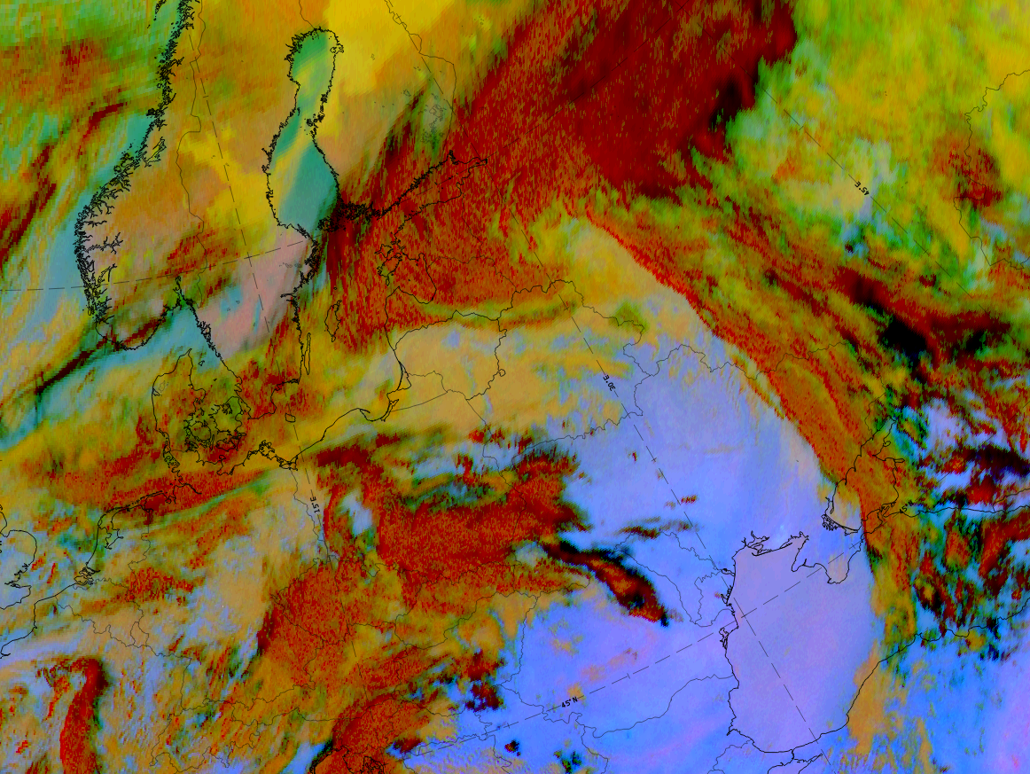
Airmass RGB
At the rear of the occlusion spiral there are dark blue and brown colours representing the cold and dry air. Immediately at the rearward side of the CF cloud band, as well as in the centre of the cloud spiral, the brown stripe is usually very intense in colour.
The cloud band and spiral looks very similar to the IR images but in the innermost part pf the spiral a brown shade region can be overlaid, which represents overflowing cold and dry air.
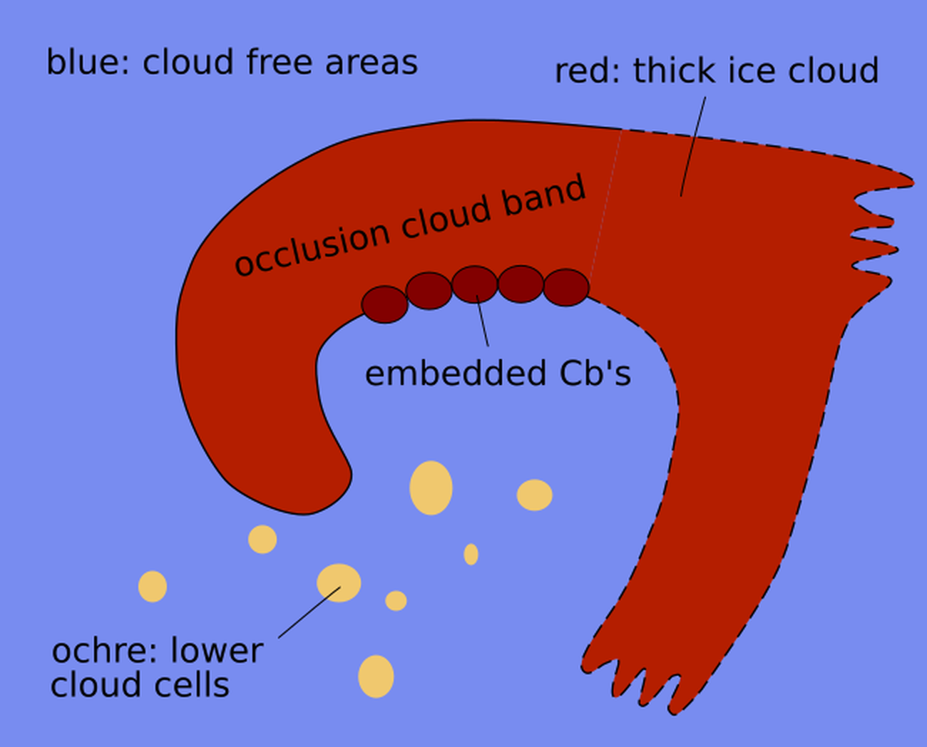
Dust RGB
The Dust RGB shows pinkish-blue colours - representing a cloud free region. Frequently there are low cloud patches, as well as cold air cloud cells, which show up in yellow-brown colours.
The cloud spiral in case of a WCB occlusion shows dark-red and structures colours according to the convective character of the thick ice cloudiness.
 |
 |
Legend: schematics for basic RGBs, Left: airmass RGB; right: dust RGB
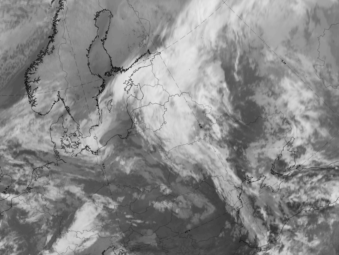
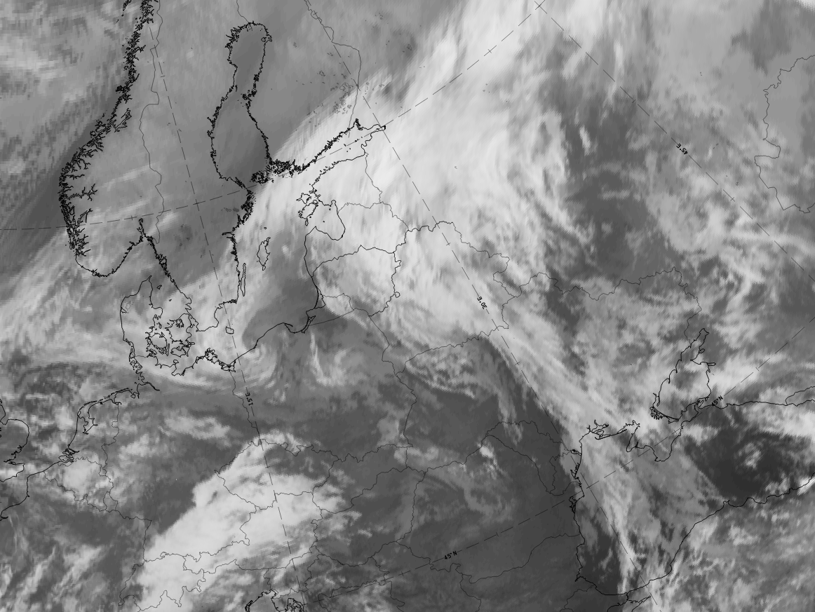
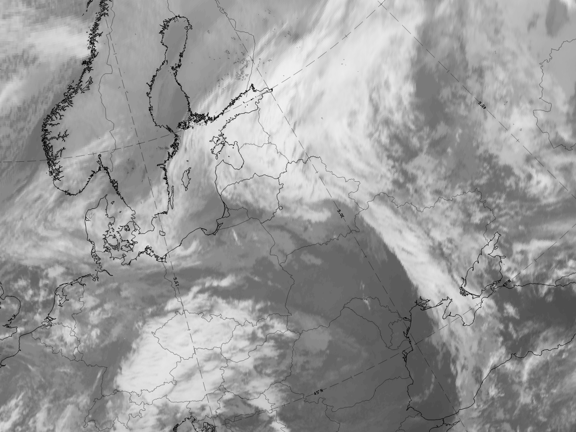
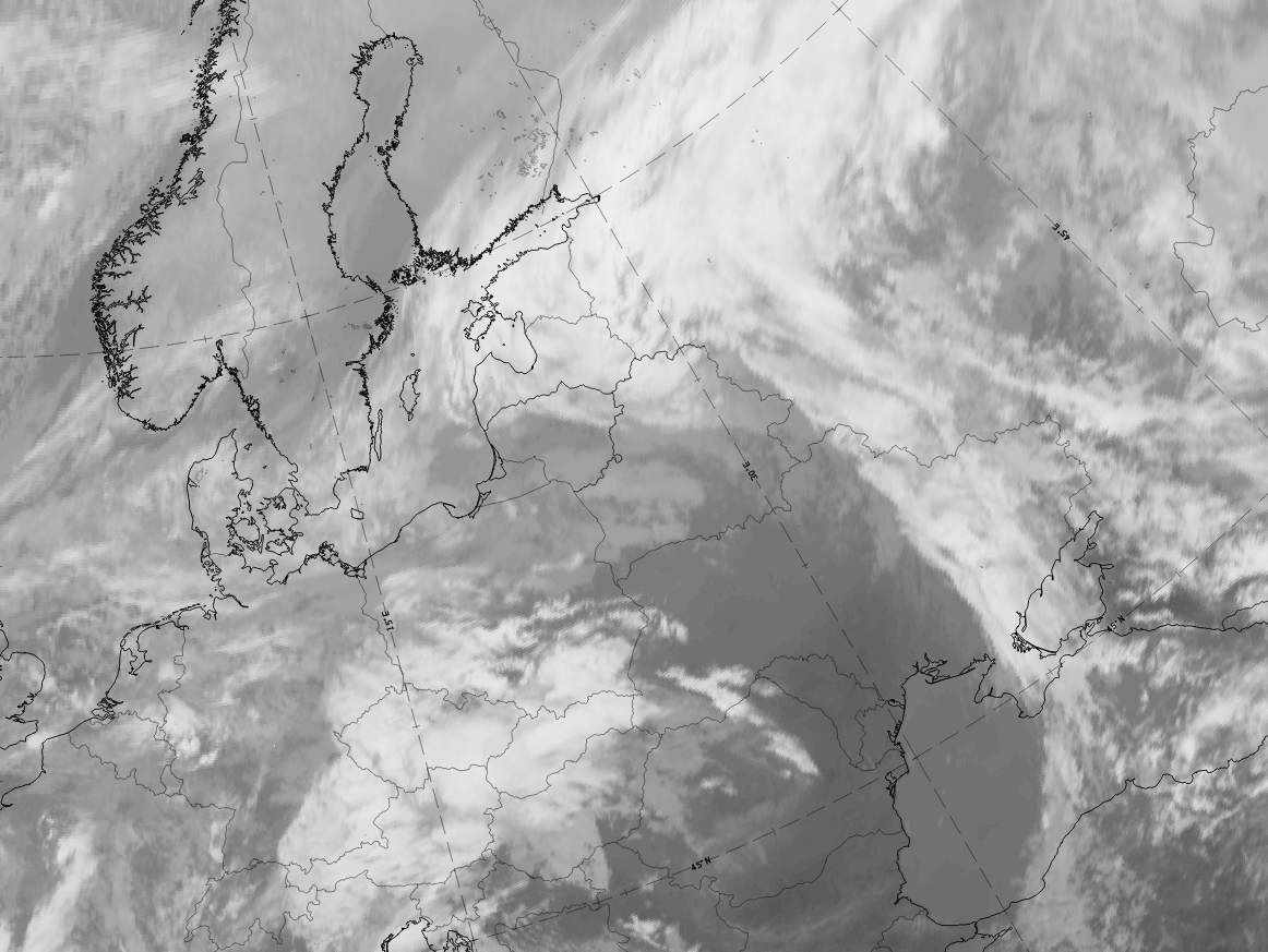
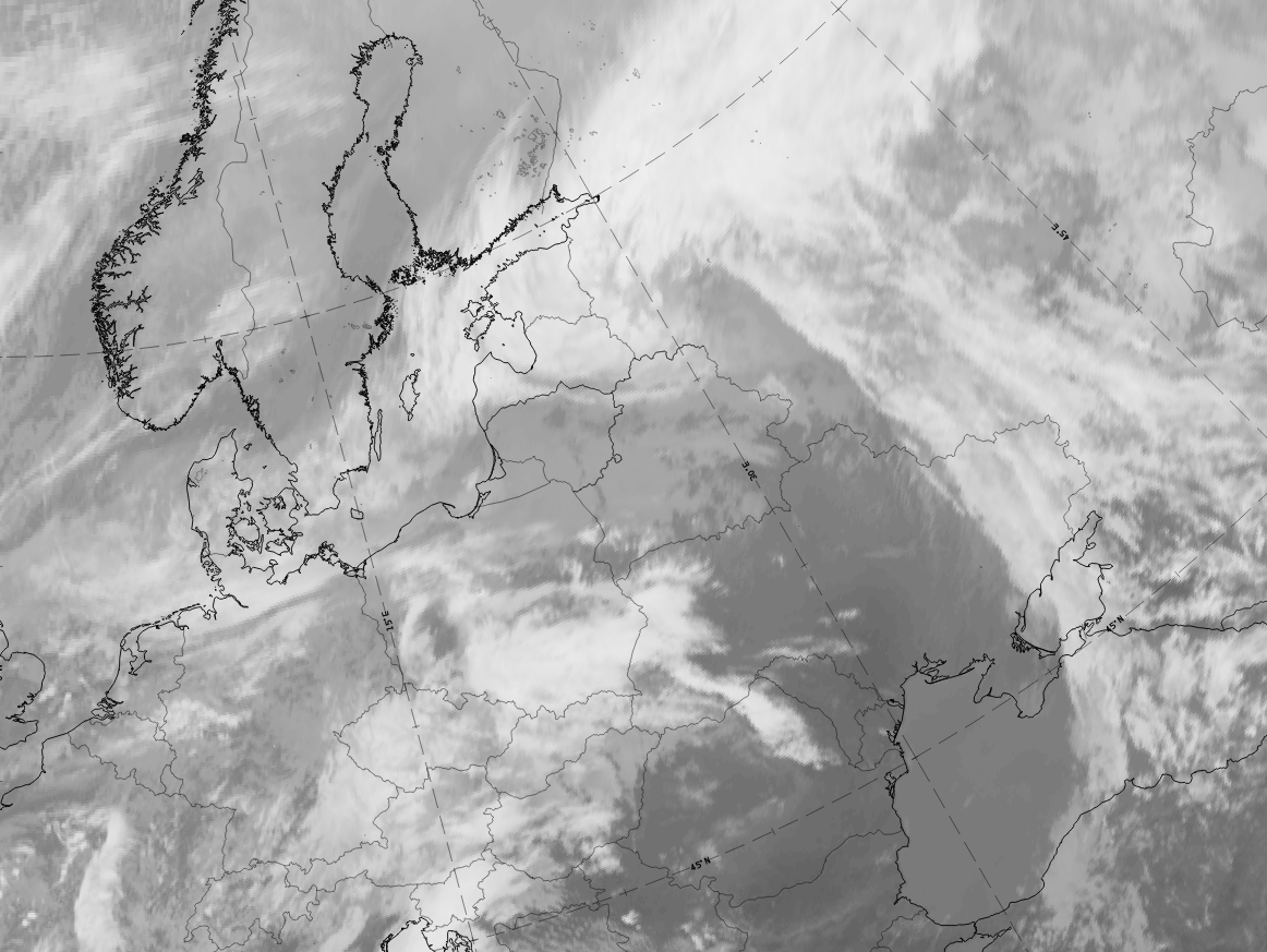
The case from 5 November 2019 shows that between 00 and 15 UTC, a development from a wave stage over Lithuania and Belarus transitioned to a fully developed occlusion spiral extending from Russia across the Baltic States into the Baltic Sea.
 |
 |
 |
 |
 |
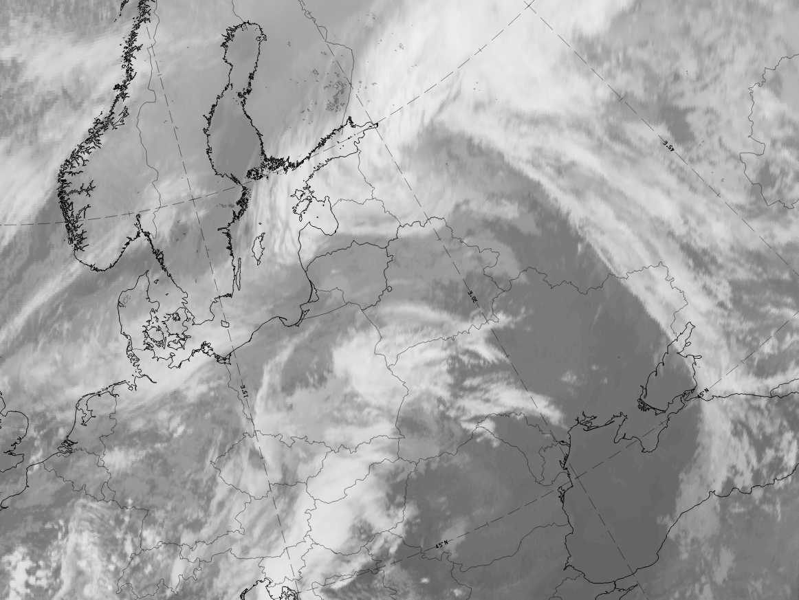 |
Legend: 5 November 2019, IR images, 3 hourly from 00 to 15 UTC.
*Note: click on the image to access the image gallery (navigate using arrows on keyboard)
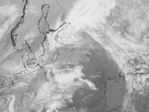
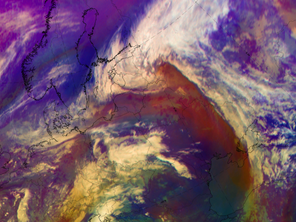
The fully developed stage of a warm conveyor belt (WCB) occlusion can be seen in all basic channels and RGBs at 5 November 2019 at 12 UTC.
|
|

|
|

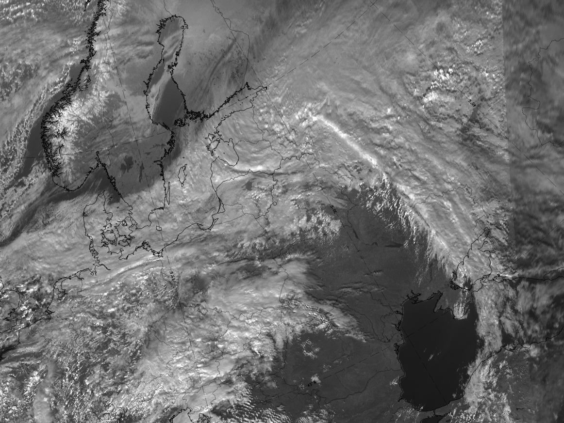
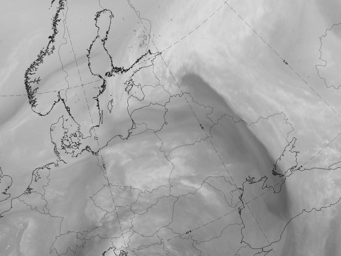
5 November 2019/12UTC: 1st row: IR (above) + HRV (below); 2nd row: WV (above) + Airmass RGB (below); 3rd row: Dust RGB + image gallery.
*Note: click on the Dust RGB image to access image gallery (navigate using arrows on keyboard)
| IR | Bright and structured clouds; cellular pattern at the inner part of the cloud spiral. |
| HRV | Bright and structured clouds; cellular pattern at the inner part of the cloud spiral. |
| WV | Bright and structured clouds; black stripe along the rear edge of the CF and within the inside of the spiral. |
| Airmass RGB | The WCB cloud spiral is similar to the IR image; a dark brown stripe at the rear of the CF cloud band corresponds to the black stripe in WV. |
| Dust RGB | Dark red coloured structures indicate thick ice cloud. |