Weather Events
| Parameter | Description - Open Cells | Description - Closed Cells |
| Precipitation |
|
|
| Temperature |
|
|
| Wind (incl. gusts) |
|
|
| Other relevant information |
|
|
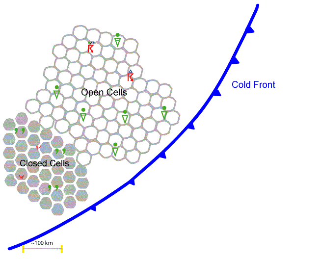
For demonstrating the weather situation two examples are shown: one for open cellular convection and one for closed cellular convection.
 |
 |
Legend:
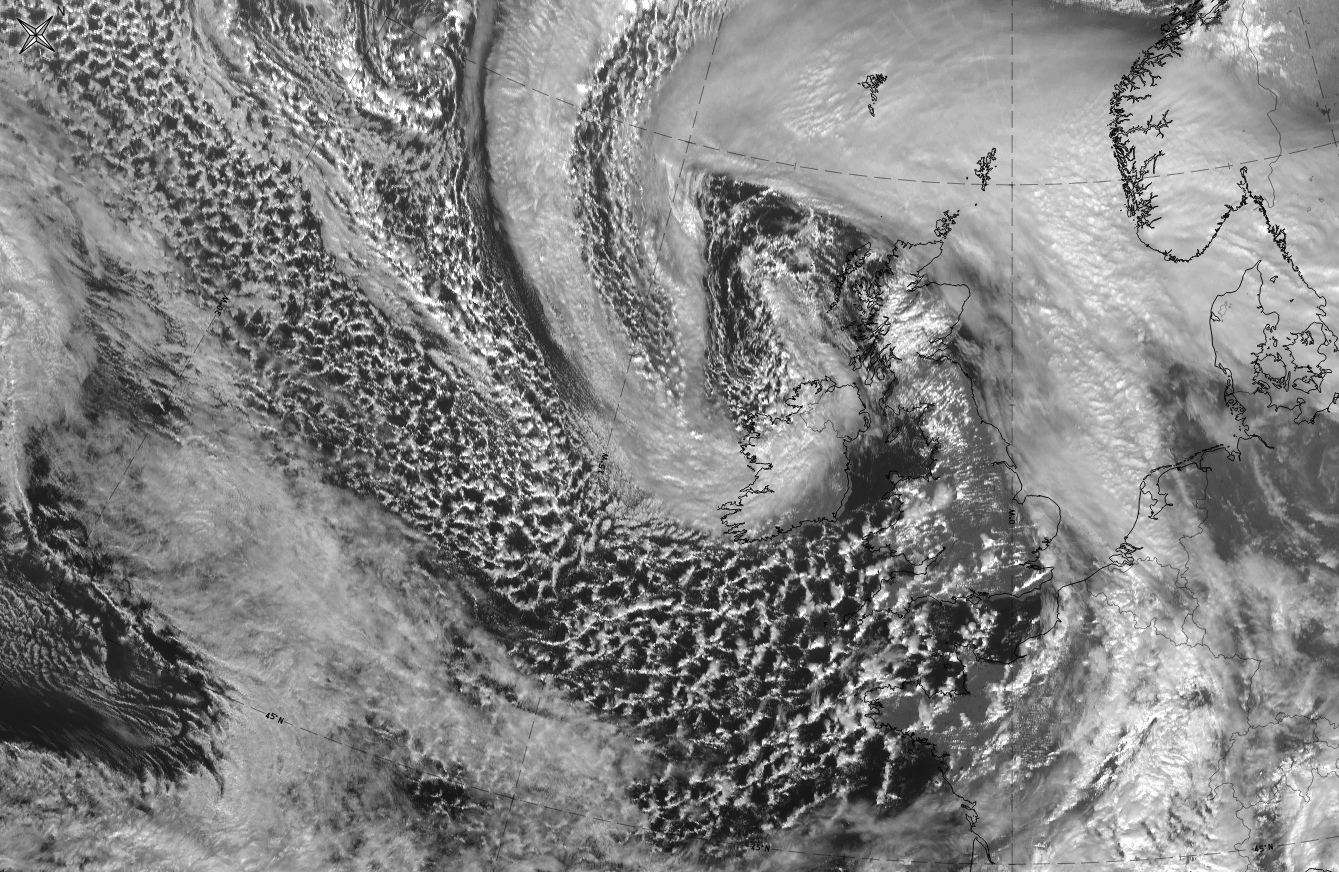
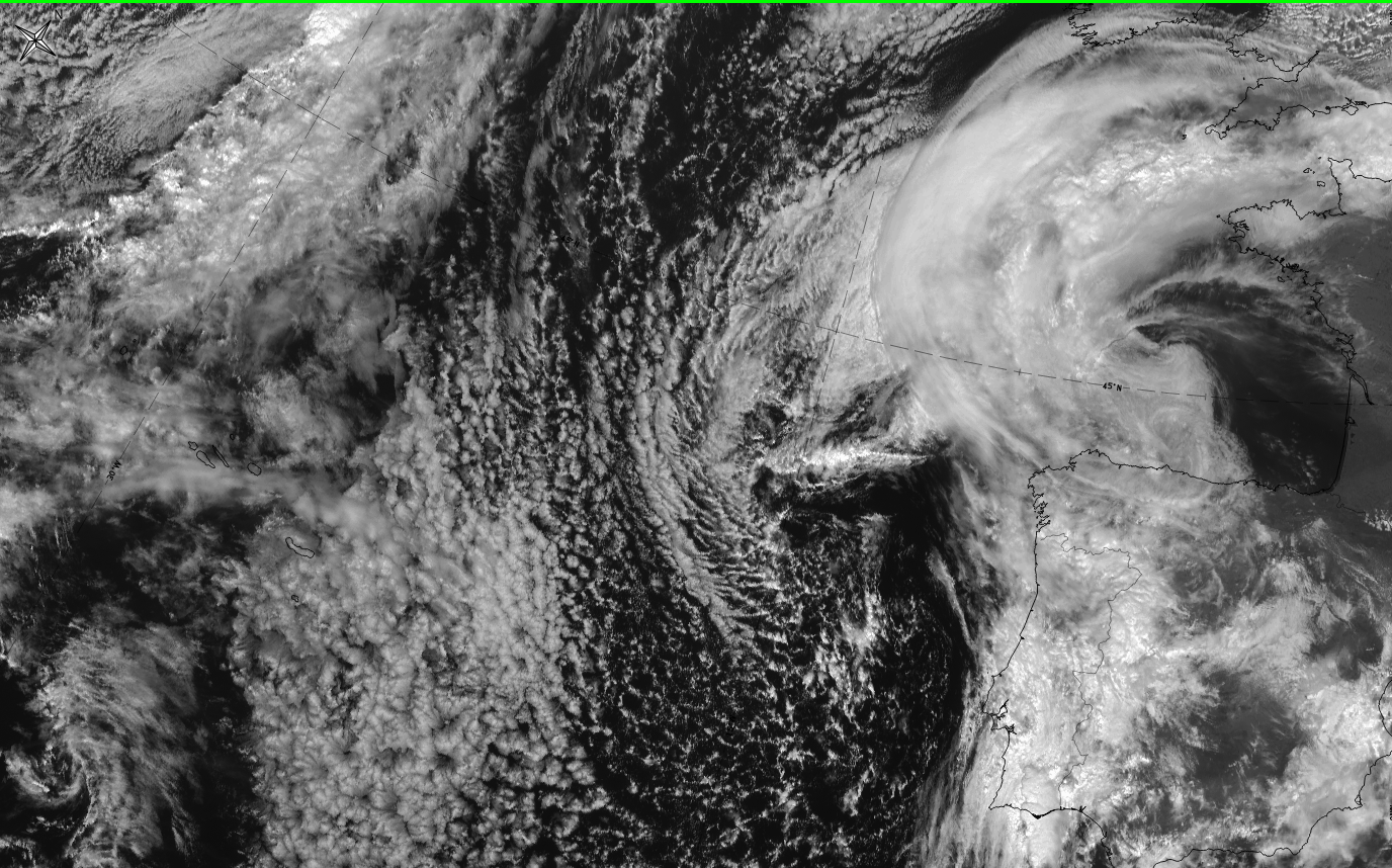
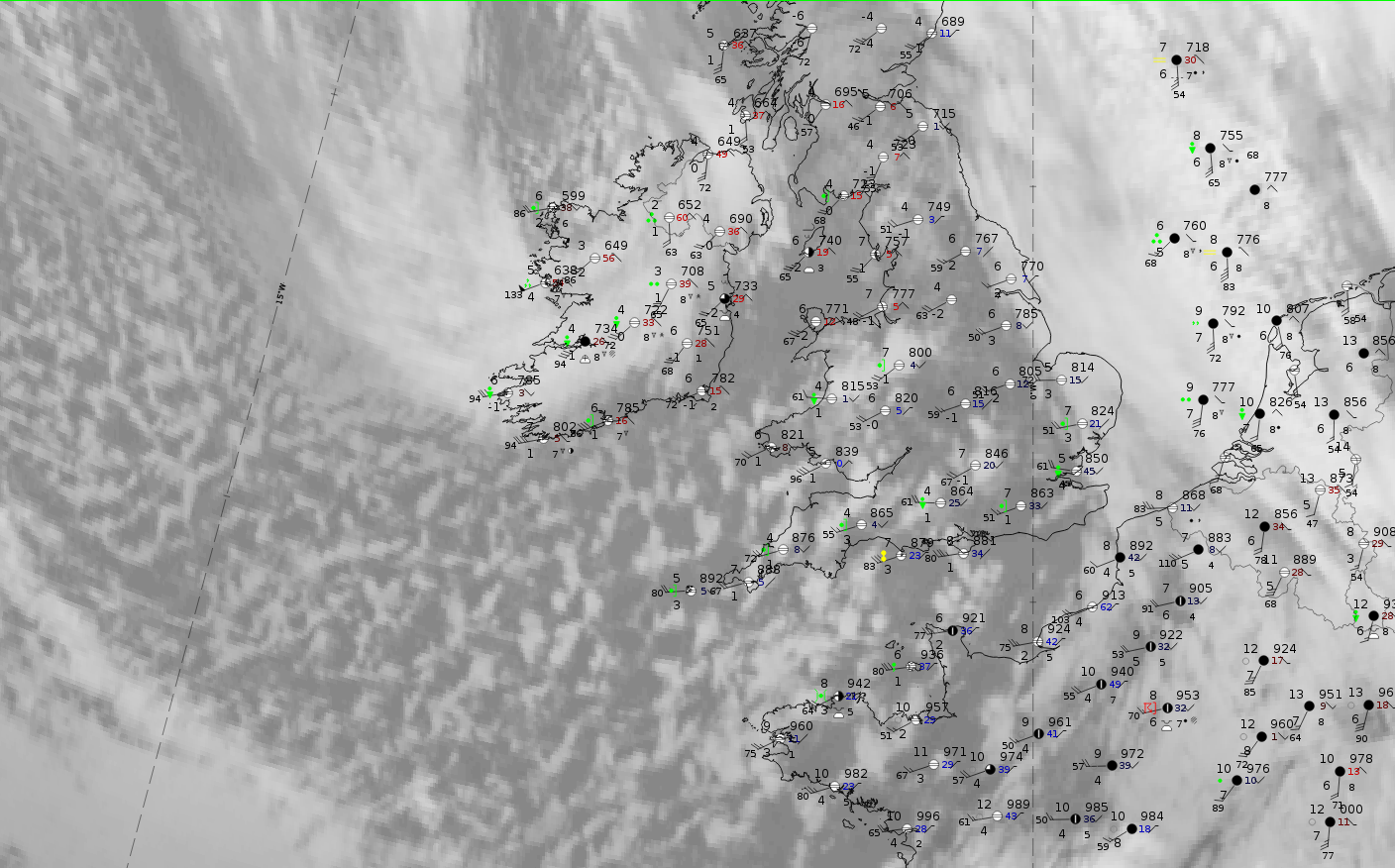
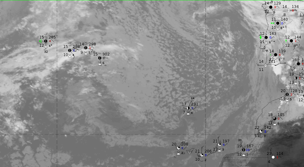
Left: 29 February 2020 at 12 UTC. HRV: open cell convection, Right:20 March 2020 at 12 UTC. HRV: closed cell convection
On 29 February 2020 at 12 UTC a large area of regularly arranged open cells extends from the NW Atlantic to Brittany, France and to SW England where the cells become larger.
|
|
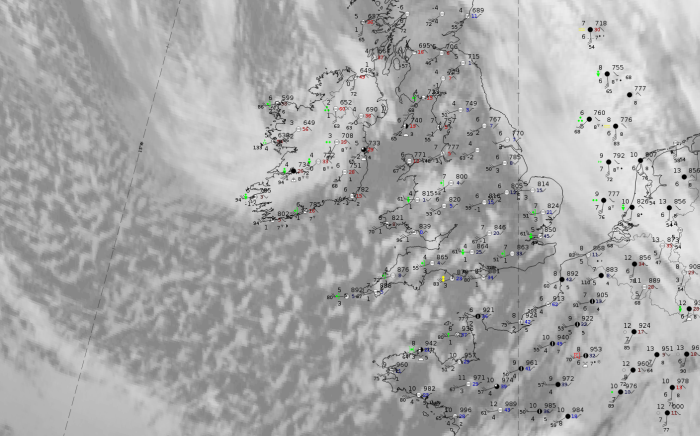
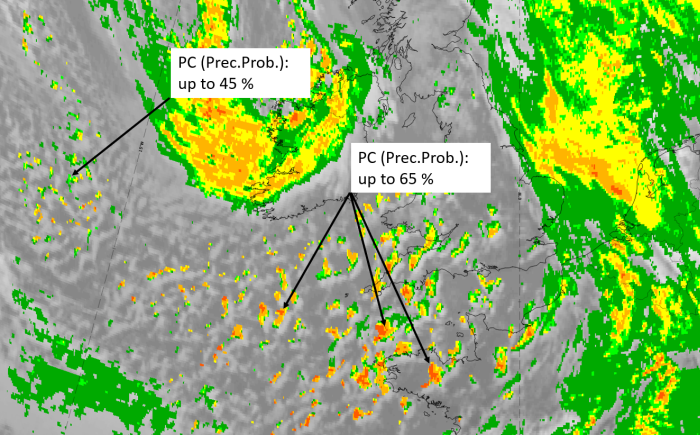
Legend: 29 February 2020 at 12UTC: IR + synoptic measurements (above) + probability of moderate rain (Precipitting clouds PC - NWCSAF).
Note: for a larger SYNOP image click this link.
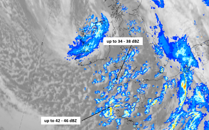
Land-based station reports at the eastern boundary of the open cell convection over land include showers with low-intensity rain. The precipitation probability of 65% there is rather high but decreases more to the west, over the Atlantic.
|
|
|
|
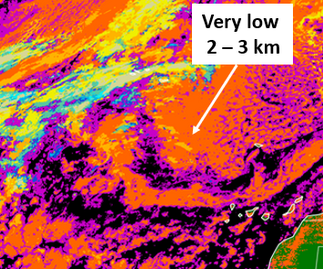
Legend:
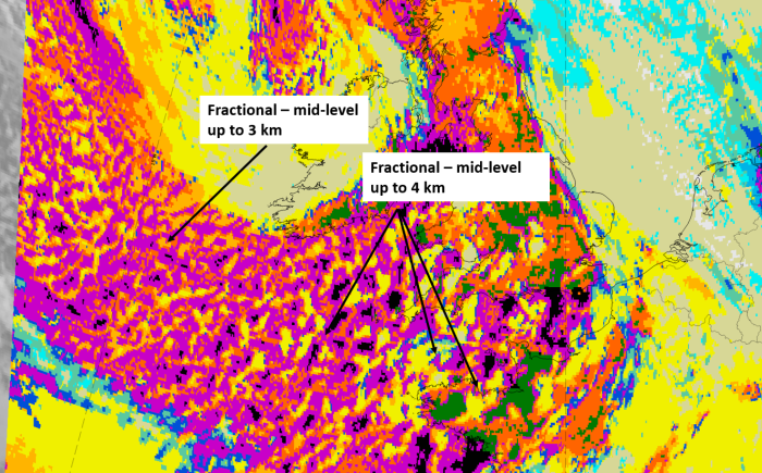
29 February 2020 at 12 UTC, IR; superimposed:
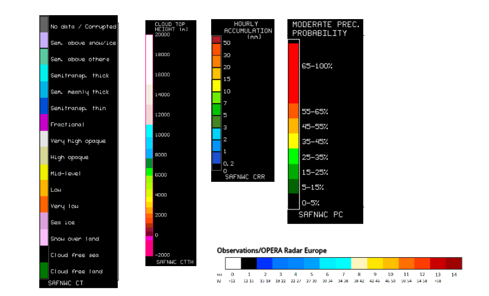
1st row: Cloud Type (CT NWCSAF) (above) + Cloud Top Height (CTTH - NWCSAF) (below); 2nd row: Convective Rainfall Rate (CRR NWCSAF) (above) + Radar intensities from Opera radar system (below).
For identifying values for Cloud type (CT), Cloud type height (CTTH), precipitating clouds (PC), and Opera radar for any pixel in the images look into the legends. (link).
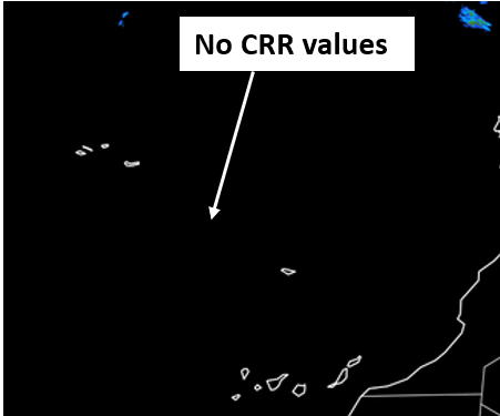
On 20 March 2020 at 12 UTC a large area of regularly arranged open cells extends from the Azores to Madeira.
 |
 |
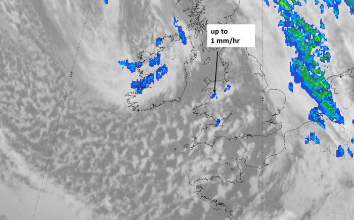
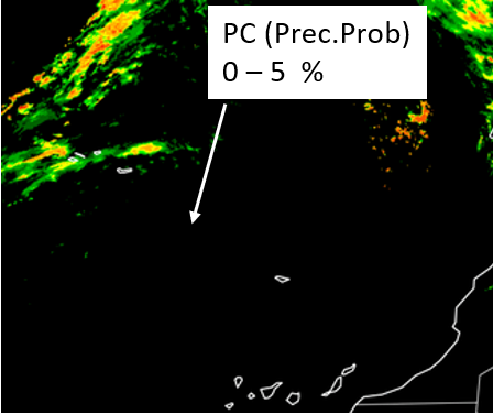
Legend: 20 March 2020 at 12UTC: l: IR + synoptic measurements; r: probability of moderate rain (Precipitating clouds PC - NWCSAF)
Station reports from Madeira and the Azores show high cloud cover values but no rain nor any showers. The precipitation probabilities are less than 5 %.
 |
 |
 |
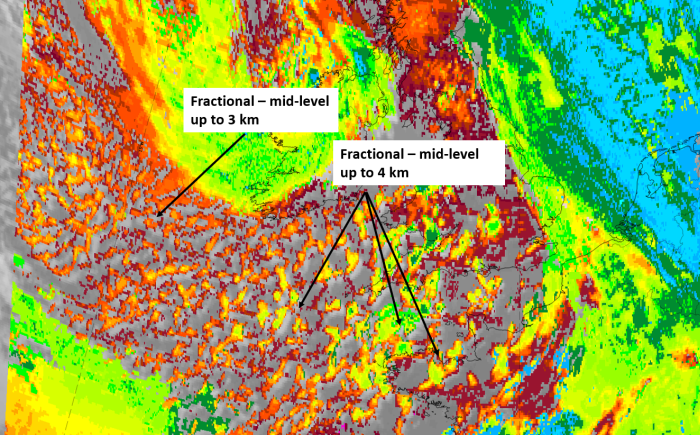
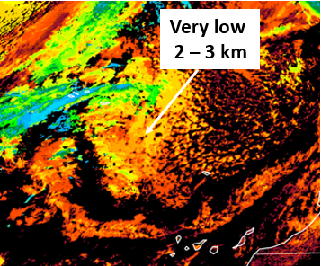
Legend:
20 March 2020 at 12 UTC, IR; images from NWCSAF SAF archive: u.l.: Cloud Type (CT NWCSAF); u.r. Cloud Top Height (CTTH - NWCSAF); l.l.: Convective Rainfall Rate (CRR NWCSAF); l.r. Radar intensities from Opera radar system
For identifying values for Cloud type (CT), Cloud type height (CTTH), precipitating clouds (PC), and Opera radar for any pixel in the images look into the legends. (link).