Cloud Structure In Satellite Images
The cloud feature called Instant Occlusion forms when a Comma cloud merges with a frontal cloud band. A comma is situated within an a cold air mass behind the Cold Front, so it is in an unstable environment, which leads to the formation of convective cloudiness. So, the process is one where stratified frontal cloud and convective clouds merge.
Appearance in the basic channels:
The appearance of Instant Occlusion in different channels:
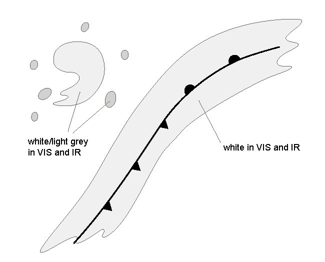
- VIS and IR: In the initial, separate comma stage, the frontal cloud band is white and the Comma cloud and the surrounding convective cloudiness are white to light grey. In the final, merged stage, the whole cloud system is white.
- WV: In the initial stage the Comma cloud is initially light grey to grey, and the frontal cloudiness is white with some light grey structure. In the final stage the whole cloud system is white with some light grey structure.
In the following pictures the initial stage is at the top, the final stage at the bottom.
|

|

|

|
Appearance in the basic RGBs:
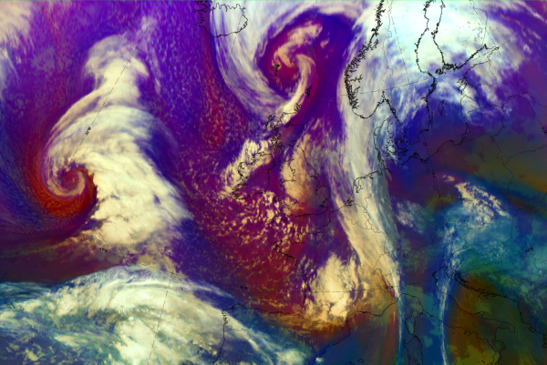
Airmass RGB
During the whole instant occlusion development, the cloud systems of both comma and front are embedded with blue to red brown colours representing a very cold and dry air mass descending from the stratosphere behind the Cold Front.
In the initial stage the frontal cloudiness is appears white, while the Comma cloud appears light orange/yellow showing the overflowing dry air, In the final stage the whole cloud system is white.
Dust RGB
Despite from other existing cloud configurations, the Dust RGB shows blue to pinkish blue colours - representing a cloud free area. Very often there are low cloud cells typically in the cold air which shows up in ochre colours, sometimes becoming thicker and therefore dark red.
Usually the comma head - which becomes during the instant occlusion process the spiral of the instant occlusion - is dark red representing thick cloudiness. The comma tail which merges with the former cold front often is much lower showing up with different shades in ochre.
 |
 |
 |
 |
Legend: Schematics for basic RGBs; for two stages of development: comma (upper) and instant occlusion stage (low)Left: airmass RGB; right: dust RGB
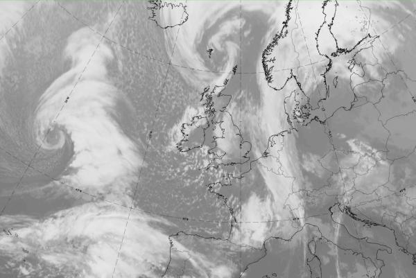
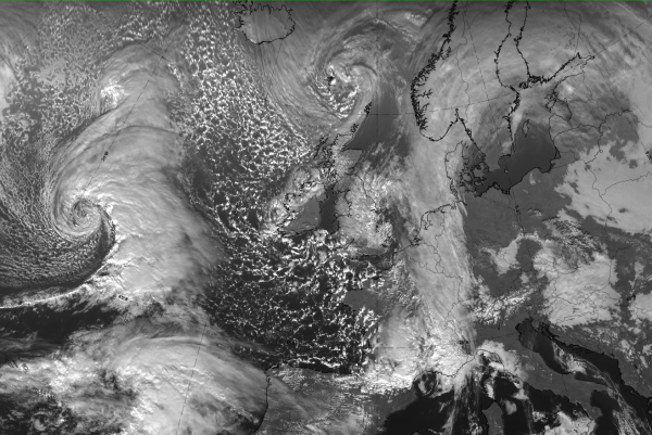
The following sequence of images shows the whole process of an “Instant Occlusion” from the initial stage with a frontal cloud band and a comma configuration in the cold air behind, then into the development stage where the comma is very close to the frontal cloud band. Finally a mature stage is shown, where the former comma forms together with the cloud band a new occlusion spiral.
 |
 |
 |
 |
 |
 |
 |
Legend: 3 hourly sequence from 16 January 2020/21 to 17 January 2020/18 UTC; IR images
*Note: click on the image to access the image gallery (navigate using arrows on keyboard)
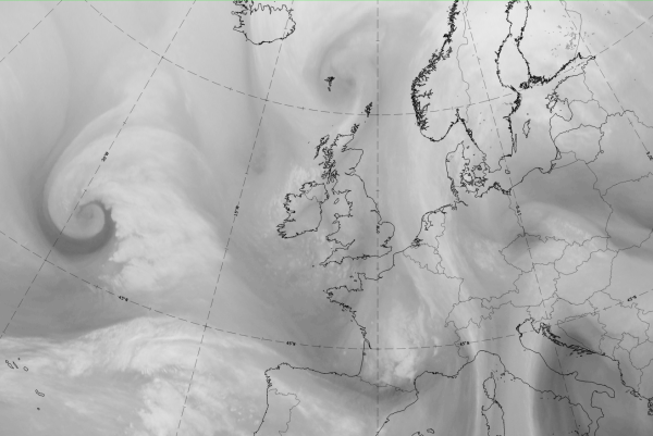
The basic images and basic RGBs of the mature stage of an instant occlusion process can be seen below with the example from 17 January 2020 /12 UTC
|
|
|
|

17 January 2020, 12UTC: 1st row: IR (above) + HRV (below); 2nd row: WV (above) + Airmass RGB (below); 3rd row: Dust RGB + image gallery.
*Note: click on the Dust RGB image to access image gallery (navigate using arrows on keyboard)
| IR | Inst. occl. spiral bright; mergence area with CF cloud band dark grey and fibrous. |
| HRV | Inst. occl. spiral bright; mergence area with CF cloud band dark grey. |
| WV | Cold front cloud band light grey indicating high upper level humidity; mergence area and inst. occl. spiral darkgrey. |
| Airmass RGB | Blue colours behind the cold front cloud band indicate cold air; dark brown more to the west shows the cold and dry air; the inst. occl. spiral is overrun by the dry air and therefore is displayed in the image as light brownish colours. |
| Dust RGB | Dark red colours indicate the thick ice cloud in the cold front band as well as in some parts of the inst. occl. spiral; in the mergence area and the largest part of the spiral, the ochre colour represents mid- level cloud. |