Weather Events
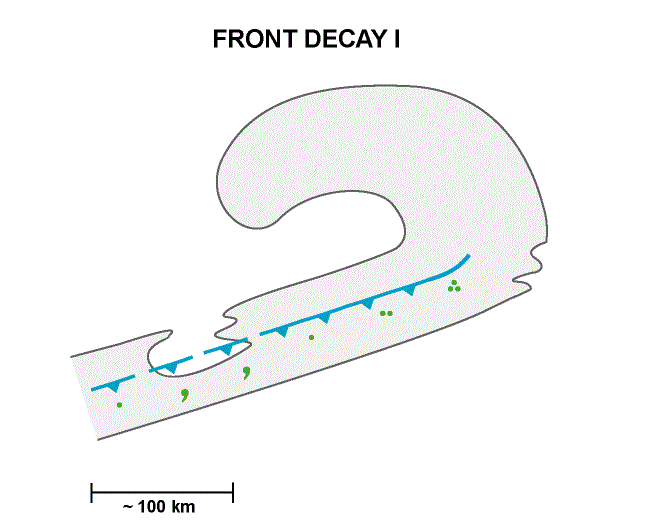
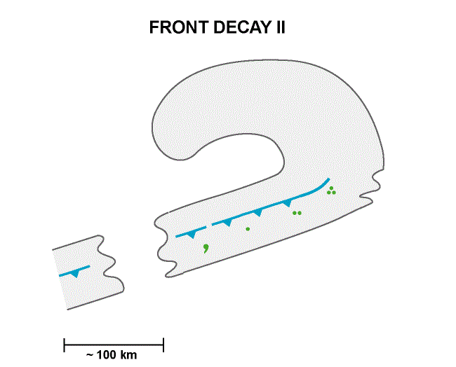
The CM of Front Decay represents a meso - scale modification of a Cold Front which leads to decay of weather events, especially of precipitation.
| Parameter | Description |
| Precipitation |
|
| Temperature |
|
| Wind |
|
| Cloud |
|
| Other relevant information | - |
For illustrating the weather within and around an area of Front Decay, the case of 23 February 2020 at 12 UTC is chosen. In the area of Front Decay, cloud fraction over Southern England has nearly completely dissipated. The clouds associated with the cold front band consists mostly of high ice cloud, shown in a black colour.
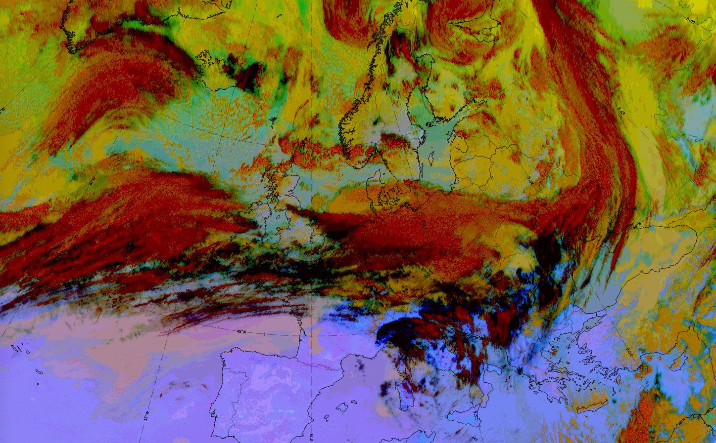
Legend: 23 February 2020 at 12 UTC; Dust RGB
|
|
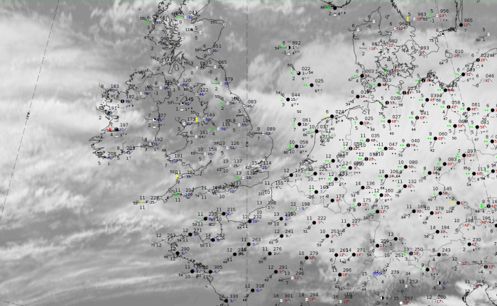
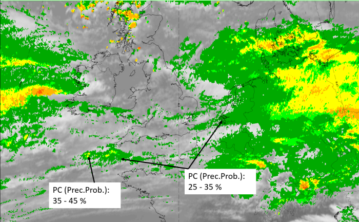
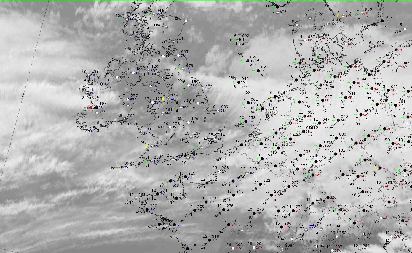
Legend: 23 February 2020 at 12UTC: IR + synoptic measurements (above) + probability of moderate rain (Precipitting clouds PC - NWCSAF).
Note: for a larger SYNOP image click this link.
Nearly all stations report heavy rain in the frontal cloud band to the east of the Frontal Decay area; here there are some reports of rain in the last 6 hours. The probability of moderate rain from NWCSAF is zero in the Front Decay area. On some cloud patches in the rest of the cold front band to the south, NWCSAF probabilities only reach 35 - 45 %.
|
|
|
|
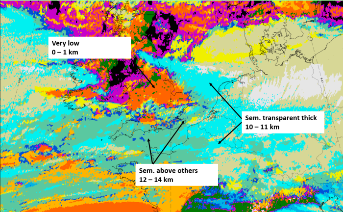
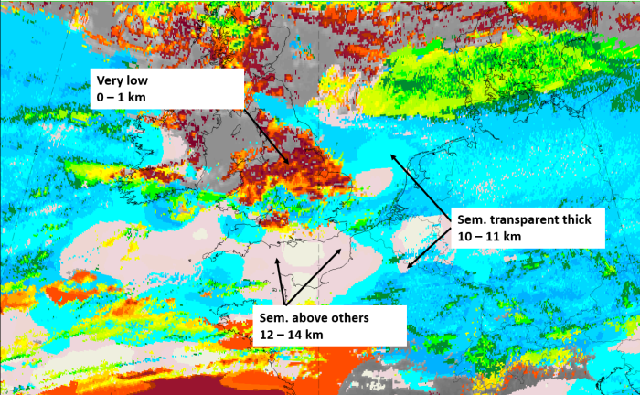
Legend: 23 February 2020 at 12 UTC, IR ; superimposed:
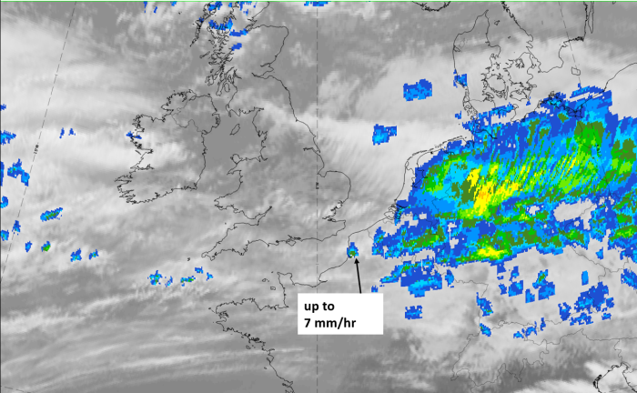
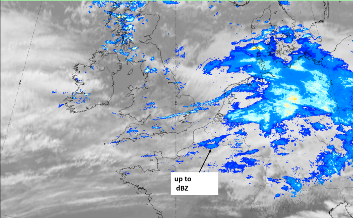
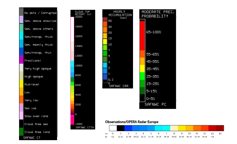
1st row: Cloud Type (CT NWCSAF) (above) + Cloud Top Height (CTTH - NWCSAF) (below); 2nd row: Convective Rainfall Rate (CRR NWCSAF) (above) + Radar intensities from Opera radar system (below).
For identifying values for Cloud type (CT), Cloud type height (CTTH), precipitating clouds (PC), and Opera radar for any pixel in the images look into the legends. (link).