Weather Events
ECs are convective cells often associated with heavy precipitation.
| Parameter | Description |
| Precipitation |
|
| Temperature |
|
| Wind (incl. gusts) |
|
| Other relevant information |
|

|
|
Legend:
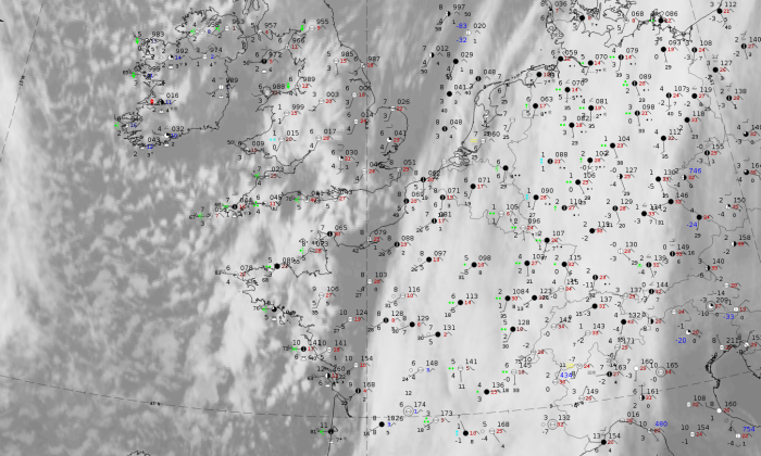
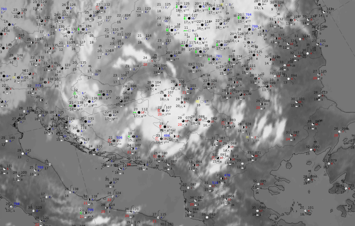
11 December 2019 at 12UTC.
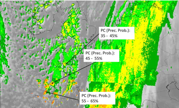
IR + synoptic measurements (above) + probability of moderate rain (Precipitting clouds PC - NWCSAF).
Note: for a larger SYNOP image click this link.
There are widespread reports of Cbs, showers and heavy rain; an area of maximum activity occurs from Cornwall to Brittany. In the southern part, cells occur with precipitation probabilities higher than 55%; however, some caution must be taken with the interpretation as a horizontal stripe over France separates different intensity groups, so a possibility of a computer problem here cannot be excluded.
|
|
|
|
Legend:
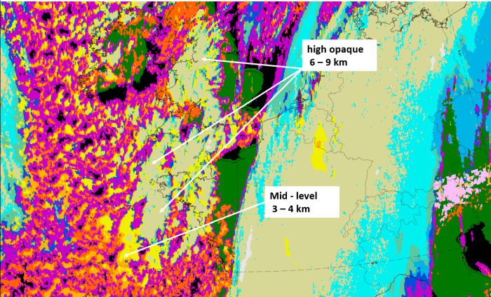
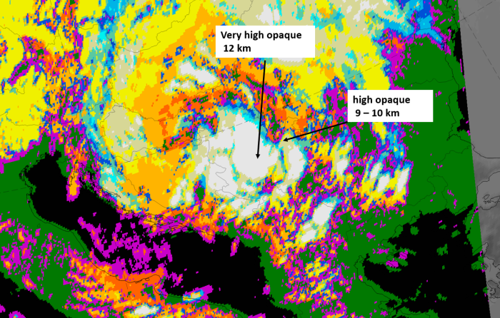
11 December 2019/12 UTC, IR ; with the following fields superimposed:
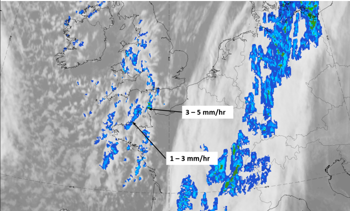
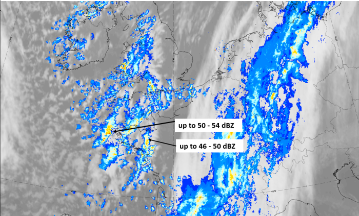
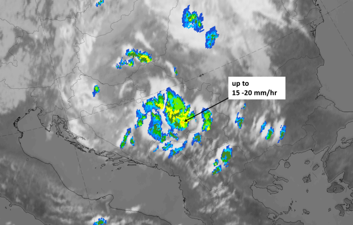
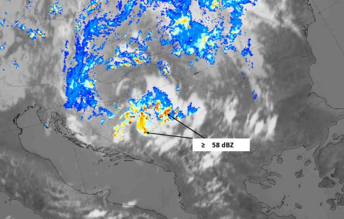
1st row: Cloud Type (CT NWCSAF) (above) + Cloud Top Height (CTTH - NWCSAF) (below); 2nd row: Convective Rainfall Rate (CRR NWCSAF) (above) + Radar intensities from Opera radar system (below).
For identifying values for Cloud type (CT), Cloud type height (CTTH), precipitating clouds (PC), and Opera radar for any pixel in the images look into the legends. (link).
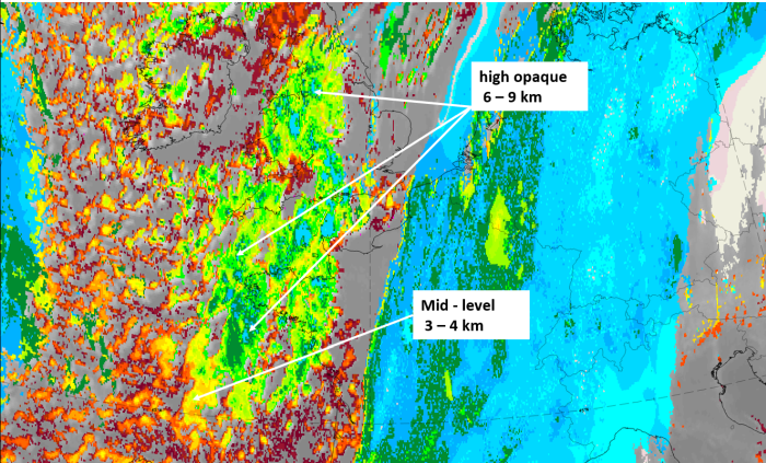
A case from 25 July 2020 at 12 UTC is shown as a supplementary example of a very convective case over land in summer time.
|
|
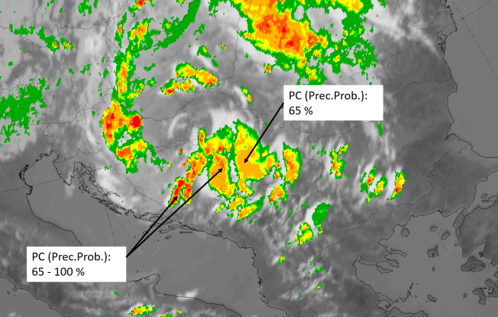
Note: for a larger SYNOP image click this link.
There are widespread heavy thunderstorm reports, and the probability of moderate precipitation is different between the single cloud cells and varies from 55% to 100 %. In this convective case this parameter is not as useful as the convective rainfall rate, which is shown below.
|
|
|
|
Legend:
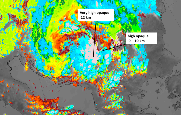
25 july 2020 at 12 UTC, IR ; with the following fields superimposed:
u.l.: Cloud Type (CT NWCSAF); u.r.: Cloud Top Height (CTTH - NWCSAF); l.l.: Convective Rainfall Rate (CRR NWCSAF); l.r.: Radar intensities from the Opera radar system.
For identifying values for Cloud type (CT), Cloud type height (CTTH), precipitating clouds (PC), and Opera radar for any pixel in the images look into the legends. (link).