Key Parameters
Typical synoptic environment
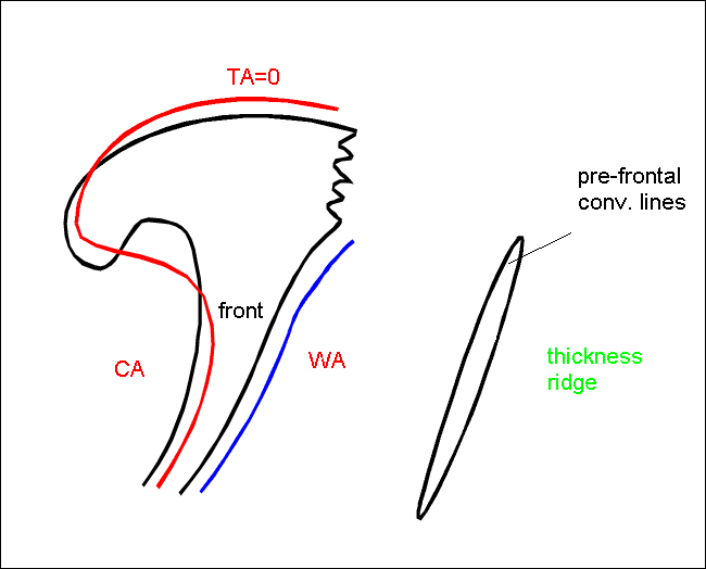
Convective lines in advance of frontal cloud bands
- Convective lines in advance of frontal cloud bands are situated within or at the rear edge of the equivalent thickness ridge.
- Since they are in the neighbourhood of fronts there can be some Thermal Front Parameter (TFP) further behind indicating the frontal cloud band.
- Although Temperature Advection (TA) is not very pronounced, there is some warm advection in front of the frontal system.
|
|
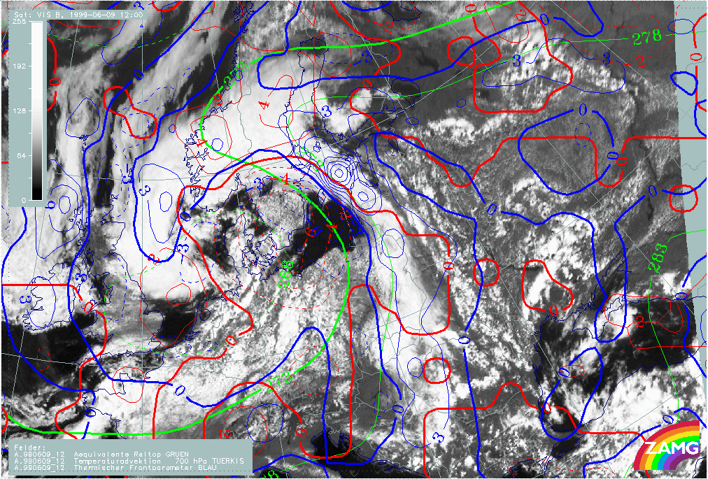
09 June 1999/12.00 UTC - Meteosat VIS image; blue: thermal front parameter 700 hPa, red: temperature advection 700 hPa, green:
equivalent thickness 700 hPa
|
|
|
The example shows the prefrontal Convergence Lines situated within weak Warm Advection (WA), an equivalent thickness ridge, and in front of the maximum of TFP.
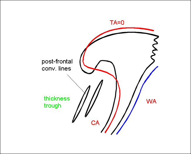
Convective lines in cold air behind Cold Fronts
- Convective lines in the cold air behind Cold Front cloud bands are situated within an equivalent thickness trough.
- Since they are in the neighbourhood of fronts there can be some TFP in advance of the convective line indicating the frontal cloud band.
- There is cold advection behind the frontal cloud band.
|
|
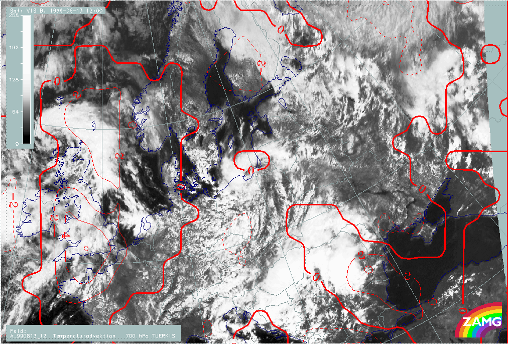
08 August 1999/12.00 UTC - Meteosat VIS image; red: temperature advection 700 hPa
|
|
|
The Convergence Lines are situated within cold advection.
- Both types occur with Showalter indices typical for instability (around 0)
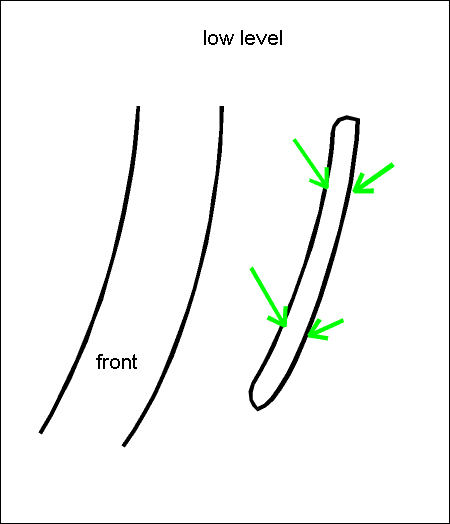
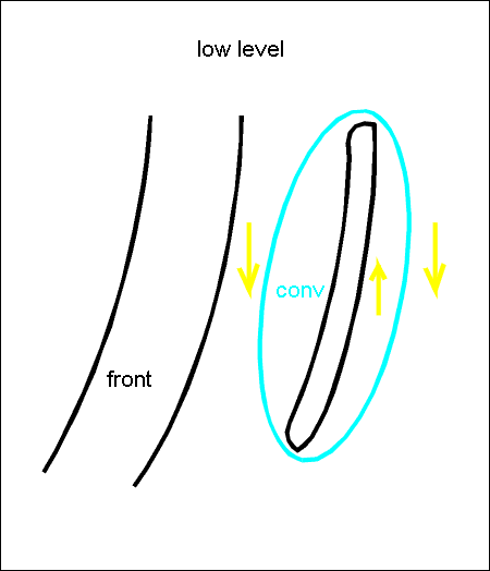
Pre-frontal Convergence Line
Typical distribution of wind field, divergence and upward motion
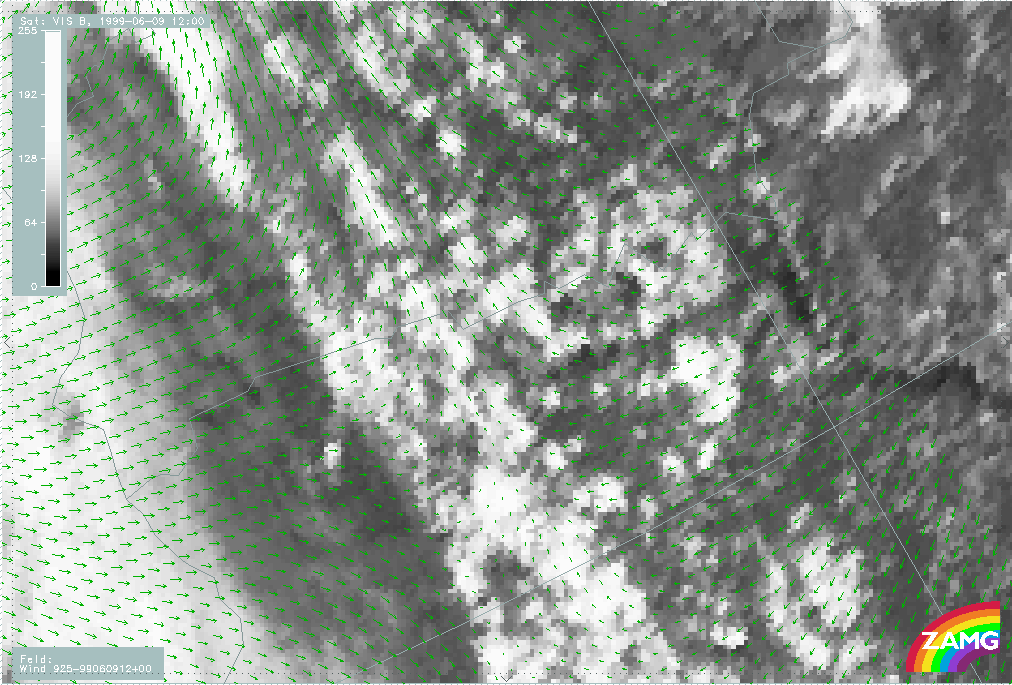
- Wind vectors: The wind field shows confluence up to a height of 850 hPa; above there is a uniform wind regime. Often there are easterly winds to the east and southerly winds to the West of the convective Convergence Line resulting in a discontinuity in the low level wind field.
- Convergence is found in the lower levels, sometimes only at 925 hPa, sometimes up to 800 hPa.
- Upward motion can be observed to a slightly higher level.
|
|
09 June 1999/12.00 UTC - Meteosat VIS image; green: wind vectors 925 hPa
|
|
|
Westerly winds to the west, easterly winds to the east of the convergence cloud band result in convergence at lower levels.
|
|
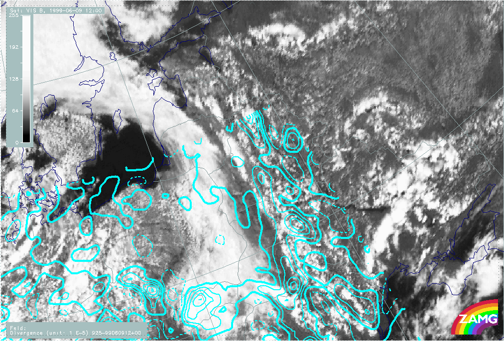
09 June 1999/12.00 UTC - Meteosat VIS image; cyan solid: convergence 925 hPa, cyan dashed: divergence 925 hPa
|

|
|
At 925 hPa the image shows strong convergence at the Convergence Lines, whilst at the frontal cloud band, no marked convergence can be found at this height.
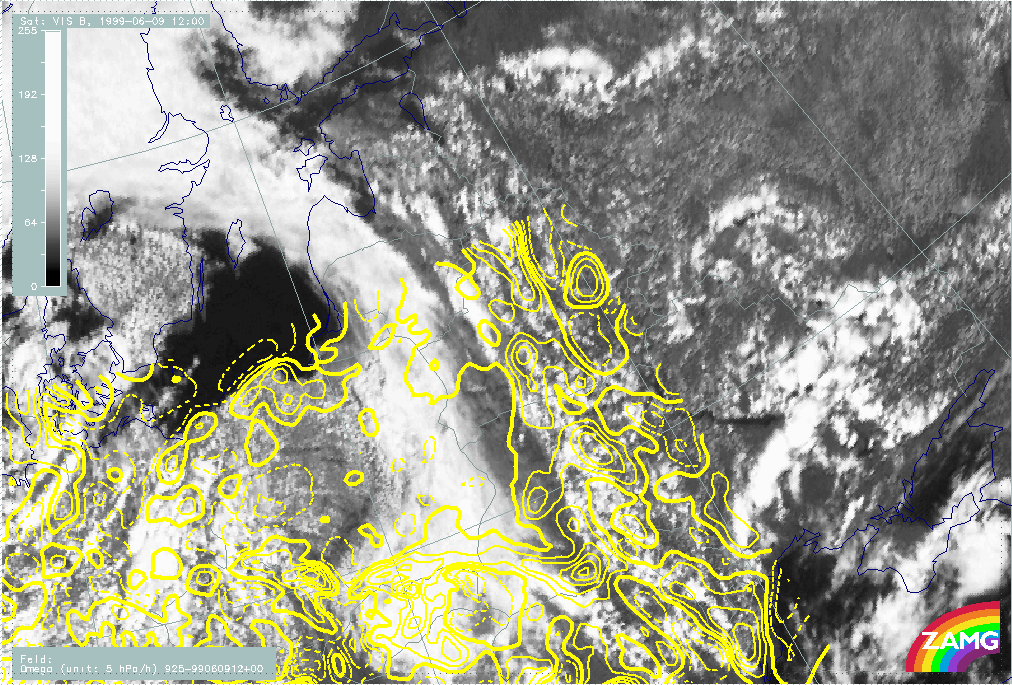
|
|
09 June 1999/12.00 UTC - Meteosat VIS image; yellow solid: upward motion 925 hPa, yellow dashed: downward motion 925 hPa
|
|
|
The vertical motion at 925 hPa corresponds to the divergence field below. There is strong upward motion at the Convergence Lines, while only weak upward motion or even subsidence is observed in the frontal cloud band.
Post-frontal Convergence Line
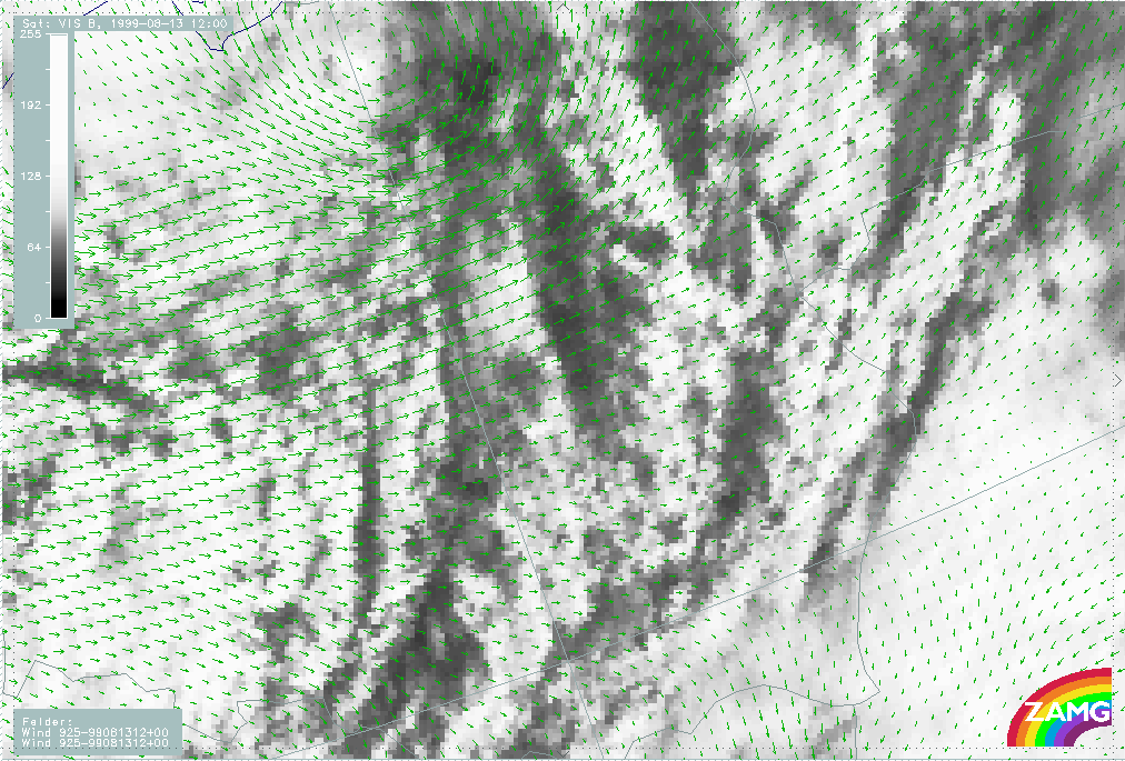
|
13 August 1999/12.00 UTC - Meteosat VIS image; green: wind vectors 925 hPa
|
|
|
The wind vectors show westerly winds decreasing to the east.
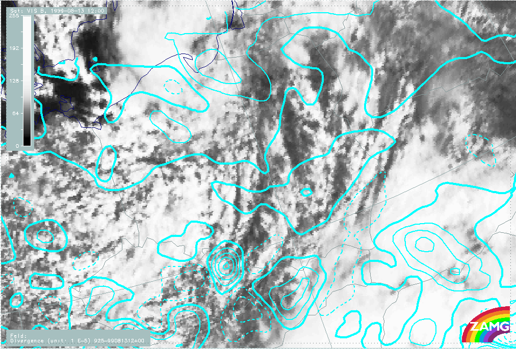
|
13 August 1999/12.00 UTC - Meteosat VIS image; cyan solid: convergence 925 hPa, cyan dashed: divergence 925 hPa
|
|
|
The image shows convergence prevailing at Convergence Lines although the line structure is not reflected in the model field. At higher levels, less convergence and a larger area of divergence is seen.
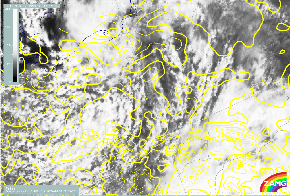
|
13 August 1999/12.00 UTC - Meteosat VIS image; yellow solid: vertical motion - upward motion 925 hPa, yellow dashed: vertical
motion - downward motion 925 hPa
|
|
|
The field of vertical motion corresponds with the field of divergence. At the lower level there is a large area of upwards motion, whereas there is more downward motions at higher levels.
The post frontal Convergence Lines are not as well marked as pre frontal lines. They also show less convective activity.