Table of Contents
Cloud Structure In Satellite Images
There are often also lines of convective cloud which occur independently from orographic obstacles (see Orographically Induced Convergence Lines ). They are often more or less stationary or at least show a much slower propagation than the surrounding cloud systems. Such a phenomenon can be observed with convection lines
- in advance of a frontal cloud band
- within cold air behind frontal systems.
Regions where these phenomena can be frequently observed during summer time include Germany, Poland, Czech Republic and the Baltic States.
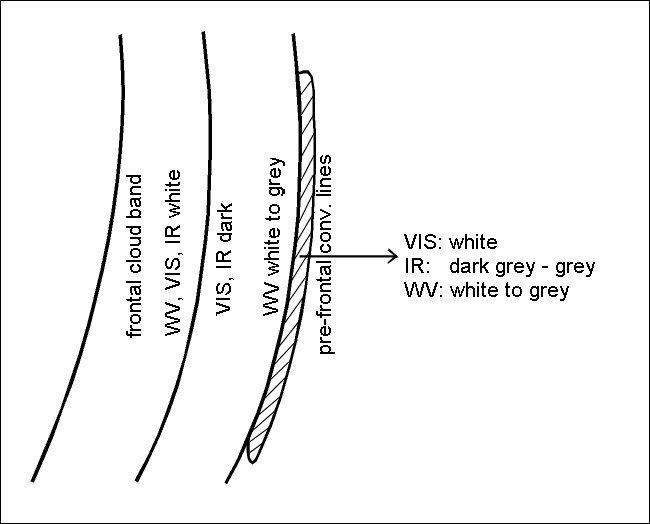
Convective lines with very strong convective activity are indicated by high brightness in VIS, IR and WV channels.
Less active convective lines appear white in the VIS, grey in the IR image and mostly do not show up in the WV image. Sometimes they are even situated in a dry (black) zone in WV images.
|
|
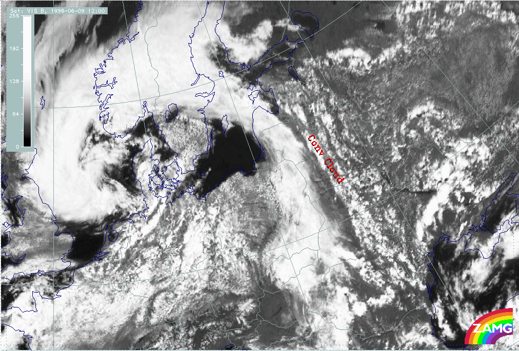
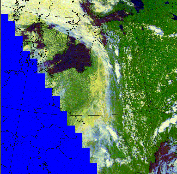
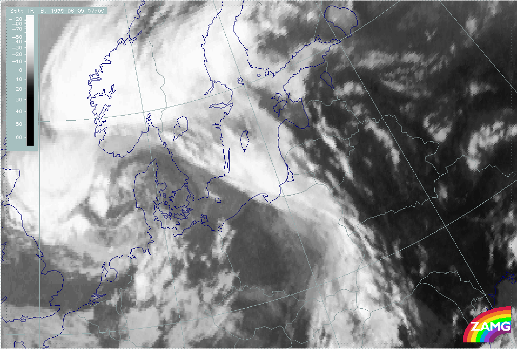
09 June 1999/12.00 UTC - Meteosat VIS image
|
|
|
|
|
|
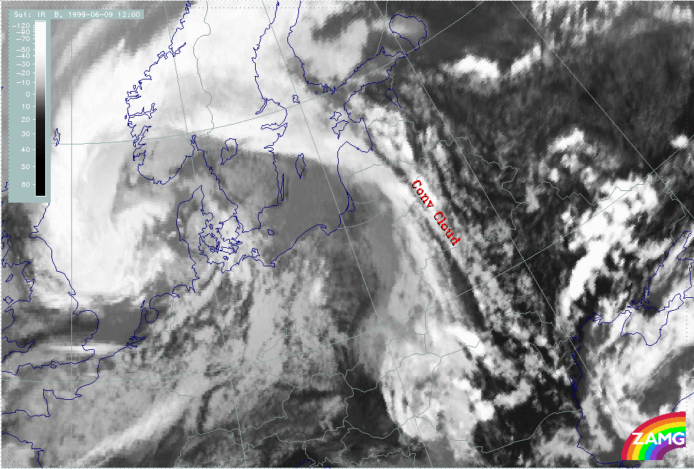
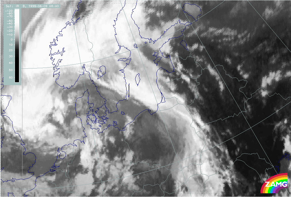
09 June 1999/12.00 UTC - Meteosat IR image
|
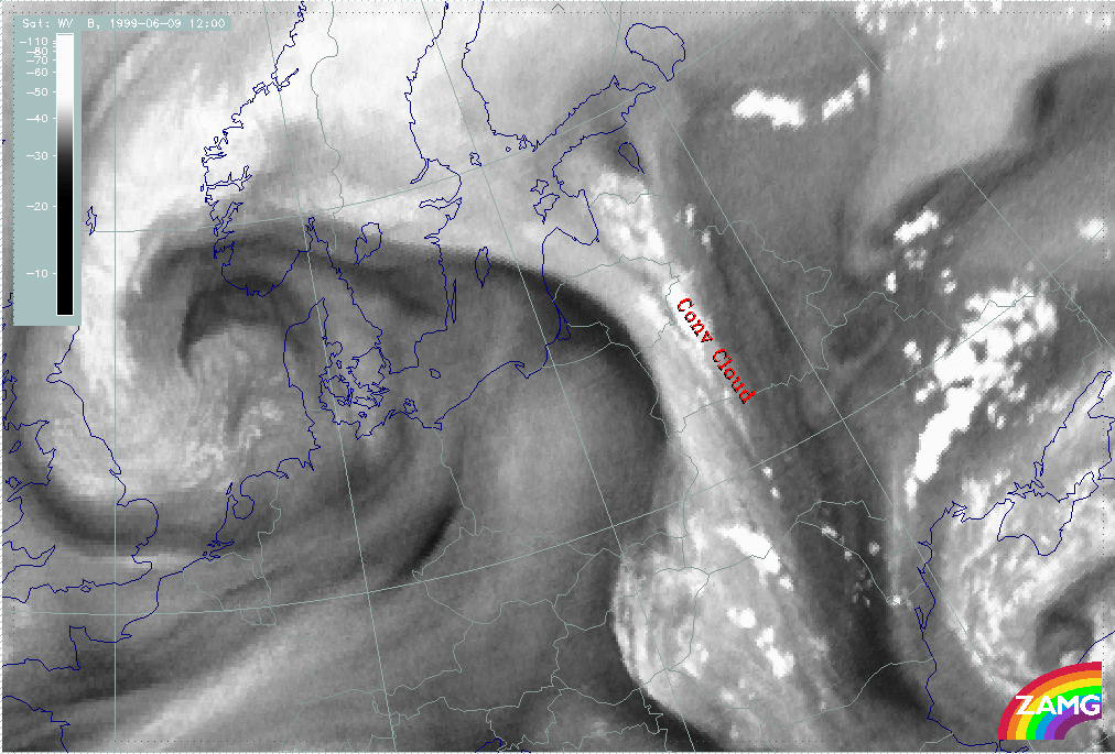
09 June 1999/12.00 UTC - Meteosat WV image
|
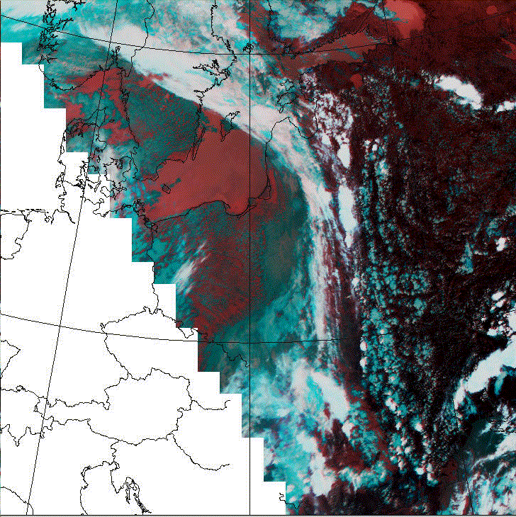
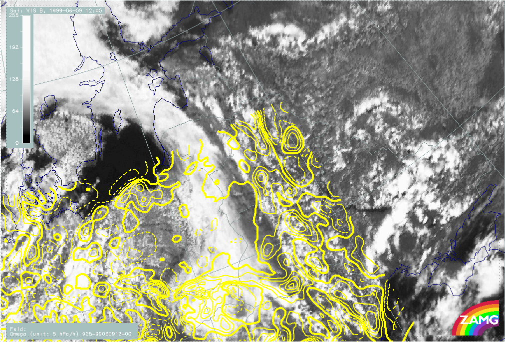
The example from 01 July 1999/12.00 UTC shows a convective Convergence Line immediately in front of a frontal cloud band; the distance between the frontal cloud band and the convective Convergence Line seems to be closer in IR and WV than in VIS which is caused by higher cloud elements and high upper level humidity at the leading side of the frontal cloud band.
The AVHRR channels show a more detailed structure. Some cellular substructures within the lines can be detected which are not visible in Meteosat images.
Some slight difference can be found between the VIS1 and VIS2 channels: VIS2 shows the line being more distinct and continuous. The combination channel 124 shows the Convergence Lines as a white to light blue cloud band. A discrimination between thick cloudiness and the thin cirrus clouds at the edge can be done. Use of combination channel 345 shows a more a white to bluish appearance.
|
01 July 1999/11:53 UTC - AVHHR image
|
01 July 1999/11:53 UTC - AVHHR image
|
|
|
Both channel combinations show the Convergence Lines very distinctly. The main area is white, the edges are bluish representing only high cloud.
Meteorological Physical Background
As already mentioned in the first sub-chapter (see Cloud structure in satellite image ) there are two synoptic-scale environments which lead to the development of convective Convergence Lines discussed in this chapter: the leading area of frontal cloud bands and the cold air region behind frontal cloud bands. Little relationship to parameters typical for these regions and contributing to upward motion such as temperature advection (warm advection) or vorticity advection (positive vorticity advection) could be found. As these convective lines can be regarded as small scale phenomena Local Area Models (LAM) have to be studied for a deeper explanation.
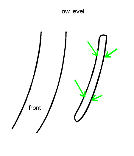
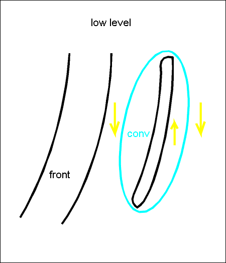
Likewise, for the orographically driven convective Convergence Lines (see Orographically Induced Convergence Lines ) cloudiness is produced by upward motion due to low level convergence which is the result of different processes described below. These Convergence Lines also show a life cycle during the day time dependant on solar radiation with a maximum of convection in the early afternoon.
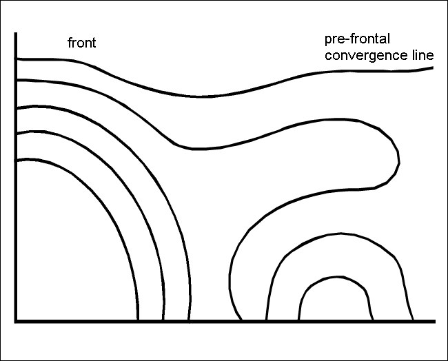
The pre-frontal Convergence Lines
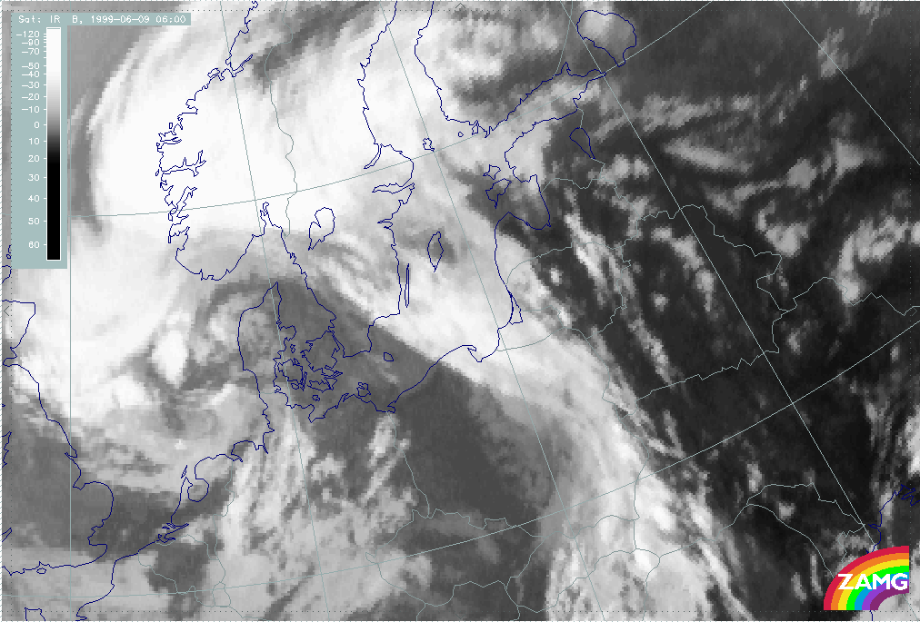
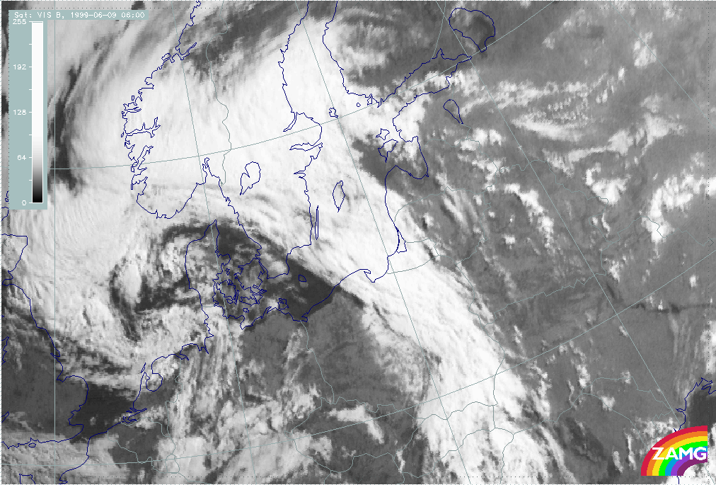
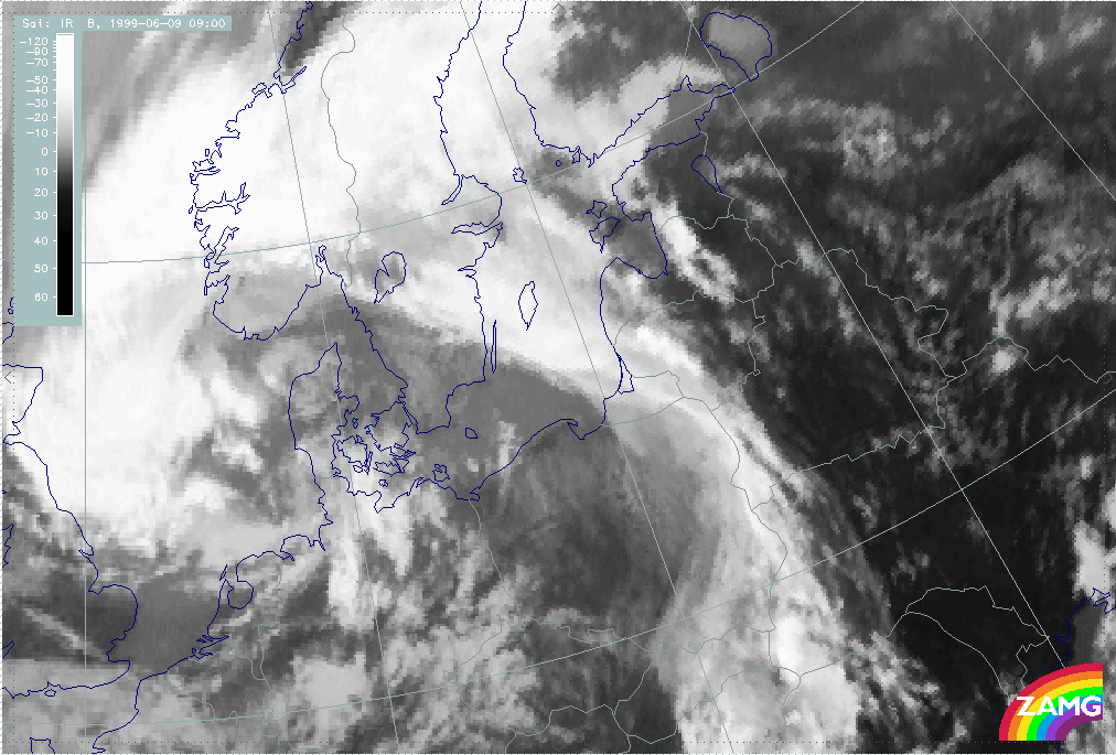
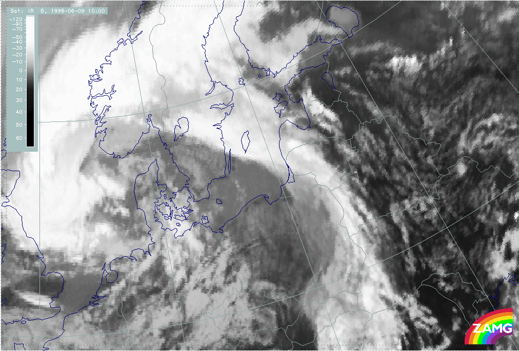
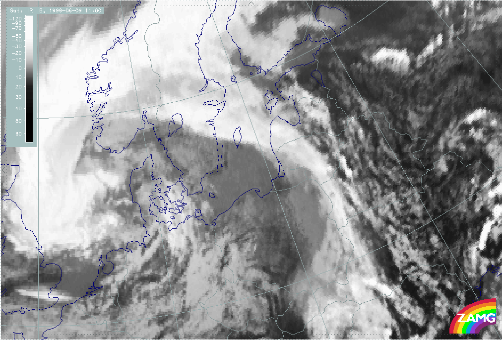
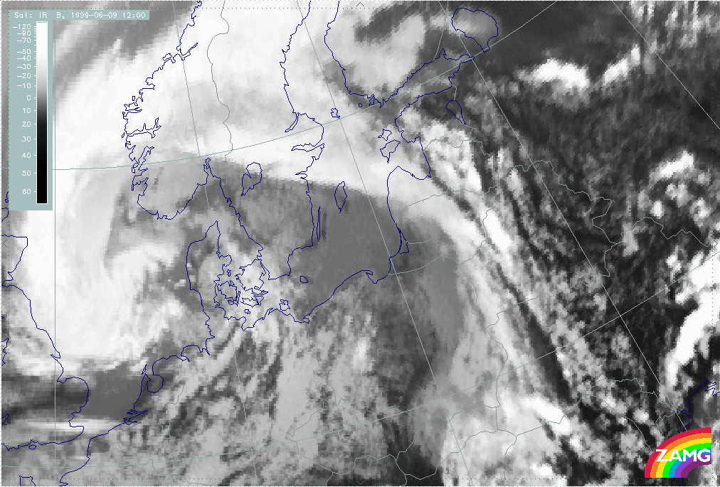
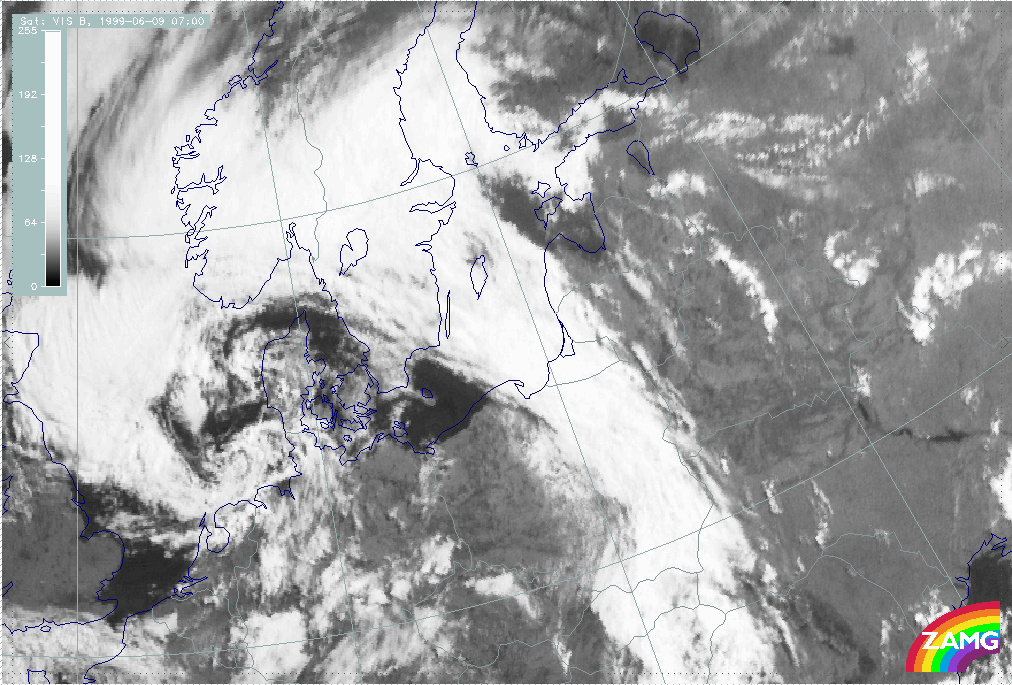
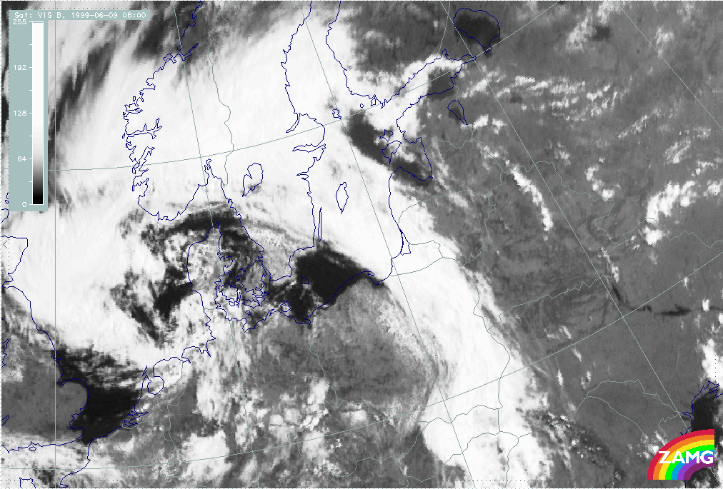
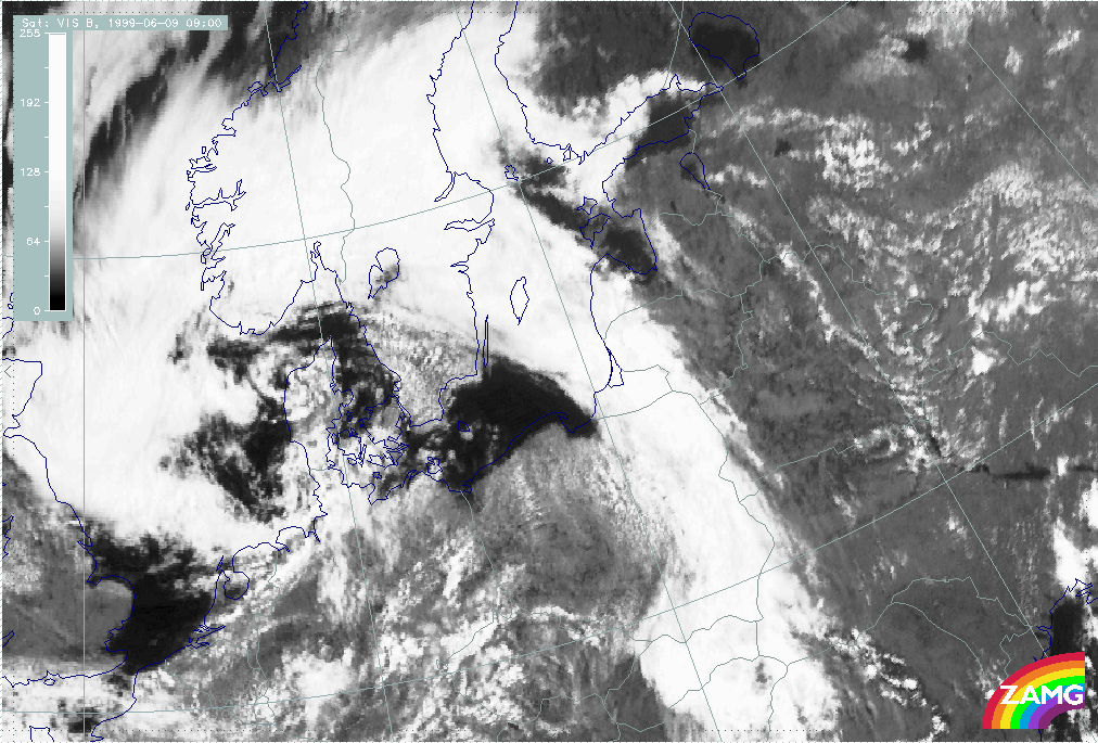
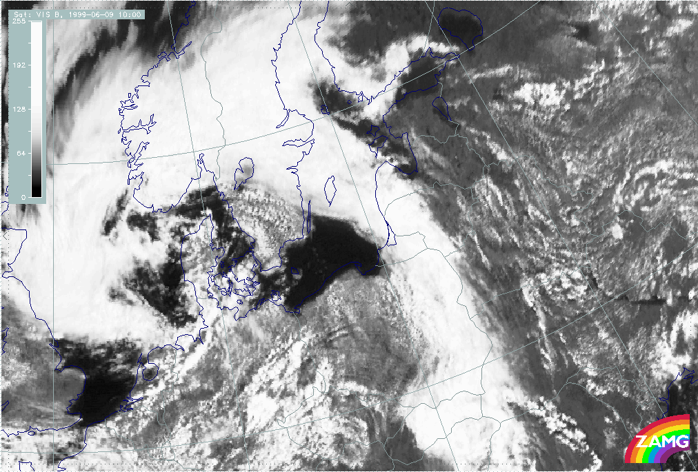
Pre-frontal convective lines are influenced by an approaching frontal system as well as the diurnal variation of solar radiation. Consequently, the synoptic situation is changing during day.
|
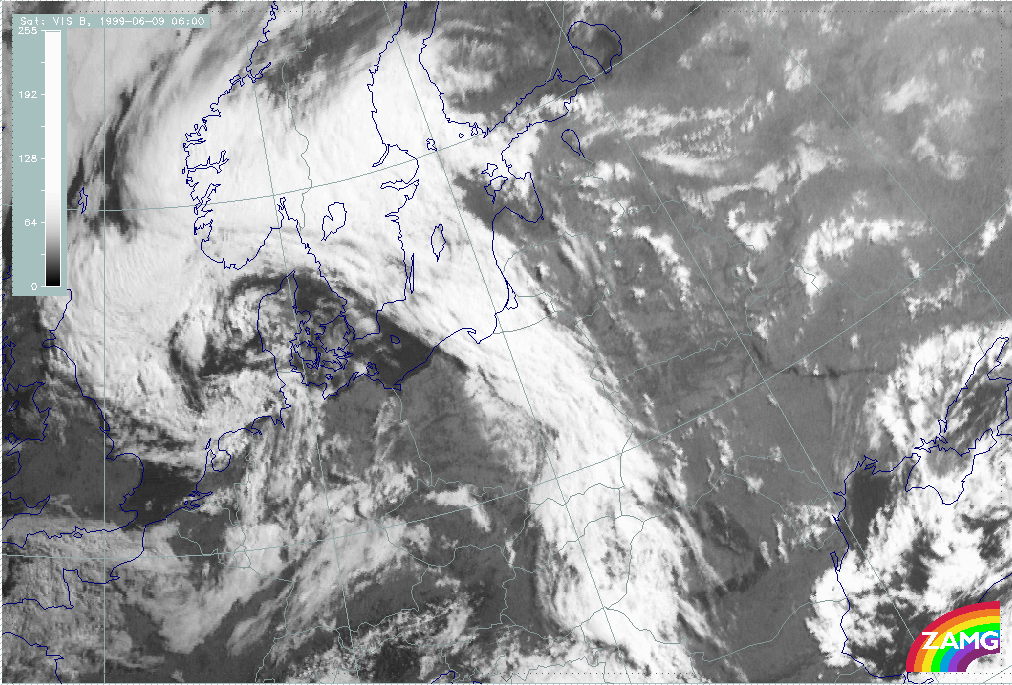
09 June 1999/06.00 UTC - Meteosat VIS image
|
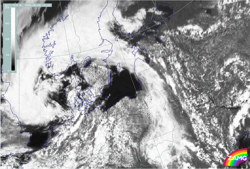
09 June 1999/12.00 UTC - Meteosat VIS image
|
|

|
|
|
|
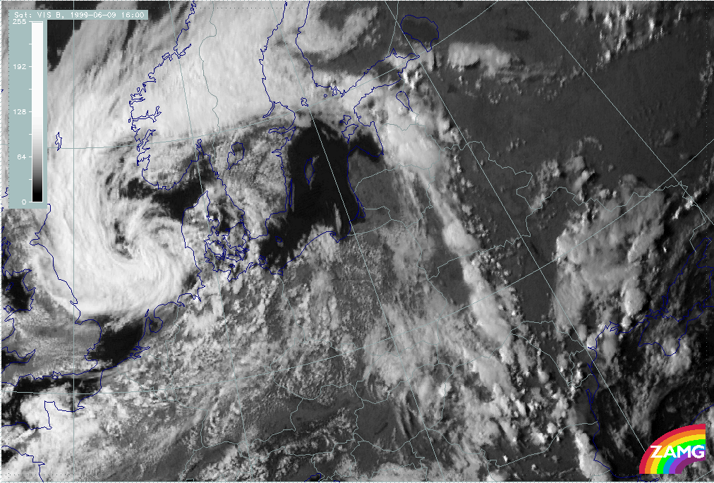
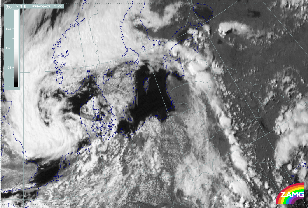
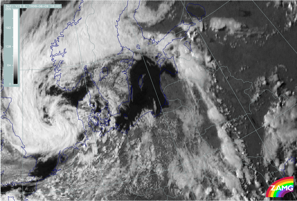
09 June 1999/16.00 UTC - Meteosat VIS image
|
|
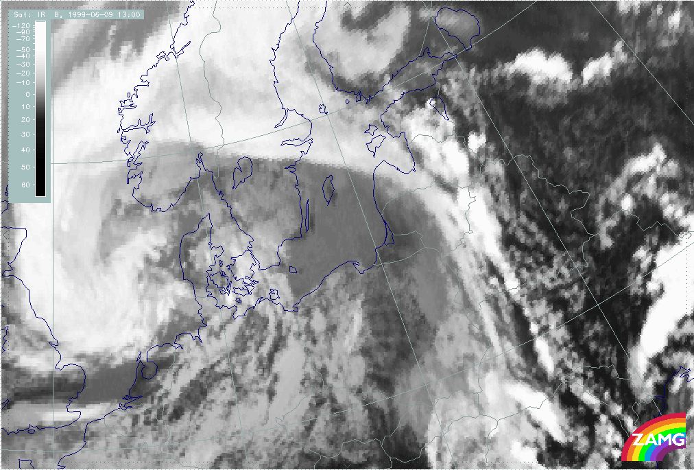
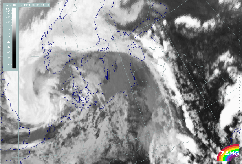
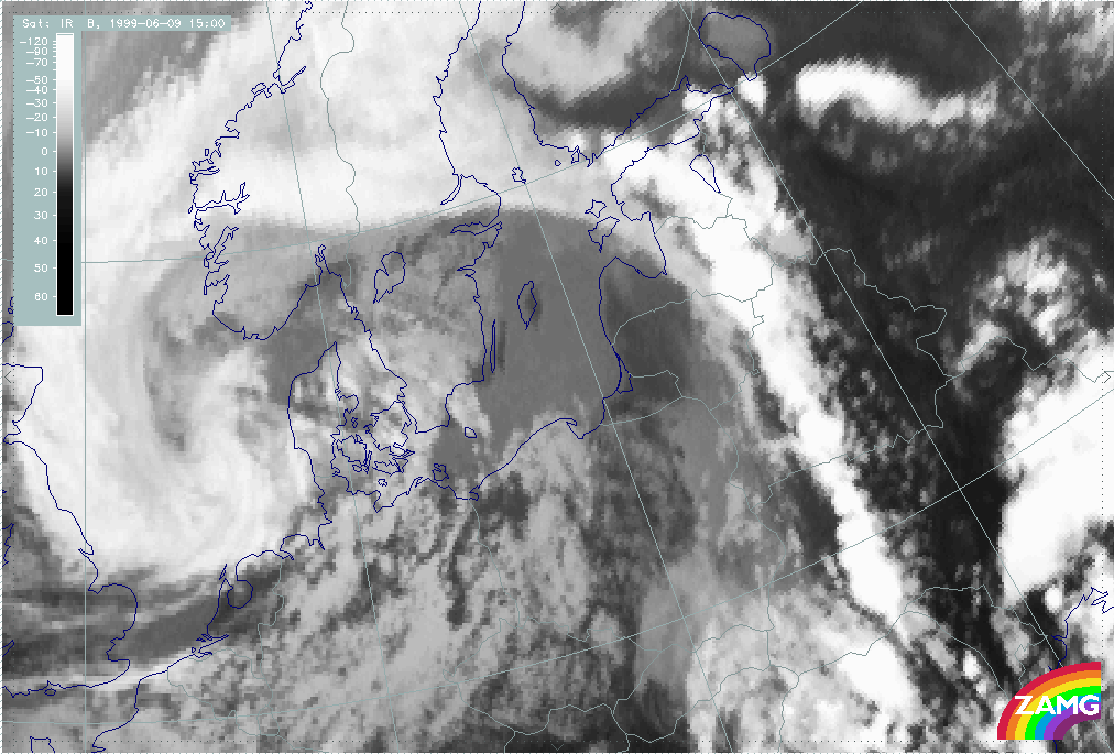
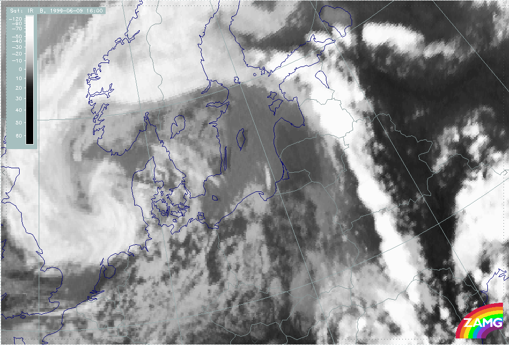
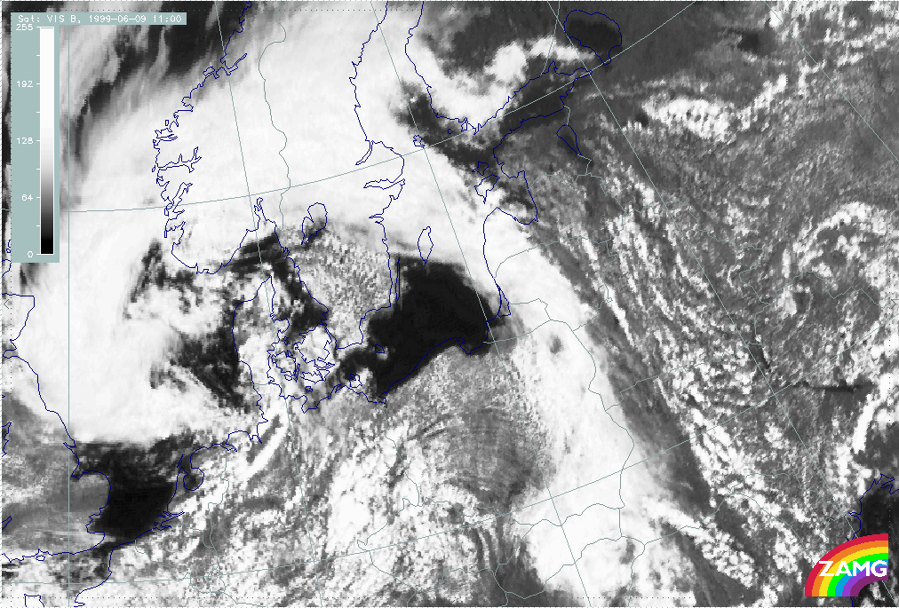
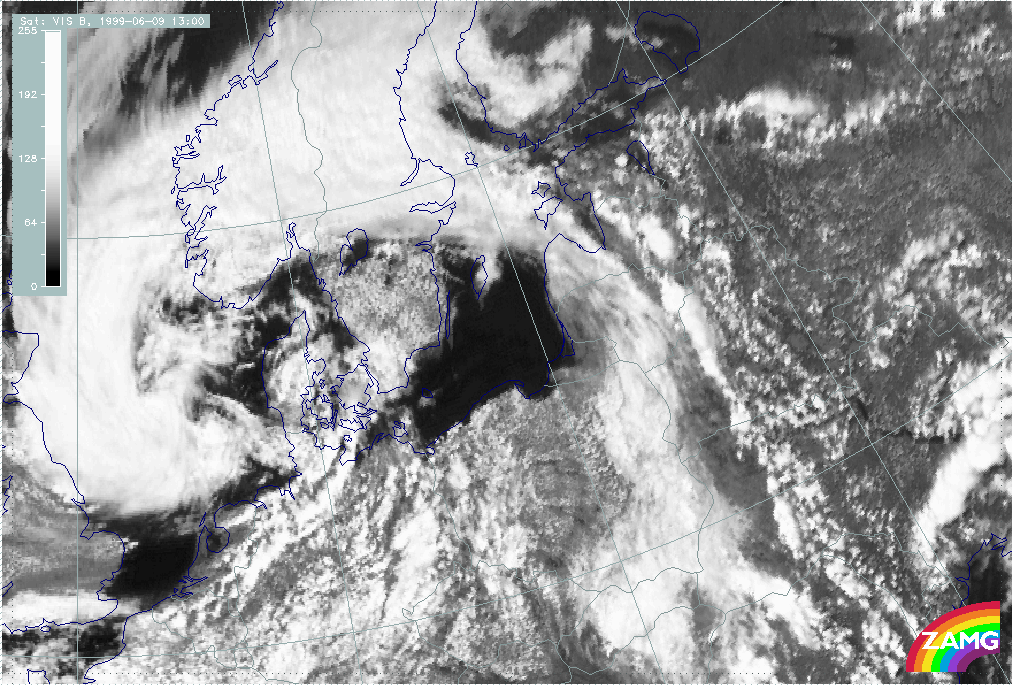
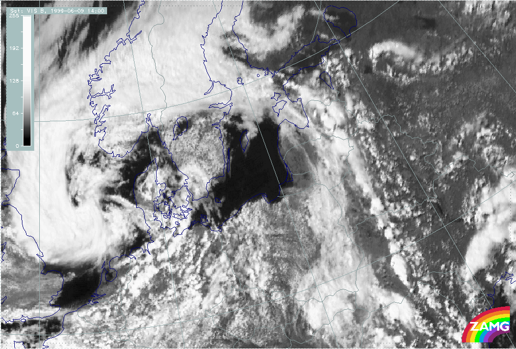
The sequence from 06 to 16 UTC clearly shows the convective developments along the Convergence Line. The very intensive developments are shown by a satellite image sequence. Two influences can be noticed:
- The development related to the solar radiation and heating of the land
- The approach of the upper level cloudiness (better seen in the IR images) which might be indicative of the cold air at upper levels; at the same time low level clouds (better seen in the VIS image) remain to the rear of the Convergence Line and slowly dissolve.
|
09 June 1999/06.00 UTC - Meteosat IR image; 09.00 - 16.00 UTC hourly image loop
|
09 June 1999/06.00 UTC - Meteosat VIS image; 09.00 - 16.00 UTC hourly image loop
|
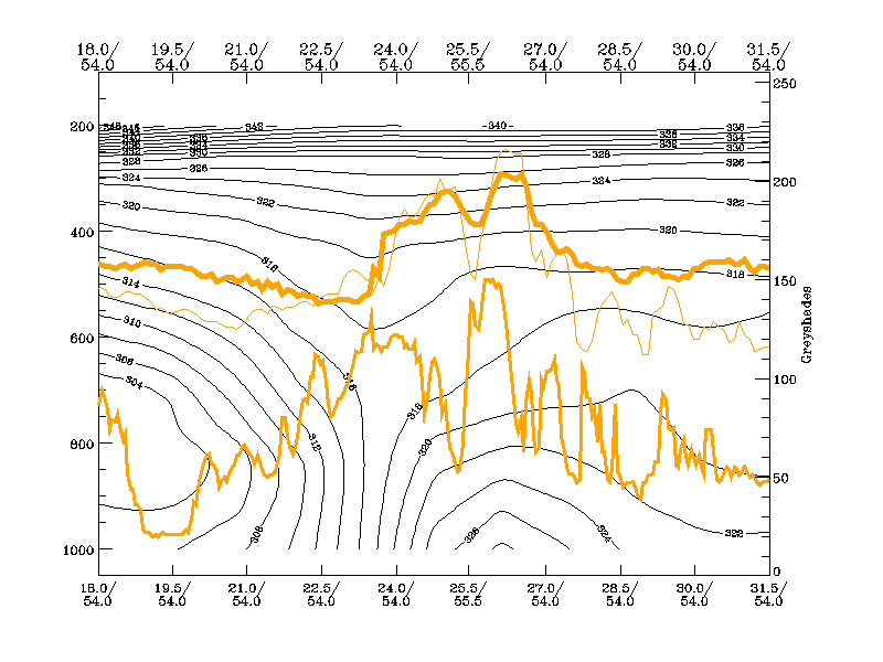
The existence of colder and drier air crossing at higher levels can be checked with help of relative streams.
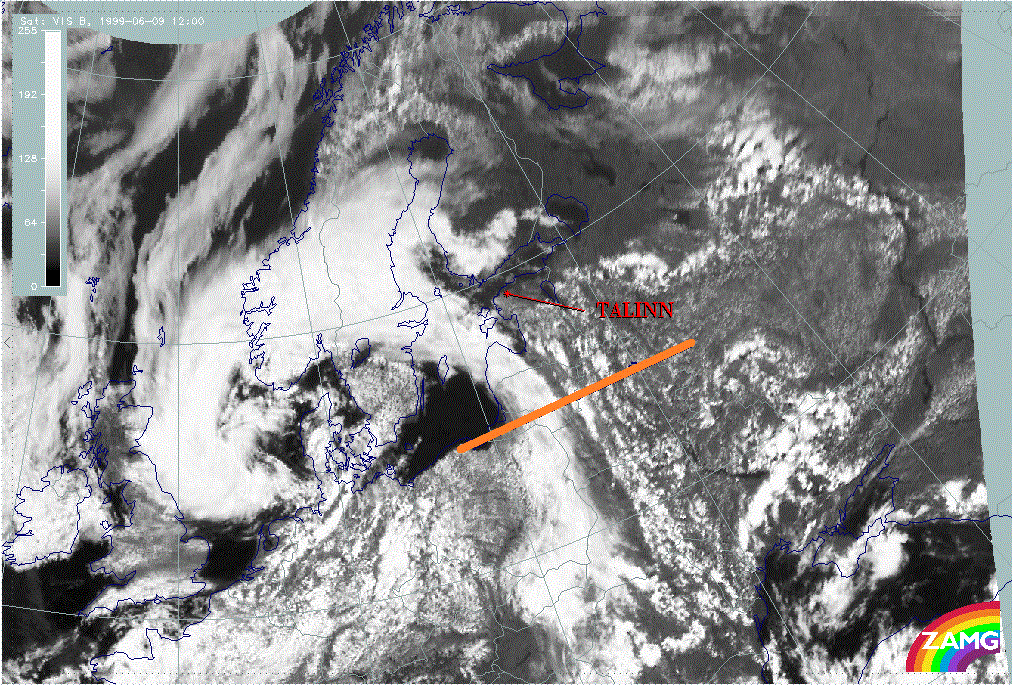
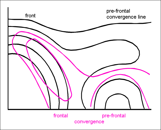
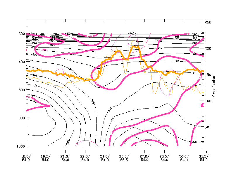
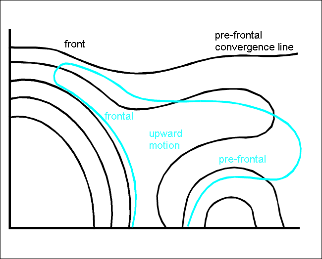
The vertical cross section shows two peaks in the pixel values. One at 54N/23E is the frontal cloud band. The other at 54N/26E belongs to the convective Convergence Line. The isentropic surface of 318K lies above both the frontal and the unstable layer.
|
09 July 1999/12 UTC - Vertical cross section; black: isentropes (ThetaE), orange thin: IR pixel values, orange thick: VIS pixel values
|
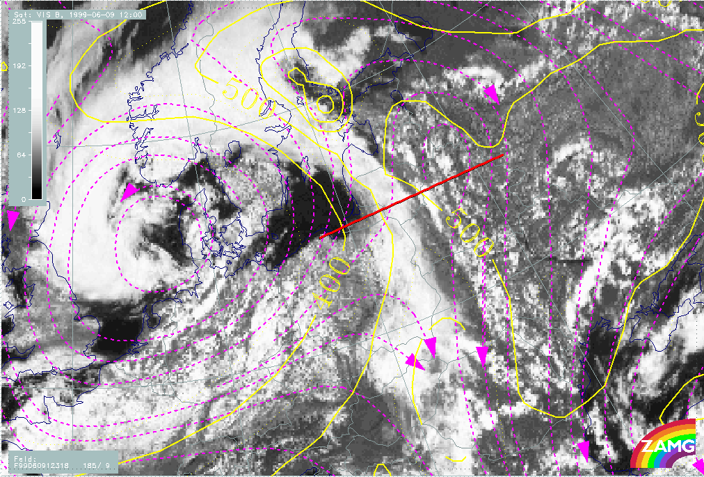
09 June 1999/12.00 UTC - Meteosat VIS image; magenta: relative streams 318K, yellow: isobars 318K; position of vertical cross
section indicated
|
|
|
There is a relative stream from the cold air behind the frontal zone crossing the Cold Front band. This leads to an unstable stratification of the troposphere and goes hand in hand with the intensification of the convective cells. The mechanism for the developing of convective cloudiness described in the chapter describing MCSs (see Cb and MCS ) is also evident in this conceptual model.
But this is only an insight into the situation at the synoptic scale. The results cannot explain the band form of the pre-frontal Convergence Line. For this LAM models (e.g. Aladin) have to be studied. Small scale wind fields clearly show a confluence zone in front of the main frontal cloud band which results in a small scale convergence zone.
|
09 June 1999/12.00 UTC - Meteosat VIS image; green: wind vectors 925 hPa
|
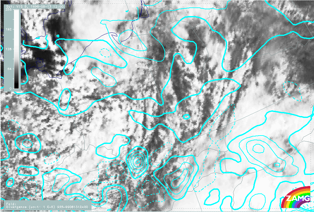
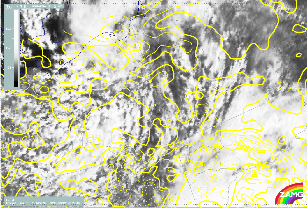
09 June 1999/12.00 UTC - Meteosat VIS image; cyan solid: convergence 925 hPa, cyan dashed: divergence 925 hPa
|
|
|
Such a situation is common knowledge of forecasters. The main reason is differential heating. It is similar to the process mentioned for the development of Cb Clusters in warm air (see Cumulonimbus Clusters In Warm Air ). Nevertheless there are some open questions regarding the location of the development of the Convergence Line. In about half of the cases the line appears at the eastern boundary of the bright WV band. This indicates different air masses above resulting in different heating of the ground.
Post-frontal convergence bands
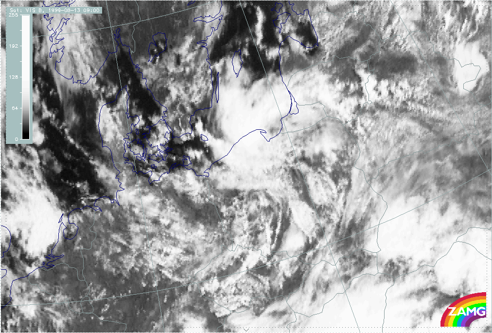
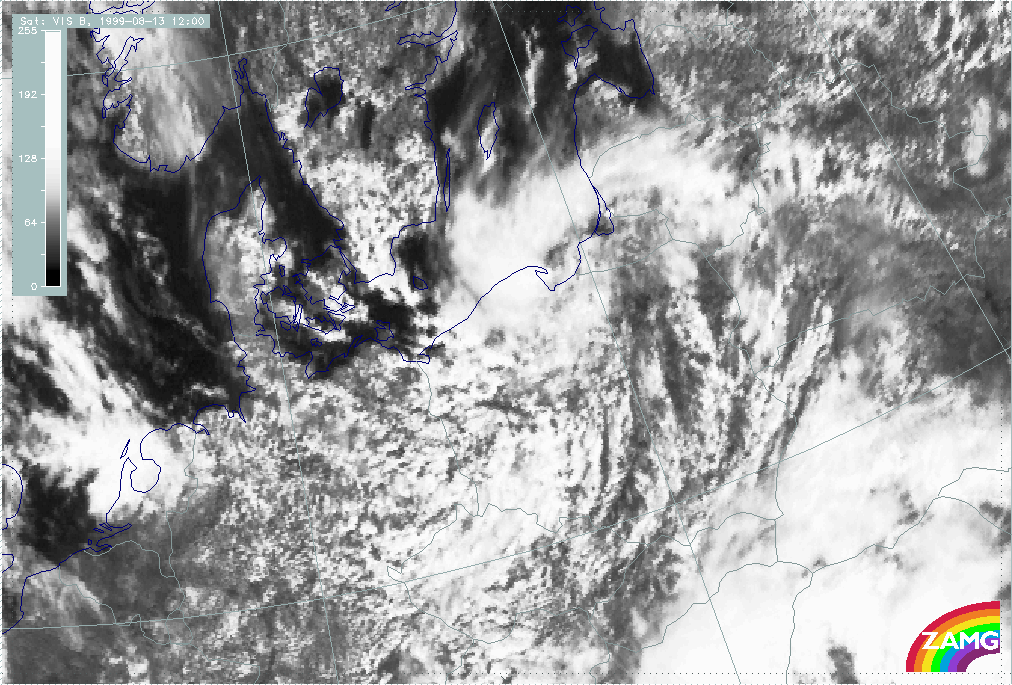
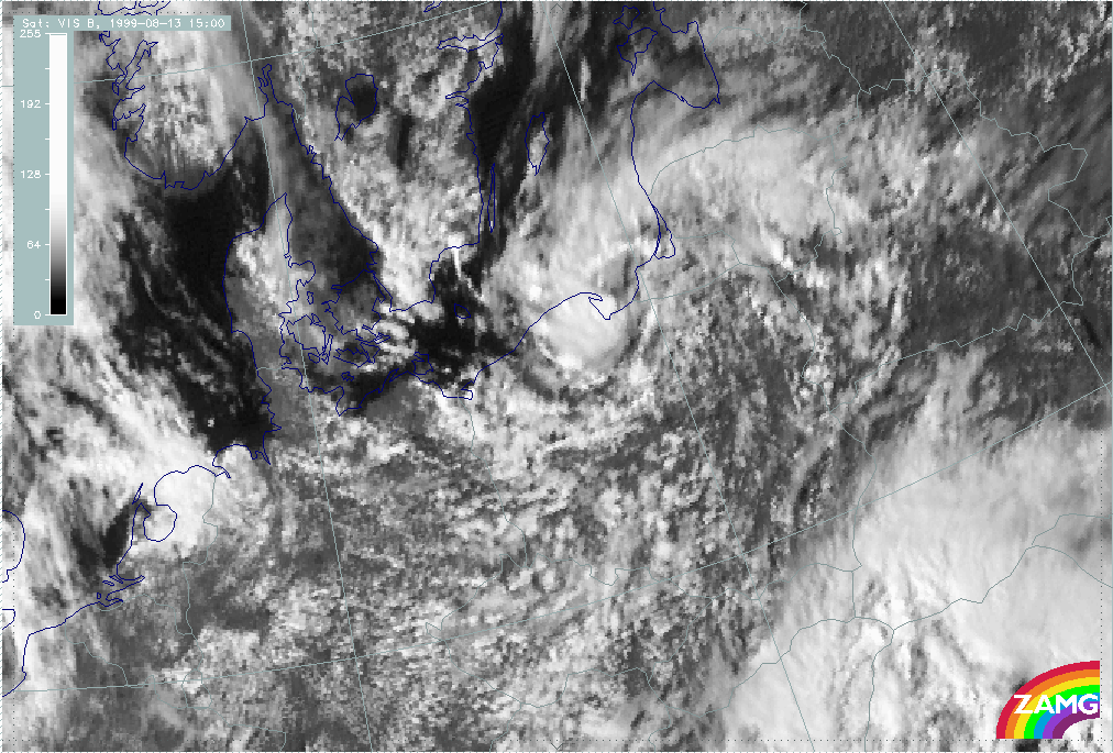
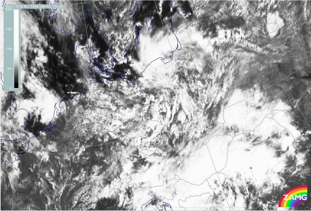
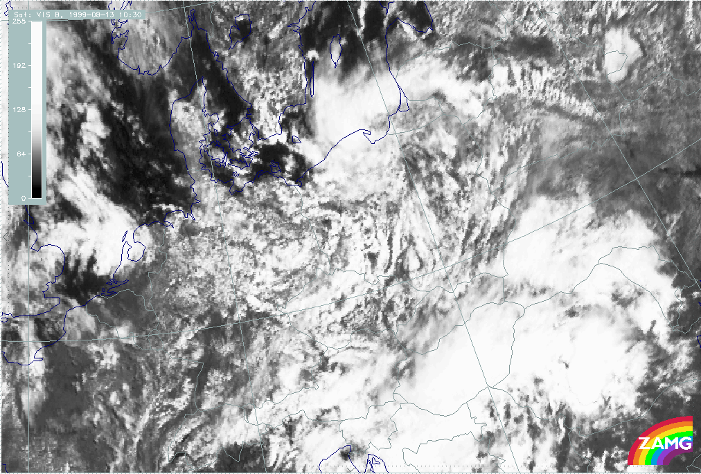
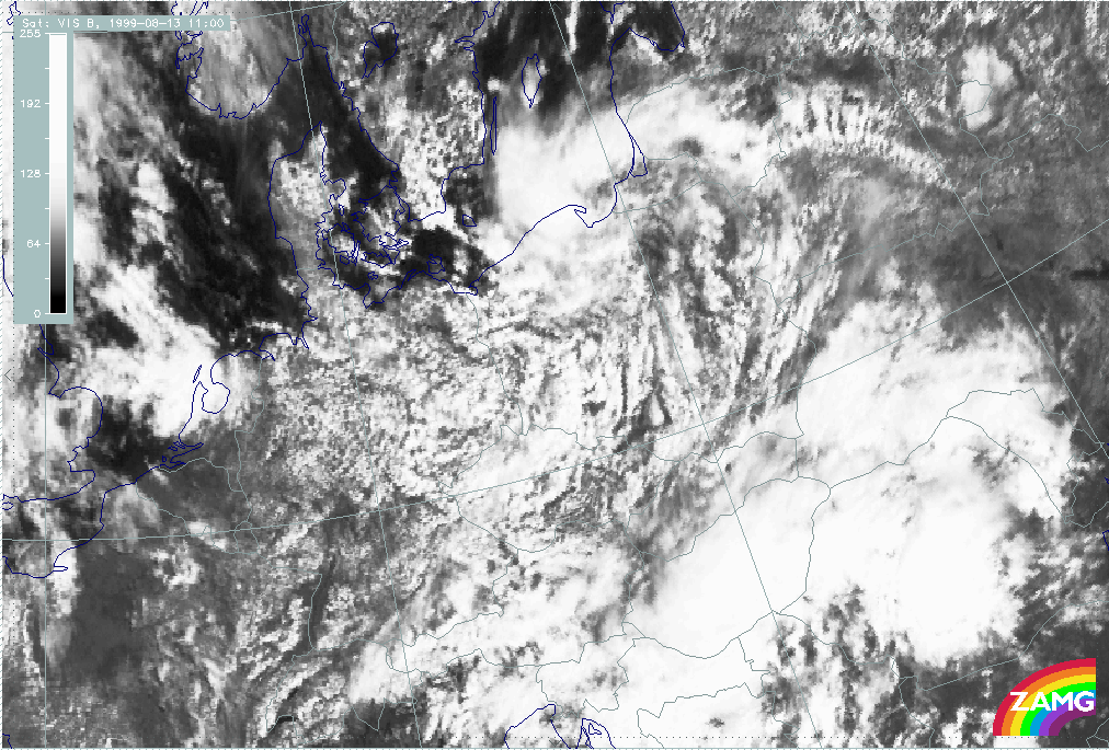
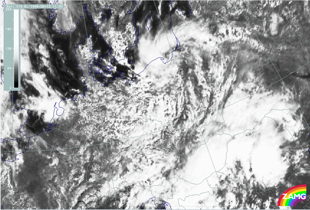
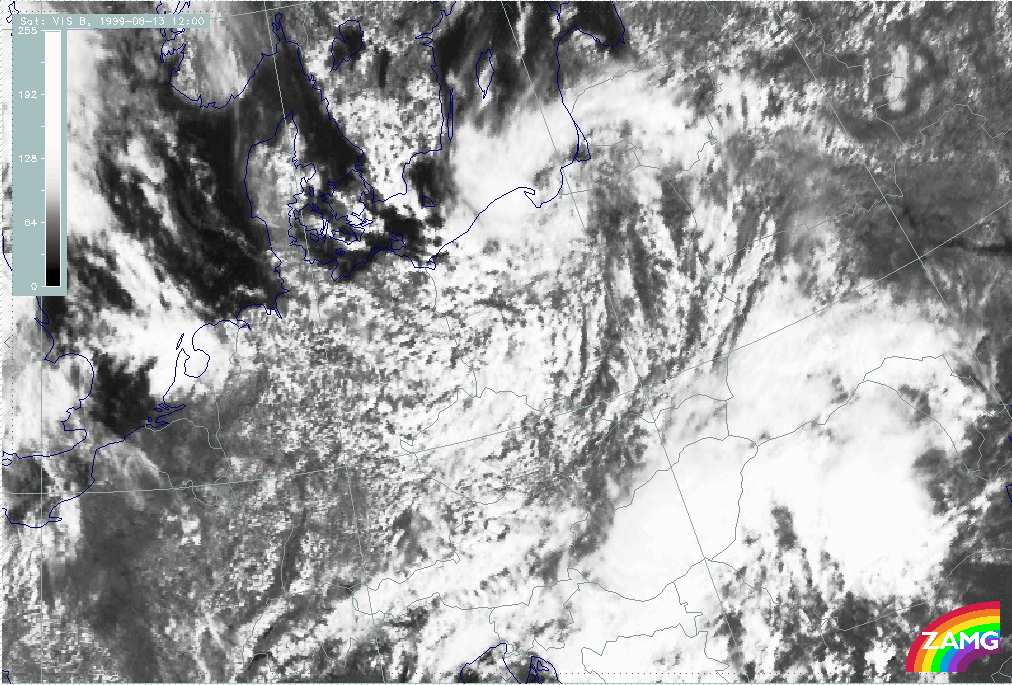
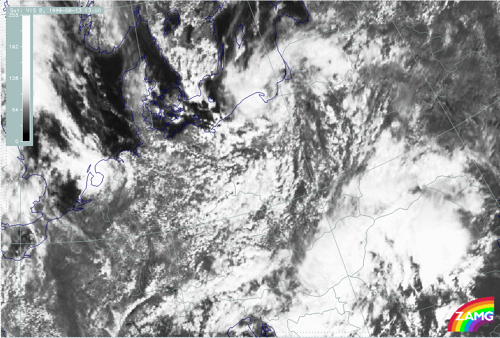
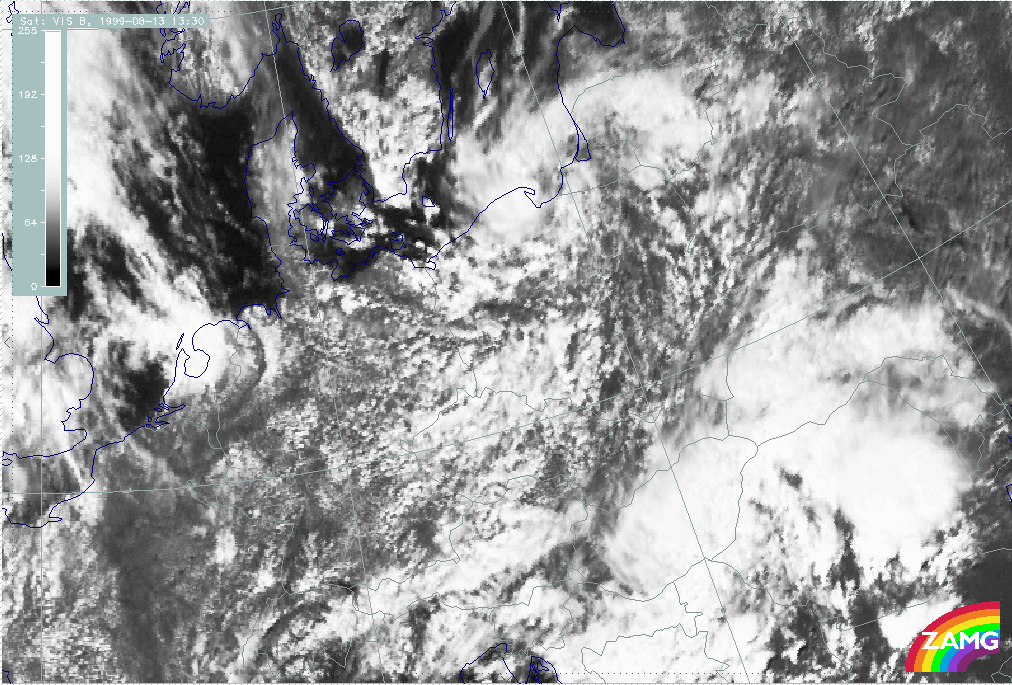
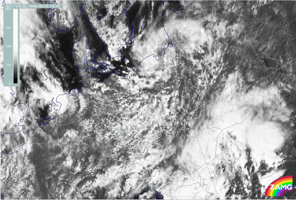
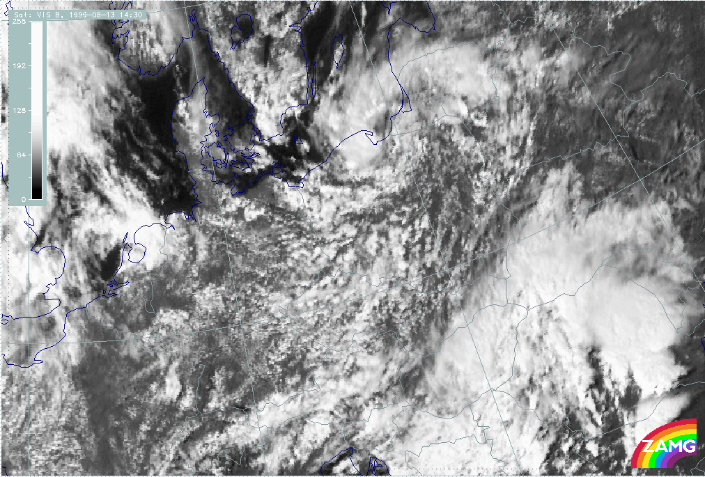
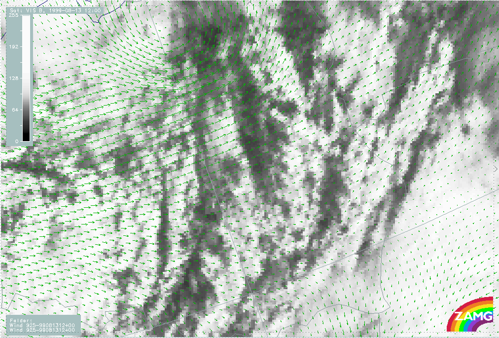
According to literature, convergence bands in the cold air are caused by instability and solar radiation and there is a life cycle during the day. However, the sequence shown below shows a decrease of convective cloudiness already in the early afternoon.
One might conclude that there are no additional factors that increase the convergence such as the flow of drier and cooler air at higher levels, typical for pre-frontal Convergence Lines. The post-frontal cloud bands already lie within dry and cold air which restricts the vertical extent of the convective lines.
|
13 August 1999/09.00 UTC - Meteosat VIS image
|
13 August 1999/12.00 UTC - Meteosat VIS image
|
|
|
|
|
|
13 August 1999/15.00 UTC - Meteosat VIS image
|
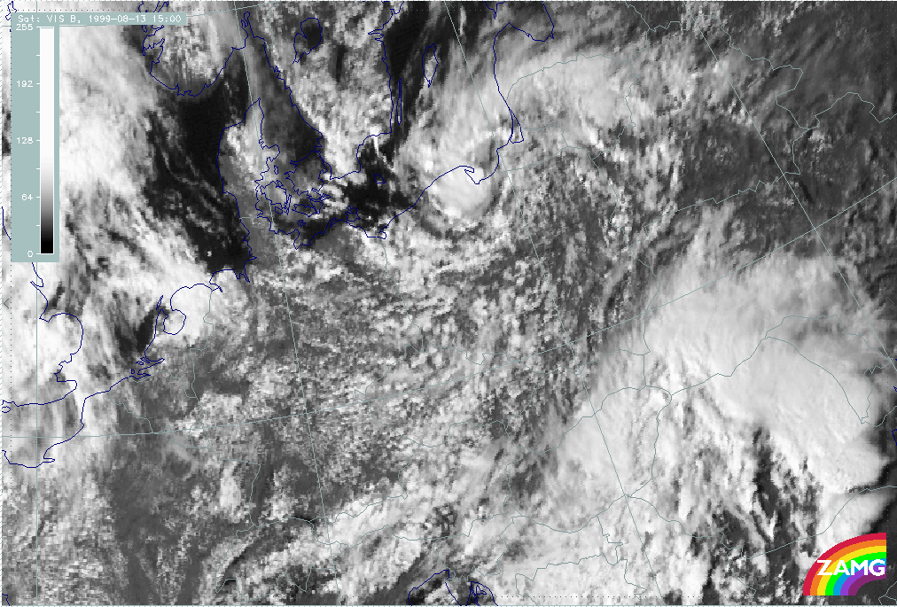
13 August 1999/10.00 UTC - Meteosat VIS image; 10.00 - 15.00 UTC half-hourly image loop
|
Key Parameters
Typical synoptic environment
Convective lines in advance of frontal cloud bands
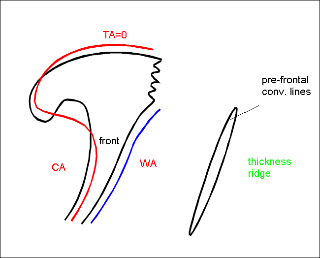
- Convective lines in advance of frontal cloud bands are situated within or at the rear edge of the equivalent thickness ridge.
- Since they are in the neighbourhood of fronts there can be some Thermal Front Parameter (TFP) further behind indicating the frontal cloud band.
- Although Temperature Advection (TA) is not very pronounced, there is some warm advection in front of the frontal system.
|
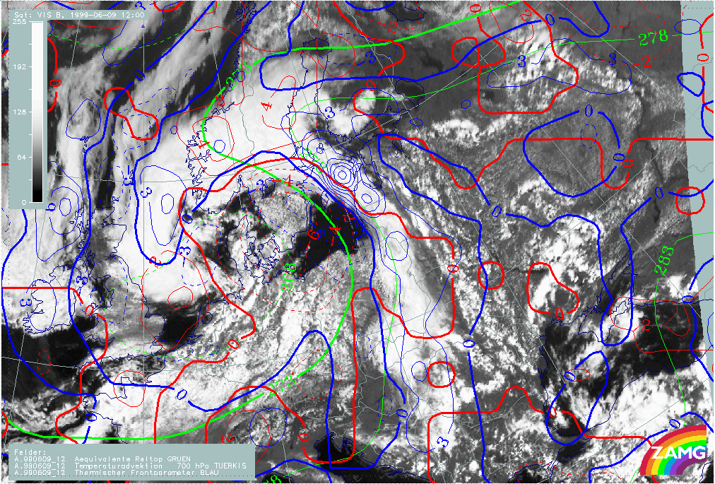
|
09 June 1999/12.00 UTC - Meteosat VIS image; blue: thermal front parameter 700 hPa, red: temperature advection 700 hPa, green:
equivalent thickness 700 hPa
|
|
|
The example shows the prefrontal Convergence Lines situated within weak Warm Advection (WA), an equivalent thickness ridge, and in front of the maximum of TFP.
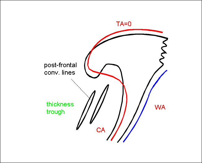
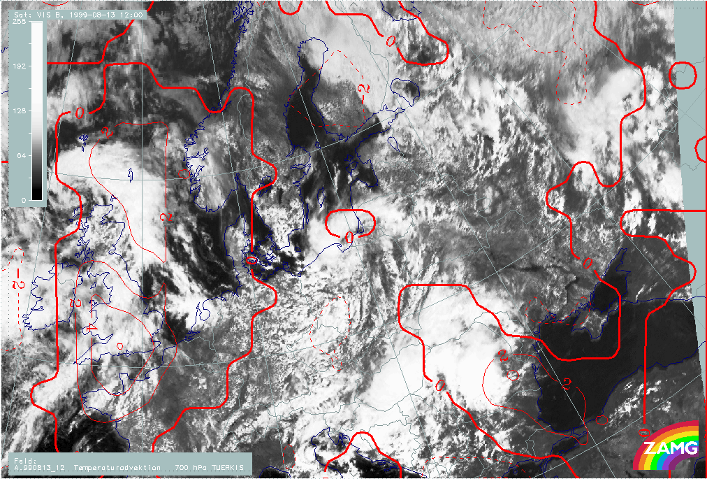
Convective lines in cold air behind Cold Fronts
- Convective lines in the cold air behind Cold Front cloud bands are situated within an equivalent thickness trough.
- Since they are in the neighbourhood of fronts there can be some TFP in advance of the convective line indicating the frontal cloud band.
- There is cold advection behind the frontal cloud band.
|
|
08 August 1999/12.00 UTC - Meteosat VIS image; red: temperature advection 700 hPa
|
|
|
The Convergence Lines are situated within cold advection.
- Both types occur with Showalter indices typical for instability (around 0)
Pre-frontal Convergence Line
Typical distribution of wind field, divergence and upward motion
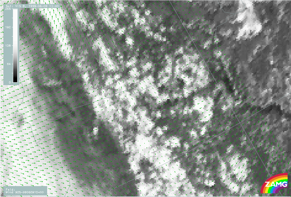
- Wind vectors: The wind field shows confluence up to a height of 850 hPa; above there is a uniform wind regime. Often there are easterly winds to the east and southerly winds to the West of the convective Convergence Line resulting in a discontinuity in the low level wind field.
- Convergence is found in the lower levels, sometimes only at 925 hPa, sometimes up to 800 hPa.
- Upward motion can be observed to a slightly higher level.
|
|
09 June 1999/12.00 UTC - Meteosat VIS image; green: wind vectors 925 hPa
|
|
|
Westerly winds to the west, easterly winds to the east of the convergence cloud band result in convergence at lower levels.
|
|
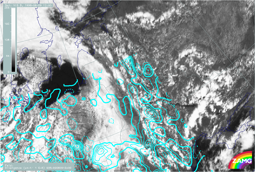
09 June 1999/12.00 UTC - Meteosat VIS image; cyan solid: convergence 925 hPa, cyan dashed: divergence 925 hPa
|

|
|
At 925 hPa the image shows strong convergence at the Convergence Lines, whilst at the frontal cloud band, no marked convergence can be found at this height.
|
|
09 June 1999/12.00 UTC - Meteosat VIS image; yellow solid: upward motion 925 hPa, yellow dashed: downward motion 925 hPa
|
|
|
The vertical motion at 925 hPa corresponds to the divergence field below. There is strong upward motion at the Convergence Lines, while only weak upward motion or even subsidence is observed in the frontal cloud band.
Post-frontal Convergence Line
|
13 August 1999/12.00 UTC - Meteosat VIS image; green: wind vectors 925 hPa
|
|
|
The wind vectors show westerly winds decreasing to the east.
|
13 August 1999/12.00 UTC - Meteosat VIS image; cyan solid: convergence 925 hPa, cyan dashed: divergence 925 hPa
|
|
|
The image shows convergence prevailing at Convergence Lines although the line structure is not reflected in the model field. At higher levels, less convergence and a larger area of divergence is seen.
|
13 August 1999/12.00 UTC - Meteosat VIS image; yellow solid: vertical motion - upward motion 925 hPa, yellow dashed: vertical
motion - downward motion 925 hPa
|
|
|
The field of vertical motion corresponds with the field of divergence. At the lower level there is a large area of upwards motion, whereas there is more downward motions at higher levels.
The post frontal Convergence Lines are not as well marked as pre frontal lines. They also show less convective activity.
Typical Appearance In Vertical Cross Sections
There is diurnal variation of parameters corresponding to the development of convective convergence cloudiness; the parameters shown below are characteristic of the maximum rate of development around noon.
|
09 June 1999/12.00 UTC - Meteosat VIS image; position of vertical cross section indicated
|
|
|
- Isentropes of equivalent potential temperature show a typical unstable stratification in low to middle levels depending on the intensity of the cloud systems. This can be seen as decreasing values of equivalent potential temperature with height.
|
|
09 July 1999/12 UTC - Vertical cross section; black: isentropes (ThetaE), orange thin: IR pixel values, orange thick: VIS pixel
values
|
|
|
The Convergence Line is represented by the peak around 54N/26E. Tbe peak immedietely to the E (54N/23E) represents the frontal cloudiness.
- Convergence is found mainly in the lower levels, sometimes only at 925 hPa. However, it extends up to about 800 hPa in places. Upward motions can be observed reaching a slightly higher level.
|
|
09 July 1999/12.00 UTC - Vertical cross section; black: isentropes (ThetaE), magenta thin: divergence, magenta thick: divergence,
orange thin: IR pixel values, orange thick: VIS pixel values
|
|
|
There is distinct convergence in lower layers up to 850 hPa in the area of the peak representing the convergence cloud band.
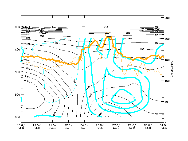
- Vertical motion is upward in lower and middle layers and downward at higher levels. Upward motion usually reaches a higher level than the convergence.
|
|
09 July 1999/12.00 UTC - Vertical cross section; black: isentropes (ThetaE), cyan thick: vertical motion (omega) - upward motion,
cyan thin: vertical motion (omega) - downward motion, orange thin: IR pixel values, orange thick: VIS pixel values
|
|
|
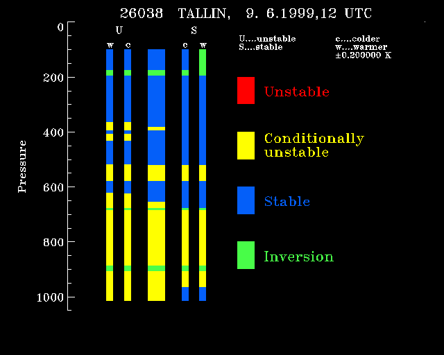
- Radiosondes within the convergence cloud bands show unstable or conditionally unstable layers up to 650 hPa separated by thin stable layers or even small inversions.
The thick central column represents the radiosounding (the thin columns represent fictious soundings as they would appear if the temperature changes by a small amount at various levels. Features appearing in both types of sounding indicate firm features of the sounding.). There is a thick, conditionally unstable, layer from the surface up to 650 hPa and some thinner layers above.
|
09 June 1999/12.00 UTC - radiosonde Tallin, stability analysis (blue: absolutely stable, yellow: conditionally unstable, red:
absolutely unstable, green: inversion)
|
|
|
Profile of stability derived from the radiosonde at Tallin at 9 June 1999, 12 UTC.
Weather Events
| Parameter | Description |
| Precipitation |
|
| Temperature |
|
| Wind (incl. gusts) |
|
| Other relevant information |
|
|
|
01 July 1999/12.00 UTC - Meteosat IR image; precipitation in mm (06.00 - 18.00 UTC), weather events (green: rain and showers, blue:
drizzle, cyan: snow, red: thunderstorm, yellow: fog, black: no precipitation)
|
|
|
References
- James, Browning (1979): Mesoscale structure of line convection at surface cold fronts, Quart. Journal Royal Met. Society, 105, 371-382
- Hobbs, Persson (1982): The Mesoscale and Microscale Structure and Organization of Clouds and Prcipitation in Midlatitudes Cyclones, Journal of Atm. Sciences, 39 (2), 280-295
- Ogura, Liou (1980): The structure of a Midlatitude Squall line: A Case Study, Journal of Atm. Sciences, 37, 553-567
- Thorpe, Miller, Moncrieff (1982): Two-dimensional Convection in Non-constant Shear: a Model of Midlatitude Squall Lines, Quart. Journal Royal Met. Society, 108 (458), 739
- Ziegler (1996): Convective Initiation of a Dryline: A Model Study, Monthly Weather Review, 1996, 125 (6), 1001 - 1026