Typical Appearance In Vertical Cross Sections
Two types of vertical cross sections are presented in this chapter: one from the large scale ECMWF model and the other from the meso-scale model Aladin.
Vertical cross-sections from the ECMWF model
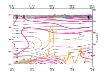
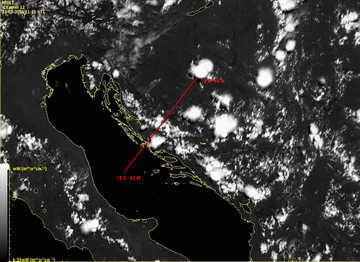
When ECMWF cross-sections are analyzed, it can be noted that some features can be recognised even with the coarse grid of this large area model. The typical parameters are equivalent potential temperature, divergence and upward motion. The ECMWF cross section is laid over a Greek Convergence Line.
|
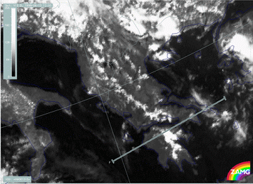
13 June 1999/12.00 UTC - Meteosat 7 VIS image; position of vertical cross section indicated
|
|
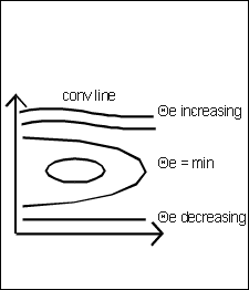
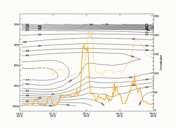
The isentropes show an unstable air mass up to 700 hPa (or even higher) characterised by decreasing values of equivalent potential temperature with height. The difference between the surface and the minimum value can exceed 10 degrees.
|
|
13 June 1999/12.00 UTC - Vertical cross section; black: isentropes (ThetaE), orange thin: IR pixel values, orange thick: VIS pixel
values
|
The convective line under consideration is accompanied by the pronounced peak, located in the centre of the image at about 22,5E/37,5N. The shift between VIS and IR signals represent the core and the Cirrus shield of the cell. The unstable air mass can be observed from the surface up to 550 hPa in this region.
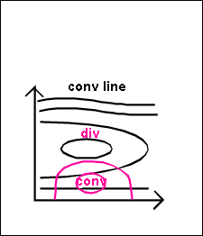
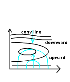
- There is convergence in low layers and divergence above.
|
|
13 June 1999/12.00 UTC - Vertical cross section; black: isentropes (ThetaE), magenta thin: divergence, magenta thick: divergence,
orange thin: IR pixel values, orange thick: VIS pixel values
|
The example shows pronounced convergence up to 900 hPa, above there is divergence.
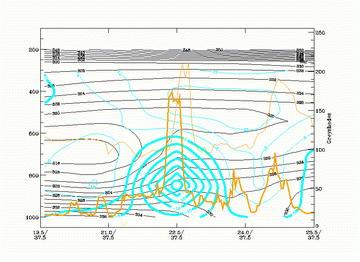
- Upward motion is situated in the convergence lines on top of the convergence zone.
|
|
13 June 1999/12.00 UTC - Vertical cross section; black: isentropes (ThetaE), cyan thick: vertical motion (omega) - upward motion,
cyan thin: vertical motion (omega) - downward motion, orange thin: IR pixel values, orange thick: VIS pixel values
|
Vertical cross-sections from the meso-scale model Aladin
The example cross-section is laid across the Dinaric Alps as shown in the image below.
|
24 July 2006/11.45 UTC - Meteosat 8 HRVIS image; position of vertical cross section indicated
|
|
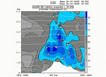
- Highest values of relative humidity are found above the mountain chain, representing the clouds forming there.
- The isentropes show an unstable air mass up to 2.5 km height in the region above the mountains
|
24 July 2006/12.00 UTC - Vertical cross section; grey: relative humidity <60%; blue: relative humidity >60%; white: potential
temperature (isentropes)
|
|
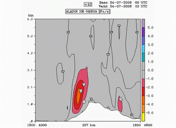
- Upward motion occurs above the slopes of the mountains.
|
24 July 2006/12.00 UTC - Vertical cross section; red: omega <0 (upward motion)
|
|
Vertical velocity field shows that there is upward motion in the first 3 km above the ground, slightly on the seaward side of the mountain.
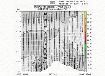
- Convergence of the wind in the lower layers above the mountain chain
|
24 July 2006/12.00 UTC - Vertical cross section; wind vectors; grey: wind speed; white: isotherms
|
|
The wind field shows convergence of the wind taking place in the lower 2 km.
Radio Sonde data
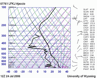
Another way to investigate the vertical structure of the atmosphere in the region of the convergence induced by orographic influence is the analysis of the radiosonde measurement, presented by Skew T diagram.
A Skew T diagram is a plot of temperature with height as denoted by pressure. The pressure lines are plotted horizontally and are on an inverse log scale. The concept of Skew T means that the temperature is not plotted vertically but angles off to the right at a 45 degree angle. The green curved lines are called dry adiabats. The blue curved lines are saturation adiabats. The sounding is plotted as two black lines. The right line is the temperature profile and the left line is the dewpoint profile. The thin black line (behind the temperature line) is the parcel temperature. The winds are plotted as wind barbs with height on the right edge of the plot.
The example shown here is from the radiosonde station in Ajaccio.
|
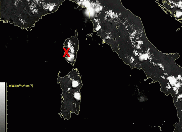
24 July 2006/11.45 UTC - Meteosat 8 HRVIS image; position of Ajaccio station indicated
|
24 July 2006/12.00 UTC - Skew T diagram of the radio sonde measurement in Ajaccio
|
What is seen in this Skew T plot is that the atmosphere above the Ajaccio station was not very unstable, although some of the stability parameters, such as Showalter index and K index, indicate instability. If the parcel temperature is looked at it can be seen that a parcel in given conditions is cooler than the surrounding air or, in other words, rather stable. Since Ajaccio is not placed at the mountain top, but very low (at the altitude of just 9 m) the effect of the mountain is not visible. In other words, this diagram represents the conditions of the air surrounding the mountain, but not at the mountain itself. The fact that the air was rather stable corresponds to the theoretical background of the Convergence Lines which actually develop in generally stable air and the formation of the clouds is caused by the convergence produced by diabatic heating of the mountain slopes.
