Cloud Structure In Satellite Images
Compared to the appearance in the Meteosat 7 images, in which they were seen as bright lines along the mountain chains, higher spatial resolution of Meteosat Second Generation images enables the distinction of very small convective cells within the Convergence Line.
Convergence lines can be seen in all 12 Meteosat 8 channels.
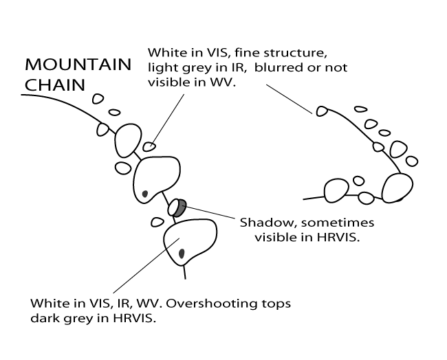
- The best channels to detect small scale convective Convergence Lines are the visible channels 0.6 and 0.8µm where the lines are bright, but the best of all is the High Resolution Visible (HRVIS) channel in which also the small cells within the Line are visible.
- In the IR images Convergence Lines can be either white or grey. Sometimes it is not possible to discriminate between high cloud fibres and convective cloudiness. Consequently, this can lead to an overestimating of convective cloudiness. However, well developed cells are easily recognisable also in the IR channels. Cloud tops of single cells within the line can reach temperatures of -50°C or even lower, whereas in other parts of the Convergence Line there can be much lower cells with cloud top temperatures of -10 to 0°C.
- In the WV channel 6.2, very small scale cells within the convective Convergence Lines cannot be detected easily. However, in parts with large convective cells can one see white spots in a dark or grey background. If the convective activity is very strong, these spots are very easily detectable. The situation is even clearer in WV 7.3 channel where the high level humidity is not present, so the cells differ much more from the background.
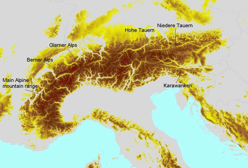
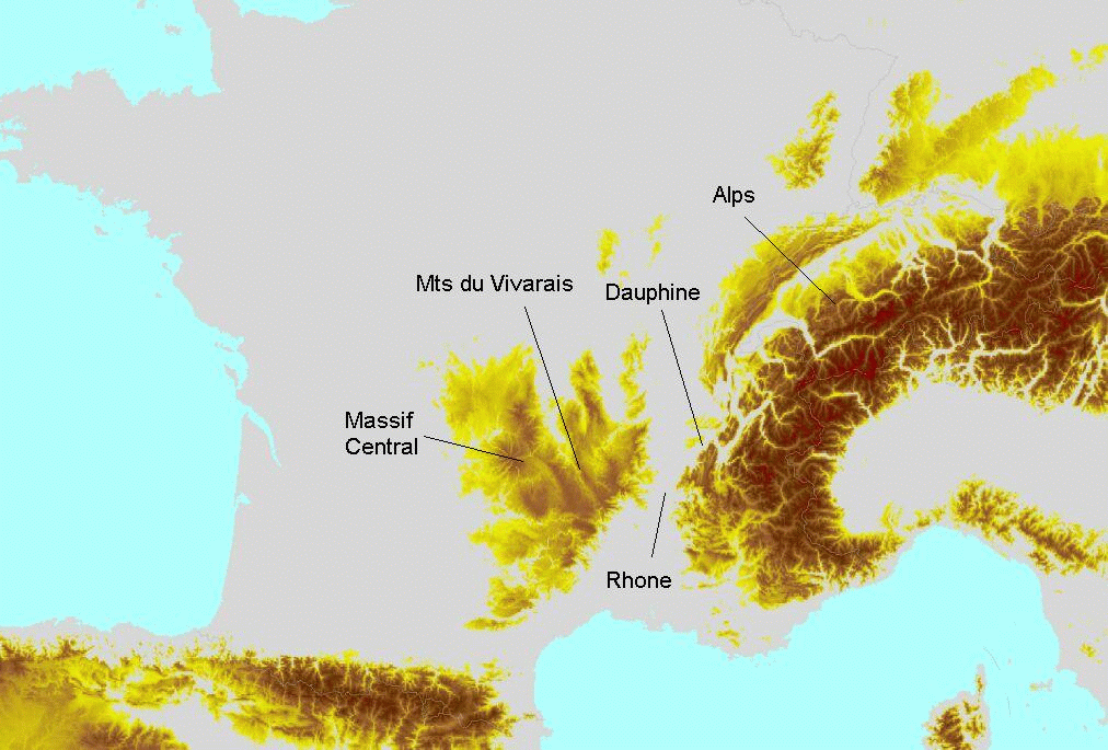
In Western and Central Europe, such lines can often be found over the Pyrenees, the Central Mountains in France, over the Alps, the Carpathian Mountains, in Italy over the Apennines, over the Dinaric Alps, the mountains on the Peloponnesian and the Pindos mountains with continuation to Macedonia.
Orographic Convergence Lines show a typical life cycle of several hours depending on the time of day. Development can be followed in all channels, however the appearance is most pronounced in the VIS channels, especially HRVIS.
|
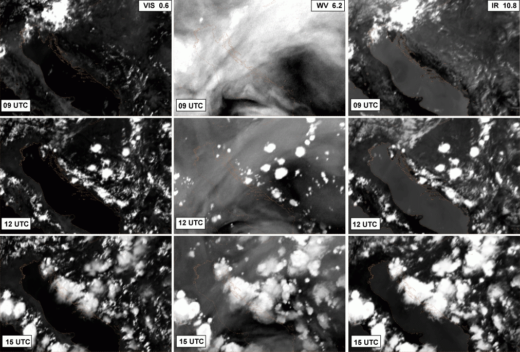
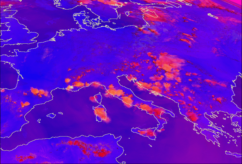
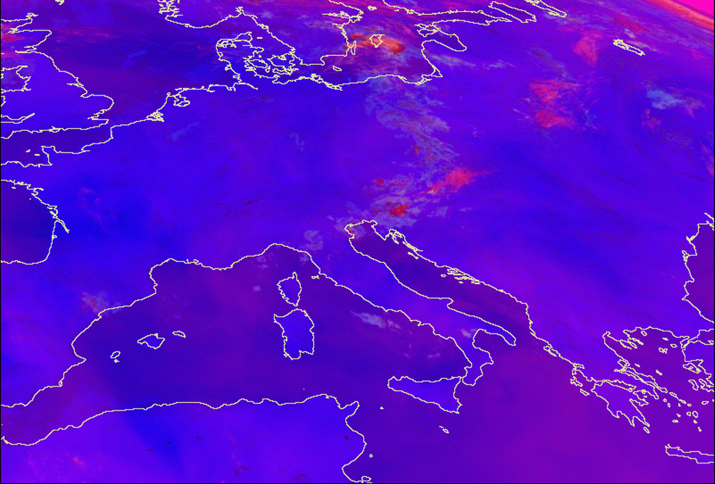
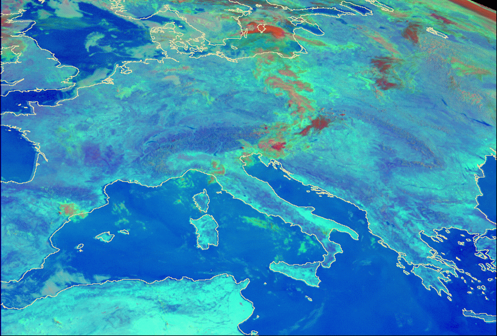
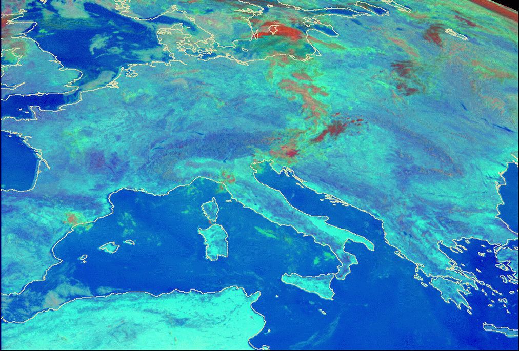
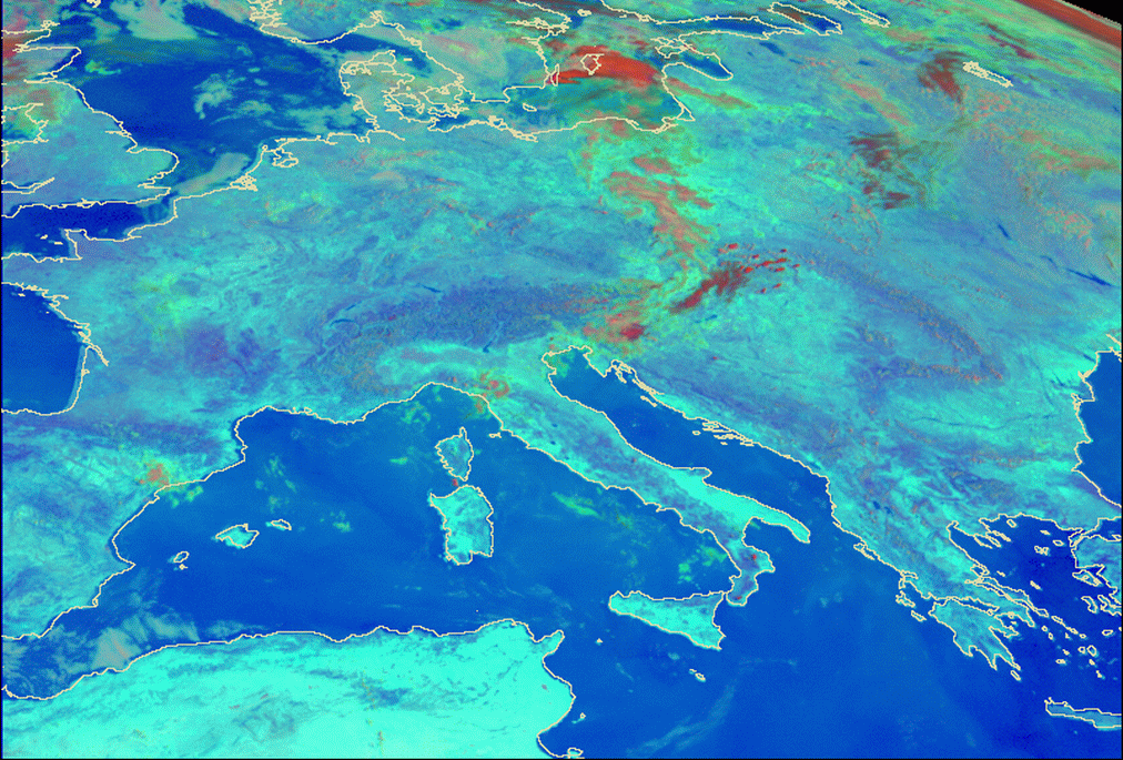
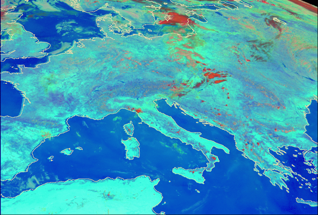
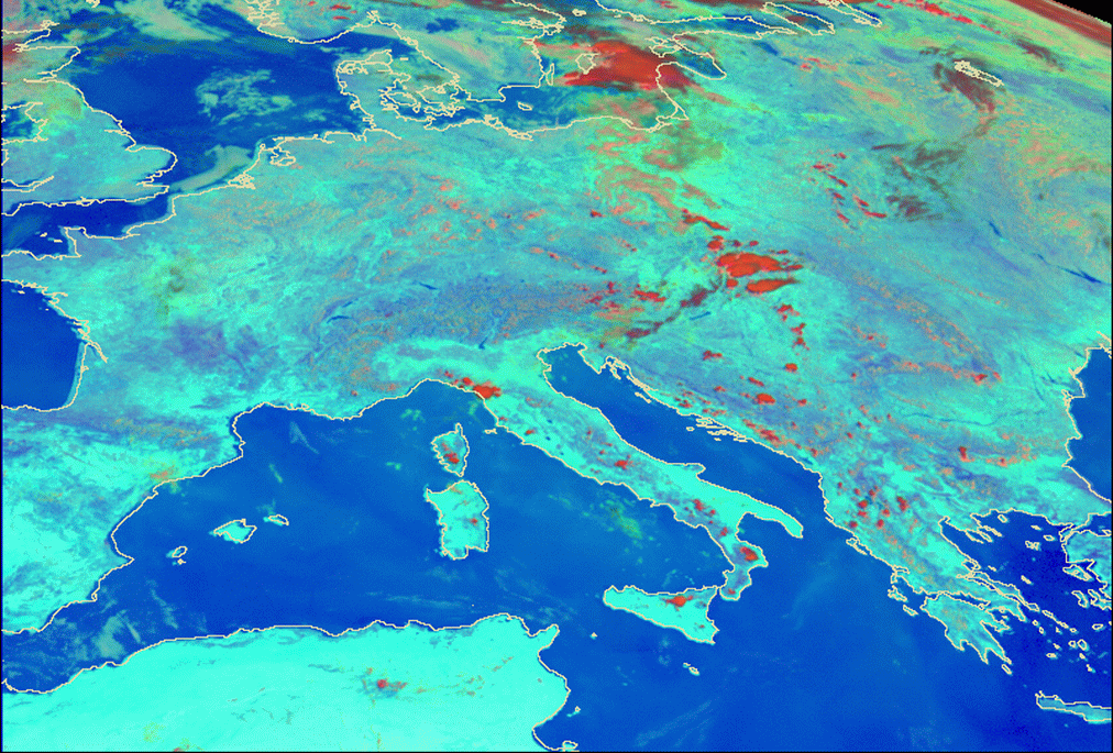
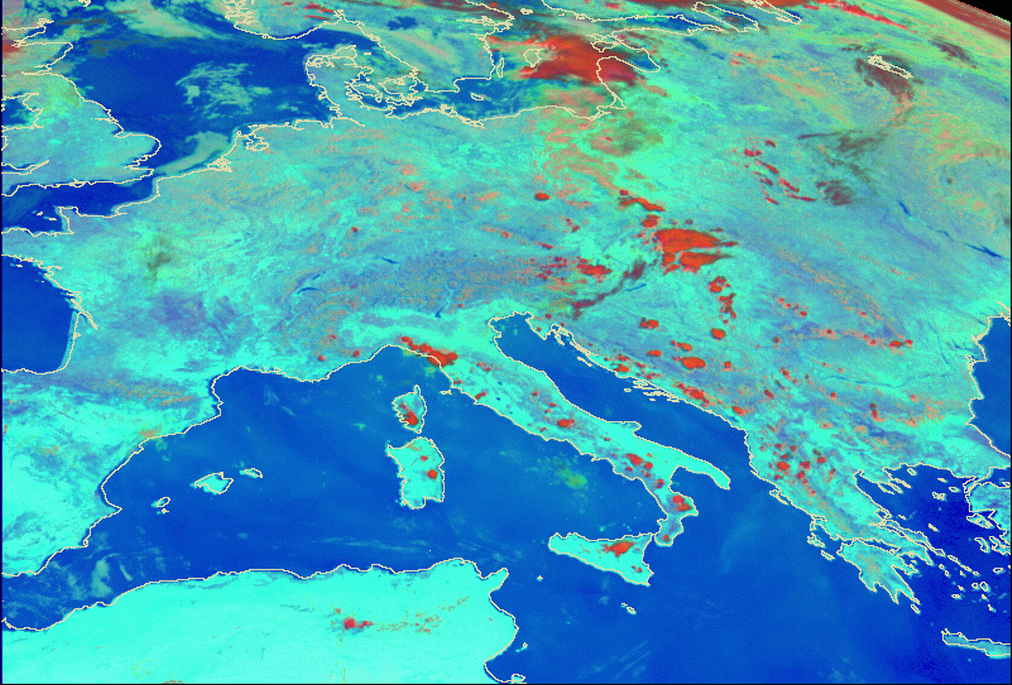
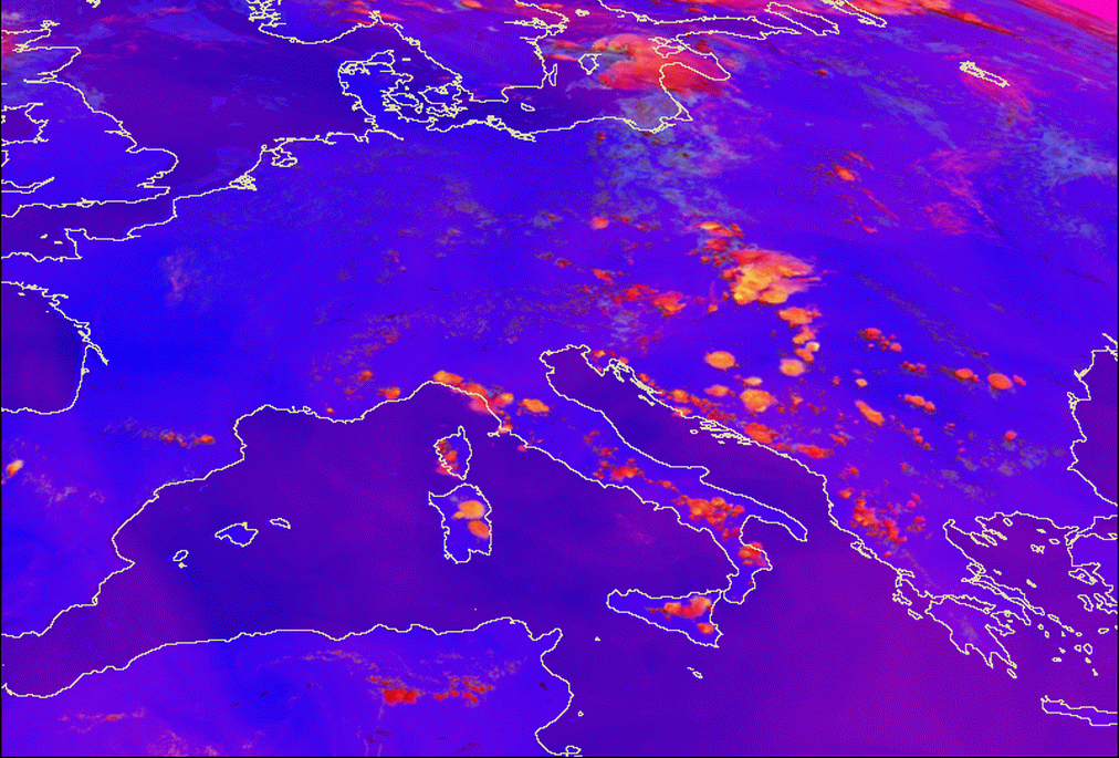
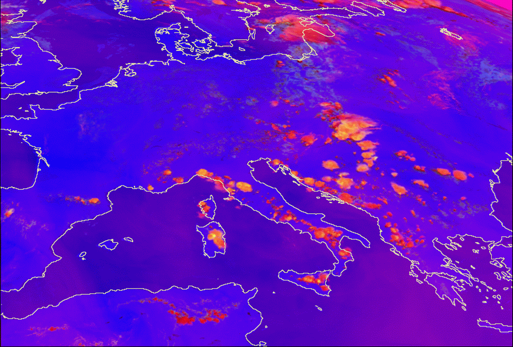
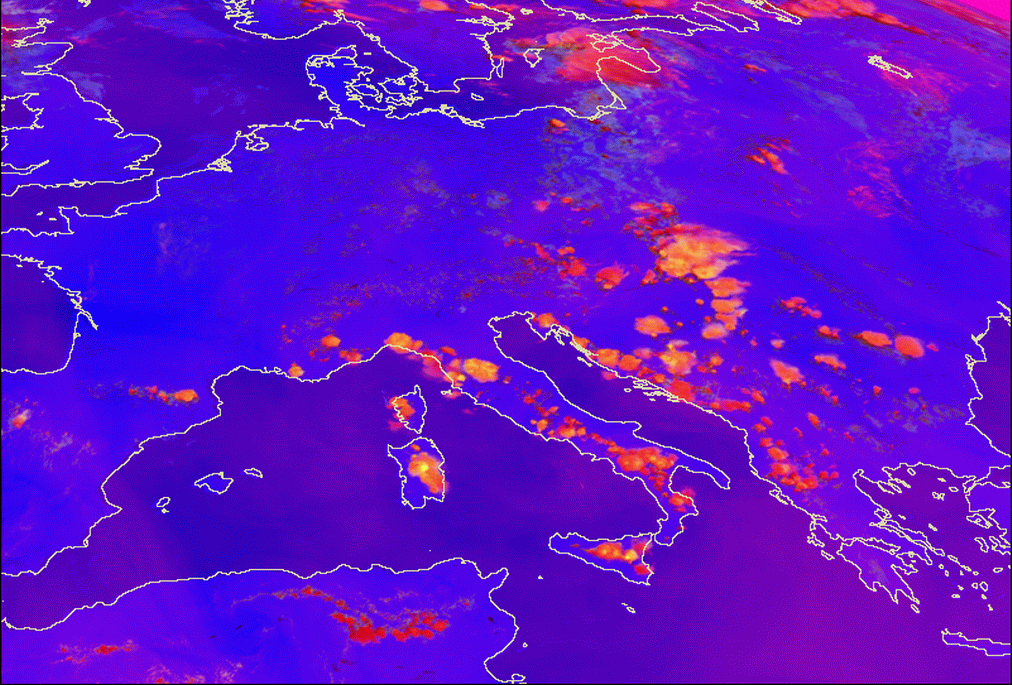
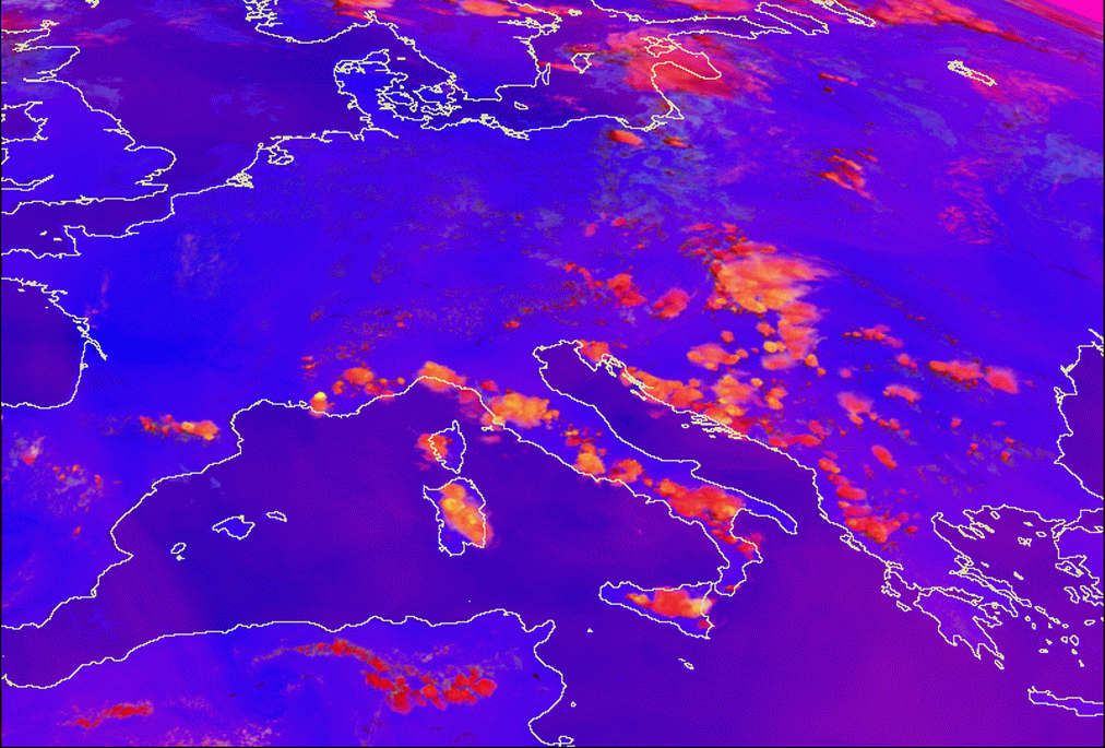
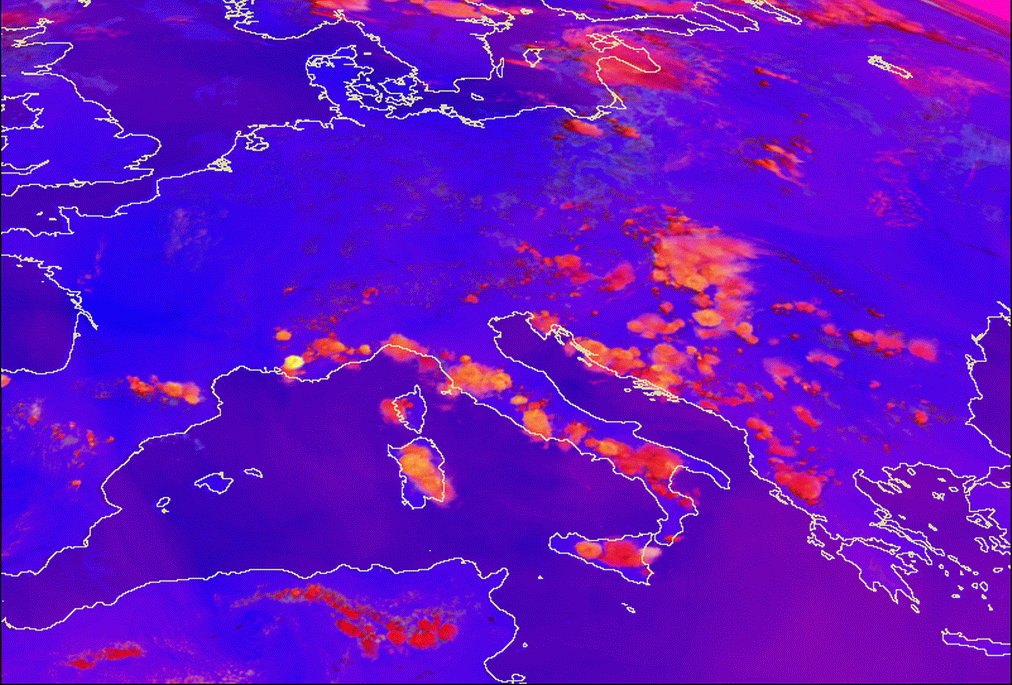
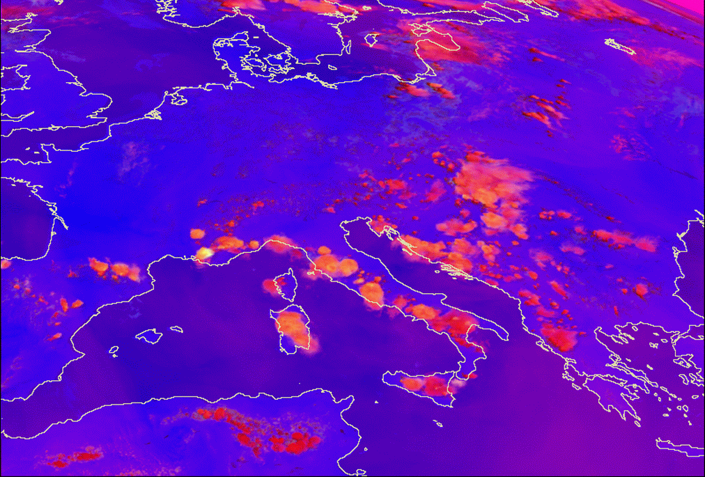
Meteosat 8 images on 24 July 2006 - first row 09 UTC, second row - 12 UTC, third row - 15 UTC; first column - VIS 0.6 µm,
second column - WV 6.2 µm, third column - IR 10.8 µm
|
|
|
Convective Convergence Lines in some typical regions and the appearance in HRVIS images in different times of day are described in more detail below.
1. Appearance in High Resolution Visible images
1.1 Greek convective Convergence Lines
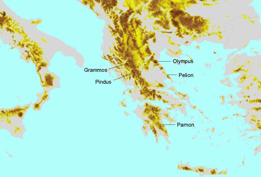
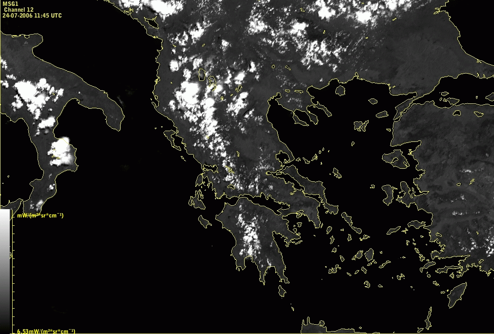
Lines of convective clouds can often be found over the Peloponnesian (Parnon), Pindus and Grammos mountains. Sometimes there are smaller lines in the East over neighbouring mountain chains.
|
|
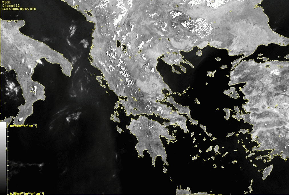
24 July 2006/09.00 UTC - Meteosat 8 HRVIS image
|
|
|
|
|
|
24 July 2006/12.00 UTC - Meteosat 8 HRVIS image
|
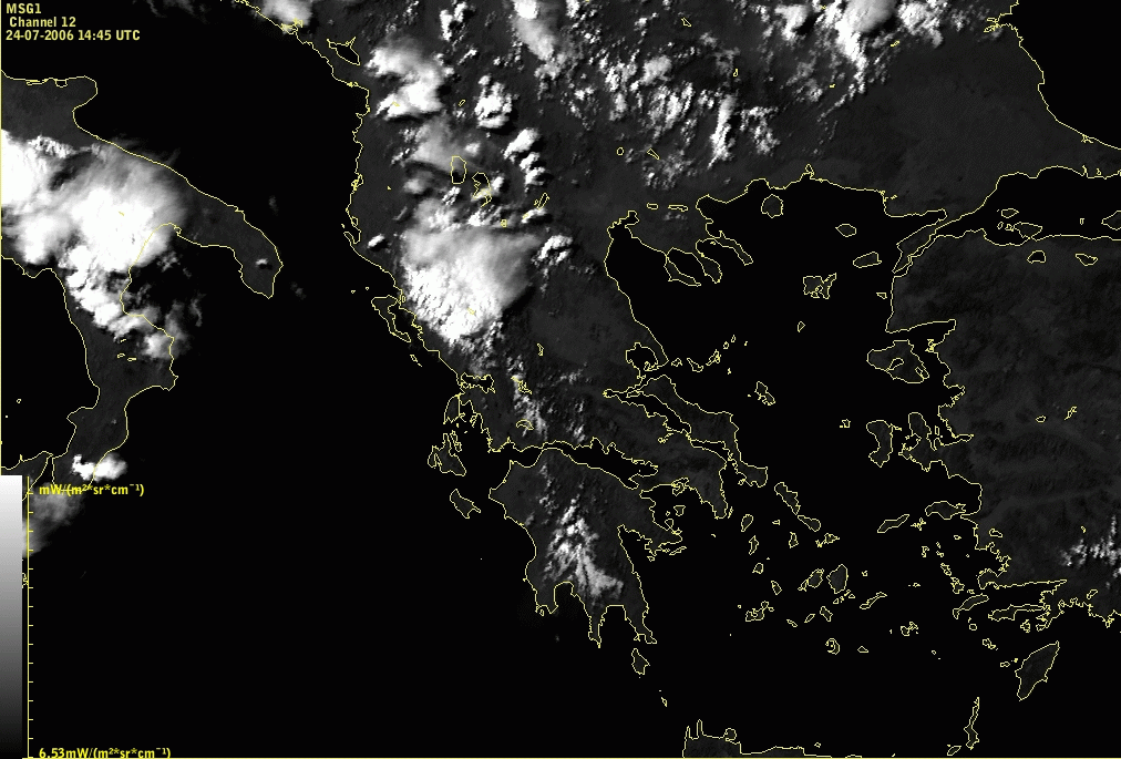
24 July 2006/15.00 UTC - Meteosat 8 HRVIS image
|
The convective Convergence Line under consideration extends from the SE Peloponnes across N. Greece to Macedonia.
There is a distinct life cycle of the clouds during daytime. In the morning hours there is usually no activity or only small cumuli clouds are present, but already clearly showing the correlation to the mountain chain. Development starts around noon, when some cells are already well developed. In the afternoon, over the highest mountain peaks, convective cells can develop into larger systems or merge with other cells. Cirrus anvils form and show the prevailing wind direction. At the same time smaller cells are dissolved.
It should be mentioned here that the time stated in the top left corner of the images is the time of the beginning of the scan over the south pole. In the mid-latitudes of the northern hemisphere the time of the image is almost 15 minutes later, therefore the time in the captions under the images differ from the time in the image for 15 minutes (the time in the captions is closer to the real time). This is valid for all Meteosat 8 images used in this Conceptual model.
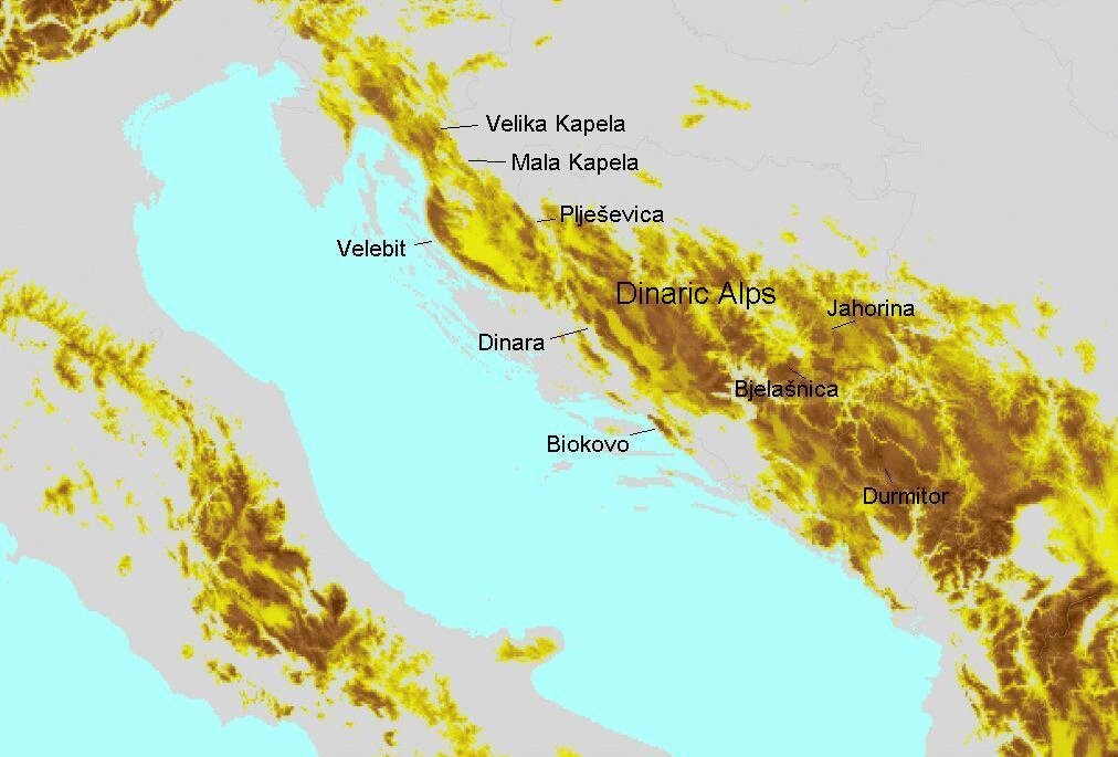
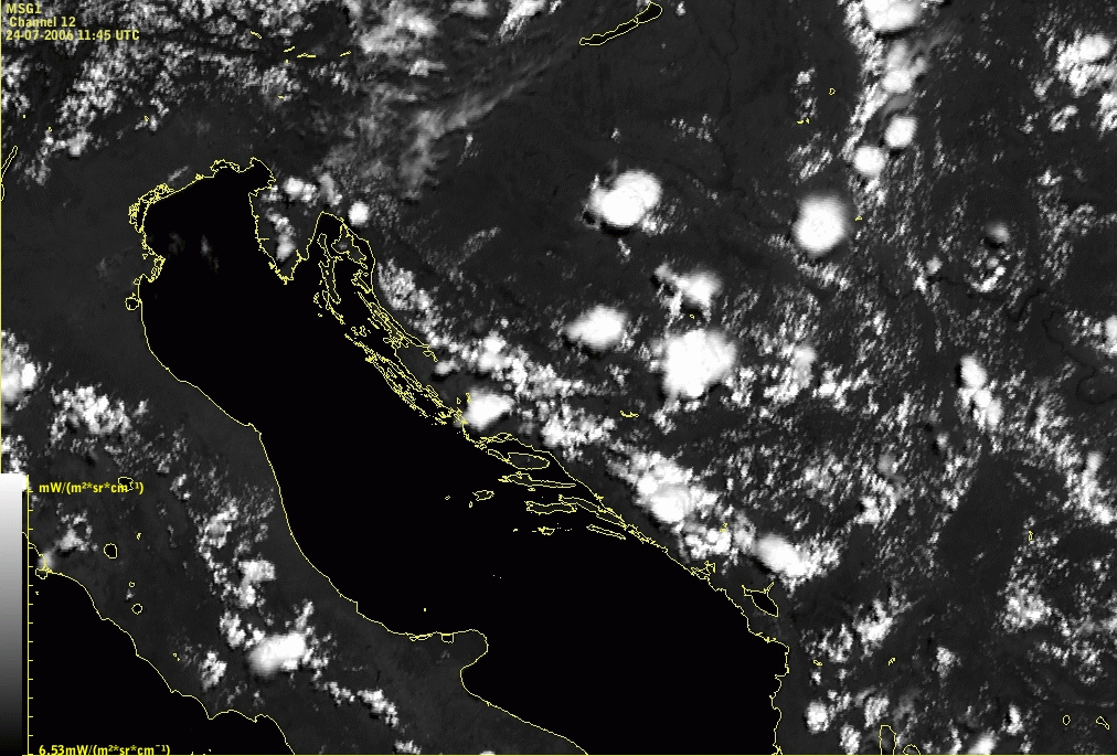
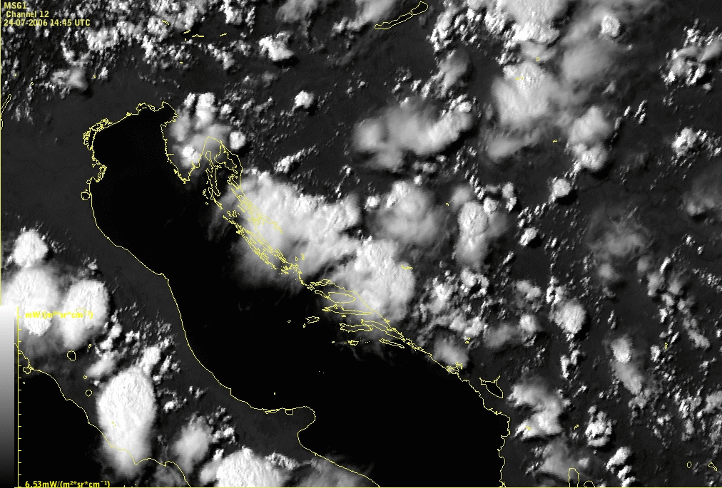
1.2 Convective Convergence Lines over the Dinaric Alps
Lines of convective clouds often develop from the Northwest to the Southeast part of the Dinarides. The convective cells within the line are most pronounced over the highest mountain peaks, and more developed near to the Adriatic coast. At 12.00 UTC the characteristic clouds are clearly visible over mountains Velebit, Dinara, Mala and Velika Kapela, Jahorina, Bjelašnica and Durmitor. In the afternoon clouds can merge into bigger systems and cirrus anvils form, whereas some of the cells are dissolved.
|
|
24 July 2006/09.00 UTC - Meteosat 8 HRVIS image
|
|
|
|
|
|
24 July 2006/12.00 UTC - Meteosat 8 HRVIS image
|
24 July 2006/15.00 UTC - Meteosat 8 HRVIS image
|
The convective Convergence Line over Dinaric Alps extends along the Adriatic coast and exhibits characteristic development during the day.
1.3 Alpine Convergence Lines
Also in the area of the Alps orographic Convergence Lines can be observed but these events have to be differentiated a bit more:
- there are Convergence Lines very similar to the ones already mentioned; they appear in the N-S oriented part of the W. Alps and are quite bright;
- there are Convergence Lines in the W-E oriented part of the Central and E. Alps mainly along the highest mountain chains; these lines are usually less bright and also more narrow than the other types just mentioned; they are most easily seen when developing in front of approaching fronts from the W.
|
|
24 July 2006/09.00 UTC - Meteosat 8 HRVIS image
|
|
|
|
|
|
24 July 2006/12.00 UTC - Meteosat 8 HRVIS image
|
24 July 2006/15.00 UTC - Meteosat 8 HRVIS image
|
Development of convective lines over Alps during the day show stronger development in the western Alpine region.
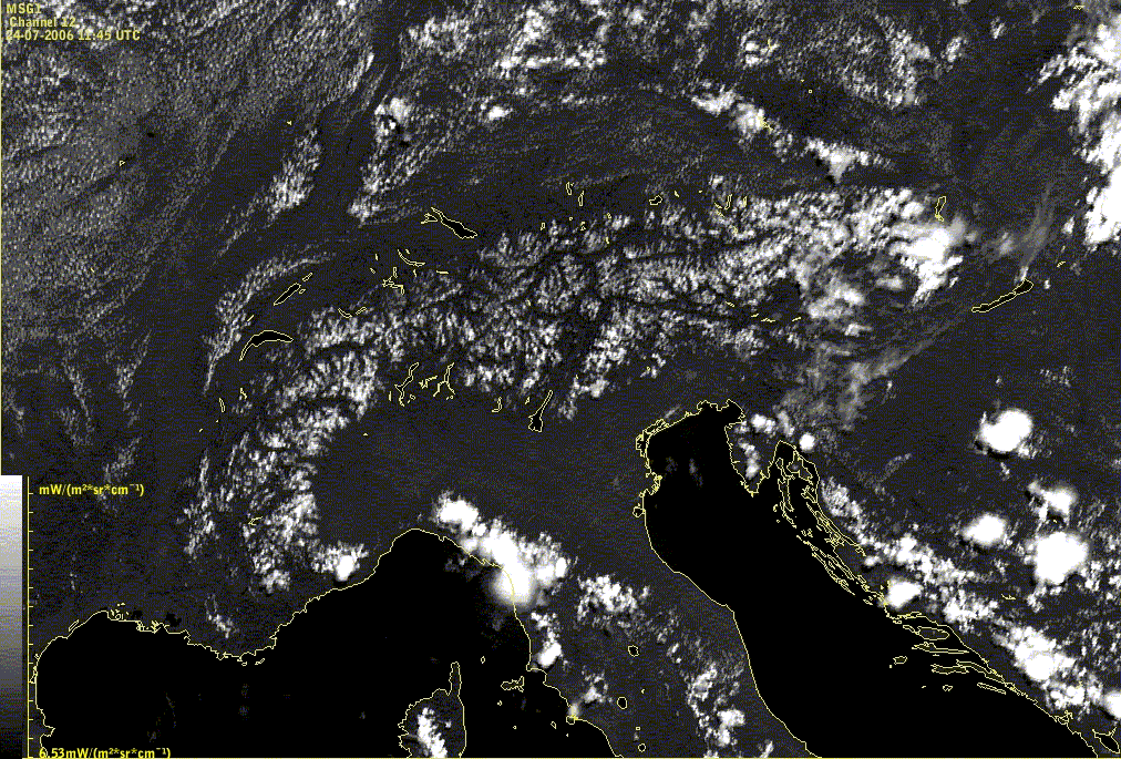
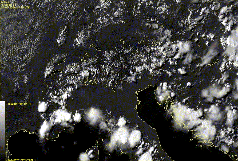
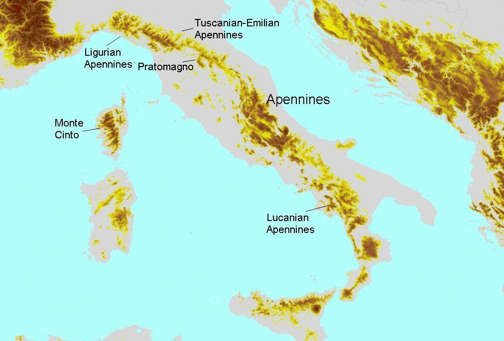
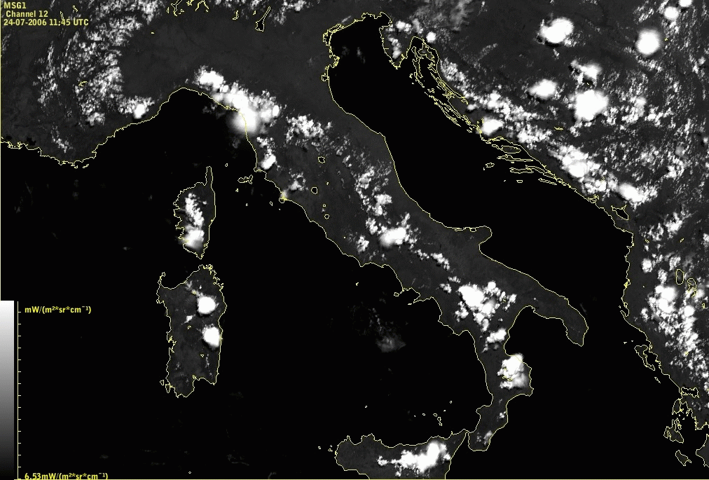
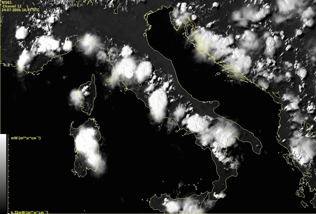
1.4 Apennine convective Convergence Lines
Over the Apennines convective clouds can be seen all along the peninsula with the largest cells over the highest mountains. On Corsica and Sardinia clouds are also visible over the mountain peaks and on Sicily over Etna. The brightest clouds at 12.00 UTC are over Ligurian, Tuscanian-Emilian, Central and Lucarian Apennines.
|
|
24 July 2006/09.00 UTC - Meteosat 8 HRVIS image
|
|
|
|
|
|
24 July 2006/12.00 UTC - Meteosat 8 HRVIS image
|
24 July 2006/15.00 UTC - Meteosat 8 HRVIS image
|
Lines of convective clouds over the Apennines show typical development including convective clouds over islands Sardinia, Corsica and Sicily.
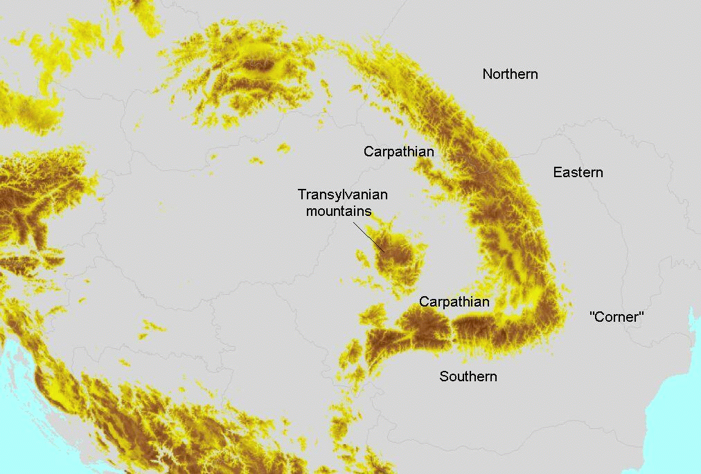
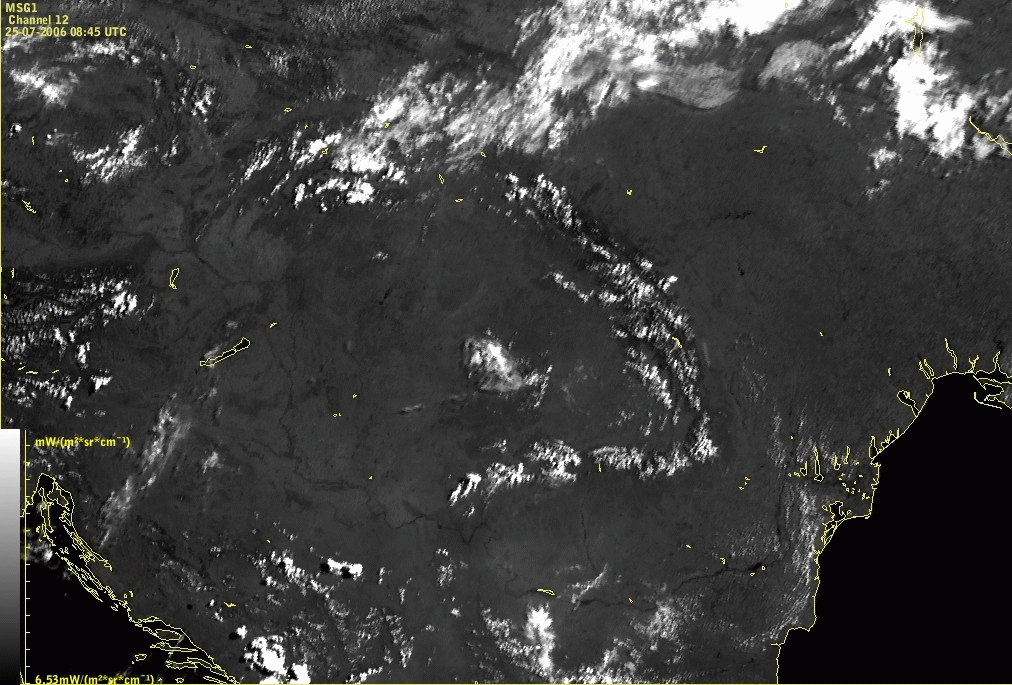
1.5 Carpathian Convergence Lines
Cloudiness situated over the Carpathian and Transylvanian mountains is a regular phenomenon.
|
|
25 July 2006/09.00 UTC - Meteosat 8 HRVIS image
|
|
|
|
|
|
25 July 2006/12.00 UTC - Meteosat 8 HRVIS image
|
25 July 2006/15.00 UTC - Meteosat 8 HRVIS image
|
As in all other regions, a typical life cycle shows high relationship with the time of the day.
Clouds begin to develop in the morning hours. The HRVIS image shows the Carpathian mountains very dark (darker than the cloud free surroundings) with some few white dots already appearing. In the IR image the mountainous area is grey. In the WV image the grey shades can range from light grey to very dark grey depending on the humidity of the middle atmosphere.
During the next hours the clouds indicate the formation of a convective Convergence Line. Around noon, convective activity is reaching a peak. Single cells within the line are clearly visible at 12 UTC in the HRVIS image, but also in the other channels. Such lines often end at the Romanian - Ukrainian border in the North. If there is a continuation of the line into the Northern Carpathians mountain region, the development can be as strong as in the other parts.
The intensity of the cells within the line varies a lot. There can be huge Mesoscale Convective Systems (MCSs) (see
Cb and MCS
) or only small convective cells. If the area of convective activity is large the typical line structure begins to dissipate.
The maximum of this phenomenon can be observed by early afternoon. Sometimes, some clouds may be weakening, whereas at the same time other
clouds are still growing. There can be a difference especially between the Eastern Carpathian and the Southern Carpathians which sometimes seem
to develop independently. At the "corner", where there is the transition between the Eastern and the Southern Carpathians, the
cloudiness is often interrupted (this is also reflected in the Local Area Model (LAM), see
Meteorological physical background
and
Key parameters
).
During the dissipation stage, the changes are first seen in the VIS image whereas in the IR channel the cloudiness disappears later. The reason is that the thin remaining cirrus can be seen in the IR channel, but not in the VIS channels.
Sometimes a substructure within the Convergence Line can be observed: the line following the main mountain chain contains several lines perpendicular to it. This can be observed both in the Eastern and Southern Carpathian mountains.
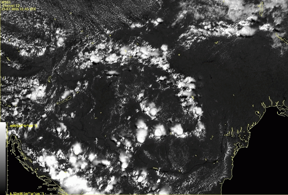
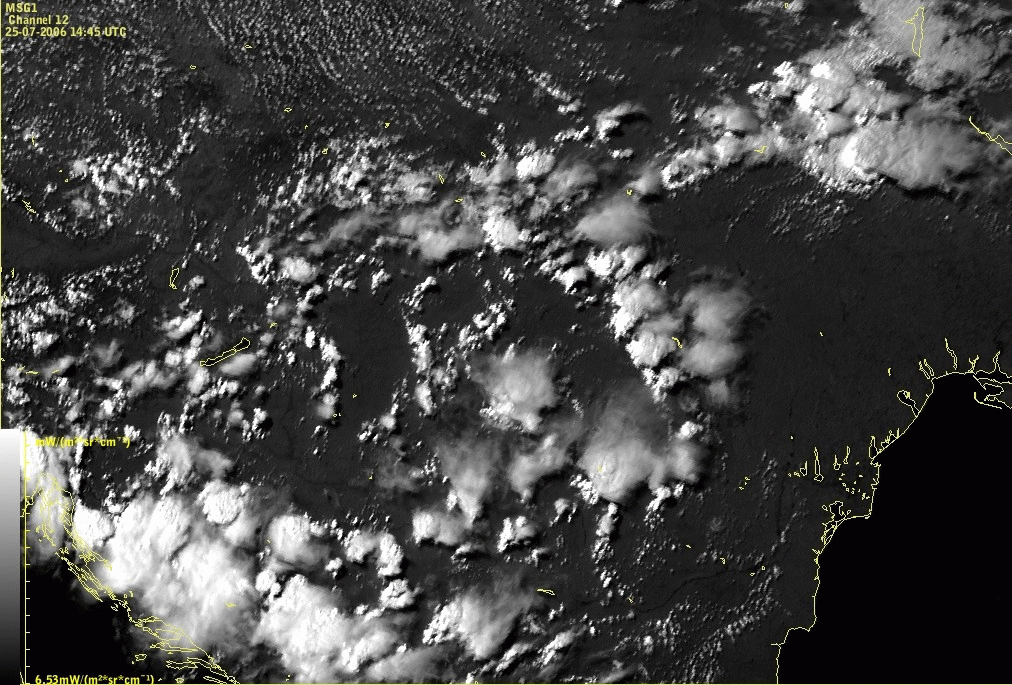
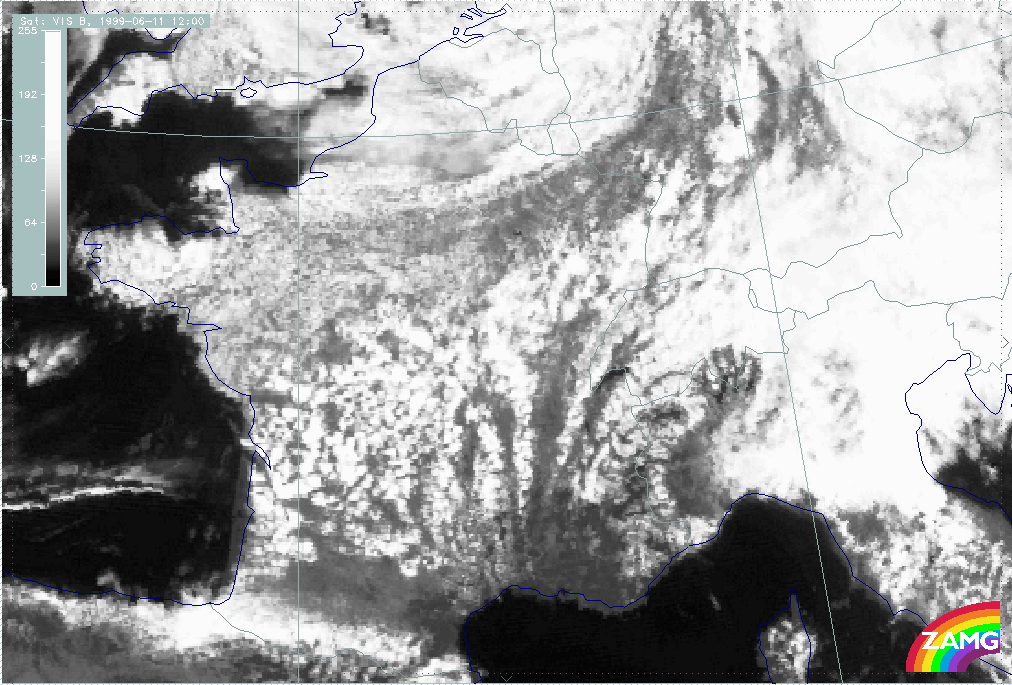
1.6 Convergence Lines in the French Mountains
In southern France, convective Convergence Lines can be observed associated with the mistral, a regional northerly cold low level wind. This
phenomenon is much less frequent than the two convective Convergence Lines mentioned above.
This situation is characterised by a lot of roughly parallel lines with a north to south orientation. These lines are evolving from
unstructured convective clouds near the Central Mountains as a consequence of convergence at low levels parallel to the mountain ridges (see
Meteorological physical background
and
Key parameters
). The conditions at higher levels are quite different showing divergence, westerly flow and low humidity so that convective activity does not
reach high levels. That is the reason why a line structure cannot be seen in the WV image but only a grey tongue over France which indicates a
region of humidity.
|
|
11 June 1999/12.00 UTC - Meteosat 7 VIS image
|
|
|
The case of 11 June 1999/12.00 UTC shows the maximum of development. The convective lines are clearly N. - S. oriented and typically fan-shaped and show a cellular structure.
Another case was found which showed that similar convective Convergence Lines can develop in southern France under different synoptic situations, namely, in the region of a decaying frontal system.
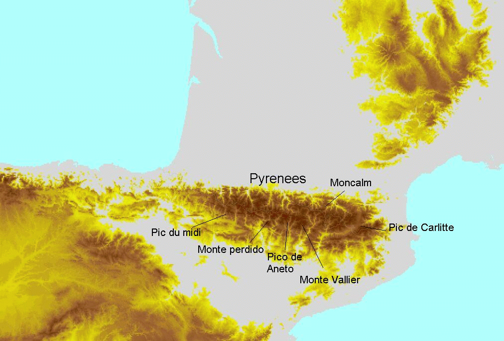
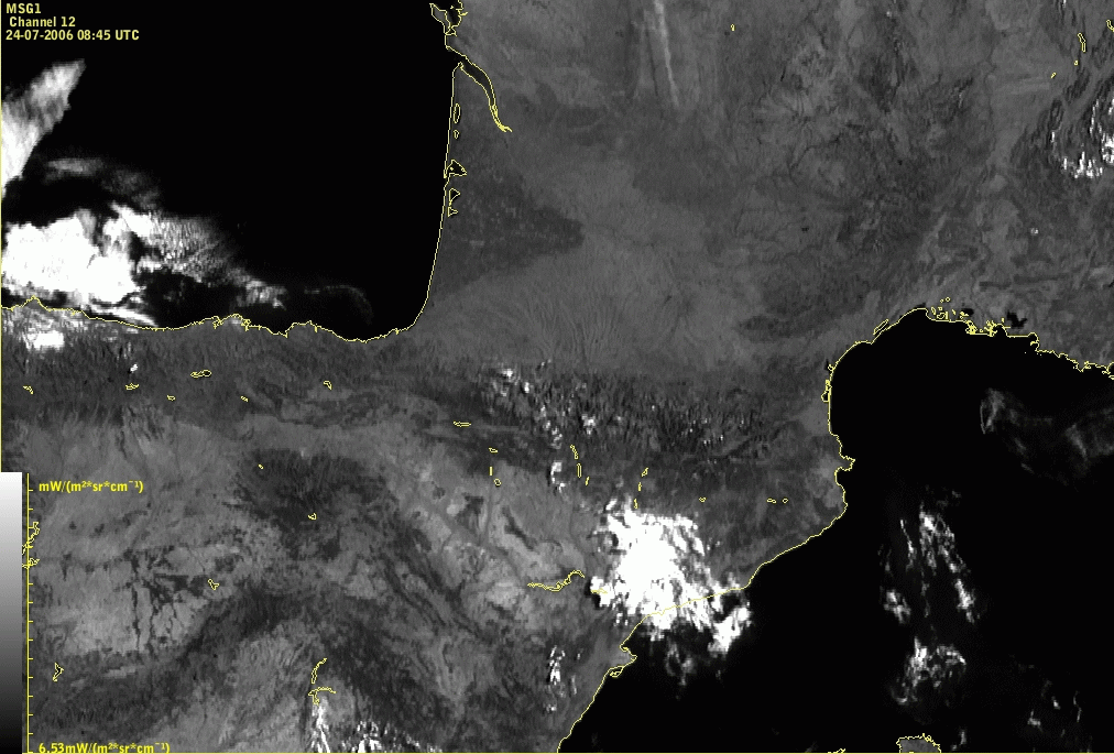
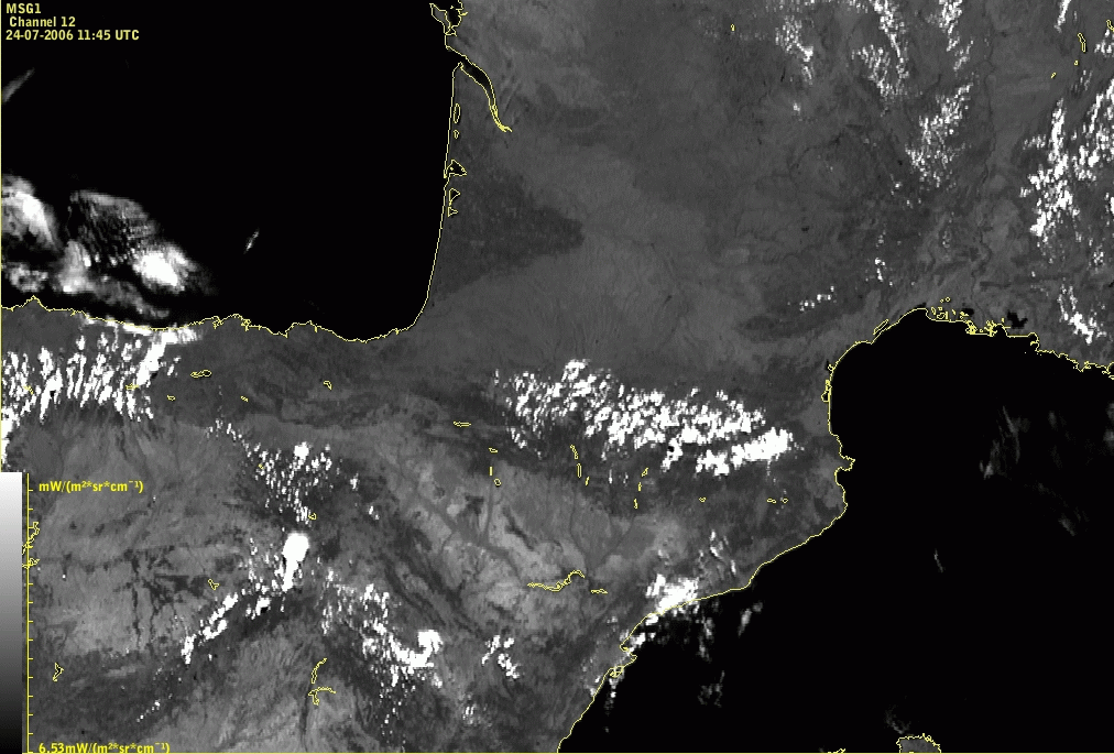
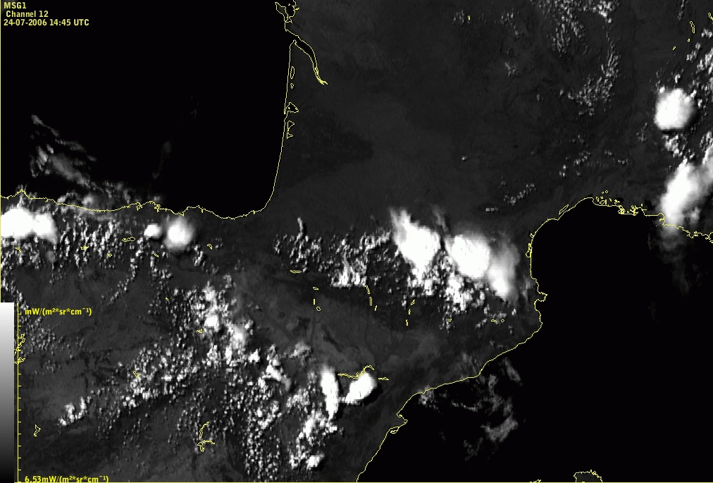
1.7 Convective Convergence Lines in the Pyrenees
Lines of convective clouds due to convergence over the Pyrenees often develop from west to east with the largest cells developing over the highest mountain peaks. More intensive development can be seen in the Eastern part of the Pyrenees from Moncalms to Pic of Carlitte in the afternoon. In HRVIS images in the Eastern part of Pyrenees the clouds are brighter than in the Western part.
|
|
24 July 2006/09.00 UTC - Meteosat 8 HRVIS image
|
|
|
|
|
|
24 July 2006/12.00 UTC - Meteosat 8 HRVIS image
|
24 July 2006/15.00 UTC - Meteosat 8 HRVIS image
|
Diurnal cycle clearly shows that the development starts around noon, whereas in the afternoon, above the highest mountain tops cells can grow very intensively.
2. Appearance in the RGB composite images
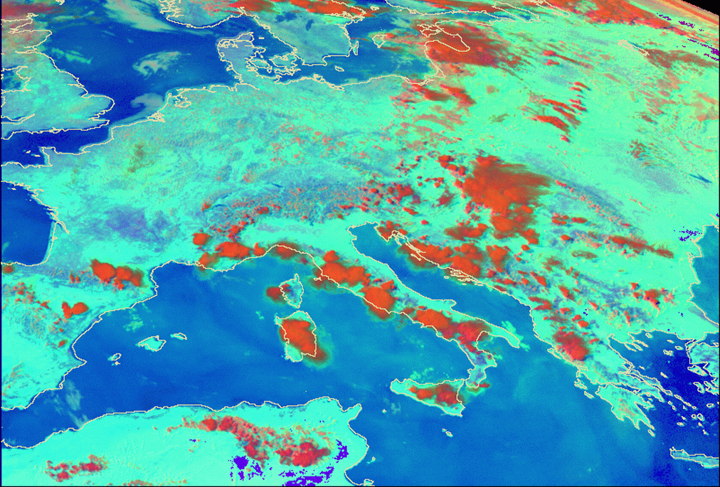
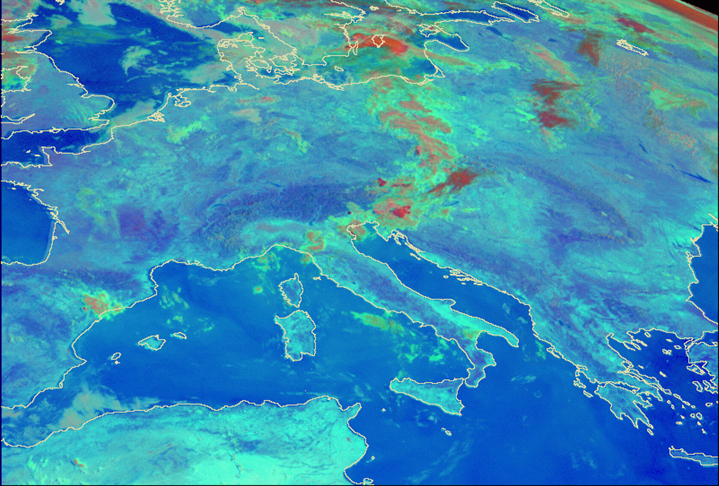
Besides in single channel images, especially HRVIS, convective Convergence Lines are easily detectable also in the RGB composites, especially Day Microphysical and Convective Storms composite. Day Microphysical composite is produced by combining 0.8 µm channel, solar component of the 3.9 µm channel and 10.8 µm channel. Convective storms composite consists of the difference of channels 6.2-7.3 µm on red, difference of channels 3.9-10.8 µm on green and difference of channels 1.6-0.6 µm on blue. The details of the enhancements for these composites can be found in the MSG Interpretation guide, RGB Images part 04 at http://oiswww.eumetsat.org/WEBOPS/msg_interpretation/PowerPoints/Channels/rgbpart04_20050420.ppt#1 .
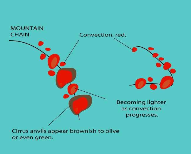
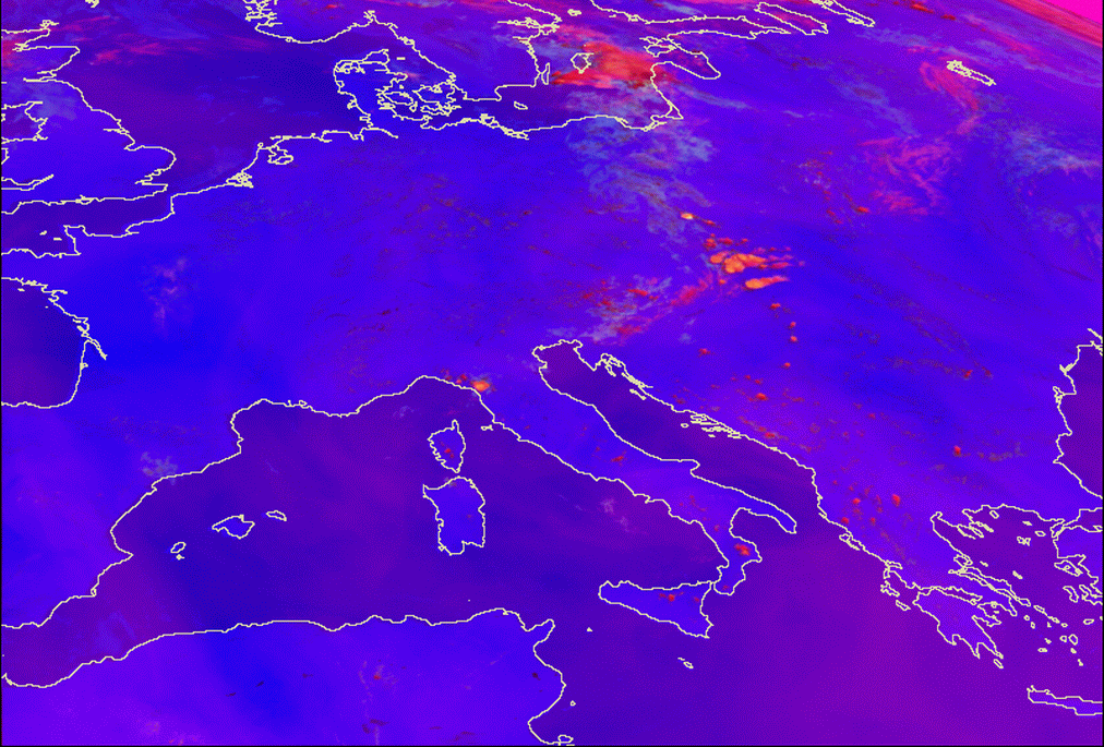
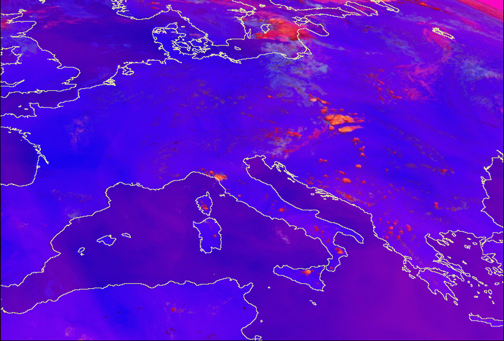
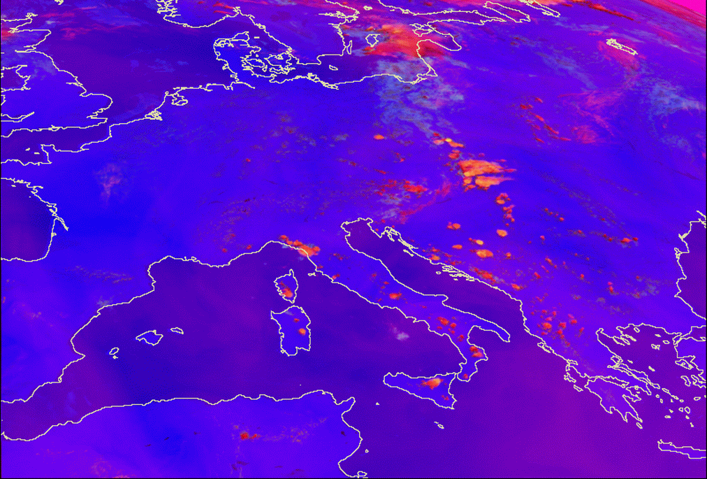
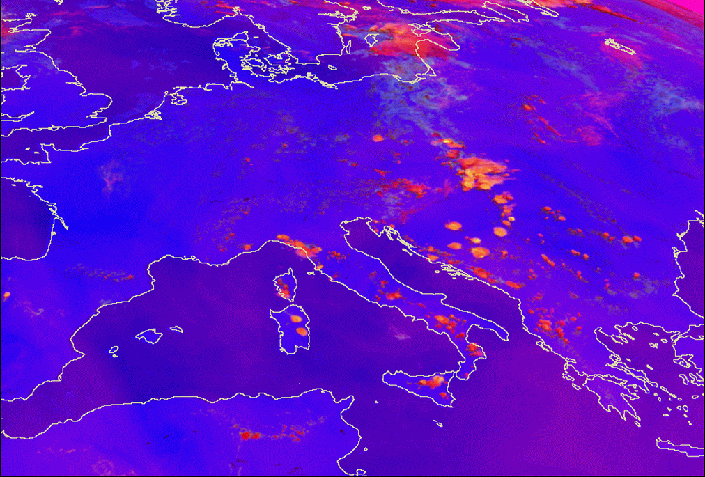
The appearance of a convective Convergence Line in the Day Microphysical composite images is shown in the sketch below and the loop of the images.
|
|
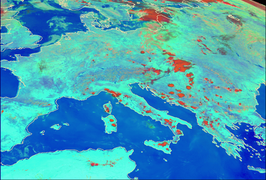
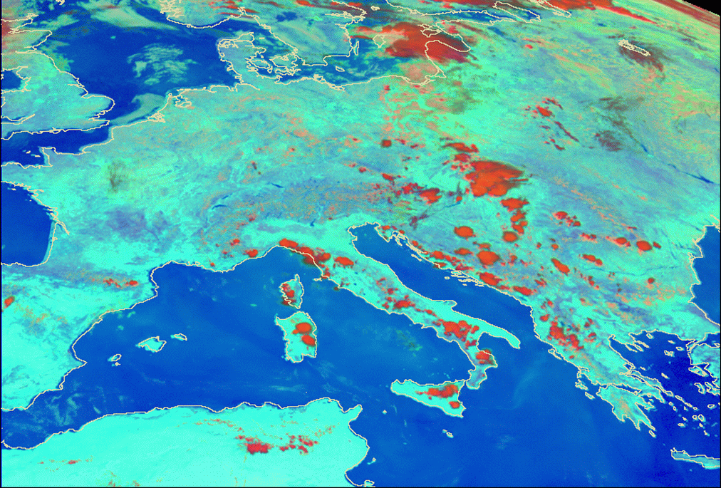
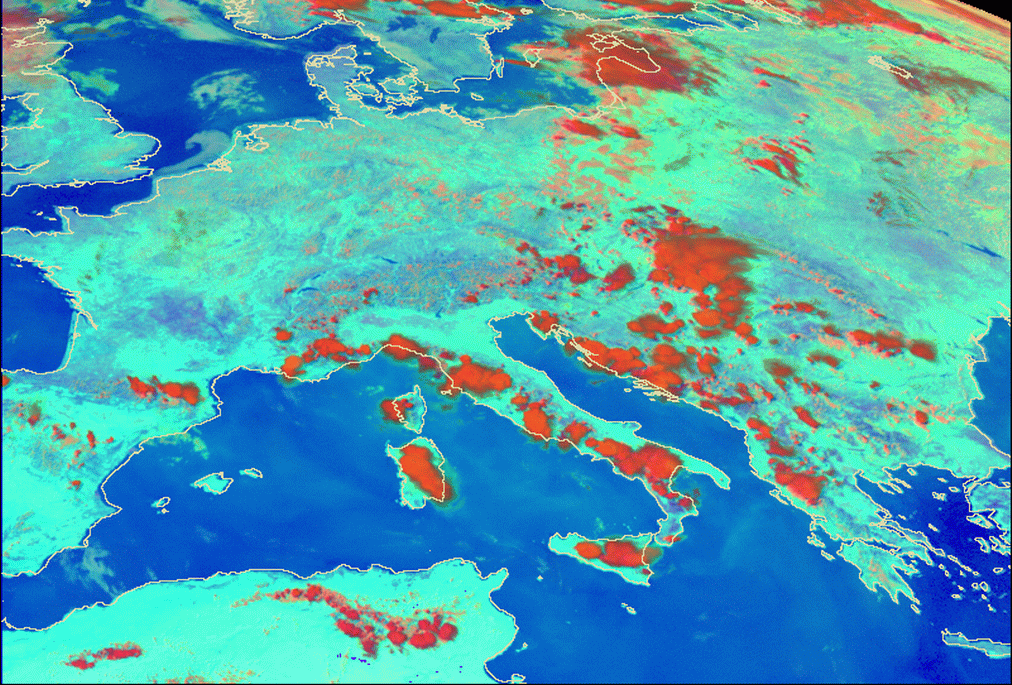
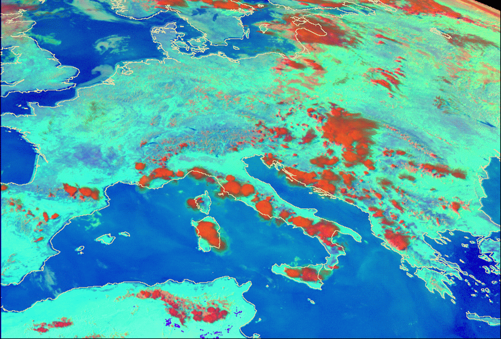
24 July 2007/08.00 UTC - Meteosat 8 Day Microphysical Summer RGB image (0.8; A3.9; 10.8); 08.00 - 15.30 UTC half-hourly image loop
|
|
|
|
|
|
24 July 2007/15.30 UTC - Meteosat 8 Day Microphysical Summer RGB image (0.8; A3.9; 10.8)
|
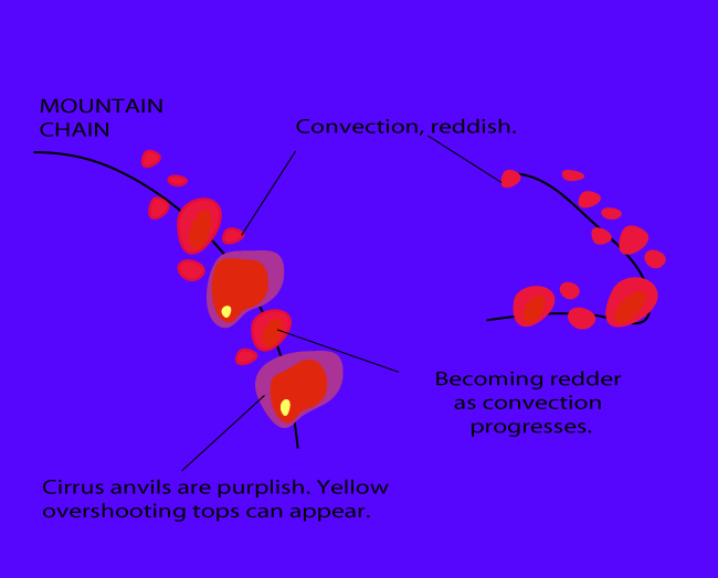
The appearance in the Convective Storms RGB is shown below:
|
|
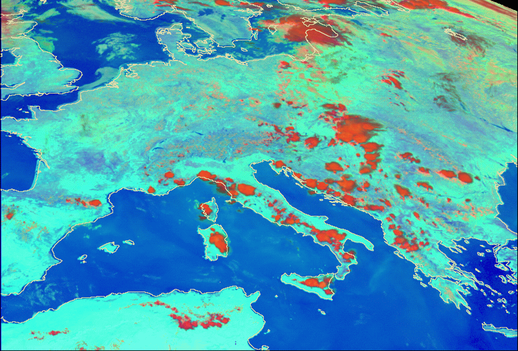
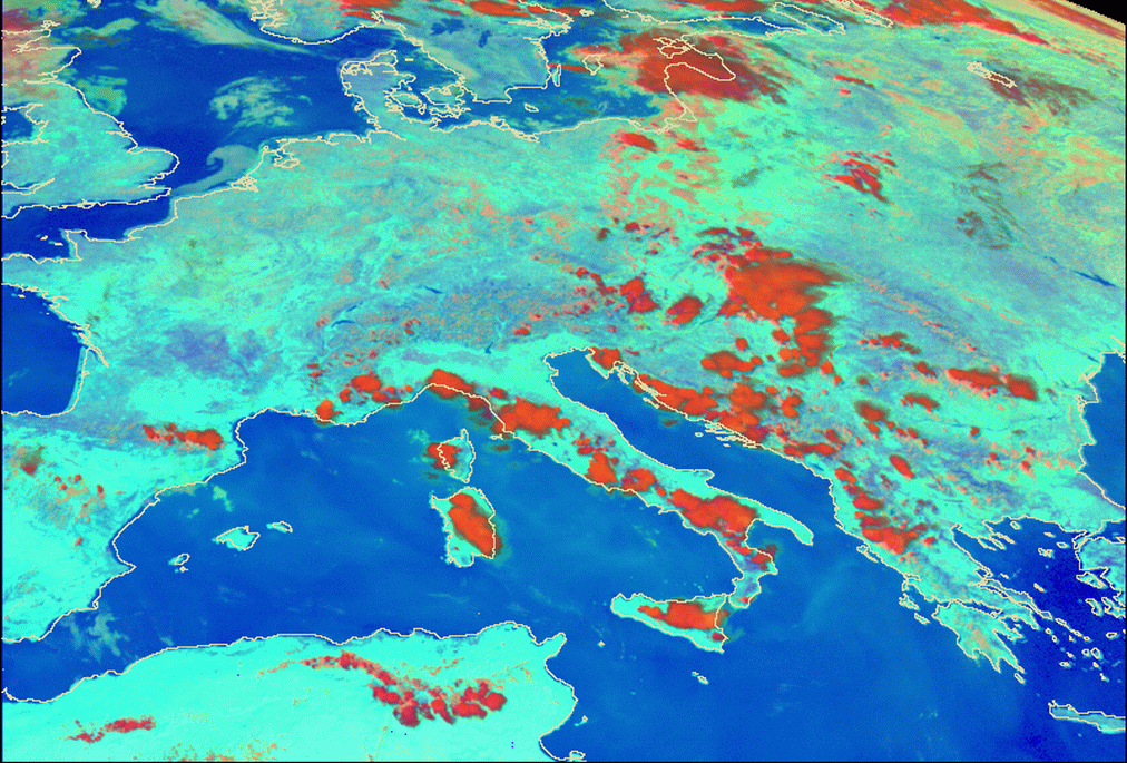
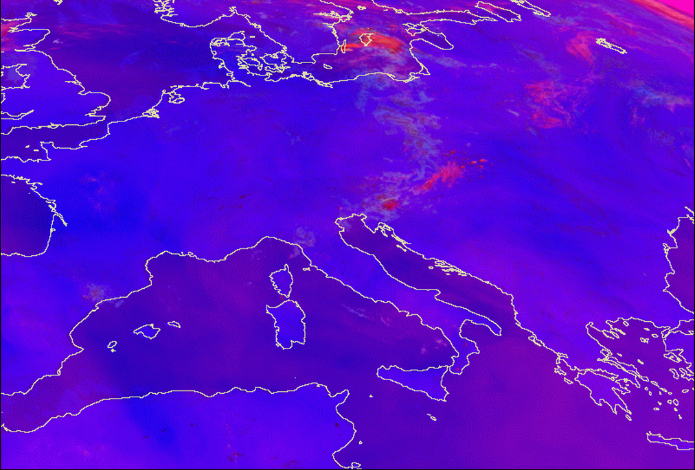
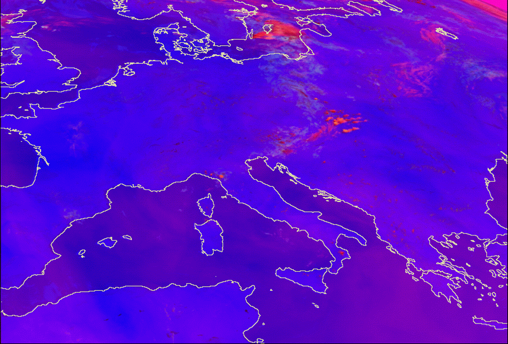
24 July 2007/08.00 UTC - Meteosat 8 Day Microphysical Summer RGB image (0.8; A3.9; 10.8); 08.00 - 15.30 UTC half-hourly image loop
|
|
|
|
|
|
24 July 2007/15.30 UTC - Meteosat 8 Convective Storms RGB image (6.2-7.3; 3.9-10.8; 1.6-0.6)
|
Day Microphysical Summer and Severe Convection RGB composites were chosen because of their ability to clearly distinguish the cells within the Convergence Line and to show the different appearance of the cells connected to their development stage.