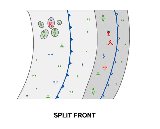
Weather Events
Weather events are highly variable and have to be split into two parts: the upper level front and the shallow moist area.
Upper front
| Parameter | Description |
| Precipitation |
|
| Temperature |
|
| Wind (incl. gusts) |
|
| Other relevant information |
|
Shallow moist area, including the surface front
| Parameter | Description |
| Precipitation |
|
| Temperature |
|
| Wind (incl. gusts) |
|
| Other relevant information |
|
|
|
|
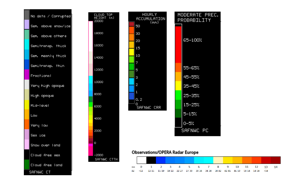
Legend:
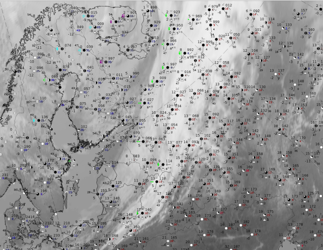
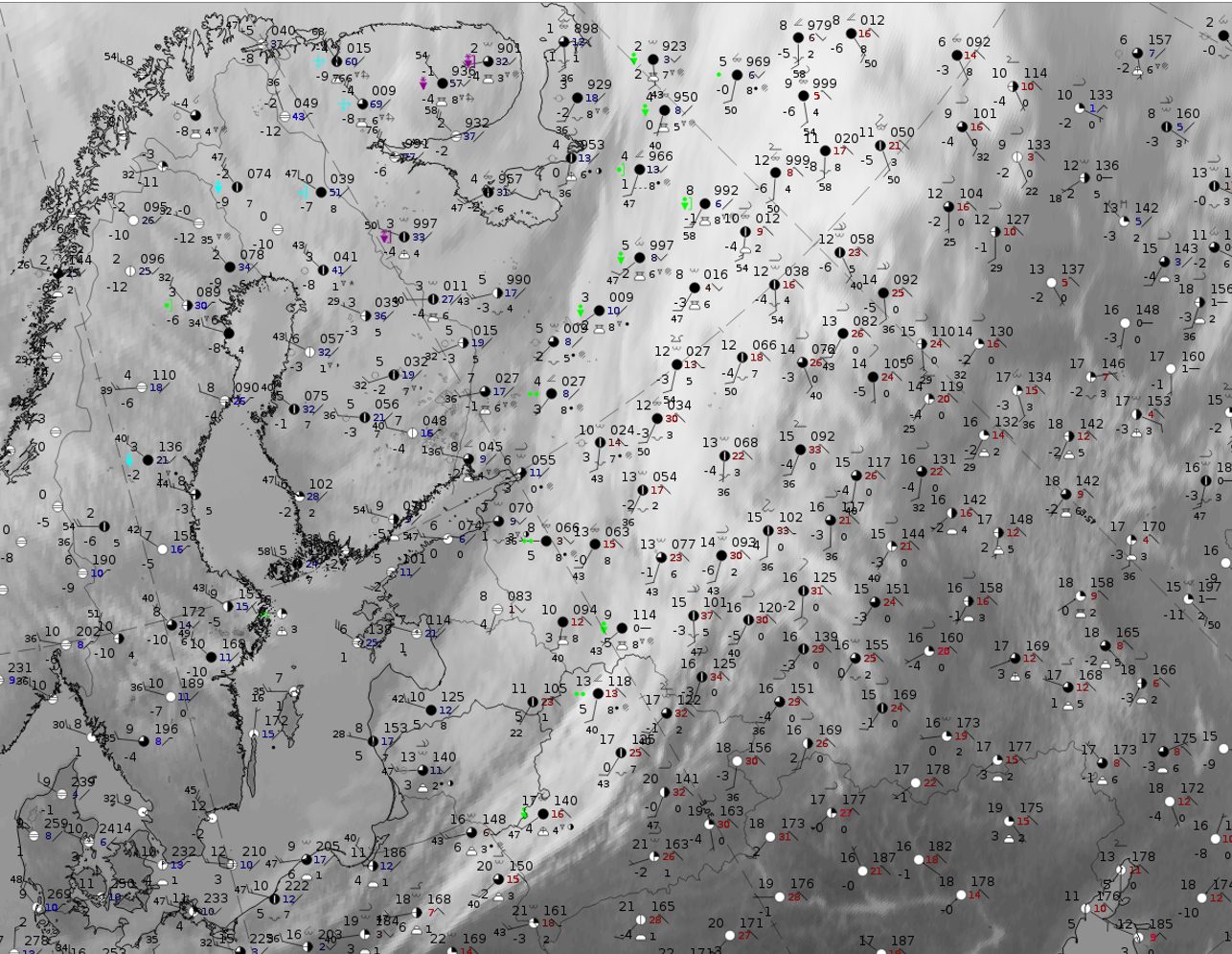
9 April 2020, 12UTC: IR + synoptic measurements (above) + probability of moderate rain (Precipitting clouds PC - NWCSAF).
Note: for a larger SYNOP image click this link.
There are many Cb and precipitation reports. In the thick part, on the leading side of the split front, a row of Cb observations with associated showers stretches from Belarus northward; they are close to the rearward edge of this thick cloud band. In the southern part of the low cloud band there are only overcast skies, located over the Baltic States, and some observations of persistent precipitation over Russia. More to the north, again thunderstorms and showers also exist. Those are connected to a maximum of cyclonic vorticity advection. The probability of precipitation computed from the PC product (NWCSAF) shows parallel, bandlike stripes with higher probabilities for both cloud bands.
|
|
|
|
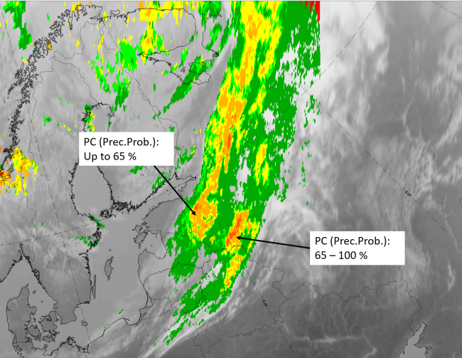
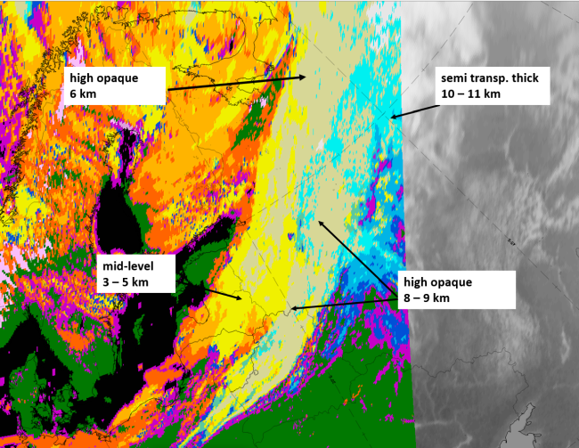
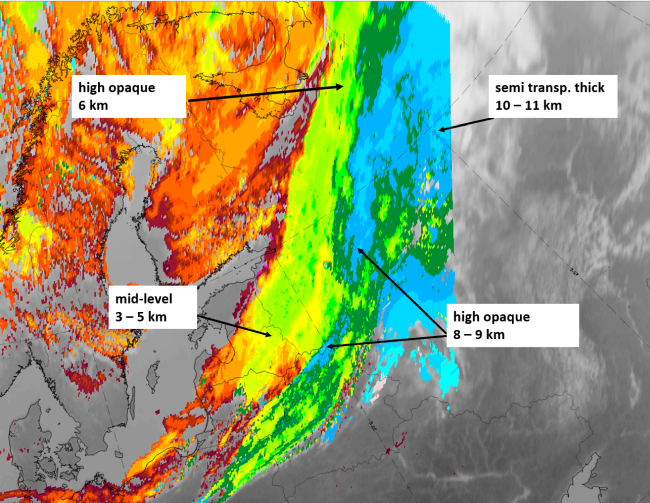
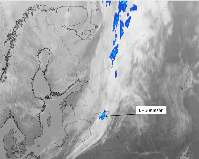
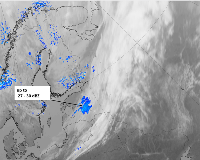
Legend:
9 April 2019, 12 UTC, IR; superimposed:
1st row: Cloud Type (CT NWCSAF) (above) + Cloud Top Height (CTTH - NWCSAF) (below); 2nd row: Convective Rainfall Rate (CRR NWCSAF) (above) + Radar intensities from Opera radar system (below).
For identifying values for Cloud type (CT), Cloud type height (CTTH), precipitating clouds (PC), and Opera radar for any pixel in the images look into the legends. (link)