Weather Events
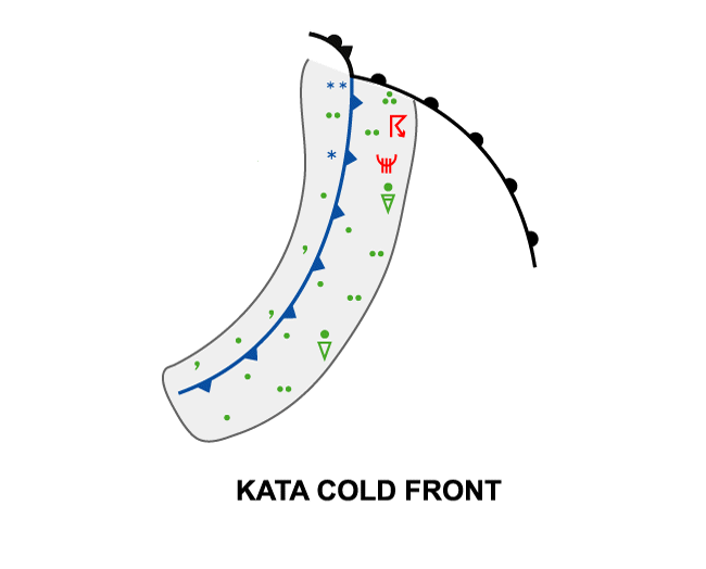
Weather features are highly variable and can differ from season to season. Features are desribed here for two types of fronts: Ana and Kata Cold Fronts.
Ana Cold Front
| Parameter | Description |
| Precipitation (incl. thunder) |
|
| Temperature |
|
| Wind (incl. gusts) |
|
| Other relevant information |
|
These features are best illustrated using data from 3 September 2019 at 12 UTC when an Ana Cold Front appeared over north-eastern Europe.
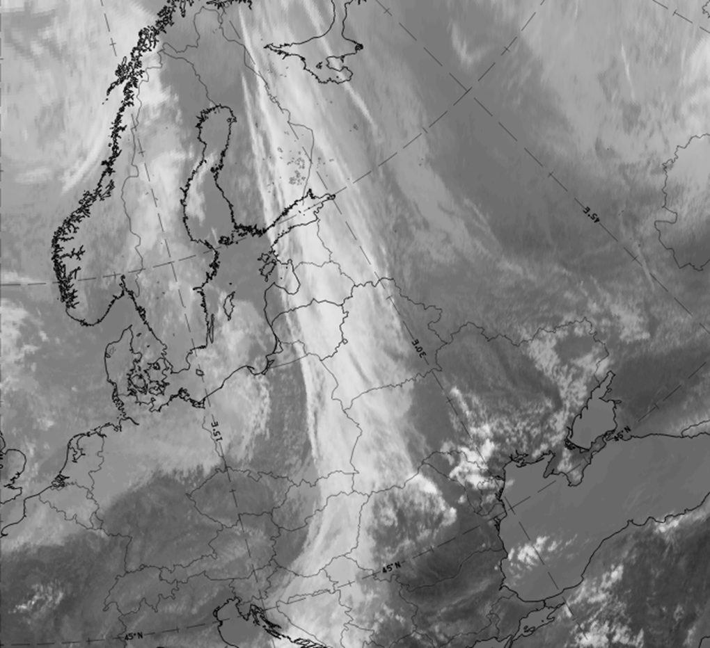
3 September 2019,12 UTC: IR image.
|
|
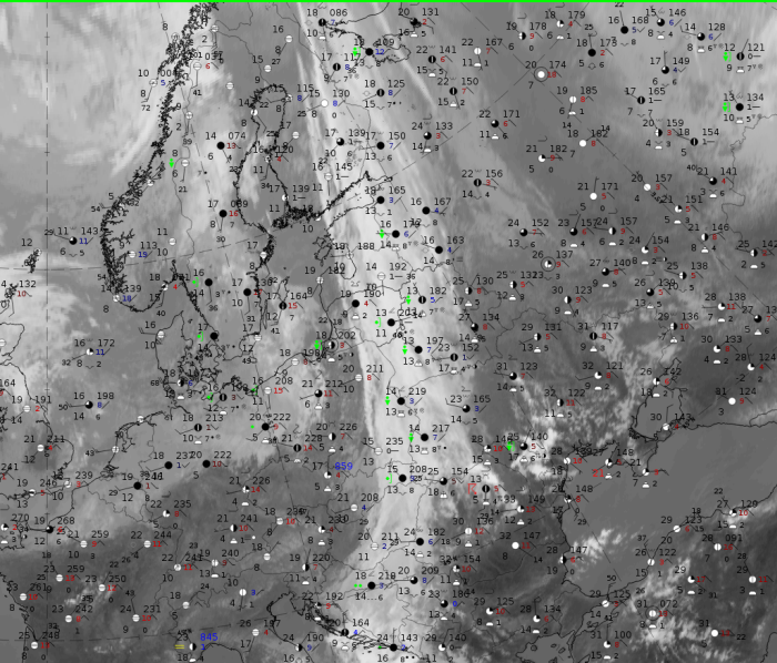
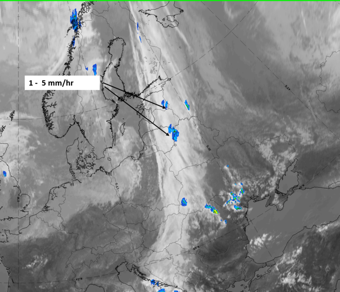
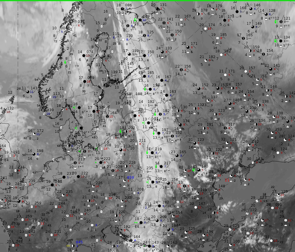
3 September 2019, 12 UTC: IR + synoptic measurements (above) + probability of moderate rain (Precipitting clouds PC - NWCSAF).
Note: for a larger SYNOP image click this link.
Precipitation in the form of showers is widespread, and several reports of Cbs can be seen. A comparison with the precipitation probability from the NWC SAF shows that the precipitation reports correspond to the areas with highest precipitation probability (ochre to red areas) south of about 60° N.
|
|
|
|
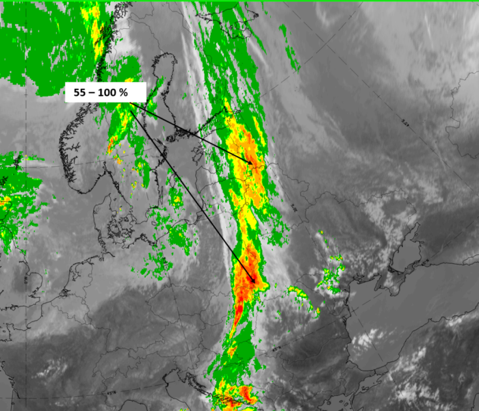
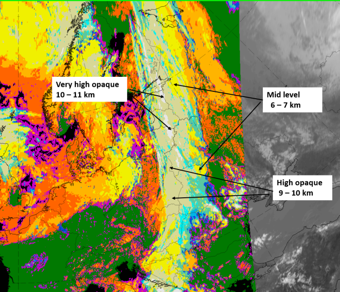
3 September 2019, 12 UTC, IR; superimposed:
1st row: Cloud Type (CT NWCSAF) (above) + Cloud Top Height (CTTH - NWCSAF) (below); 2nd row: Convective Rainfall Rate (CRR NWCSAF) (above) + Radar intensities from Opera radar system (below)
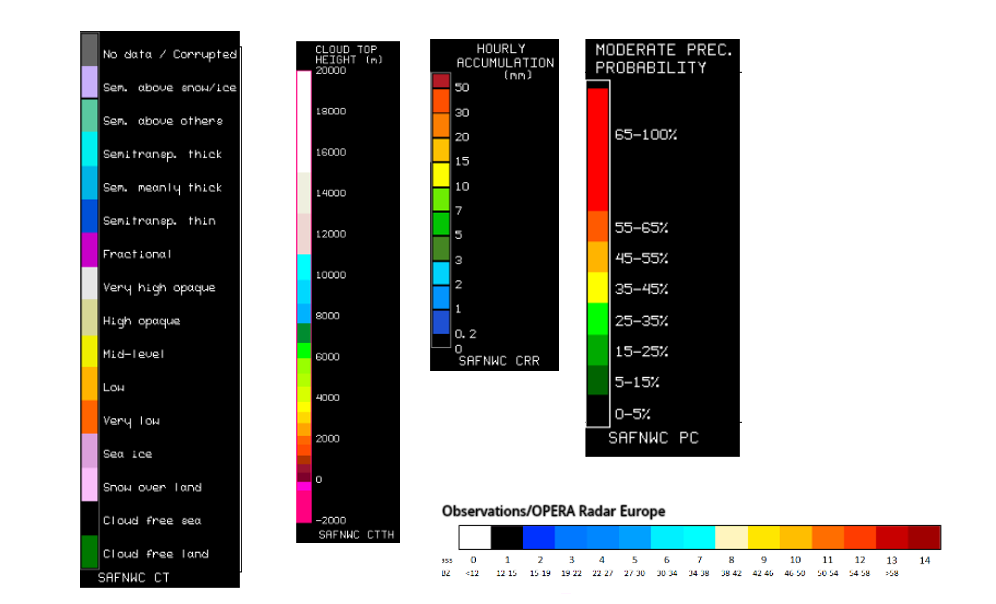
For identifying values for Cloud type (CT), Cloud type height (CTTH), precipitating clouds (PC), and Opera radar for any pixel in the images look into the legends. (link)
Kata Cold Front
| Parameter | Description |
| Precipitation (incl. thunder) |
|
| Temperature |
|
| Wind (incl. gusts) |
|
| Other relevant information |
|
These features are best illustrated using data from 4 November 2019 at 12 UTC, where a Kata Cold Front Band extended from Greece northward across the Balkan Peninsula to Poland.
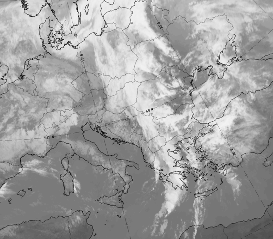
4 November 2019, 12 UTC, IR.
|
|
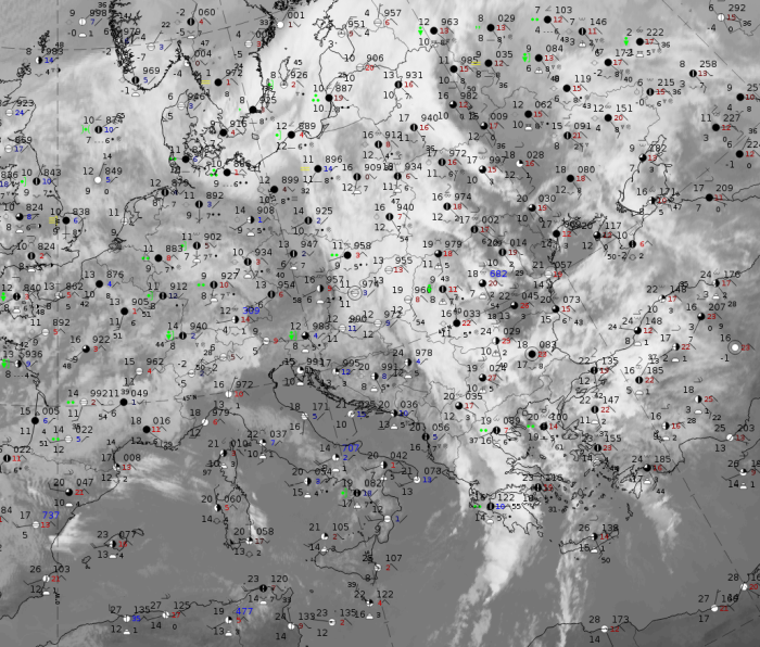
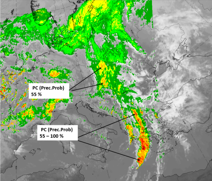
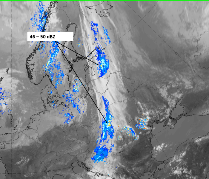
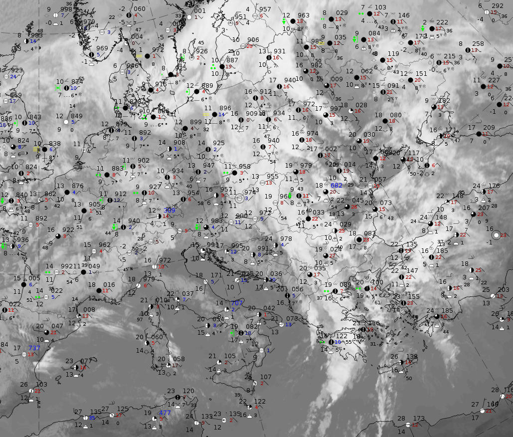
4 November 2019,12 UTC: IR + synoptic measurements (above) + probability of moderate rain (Precipitting clouds PC - NWCSAF).
Note: for a larger SYNOP image click this link.
Rain and shower observations are wide-spread. The shower reports appear more near the leading edge, while rain reports appear more near the rearward edge. The highest precipitation probabilities up to 100 %, are in the southernmost part of the kata cold front cloud band over northern Greece, the Peloponnese and further into the Mediterranean.
|
|
|
|
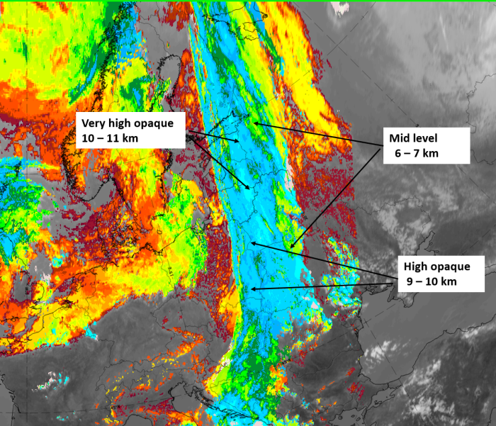
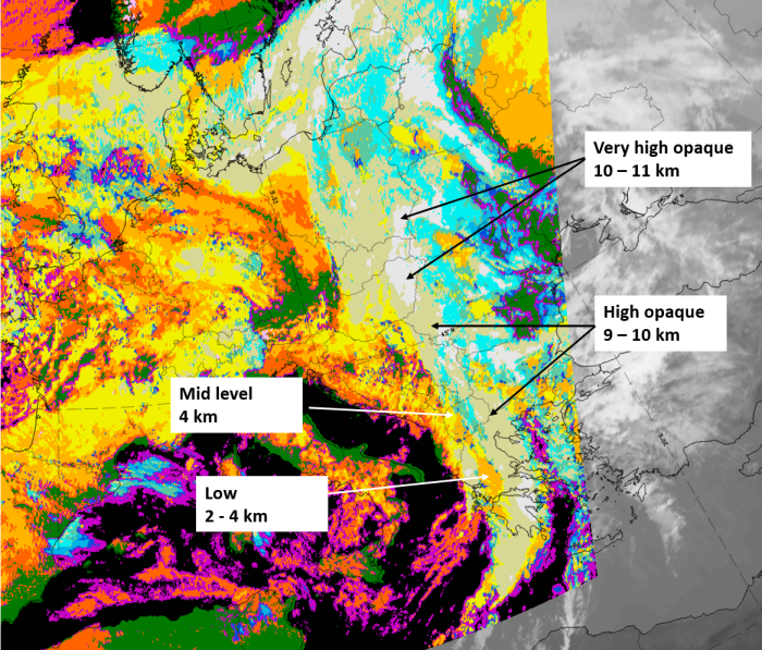
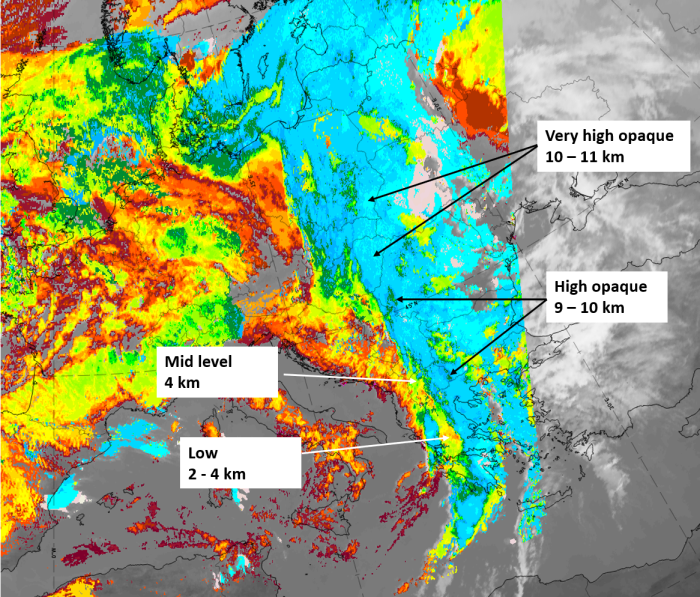
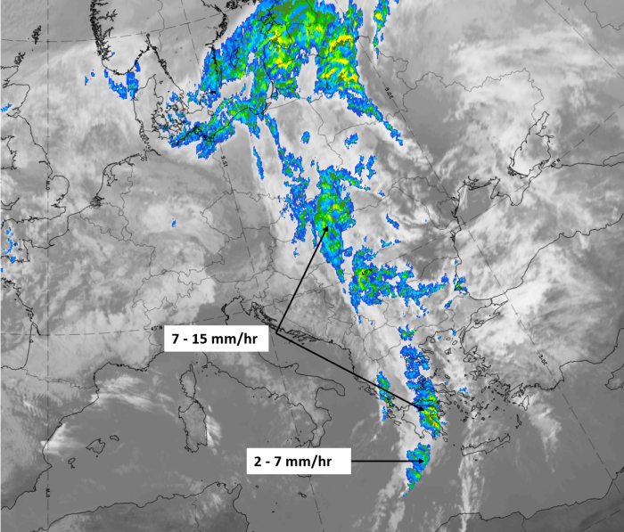
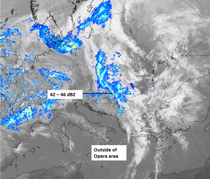
4 November 2019, 12 UTC, IR; superimposed:
1st row: Cloud Type (CT NWCSAF) (above) + Cloud Top Height (CTTH - NWCSAF) (below); 2nd row: Convective Rainfall Rate (CRR NWCSAF) (above) + Radar intensities from Opera radar system (below)
For identifying values for Cloud type (CT), Cloud type height (CTTH), precipitating clouds (PC), and Opera radar for any pixel in the images look into the legends. (link)