Cloud Structure In Satellite Images
In satellite images, Cold Fronts appear as cyclonically curved synoptic scale cloud bands. They can be divided into two subgroups: Ana and Kata fronts. These types show a slightly different structure in satellite images.
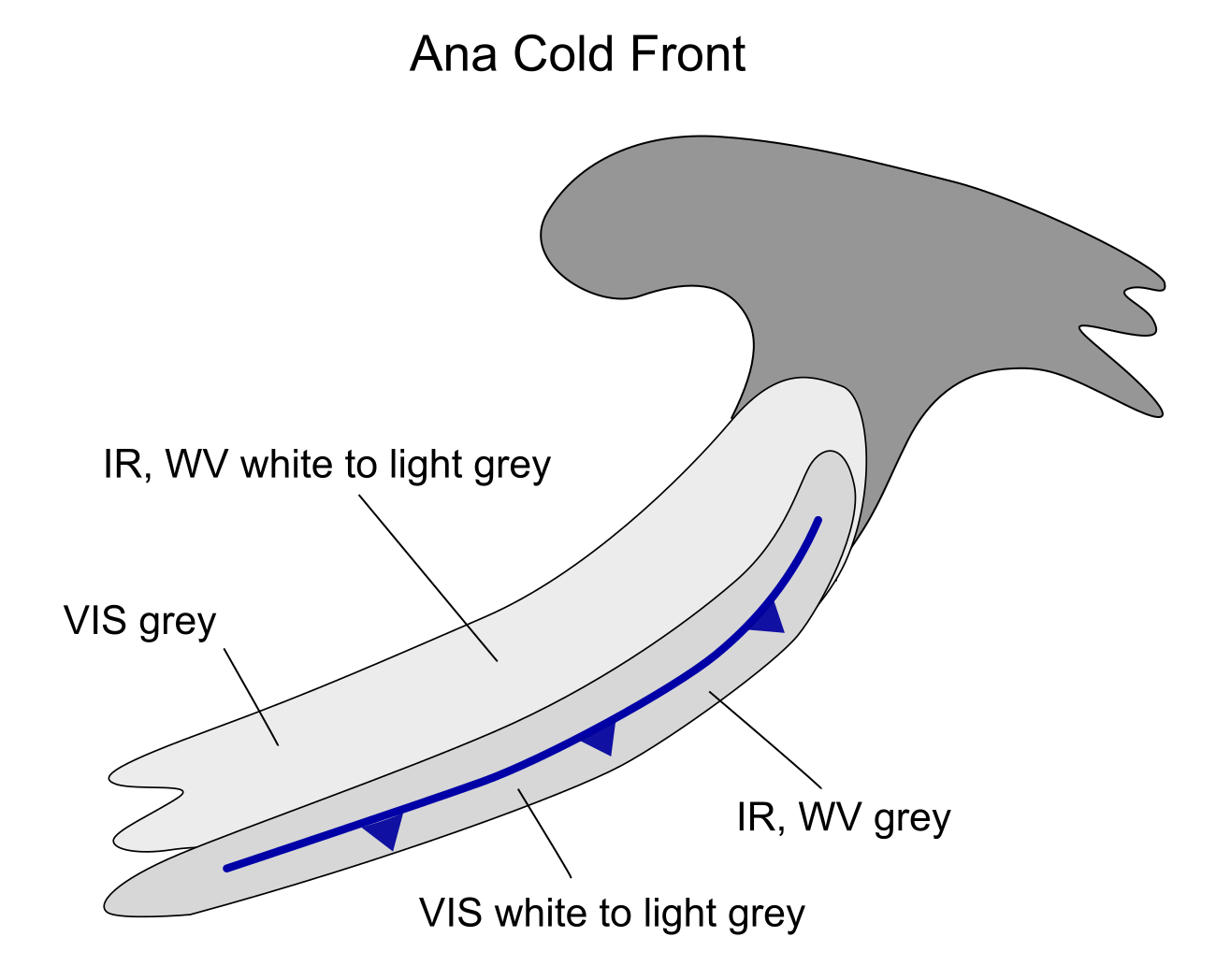
Ana Cold Front
Appearance in the basic channels
-
- Generally smooth appearance
- In VIS images, the brightest area is from the leading edge to the middle part of the cloud band, indicating lower water clouds reaching from the lowest cloud base to the mid-troposphere.
- In IR and WV images, the brightest area is from the rear edge to the middle part of the cloud band, indicating cold and high cloud tops at the rear side of the frontal system, often with embedded CBs
Appearance in basic RGBs:
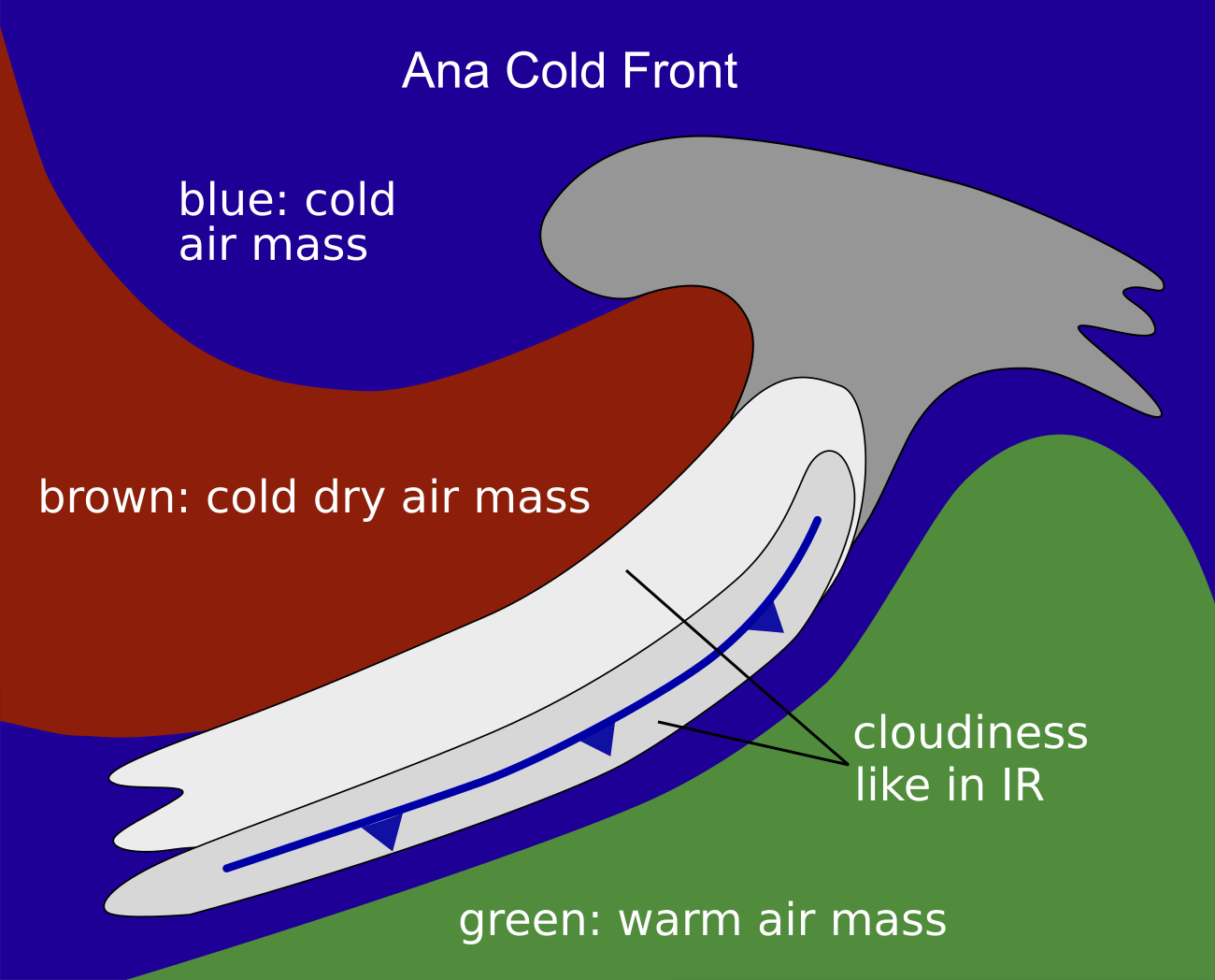
Airmass RGB
In the Airmass RGB, blue or green colours appear in front of the cloud band, representing the cold or warm air masses ahead of cold fronts (mostly depending on the geographical site being in more southern or northern latitudes); at the rear side of the cloud band blue and brown colours appear, extending from north-northwest turning to a position parallel to the cloud band. These colours are representing the cold and dry air sinking behind the cold front.
The cloud band itself looks very similar in the Airmass RGB to its appearance in the IR image.
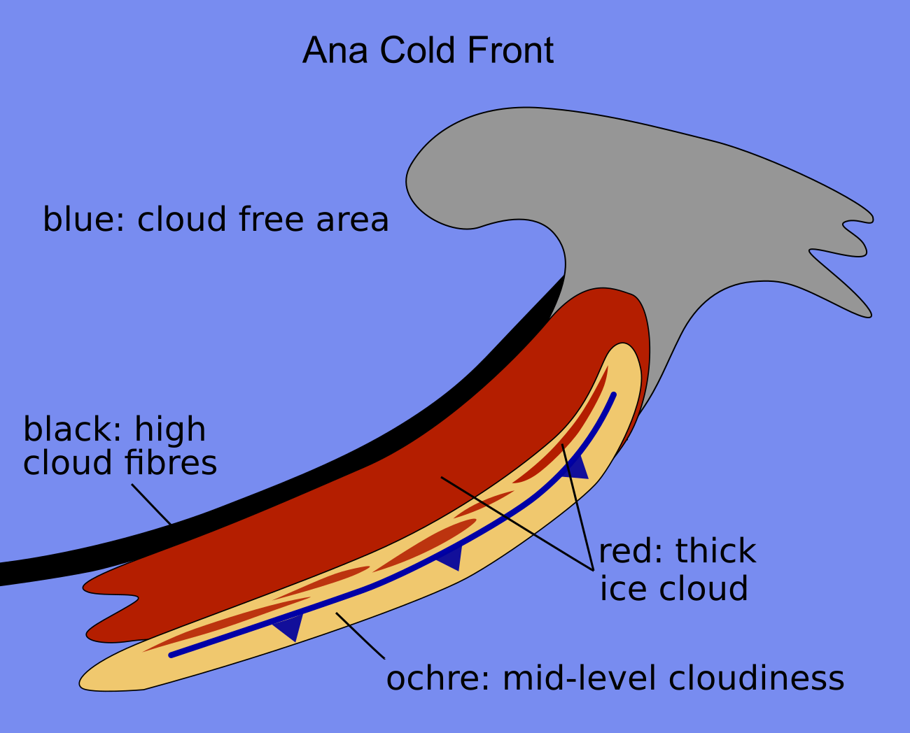
Dust RGB
In the Dust RGB the areas in front of and behind of the cloud band are light or pinkish blue, representing cloud free areas; however, these areas usually contain cloud features like cold air cloudiness in the trough behind the cold front cloud band or cloudiness in the thickness ridge in front of the frontal cloud band.
The cloud band is dominated by dark red colours representing thick ice clouds with cold tops; these dark red clouds can be either uniform or structured; in the latter case yellow to light brown colours represent mid-level cloudiness below. Often there is a black stripe at the rearward edge representing a high cloud fibre at the jet axis.
 |
 |
Schematics for basic RGBs. Left: Airmass RGB; right: Dust RGB
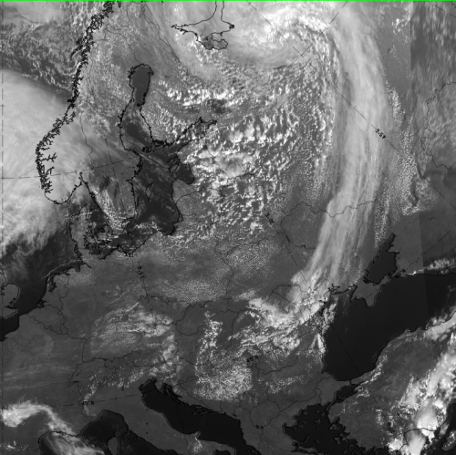
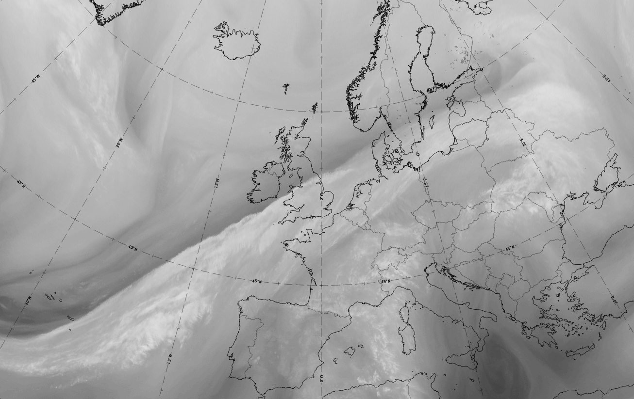
The case of 12 October 2019 at 12 UTC shows a typical example for an Ana Cold Front extending from the Atlantic north-eastward to the Baltic states and Russia.
|
|
|
|
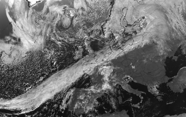
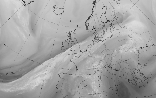
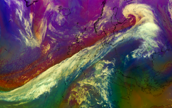
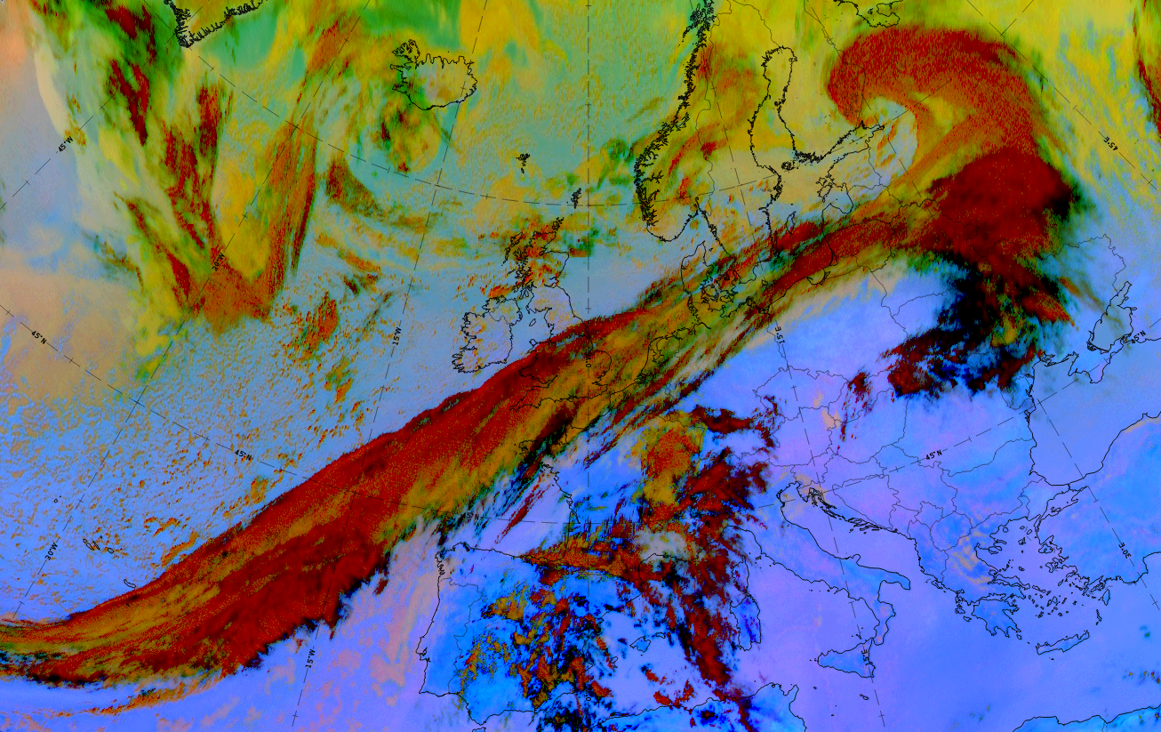
12 October 2019, 12UTC: 1st row: IR (above) + HRV (below); 2nd row: WV (above) + Airmass RGB (below); 3rd row: Dust RGB + image gallery.
*Note: click on the Dust RGB image to access image gallery (navigate using arrows on keyboard)
| IR | Brightest colours in the rearward part of the band. |
| HRV | Brightest colours in the leading part of the band. |
| WV | Light grey with embedded brighter structures and a dark stripe at the rear of and parallel to the cloud band. |
| Airmass RGB | Greenish colours in front of the cloud band (warm air masses); blue colours behind the cloud band (cold air masses); broad brown stripe at the rear of and parallel to the cloud band representing cold and dry air. |
| Dust RGB | Dark red colours (thick ice cloud); ochre colours (mid-level water cloud) at the leading part of the band and where the dark red area is broken; black stripes (high cloud fibres) at the leading and the rearward edges. |
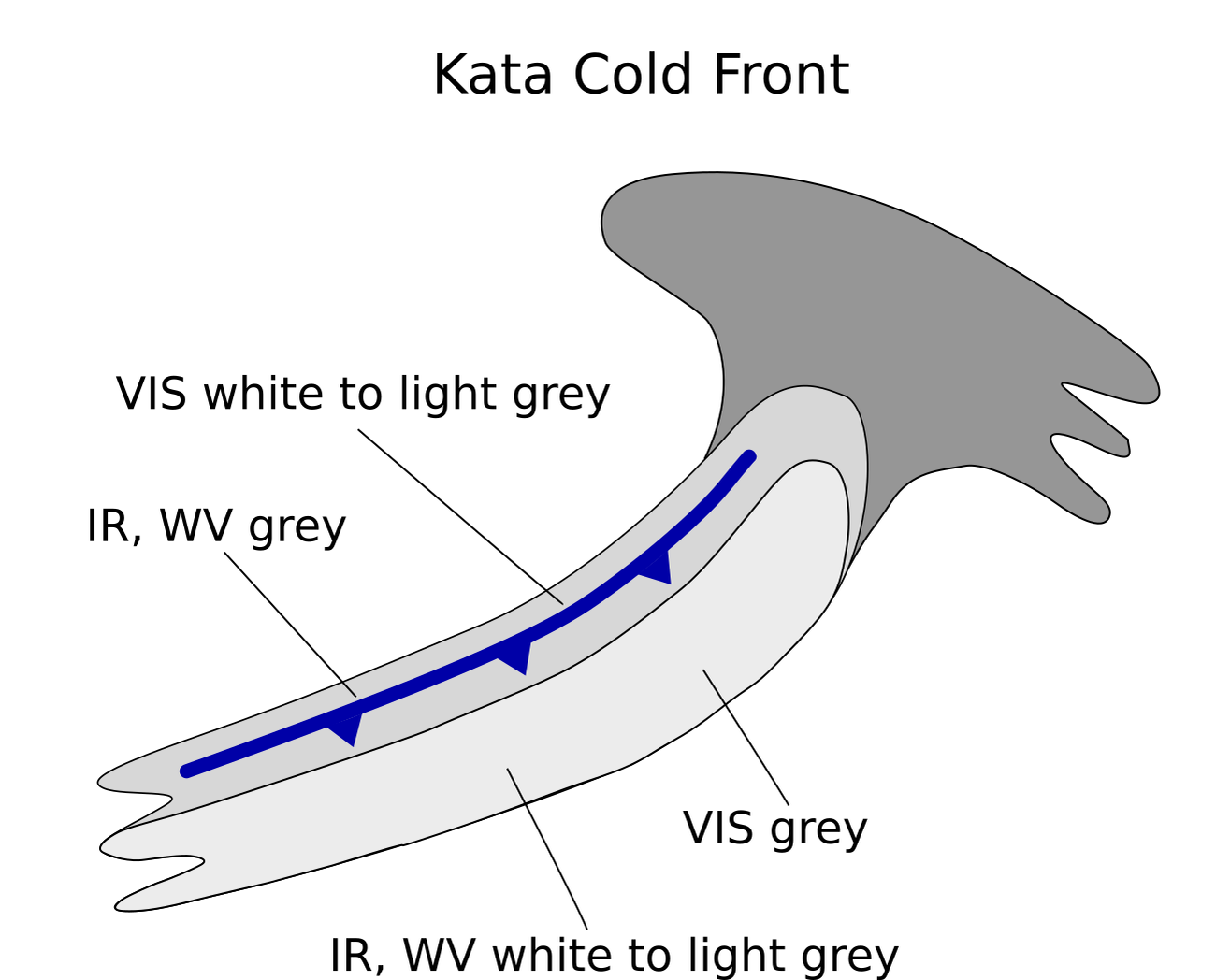
Kata Cold Front
Appearance in the basic channels:
-
- Structured appearance
- In VIS images, the brightest area is from the rear edge to the middle part of the cloud band, indicating lower water clouds.
- In IR and WV images the brightest area is from the leading edge to the middle part of the cloud band, indicating cold and high cloud tops, often with embedded CBs.
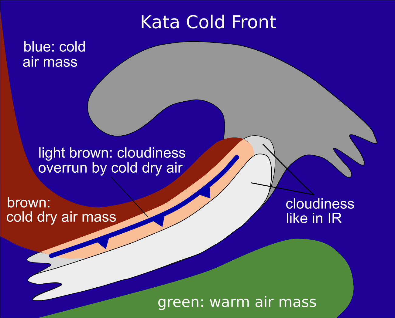
Appearance in the basic RGBs:
Airmass RGB
At the rear of Kata Cold Fronts, the downward protruding cold air shows up as blue and brown areas indicating the cold and the cold and dry air.
The cloud band of a Kata Cold Front has very similar appearance in the Airmass RGB to that in the IR image; as in case of Kata fronts the jet streak and therefore the dry air on the cyclonic side often penetrate parts of the frontal cloud band and these areas appear with a brownish shadow.
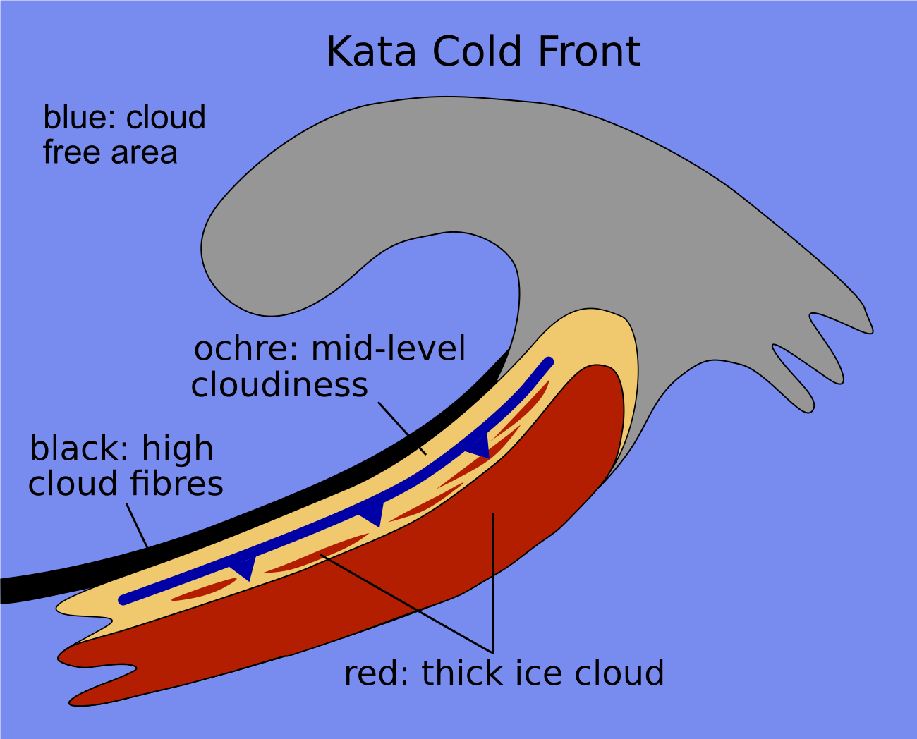
Dust RGB
The surroundings of the Kata Cold Front - especially on the rear side - show blue or pinkish blue colours where there are no clouds below; cloud cells or patches appear mostly in yellowish to ochre colours.
The largest part of the Kata Cold Front cloud band shows as dark red to red-brown colours in the Dust RGB indicating thick ice cloud; yellowish areas between the red-brown areas indicate mid-level cloudiness below and are more extensive than in the ana front case. Often there are black fibres at the leading and rearward edges, indicating high translucent cloud fibres.
 |
 |
Basic RGB schematics. Left: Airmass RGB; right: Dust RGB.
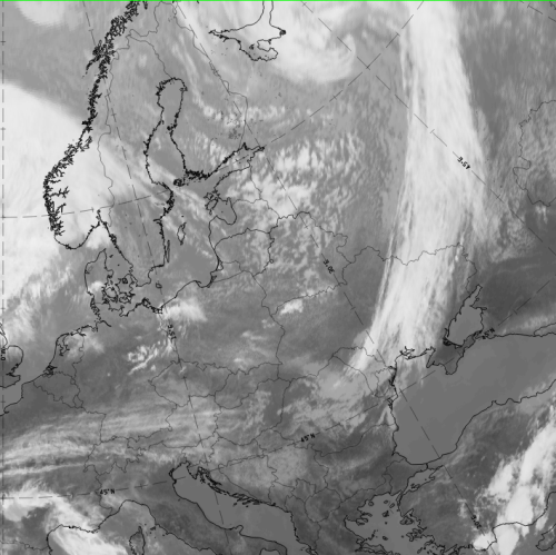
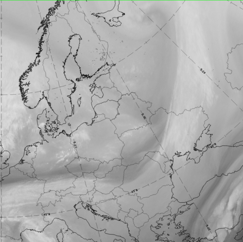
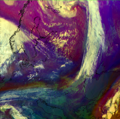
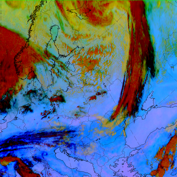
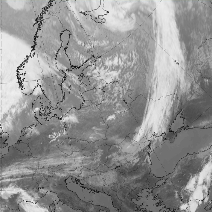
Data from 14 September 2019 at 12 UTC show a very typical example of a Kata Cold Front, which had reached NE Europe, extending from the Ukraine northward into Russia.
|
|
|
|
Legend:14 September 2019, 12UTC: 1st row: IR (above)+ HRV (below); 2nd row: WV (above) + Airmass RGB (below); 3rd row: Dust RGB + image gallery.
*Note: click on the Dust RGB image to access image gallery (navigate using arrows on keyboard)
| IR | Bright colours with structures appear over the whole cloud band. |
| HRV | Brightest colours close to the rear side of the band (thick cloud close to the surface front). |
| WV | Light grey with embedded brighter structures and a dark stipe at the rear of and parallel to the cloud band; A second dark stripe across mid-Norway and Sweden, perpendicular to the Kata Cold front band. Penetration of the dry air is not visible in this case. |
| Airmass RGB | At the rear side of the cloud band there are dark blue to brown colours (cold and dry air). The penetrating dry air, which is often a characteristic of a kata type cold front, is in this case only vaguely apparent where the blue area extends nearly perpendicular from the Norwegian coast to NW Ukraine. |
| Dust RGB | Dark red colours (thick ice cloud) in the centre of the cloud band. Very extensive black cloud fibres at the leading and rearward edges. |
It is not always easy to clearly separate Ana and Kata types. During early development the front is usually an Ana type, becoming a Kata-type later. These two types can also exist within the same front.
The structure of a Cold Front can also vary according to other features attached to or embedded within it. Conceptual models include Wave, Upper Wave, Front Intensification by Jet Crossing and Front Decay. A PVA maximum may also produce additional substructures. Kata Cold Fronts can sometimes look like Split Fronts.