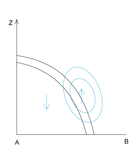
Typical Appearance In Vertical Cross Sections
- Isentropes show a downward inclined gradient zone (frontal zone), which extends through the whole troposphere.
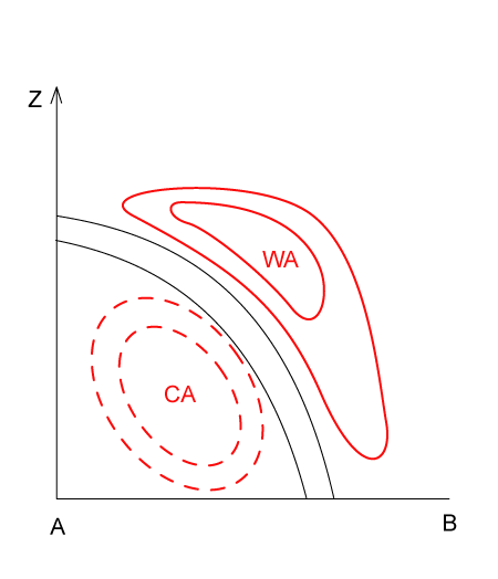
- There is warm advection ahead of the frontal zone and cold advection behind it. The cold advection is much more pronounced than the warm advection.
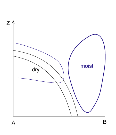
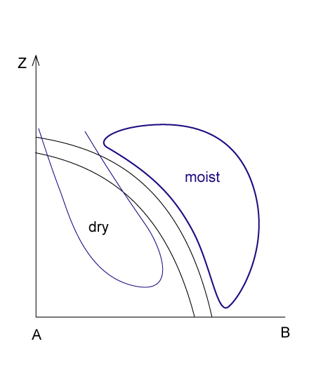
- In an Ana Cold Front the relative humidity is high ahead of the frontal zone and low behind it. In the case of a Kata Cold Front the area of high humidity is inclined forwards and, therefore, is moving away from the highest surface of the frontal zone with height. In a Kata Cold Front the dry air extends from behind into the frontal zone.
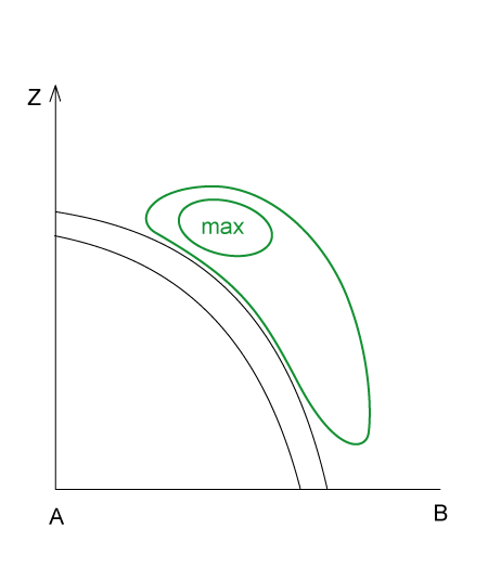
- The frontal zone lies within positive vorticity advection, which increases with height. The maximum is just below the tropopause.
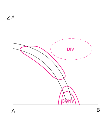
- There is convergence within the frontal zone and divergence above it.
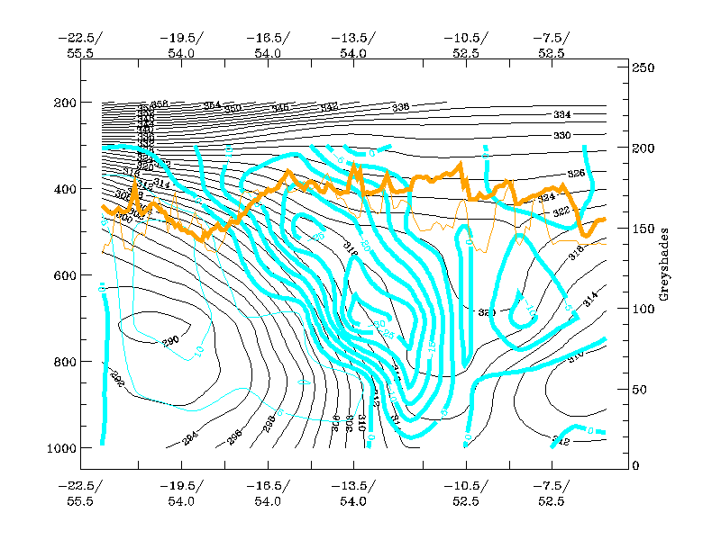
- Omega has negative values (upward motion) within and above the frontal zone. Weak positive values (downward motion) can be found behind the frontal zone.
- Pixel values in satellite images are high in VIS images for both types of Cold Fronts over the frontal zone. In an Ana Cold Front the highest values in IR and WV images coincide with the VIS values, but in a Kata Cold Front they are ahead of the frontal zone.
|
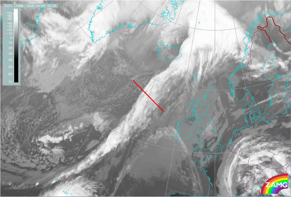
04 October 2005/12.00 UTC - Meteosat 8 IR 10.8 image; position of vertical cross section indicated
|
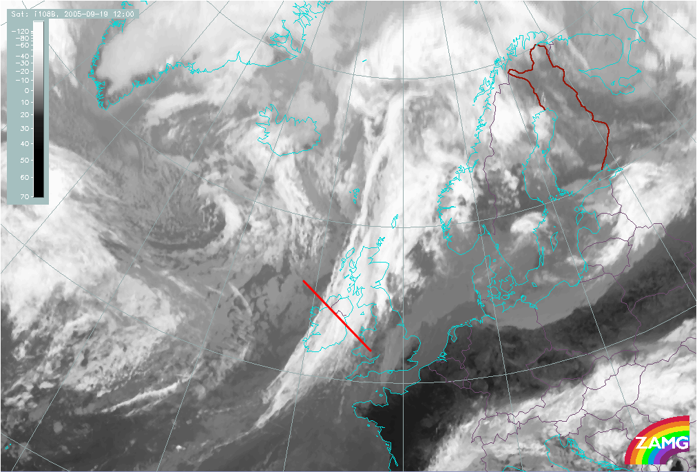
19 September 2005/12.00 UTC - Meteosat 8 IR 10.8 image; position of vertical cross section indicated
|
|
|
Relative Humidity
|
|
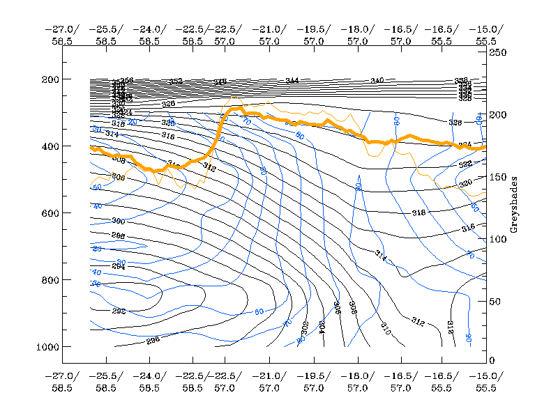
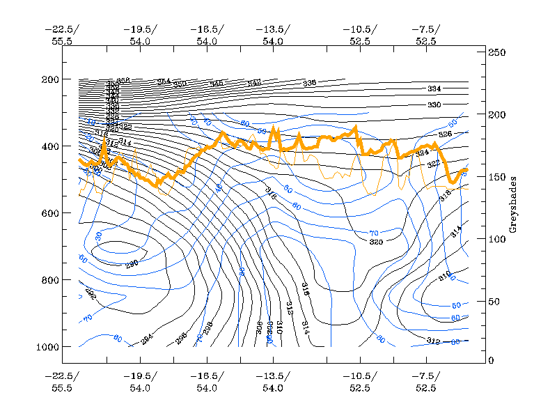
04 October 2005/12.00 UTC - Vertical cross section; black: isentropes (Θe), blue: relative humidity, orange
thin: IR pixel values, orange thick: WV pixel values
|
|
|
|
|
19 September 2005/12.00 UTC - Vertical cross section; black: isentropes (Θe), blue: relative humidity, orange
thin: IR pixel values, orange thick: WV pixel values
|
|
|
Temperature Advection
|
|
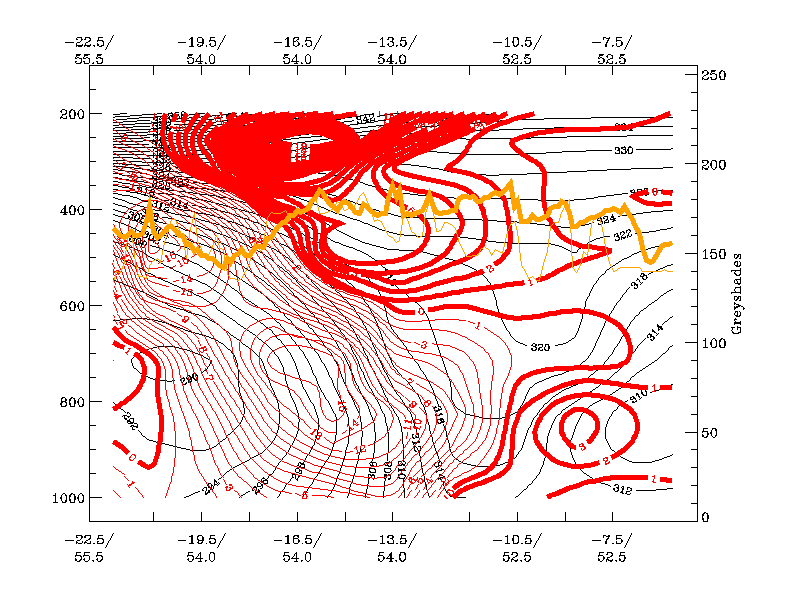
19 September 2005/12.00 UTC - Vertical cross section; black: isentropes (Θe), red thick: temperature advection
- WA, red thin: temperature advection - CA, orange thin: IR pixel values, orange thick: WV pixel values
|
|
|
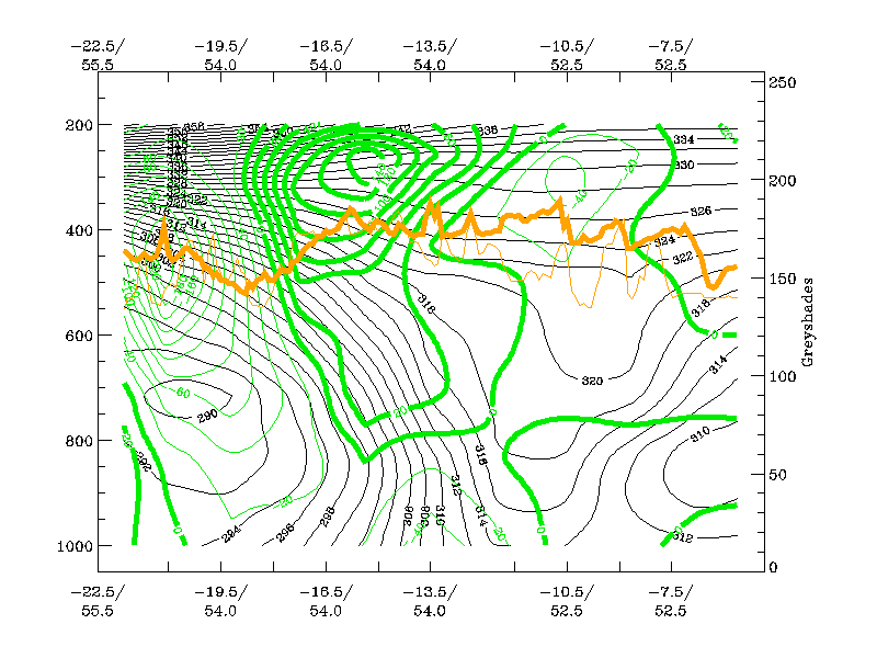
Vorticity Advection
|
|
19 September 2005/12.00 UTC - Vertical cross section; black: isentropes (Θe), green thick: vorticity advection -
PVA, green thin: vorticity advection - NVA, orange thin: IR pixel values, orange thick: WV pixel values
|
|
|
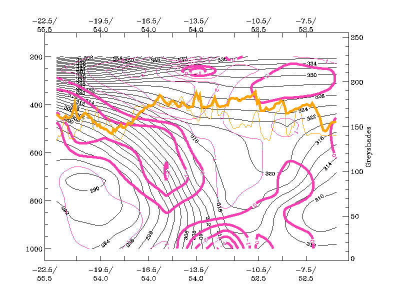
Divergence
|
|
19 September 2005/12.00 UTC - Vertical cross section; black: isentropes (Θe), magenta thick: convergence,
magenta thin: divergence, orange thin: IR pixel values, orange thick: WV pixel values
|
|
|
Vertical motion (Omega)
|
|
19 September 2005/12.00 UTC - Vertical cross section; black: isentropes (Θe),cyan thick: vertical motion (omega) -
upward motion, cyan thin: vertical motion (omega) - downward motion, orange thin: IR pixel values, orange thick: WV pixel values
|
|
|