Key Parameters
- Equivalent thickness
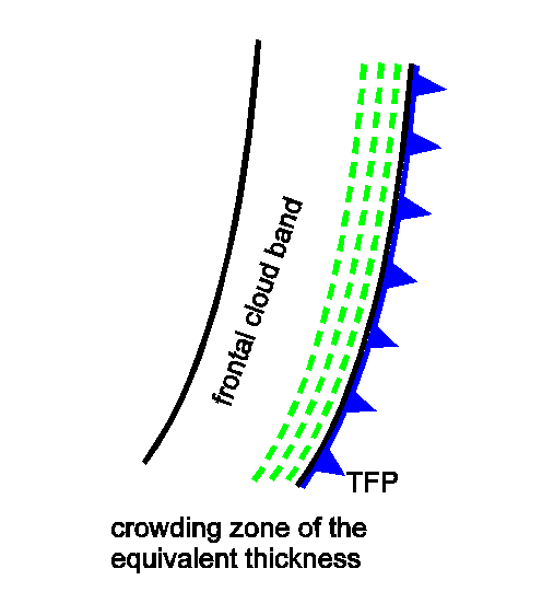
Gradient zone of equivalent thickness:- Ana Cold Front: within the cloud band
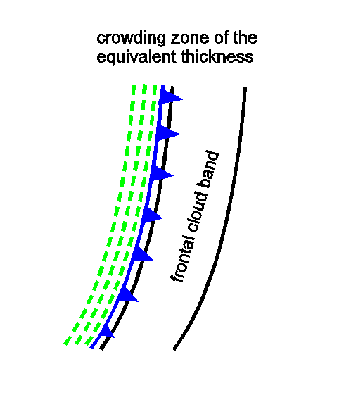
- Kata Cold Front: behind the cloud band
- Thermal front parameter (TFP)
The maximum of TFP accompanies the cloud band:- Ana Cold Front: within the leading area of the cloud band
- Kata Cold Front: within the rear area of the cloud band
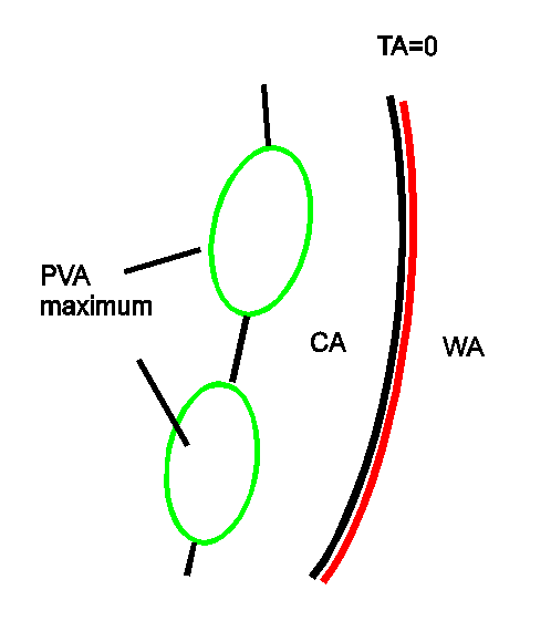
- Temperature advection
There is relatively weak warm advection ahead of the Cold Front, and pronounced cold advection behind it.- Ana Cold Front: cloudiness usually lies within CA, TA=0 ahead of cloud band
- Kata Cold Front: cloudiness usually lies within WA, TA=0 within the cloud band
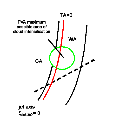
- Positive vorticity advection (PVA) in upper levels
PVA maxima can be found near the rear edge of the cloud band indicating the propagation of the upper level trough and/or the approach of a jet streak (see Front Intensification By Jet Crossing). - Isotachs at 300 hPa
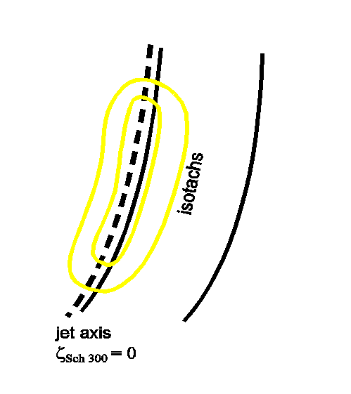
- Ana Cold Front: the jet runs behind the cloud band and parallel to it. The jet crosses the frontal system in the area of the occlusion point. The front is on the anticyclonic side of the jet.
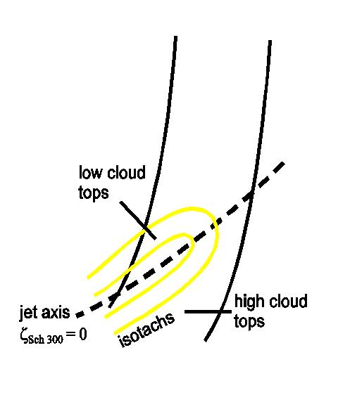
- Kata Cold Front: the jet crosses the Cold Front at a sharp angle; according to the jet crossing point the cloud band can be on the anticyclonic or cyclonic side of the jet.
- Shear vorticity at 300 hPa
Zero line of the shear vorticity:- Ana Cold Front: the zero line is close to and parallel to the rear cloud edge
- Kata Cold Front: the zero line crosses the Cold Front; usually it accompanies the transition of the lower cloud tops on the cyclonic side to higher tops on the anticyclonic side of the front.
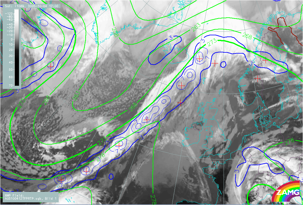
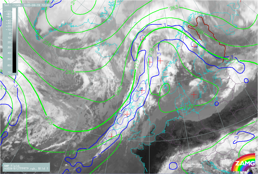
Equivalent thickness and Thermal Front Parameter (TFP)
|
|
04 October 2005/12.00 UTC - Meteosat 8 IR 10.8 image, Ana front; blue: thermal front parameter (TFP) 500/850 hPa, green: equivalent thickness
500/850 hPa
|
|
|
|
|
19 September 2005/12.00 UTC - Meteosat 8 IR 10.8 image, Kata front; blue: thermal front parameter (TFP) 500/850 hPa, green: equivalent
thickness 500/850 hPa
|
|
|
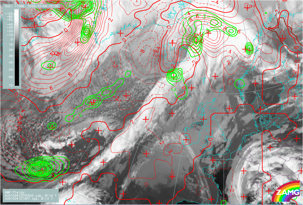
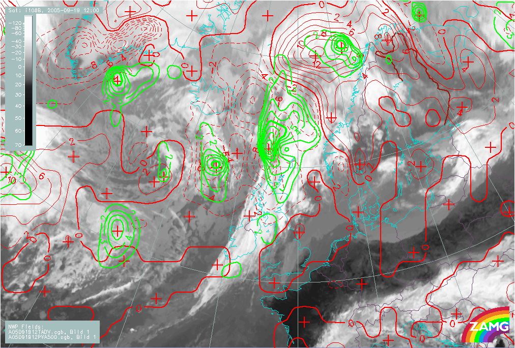
Temperature Advection and Positive Vorticity Advection (PVA)
|
|
04 October 2005/12.00 UTC - Meteosat 8 IR 10.8 image; red: temperature advection 500/1000 hPa, green: vorticity advection 500 hPa
|
|
|
|
|
19 September 2005/12.00 UTC - Meteosat 8 IR 10.8 image; red: temperature advection 500/1000 hPa, green: vorticity advection 500 hPa
|
|
|
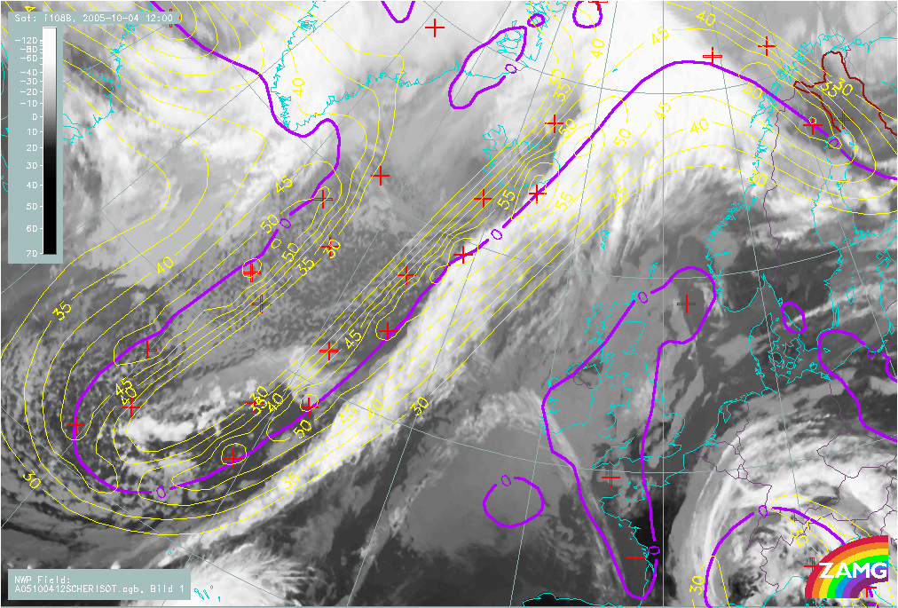
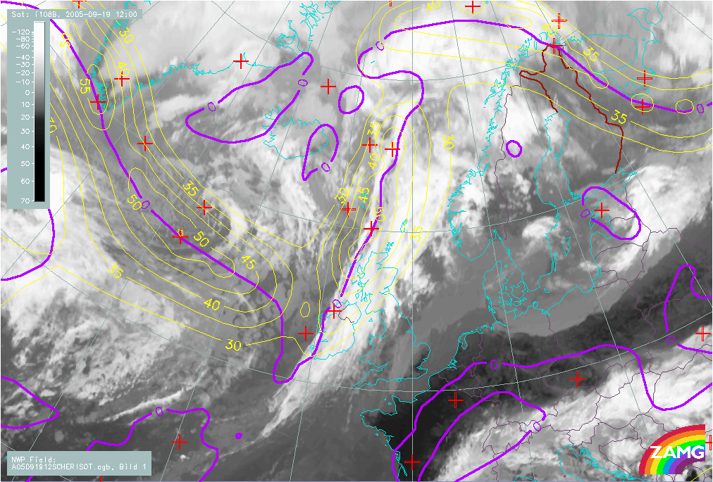
Isotachs and Shear Vorticity 300 hPa
|
|
04 October 2005/12.00 UTC - Meteosat 8 IR 10.8 image; yellow: isotachs 300 hPa, magenta: zero line of shear vorticity
|
|
|
|
|
19 September 2005/12.00 UTC - Meteosat 8 IR 10.8 image; yellow: isotachs 300 hPa, magenta: zero line of shear vorticity
|
|
|