Typical Appearance In Vertical Cross Sections
A cross section of the synoptic environment of MCSs along the leading edge of a frontal cloud band is characterised by the following features:
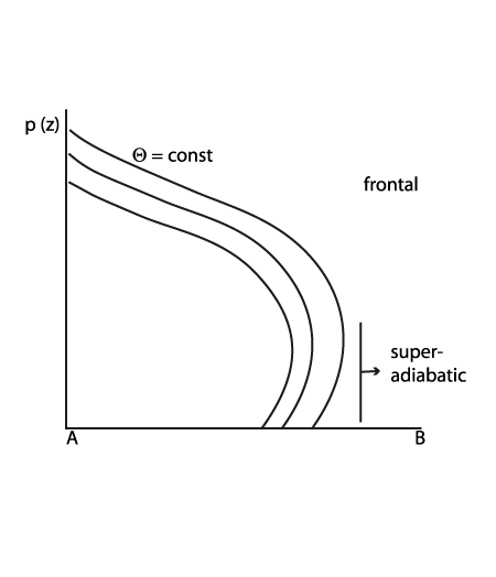
- Isentropes of equivalent potential temperature show an unstable stratified troposphere within the lower and mid-levels of the troposphere, which is mostly superadiabatic in the lower layers.
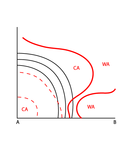
- The vertical distribution of temperature advection is characterised by CA at middle and higher levels indicating cold air overrunning the frontal air mass. This means that the stratification becomes unstable.
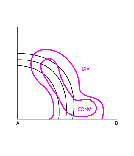
- Fields of divergence indicate convergence within the lower and mid-levels. In the case of pre frontal MCS development, the convergence is part of the frontal circulation cell and has a distinct pre frontal maximum, indicating strong ascending motion.
|
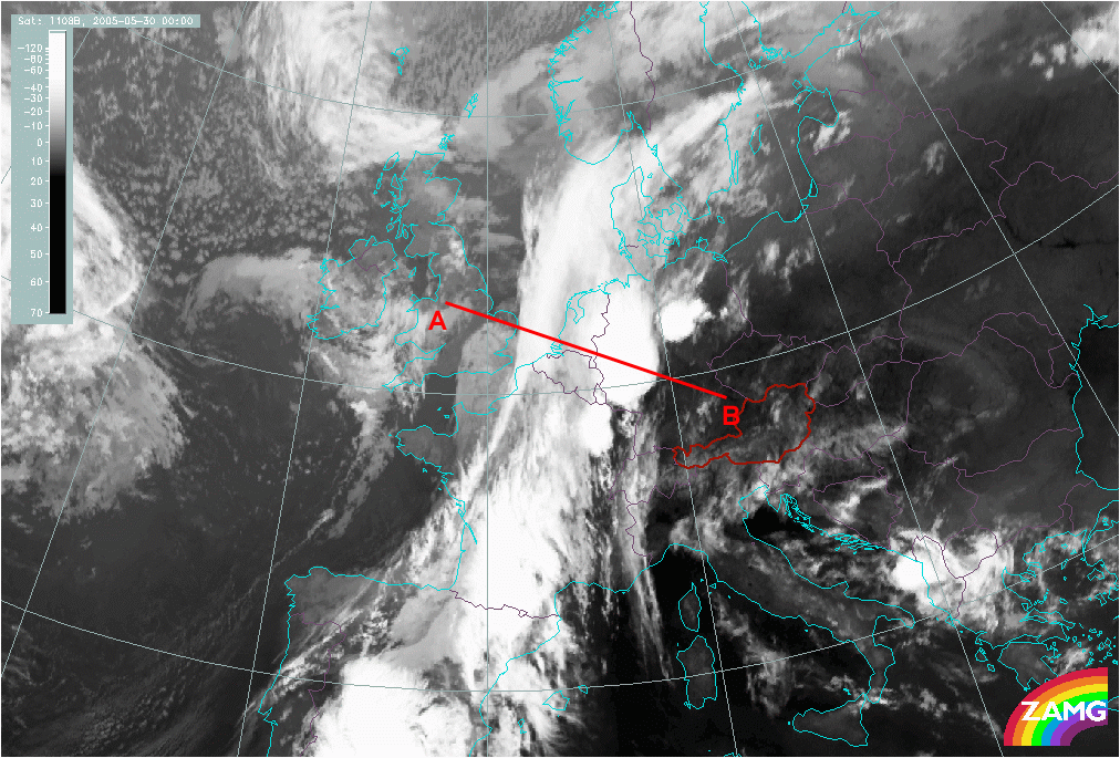
30 May 2005/00.00 UTC - Meteosat IR10.8 image; position of vertical cross section indicated
|
|
|
|
Vertical distribution of isentropes typical for development of MCS
|
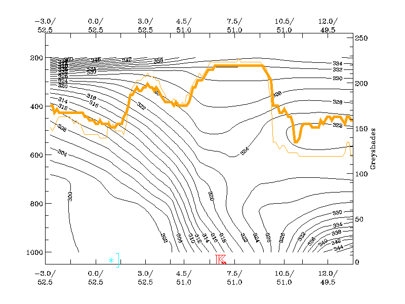
30 May 2005/00.00 UTC - Vertical cross section; black: isentropes (ThetaE), orange thin: IR pixel values, orange thick: WV pixel
values
|
|
|
|
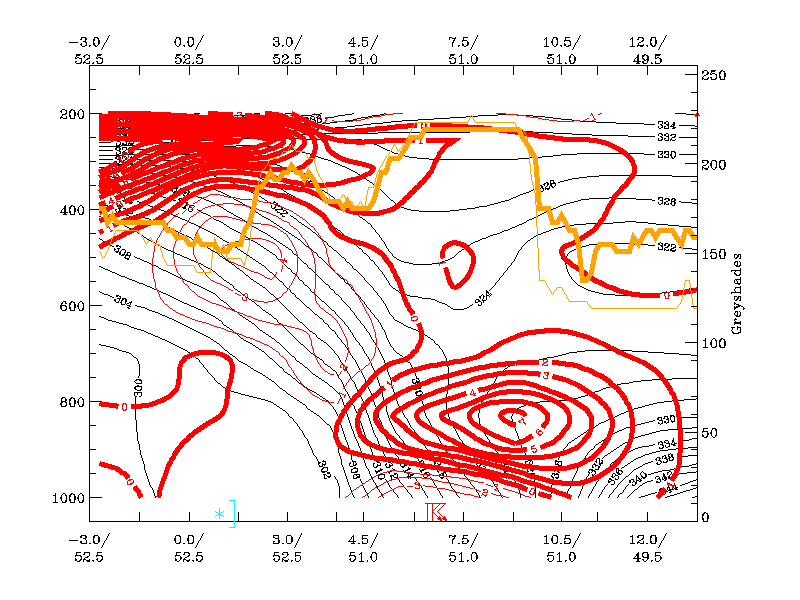
Vertical distribution of isentropes and temperature advection typical for development of MCS
|
30 May 2005/00.00 UTC - Vertical cross section; black: isentropes (ThetaE), red thick: temperature advection - WA, red thin:
temperature advection, CA, orange thin: IR pixel values, orange thick: WV pixel values
|
|
|
|
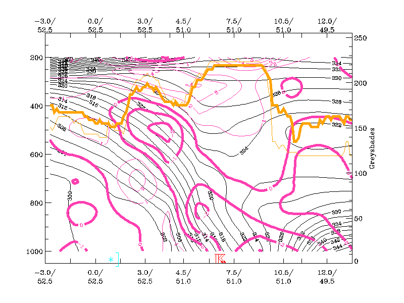
Vertical distribution of isentropes and divergence typical for development of MCS
|
30 May 2005/00.00 UTC - Vertical cross section; black: isentropes (ThetaE), magenta thin: divergence, magenta thick: convergence,
orange thin: IR pixel values, orange thick: WV pixel values
|
|
|
The above images show cross sections across the frontal cloud band and the MCSs in the warm air ahead of it. Isentropes in this area show an unstable stratified troposphere while the pronounced upward motion is driven by strong low and mid-level convergence. The existence of MCSs is indicated by high pixel values in the IR as well as in the WV image.