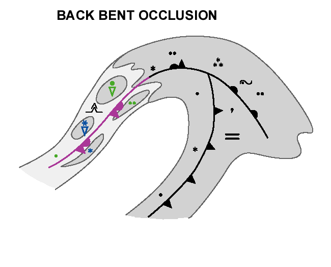
Weather Events
| Parameter | Description |
| Precipitation | Moderate rain ahead of the warm occluded front near the low, elsewhere moderate to light rain or drizzle. Showers behind the cold occluded front. |
| Temperature | A decrease in the temperature behind the cold occluded front. |
| Wind (incl. gusts) | Possibly strong and gusty winds behind the cold occluded front. |
| Other relevant information | - |
For demonstration of weather the back-bent occlusion at 30 June 2020 at 06 UTC is chosen.
|
|
Hover over the image and move your pointer left and right to fade between images.Tap if using a touch interface. |
Legend:
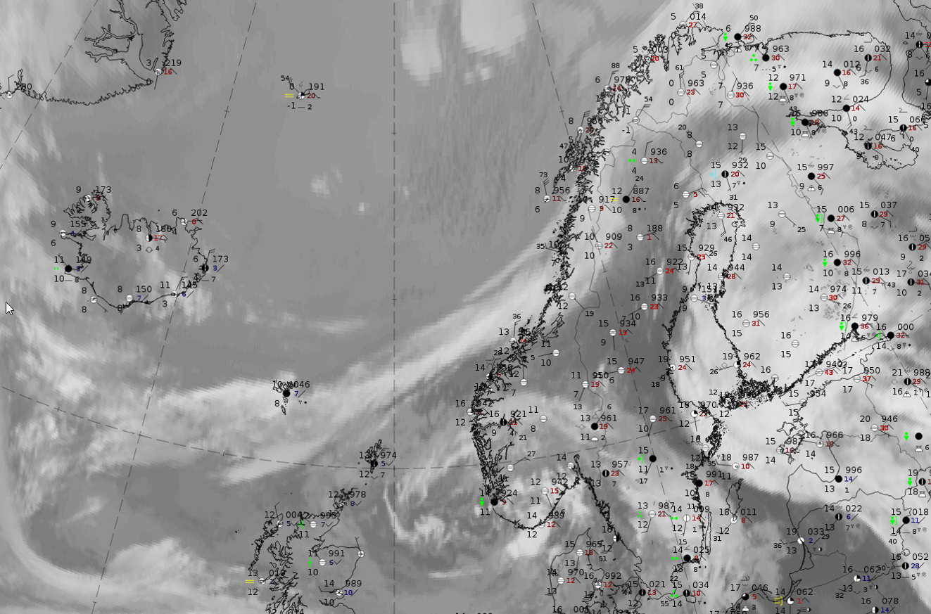
30 June 2019 at 06 UTC: IR + synoptic measurements (above) + probability of moderate rain (Precipitting clouds PC - NWCSAF).
Note: for a larger SYNOP image click this link.
Synoptic measurements are only available for the occluded part near the former low centre. This is over North-Norway and North-Finland. The observations show precipitation not in shower form and precipitation probabilities from the NWCSAF are high there. For the back-bent part of the occlusion which extends from the Norwegian coast westward across the Norwegian Sea where there are no synoptic observation stations available the precipitation probabilities are much lower, but (this can be seen in the next figure) the convective rainfall rate determined from the NWCSAF is higher in this part than to the northeast. This corresponds with synoptic symbols in the schematic.
|
Hover over the image and move your pointer left and right to fade between images.Tap if using a touch interface. |
|
Hover over the image and move your pointer left and right to fade between images.Tap if using a touch interface. |
30 June 2020 at 06 UTC;
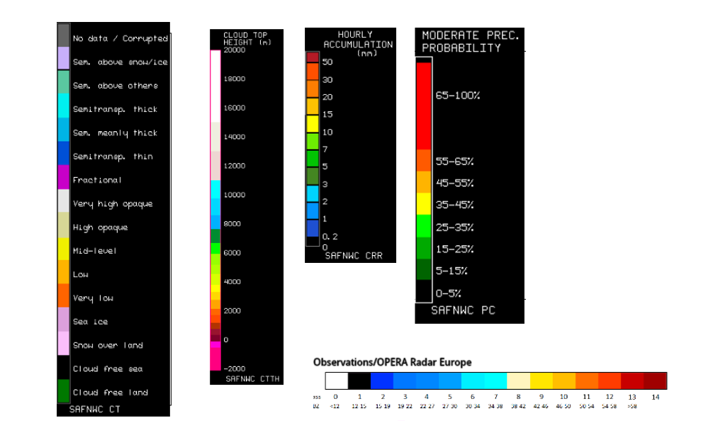
1st row: Cloud Type (CT NWCSAF) (above) + Cloud Top Height (CTTH - NWCSAF) (below); 2nd row: Convective Rainfall Rate (CRR NWCSAF) (above) + Radar intensities from Opera radar system (below).
For identifying values for Cloud type (CT), Cloud type height (CTTH), precipitating clouds (PC), and Opera radar for any pixel in the images look into the legends. (link).