Common Remarks
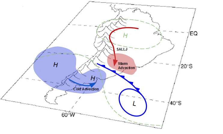
The meteorological phenomena that occur in the central part of Argentina are mostly related to the passage of baroclinic waves immersed in the westerlies flow. Cold frontal systems or cold fronts are associated with different cloud patterns that can be clearly identified in satellite images.
 |
I. Appearance in Satellite Data
Learn about how to recognise and detect Cloud Patterns Associated with Cold Fronts in Central Argentina in satellite images.
II. Meteorological Physical Background
Find out more about the meteorlogical and physical background of Cloud Patterns Associated with Cold Fronts in Central Argentina
III. Key Parameters
Learn which key parameters to use for montoring Cloud Patterns Associated with Cold Fronts in Central Argentina
IV. Typical Appearance In Vertical Cross Sections
Find out the typical appearance of Arctic Cloud Patterns Associated with Cold Fronts in Central Argentina in vertical cross section
V. Weather Events
Explore the weather events associated with Cloud Patterns Associated with Cold Fronts in Central Argentina
VI. References
Let these comprehensive documents in the references assist you in finding more about Cloud Patterns Associated with Cold Fronts in Central Argentina