Chapter III: A Special Case Of Lee Waves: The Foehn Clouds
Table of Contents
- Chapter III: A Special Case Of Lee Waves: The Foehn Clouds
- The Foehn Wall
- The Foehn Gap
- The Foehn Cloud
- Exercise
The Foehn Clouds
In this chapter, we will focus on the clouds typical for the Foehn wind. The Foehn wind is characterized by strong winds at the lee side of a mountain range. Adiabatic heating warms the air stream on its way down, which brings a considerable temperature change especially in the winter months. Foehn wind events cause many people to suffer from hearth and circulation problems.
The Foehn Wall
There is a frequent occurrence that can be observed after the Foehn's onset on the lee side of mountains in winter. The warm Foehn winds blow away the cold air pond located at the bottom of the valleys. Temperature jumps of more than 25° Celsius within a short space of time have been recorded. Many winterly (positive) temperature anomalies are related to the Foehn phenomenon.
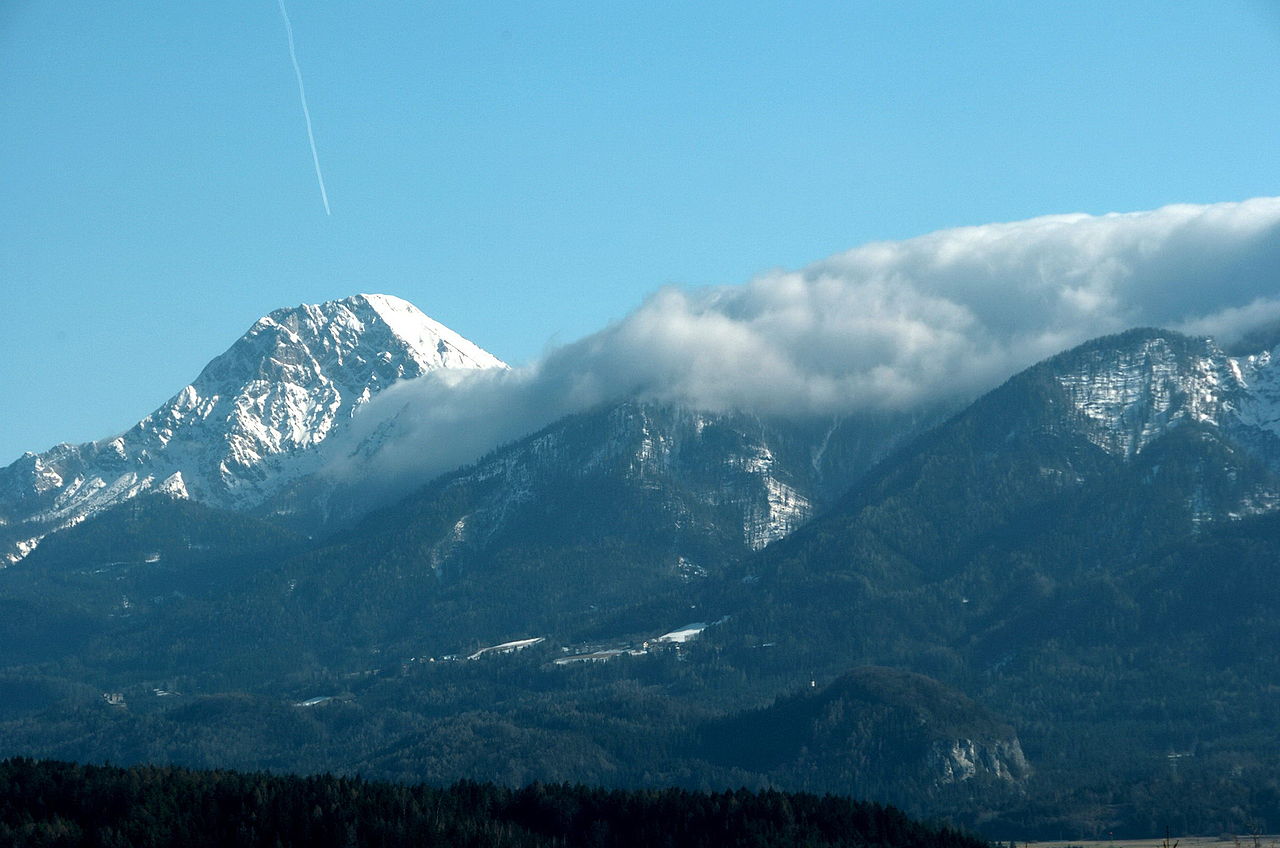
Figure 1: Foehn wall over the Karawanks (Austria); image ©: Johann Jaritz, CC BY-SA 3.0
The Foehn wall is typical for Foehn events (figure 1). This stationary wall of clouds is located over the mountain peak. The Foehn wind passes over the mountains and "falls down" on the lee side of the mountains. While the descending air warms up on the lee side, the cloud droplets evaporate and the Foehn wall forms exactly at this transition zone. In case of very strong winds, precipitation may also occur on the lee side of the mountains.
The Foehn Gap
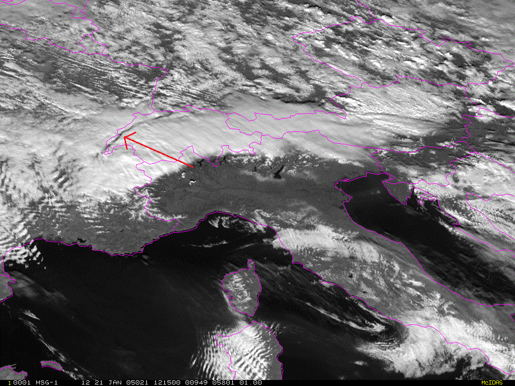
Figure 2: Foehn gap over the northern parts of Switzerland (red arrow). MSG HRV from 21 January, 2005 at 12:15 UTC.
The Foehn gap on the lee side of the mountain barrier is located at the wave trough (figure 2). The width of the Foehn gap is given by the wave length of the lee waves; wave amplitude (and not length) usually decreases rapidly downstream of the mountains.
The Foehn Cloud
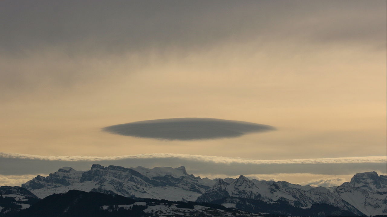
Figure 3: Altocumulus lenticularis over the Swiss Alps, © Ahdigital, CC BY-SA 3.0
The Foehn wind is usually accompanied by characteristic lee clouds, the lenticularis clouds (Altocumulus lenticularis). They are stationary clouds formed at the wave crest of a vertically oscillating air current after it has passed a mountain chain. They are typically found at altitudes of 2000 to 8000 meters. Lenticularis clouds can be composed of several layers on top of each other which make them impressive to look at. This is the result of varying humidity in the vertical profile.
Lenticularis clouds are often associated with severe turbulence, for which reason they are avoided by powered aircraft pilots. Glider pilots instead actively seek them out to exploit their updrafts.
