Synoptic Situation: Satellite Images, weather and basic numerical parameters
The frontal system under consideration covers in the beginning Central Europe from the Baltic Sea across Poland, Czech Republic, Austria, Germany into Switzerland. This rather N-S oriented frontal cloud band moves eastward into Russia during the time period of the case study. Along this frontal branch the wave A develops over Poland and moves north – northeastward across the Baltic States into Sweden.
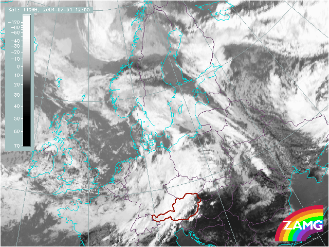
1 July 2004/12.00 UTC - MSG IR image
|
Approximately one day later a more W-E orientated branch of frontal cloudiness intensifies over Austria, Hungary and Romania and merges with the N-S oriented frontal cloud part. At the rear of this branch the second wave B develops first over Austria and Hungary and propagates to north – northeast across the Ukraine into Russia. |
IR Imagery (Meteosat 8 channel 10.8): time sequence
This chapter shows and describes the development of the waves in relevant satellite channels in a sequence of 3-hourly images.
Combined satellite imagery (IR, VIS, WV, RGB139): selected time sequences
A second chapter shows the combination of several satellite channels which helps to get a better idea if there is indeed a wave situation or not.
IR image and Geopotential height 1000 hPa: time sequence
In the following chapter the cloud configurations seen in satellite images are related to the basic field of surface pressure represented by geopotential height in 1000 hPa. 6-hourly sequences are shown.
IR image and weather: time sequence
As mentioned earlier, the weather associated to waves is important to forecasters. In the following set of images observations of precipitation and thunderstorms are related to the cloud configurations seen in satellite images in 6-hourly sequences.
Summary of the investigations in this chapter
There are similarities and differences between the two waves and their development. Both waves develop into occlusion cloud spirals, both waves have a rather long phase where only a cloud bulge can be recognised. The second wave B has a very rapid development phase from the bulge stage into the occlusion stage. For both waves a distinct lowering of the cloud tops in the frontal cloud band can be recognised under an area of overrunning dry air which can be clearly seen in the WV image. In connection with this overrunning dry air, probably even stratospheric, also an opposite phenomenon takes place, namely enhanced convective development. According to the concept of conceptual models, this is connected to the enhancement of PV and advection of PV. This process is much more intensive and classical for wave B.
Both waves are connected to intensive precipitation events and during the relevant time of the day also to thunderstorm events.
The main difference between the two cases can be found in the surface height field (height at 1000 hPa). While wave 'A' exists in an area of a height minimum (surface low) which deepens slowly, the latter wave 'B' is connected during the long first phase to a ridge in the surface charts (high pressure zone). Only during the phase of the rapid development into an occlusion spiral a surface minimum develops and deepens rapidly.