Chapter III: Further Development and Impacts
Table of Contents
- Chapter III: Further Development and Impacts
- Further Development and Impacts
- 8. March 2010
- 9. March 2010
- 10. March 2010
- Development of a new System
- 11. March 2010
Further Development and Impacts
For the first overview Loop 3.1 shows the evolution of the system on the Airmass RGB. In the following subchapters it will be discussed more in detail. The excursive development on the 8. March from 15UTC to 18UTC, when the cold air was advected over the relatively warm Mediterranean Sea, is very impressive.
Loop 3.1: MSG Airmass RGB Loop 7.3.2010 0UTC - 12.3.2010 21UTC
8. March 2010
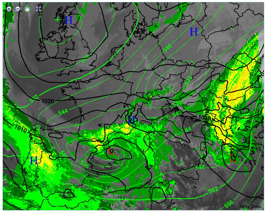
A surface low which first occurs over Spain developed due to intense cyclogenesis as a result of the massive Cold Air approach over the relatively warm (about 13°C) Mediterranean Sea (Fig 3.1). The low has by now a central pressure of about 995 hPa (Fig 3.1). The upper level low and the surface low are geographically displaced. This indicates further evolution of the System. The green to orange fields overlaid the IR10.8 Sat-Image show the probability for precipitation of the detected clouds, based on NWCSAF data. This picture shows good accuracy for precipitation in the region of the frontal System over the south of France and North-East Spain. A second upper level low with cold air has the position over Austria. This cold air will support in the following the cyclogenesis over the Mediterranean Sea.
Figure 3.1: 8.3.2010 - ECMWF SST [°C]
Figure 3.2: 8.3.2010 18UTC - MSG IR 10.8 with overlay NWCSAF Precipitating Clouds; green lines: ECMWF ATP500;
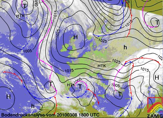
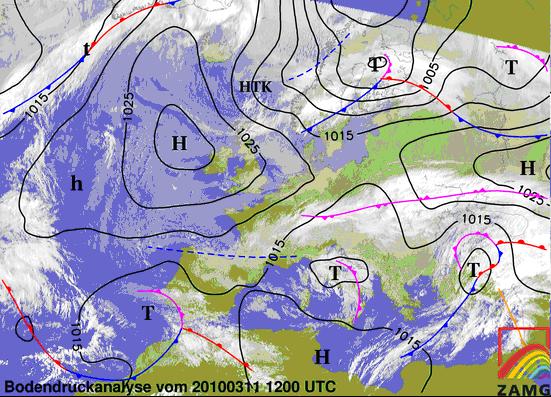
Fig 3.3: The surface chart shows the occluded System over the Mediterranean Sea which tracks eastward to Italy.
Figure 3.3: 8.3.2010 18UTC - MSG IR; black lines: MSLP; Surface Frontal Analysis
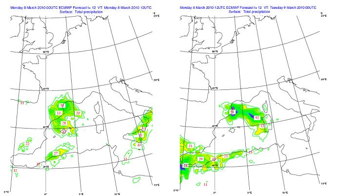
Figure 3.4: ECMWF 12h Precipitation [mm] for 8.3.2010 12UTC and 9.3.2010 0UTC
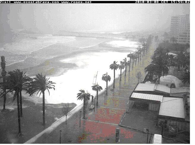
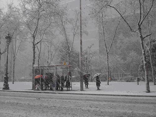
Fig 3.4: ECMWF Precipitation shows heavy precipitation in the region of the occlusion and the cold front. Meteoalarm (Fig 3.6) has an orange snow warning for France and Spain, because the 850hPa temperature in the regions with precipitation is about 288K. This indicates a potential snowline height of about 200m above sea level. In the region around Barcelona the heaviest snowfall since 25 years occurs (APA). Even in coast regions a light snow cover developed (Fig 3.5). Also directly in Barcelona snowfall was reported (Fig 3.6). Italy has a red warning for strong rain for the next days from the same system.
Figure 3.5: 8.3.2010 - Snow Covered Coastline on the Costa Brava (www.roses.net)
Figure 3.6: 8.3.2010 - Heavy Snowfall in Barcelona (www.diluvi.com)
Figure 3.6: 8.3.2010 18UTC - MeteoAlarm (further Information see Text); red lines: ECMWF ThetaE in 850hPa
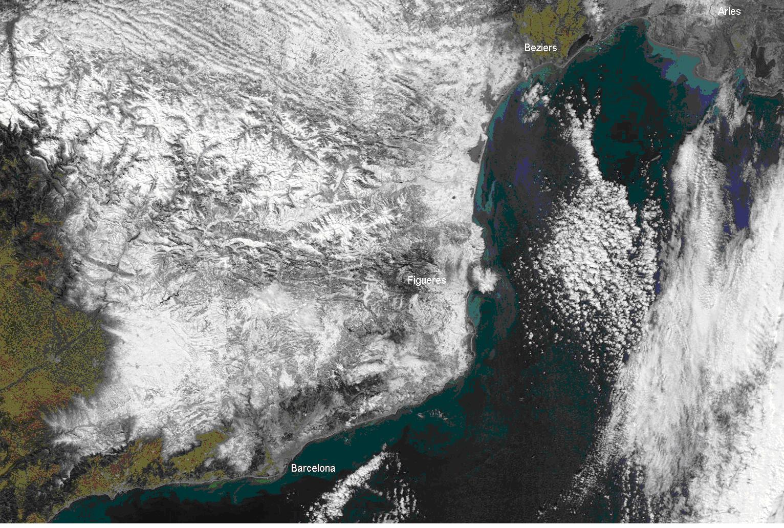
Figure 3.7: 9.3.2010 13UTC - Aqua-Sat Visible Image after the snow event (hrapidfire.sci.gsfc.nasa.gov)
Fig 3.7 shows a visible satellie image from the discussed region after the snow event. To this time the frontal system is alredy moved eastward. Because it is widely cloudfree over the east of the spanish mainland. The white areas over the land demonstrate a snow cover also down to the coast. This is very unusual, especially for March.
9. March 2010
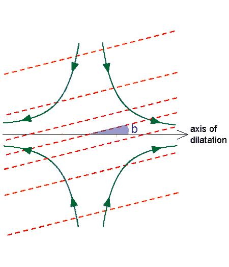
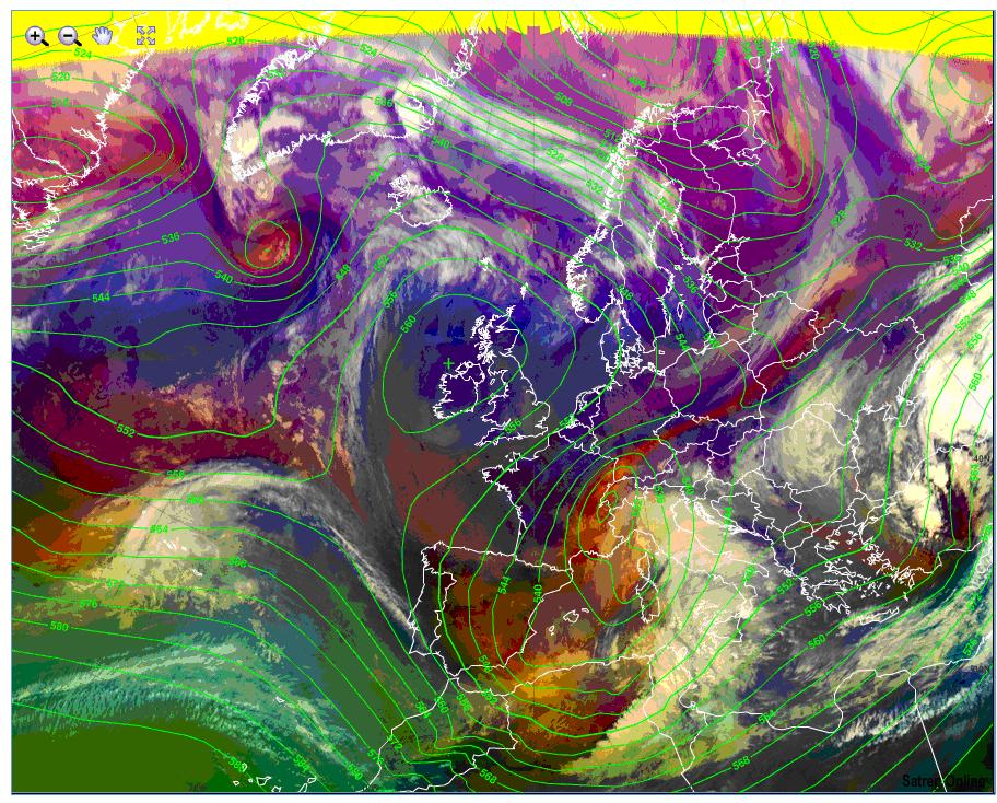
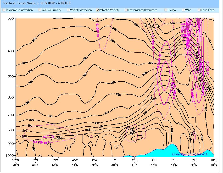
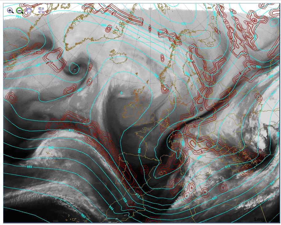
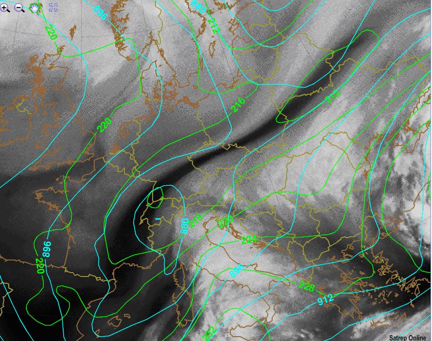
On the Airmass RGB (Fig 3.10) as reddish band and on the WV6.2 (Fig 3.12 and 3.13) as dark band we can see a deformation band across Europe. The low over the Mediterranean Sea is still provided by cold dry stratospheric air with high Potential Vorticity (Fig 3.11). In the region of a deformation band frontogenesis occurs when the angle between the axis of dilatation and the isentropes is smaller than b=45° (Fig 3.9). Because this is the case (Fig 3.13), the temperature gradient in the relevant region increases. Two other deformation zones (Fig 3.12) can bee seen over the Mediterranean and the Adriatic Sea.
Figure 3.9: frontogenetic active deformation zone; green lines: streamlines; red lines: isentropes;
Figure 3.10: 9 March 2010 12UTC - MSG Airmass RGB; green lines: ECMWF ATP500
Figure 3.11: 9 March 2010 12UTC - Vertical Cross Section 60N 10W - 40N 10E; black lines: ECMWF isentropes; purple lines: ECMWF Potential Vorticity
Figure 3.12: 9 March 2010 12UTC - MSG WV6.2; cyan lines: ECMWF ATP300; red lines: ECMWF Total Deformation at 300hPa
Figure 3.13: 9 March 2010 12UTC - MSG WV6.2; cyan lines: ECMWF ATP300; green lines: ECMWF Equivalent Thickness
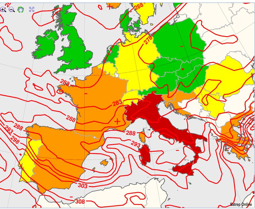
The system gets more and more energy from the Mediterranean Sea. On the 9th of March the occlusion reaches Italy with strong wind and heavy precipitation (Fig 3.15). Heavy snowfall occurs in many regions down in very low heights (Fig 3.14). In the north of Italy ThetaE in 850hPa (Fig 3.16) of about 283K implies that snowfall down to the lowlands is possible. But also in the middle of Italy the potential snowfall limit was very low. ThetaE in 850hPa (Fig 3.16) of around 288K indicates a snowfall limit of about 200m above sea level. This approximation is only suitable if the Atmosphere is mixed enough. The pressure gradient in the discussed area indicates that this should be the case. The surface pressure gradient over the East Coast of the Adriatic Sea is also very high by now - a robust Bora Wind is announcing. More detailed information about this phenomenon follows in the next chapter. Convenient to the synop reports Fig 3.16 based on NWCSAF data shows a very high probability of precipitation over Italy.
Figure 3.14: Heavy Snowfall in Bologna (54m above sea level) (Italy); (APA)
Figure 3.15: 9.3.2010 12UTC - MSG IR; black lines: MSLP; Surface Frontal Analysis
Figure 3.16: 9.3.2010 12UTC - MSG IR 10.8 with overlay NWCSAF Precipitating Clouds; red lines: ECMWF TheataE in 850hPa
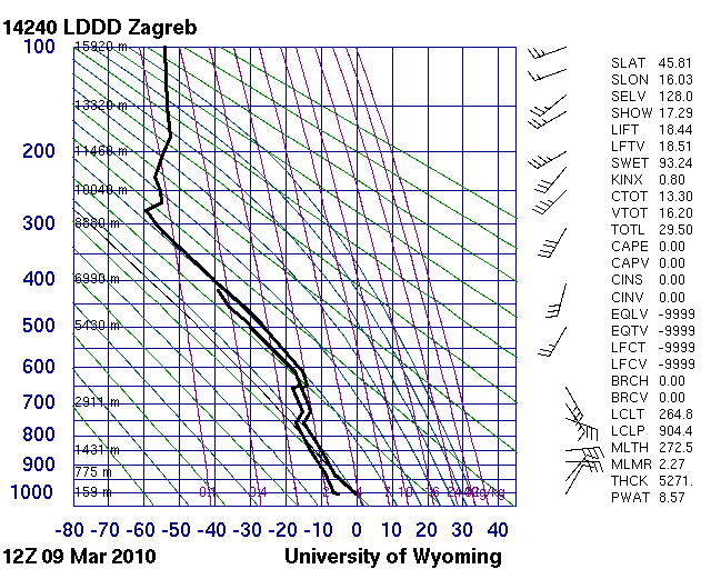
In Fig 3.17 an upper air sounding from 9 March 2010 12UTC Zagreb (Croatia) is shown. Temperature and Dew Point jumps indicate two air mass changes. This is a hint to the approaching occlusion. The indication for warm air advection is the clockwise change in wind direction with height.
Figure 3.17: 9.3.2010 12UTC sounding Zagreb (Croatia); (http://weather.uwyo.edu)
10. March 2010
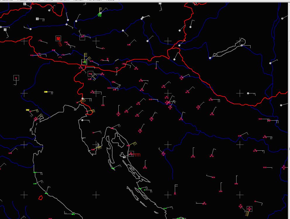
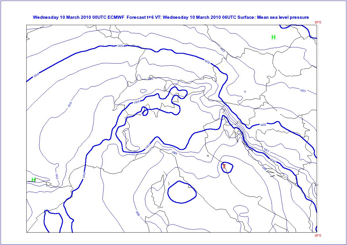
Due to advection of cold continental air from northeast and warm air from southwest a strong temperature gradient (15K/100km) between the atmosphere over the Adriatic Sea and the Adriatic mainland was build up (Fig 3.19). Due to this fact, and assisted by the close up of the Mediterranean low a very significant pressure gradient of about 15hPa was build up over the Dinaric Alps (Fig 3.20). The result is a strong katabic storm called Bora with mid wind at 6UTC of about 45kt (Fig 3.18). The Bora mostly occurs in winter and blows in gusts. The strongest gust during this event was measured in Trieste with 102kt (source: http://www.zamg.ac.at). The cold down-slope wind cools the coast areas and makes also in these regions snowfall possible. This is verified in Fig 3.18: snowfall (pink symbols) was reported in large areas of the east Adriatic region, also down to the coastlines.
Figure 3.18: 10.3.2010 6UTC - Synop ww; Mean Wind;
Figure 3.19: 10.3.2010 0UTC - Synop reports; red lines: ECMWF ThetaE in 850hPa [5K]; black lines: ECMWF MSLP [5hPa]
Figure 3.20: 10.3.2010 0UTC - blue lines: ECMWF MSLP [2.5hPa]
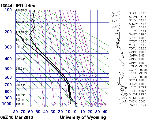
Figure 3.21: 10.3.2010 6UTC sounding Udine (Italy); (http://weather.uwyo.edu)
The strong Bora storm is also shown on the TEMP Sounding from Udine 10.3.2010 6UTC with mean wind of 55kt in ground near level (Fig 3.21). Two other interesting things we can see on this TEMP: the two front areas from the occlusion between 850hPa and 700hPa; the precipitable water content (PWAT [mm]) of about 12mm; In the night to the 10.3.2010 the occlusion reaches the north and east Adriatic coast (Fig 3.22). Together with the strong wind, heavy snowfall in Croatia and Slovenia generates partly critic situations. In the south of Austria it also begins to snow.
Figure 3.22: 10.3.2010 12UTC - MSG IR; black lines: MSLP; Surface Frontal Analysis
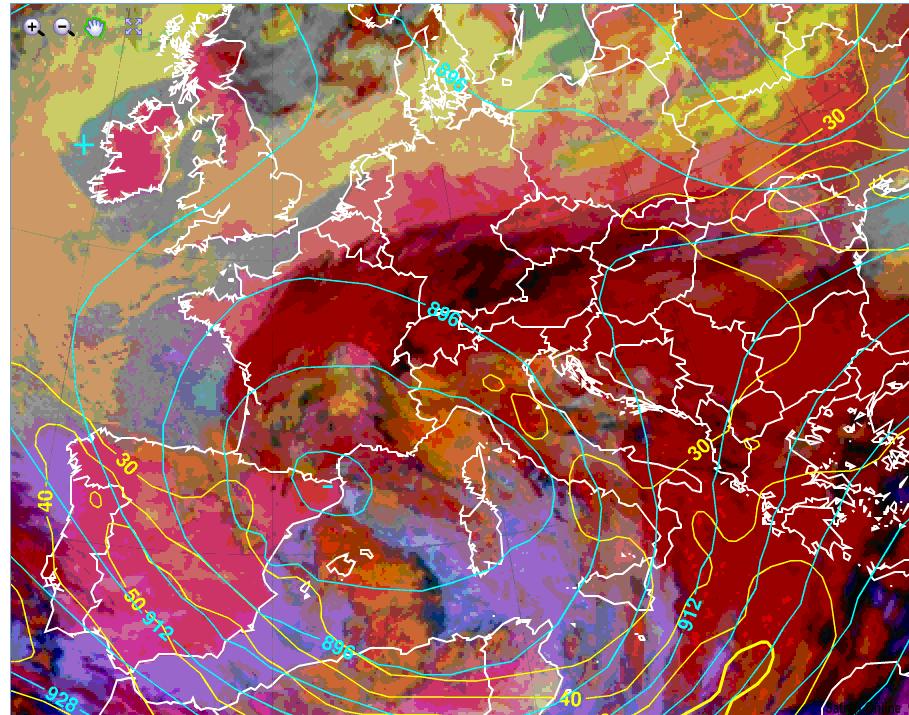
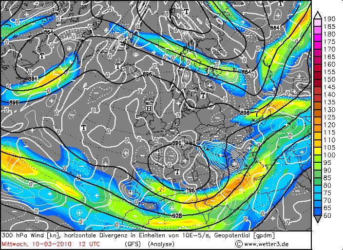
The 300hPa Geopotential height and the Isotachs show, that the region around the Adriatic Sea is in the left exit area of the jet (Fig 3.23). Thereby strong horizontal divergence in 300hPa (Fig 3.24) supports the lifting processes and the resulting precipitations.
Figure 3.23: 10.3.2010 6UTC - MSG Microphysics RGB; turquoise lines: ECMWF ATP300; yellow lines: ECMWF Isotachs in 300hPa;
Figure 3.24: 10.3.2010 12UTC GFS - black lines: ATP300; white lines: horizontal divergence in 300hPa; coloured areas: 300hPa Wind
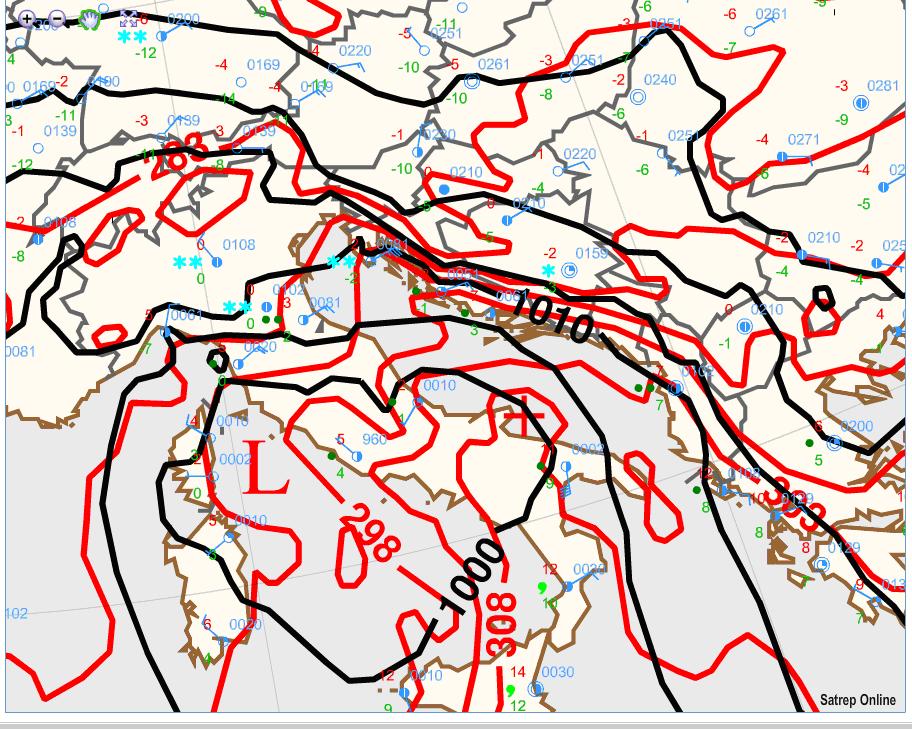
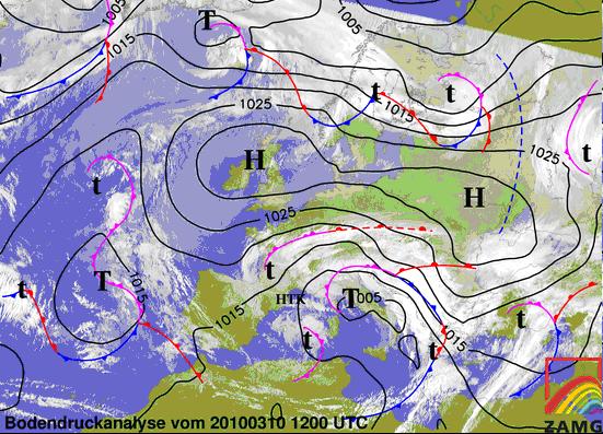
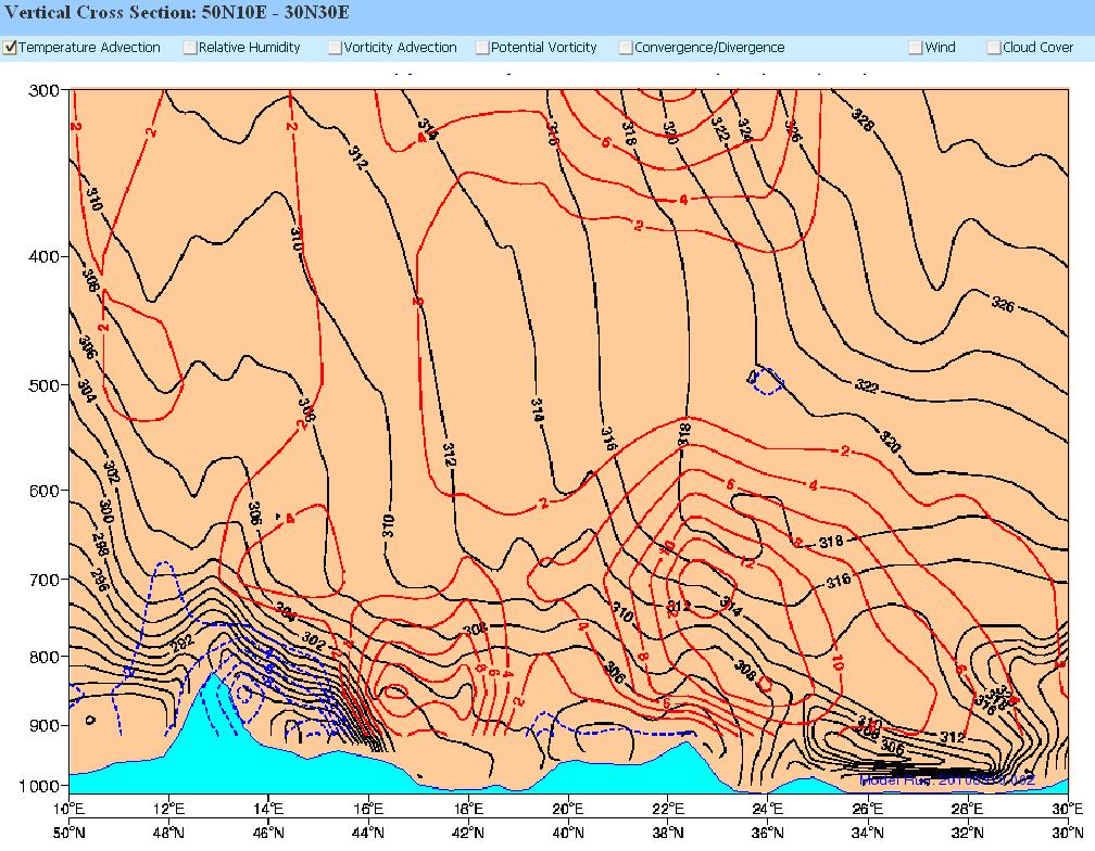
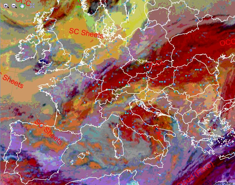
On the 10 March 12UTC the occlusion is located just in the south of the Alps (Fig 3.25) In the vertical cross section (Fig 3.26) on the left side we can see the frontal zone. The very high temperature gradient of this occlusion is a hint for the big influence on the weather in this region. In Fig 3.27 (next chapter) we see, that in the area of the frontal system a great PVA maximum is embedded. This also supports the lifting processes.
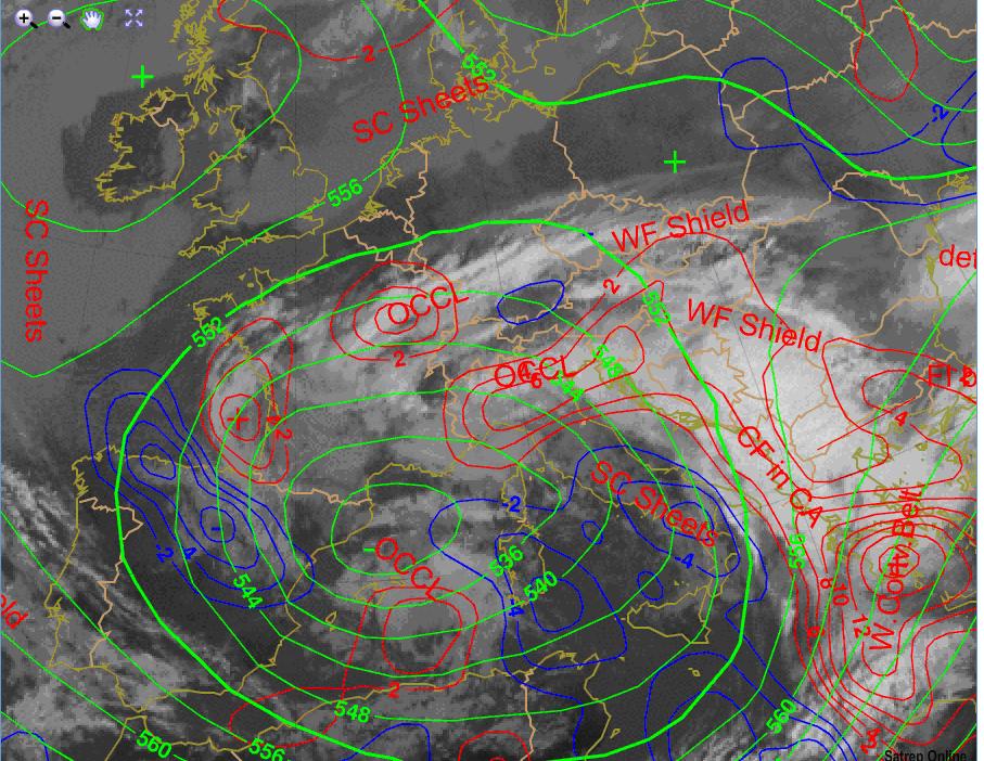
Figure 3.25: 10.3.2010 12UTC - MSG IR.10.8 with overlay SatRep; green lines: ECMWF ATP500; red/blue lines: ECMWF TA in 700hPa
Figure 3.26: 7.3.2010 12 UTC - Vertical Cross Section 50N10E - 30N30E; black lines: ECMWF isentropes; blue/red lines: TA
Development of a new System
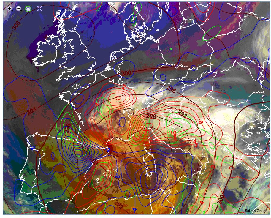
While the discussed system brings heavy snowfall and strong wind in the Adriatic region another system developed over the northeast coast of Spain. The dipole in the temperature advection (blue/red lines) (Fig 3.27) indicates the developing of a new frontal wave. PVA maxima (green lines) and dry descending stratospheric air (reddish areas) in this region support the development. The track of this new system was not easy to predict, but finally the surface low took slight astonishing the 5c track. So the system did not influenced the weather in Austria much.
Over mid-east France another frontal zone due to the frontogenetic deformation zone (discussed in a previous chapter) was build up.
Figure 3.27: 10.3.2010 0UTC - MSG Airmass RGB overlay ECMWF: brown lines: ATP700; blue/red lines: TA in 700hPa; green lines: PVA in 700hPa
11. March 2010
Figure 3.28: 11.3.2010 12UTC - MSG IR; black lines: MSLP; Surface Frontal Analysis
On the 11 March 12UTC the occlusion has passed the Alps and brings last precipitations only in the north of Austria (Fig 3.28/29). The system is weakening fast and the surface low is already filled up and disappeared. The newer frontal system described in Chapter 3.4 has already reached the Adriatic region. On the microphysics RGB (Fig 3.29) the dark reddish areas indicate clouds with ice particles associated with the discussed frontal systems. Over the north of Germany and over the Baltic Sea the white areas are a signal for fog. The synop reports with high humidity, calm air and a couple of fog reports confirm the sat image.
Figure 3.29: 11.3.2010 12UTC - MSG Microphysics RGB wirh overlay SatRep and Synop Reports

