Chapter II: Initial weather situation: 13 May 06.00 UTC
Table of Contents
- Chapter II: Initial weather situation: 13 May 06.00 UTC
- Initial weather situation: 13 May 06.00 UTC
Initial weather situation: 13 May 06.00 UTC
A long extended Cold Front lies from Germany to Switzerland. It is characterised by unstable stratification up to 800 hPa and an expected displacement to the east of about 3 degrees within 12 hours. Ahead of the Cold Front a large unstable area can be observed with Showalter index below 3, even below 0 in part.
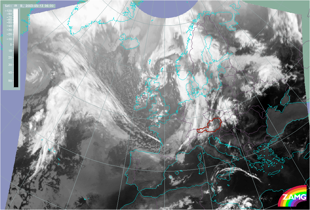
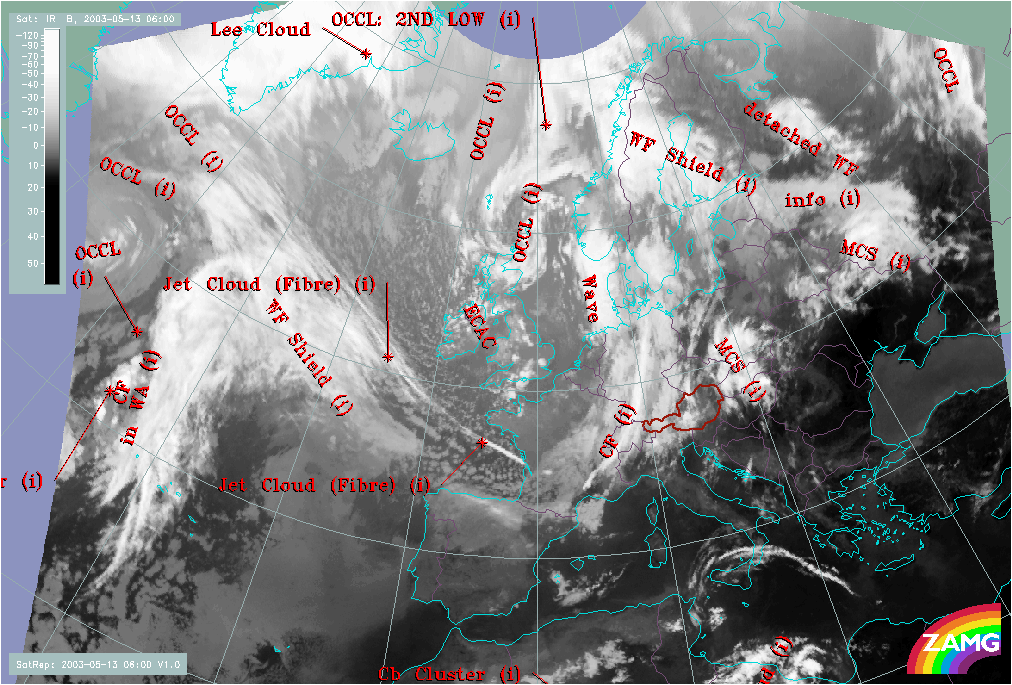
Figure 2: left: 13 May 2003/06.00 UTC - Meteosat IR image
right: 13 May 2003/06.00 UTC - Meteosat IR image; SatRep overlay: names of conceptual models
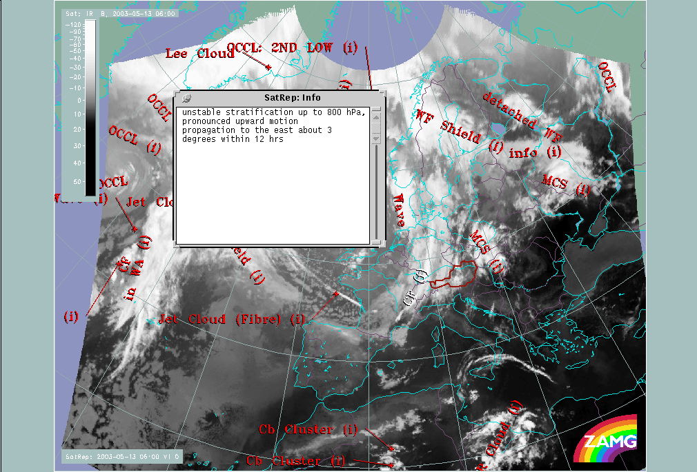
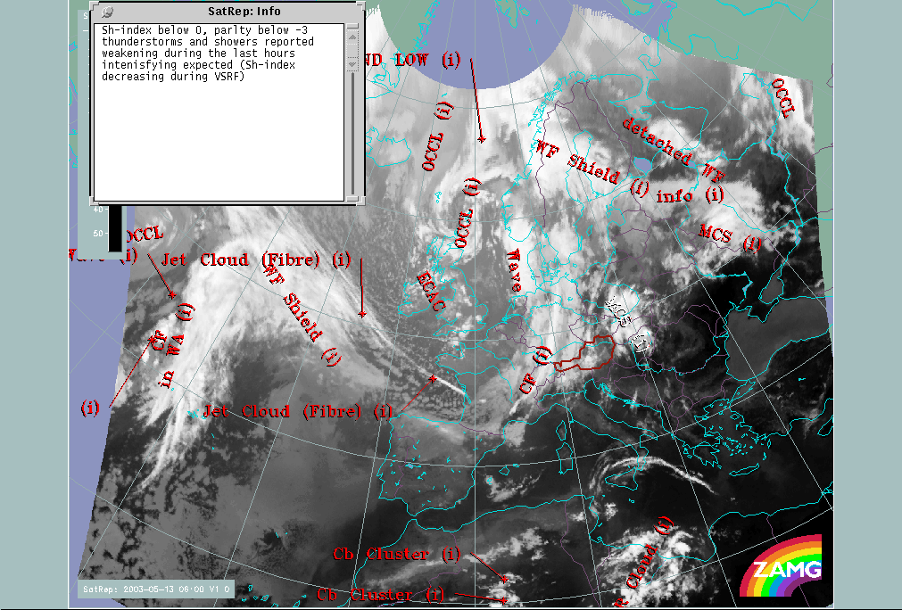
Figure 3: left: 13 May 2003/06.00 UTC - Meteosat IR image; SatRep overlay: names of conceptual models; The window in the upper left corner shows the additional information the meteorologists has written for the Cold Front situated above western Europe.
right: 13 May 2003/06.00 UTC - Meteosat IR image; SatRep overlay: names of conceptual models; The window in the upper left corner shows the additional information the meteorologists has written for the MCS situated over Poland - Slovakia.
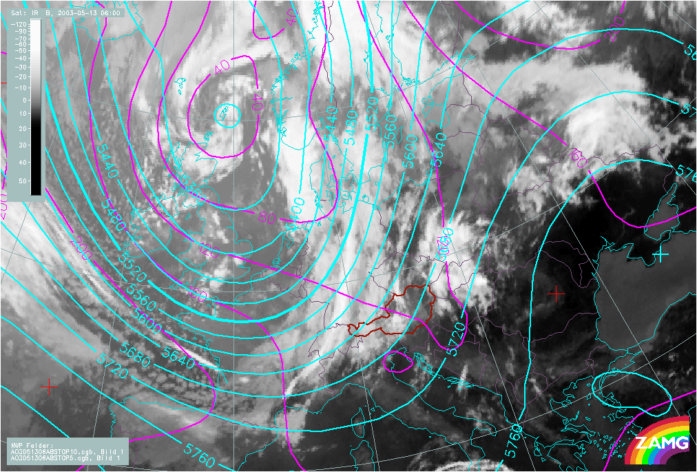
Figure 4: 13 May 2003/06.00 UTC - Meteosat IR image; red: height contours 1000 hPa, green: height contours 500 hPa
A pronounced low is situated over the Norwegian Sea. 1000 hPa height contours show a pronounced trough with axis oriented southeast northwest, from Croatia to Denmark. 500 hPa height contours show a trough axis over France.
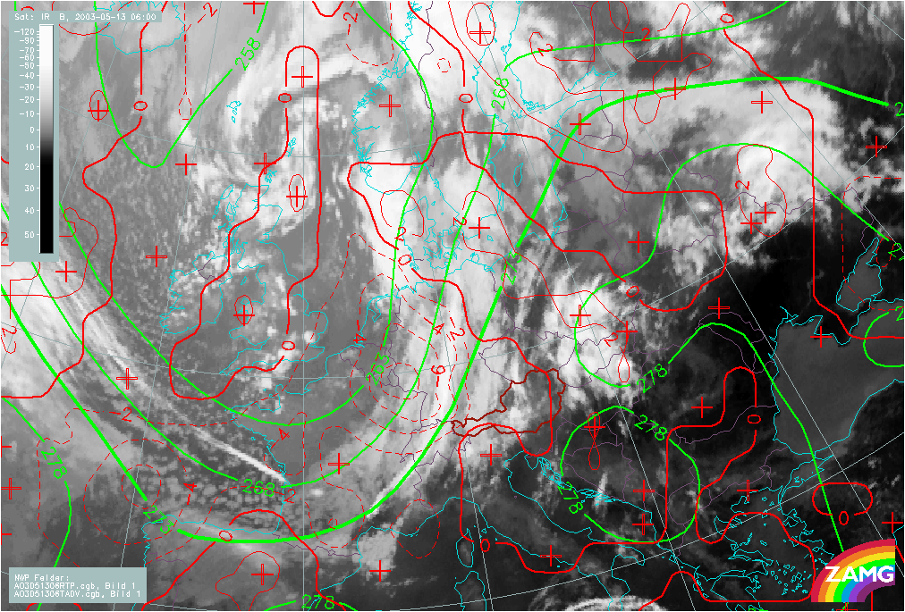
Figure 5: 13 May 2003/06.00 UTC - Meteosat IR image; red: temperature advection 700 hPa, green: equivalent thickness, blue: TFP
TFP, TA and thickness indicate a typical frontal situation. The maximum of TFP is located above Switzerland, followed by a thickness trough immediately behind. The frontal cloud band lies within CA whereas the convective system in the east is under the influence of WA.
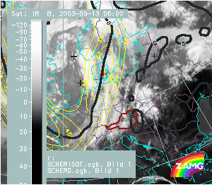
Figure 6: 13 May 2003/06.00 UTC - Meteosat IR image; yellow: iotachs 300 hPa, black: zero line of shear vorticity 300 hPa
The jet axis runs along the rear edge of the Cold Front cloud band. A pronounced jet streak can be seen over Denmark.

Figure 7: 13 May 2003/06.00 UTC - Meteosat IR image; yellow: iotachs 300 hPa, black: zero line of shear vorticity 300 hPa
In the eastern part of Austria the Showalter index is below 0. The prefrontal unstable Showalter values increase within the frontal cloud band. A narrow line of convection can already be seen.