Author
Jarno Schipper - ZAMGVeronika Zwatz-Meise - ZAMG
Introduction
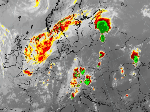
The case study will deal with the development of a prefrontal convergence line. Several convective cells develop on July 30th ahead of a front stretching from the Baltic States towards Northern Italy. The case is associated to large amount of precipitation. The development and the onset of this convective event is shown using several MSG channels and RGBs as also several NWP parameters.

|

|
|
Meteosat 8 Enhanced IR10.8 image - 30th July 2005:17 UTC Several convective cells can be seen over Central Europe. |
The aim of this case study is to:
- Show the onset of convective event using various Meteosat 8 channels and artificial coloured combinations.
- Study satellite imagery in combination with NWP fields (including LAM)
- Investigation of the dynamic background by considering the basic and derived numerical model parameters
The Pre-frontal convective line that is described in this case study is influenced by an approaching frontal system as well as the diurnal variation of solar radiation. To be able to follow the case study from the beginning it is preferable to study the chapter dealing with non-orographic convergence lines from the “Manual of Synoptic Satellite Meteorology”.