Motivation
During the time period between January 29th and February 5th 2014, heavy precipitation was observed on the eastern slopes of the Alps. Heavy precipitation in Slovenia and western part of Croatia included different types of precipitation like snow, rain, freezing rain, sleet and ice pellets. The high amount of snow and glaze caused infrastructural damage, electricity loss and closing of railways and roads. Some settlements got completely cut off and mountain rescue teams were the only ones who could reach them.
Heavy damage on woodland was caused by the heavy load of thick layer of snow and ice. However, the most affected area was Gorski kotar. The surroundings were covered with up to 20 mm of ice, which was the result of 5 days of freezing rain. Croatian authorities declared natural disaster.
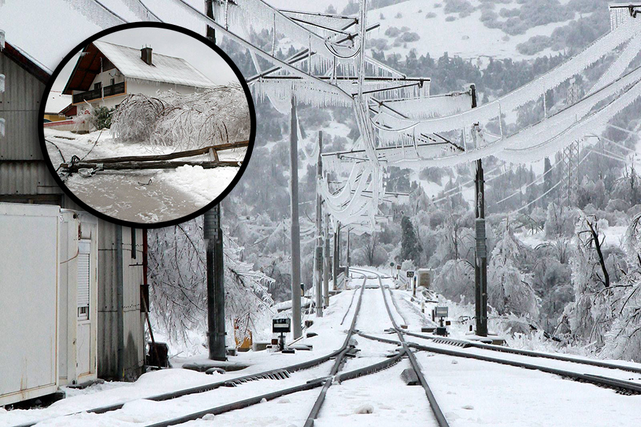 Figure 1: Railroad Ogulin - Rijeka was closed for a few days due to icing. |
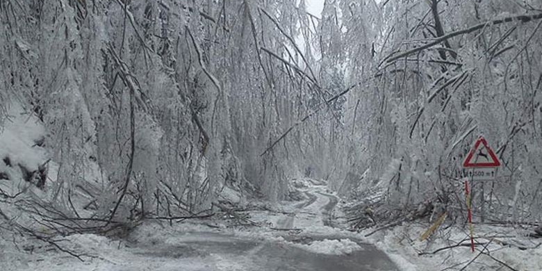 Figure 2: Road in Rogozno (Gorski kotar) after freezing rain episode. |
 Figure 3: Closed local road in Gorski kotar due to tree debris. |
 Figure 4: Thick ice cover on branches and leaves. |
This kind of weather is not common in Croatia, especially not for such a long period of time. According to climatological data, the longest period of freezing rain, 7 days in a row, occurred in Ogulin (west part of Croatia, in Gorski kotar region) between January 4th and 10th in 1997. Meteorological observations in Ogulin are conducted since 1949. In period between 1949 and 2014, in February there were 13 days with freezing rain in total.
A similar situation appears at the meteorological station Parg in Gorski kotar. The longest period of freezing rain was recorded in December 1995 and 1996, with 5 days in a row. In February, in period between 1950 and 2012, there were 12 days with freezing rain in total.
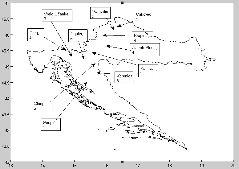
Figure 5: Number of days with freezing rain from 29th January till 5th February, 2014
What happened?
This winter precipitation diversity occurred due to the vertical structure of the atmosphere. Snow crystals melted during their passage through a warm layer of air (T>0 °C), while the existence of shallow cold air layer caused water droplets to cool again. Even though their temperature dropped below 0 °C, the water droplets had no time to re-freeze, therefore the super cooled droplets froze on impact with the cold surface and formed ice coating.
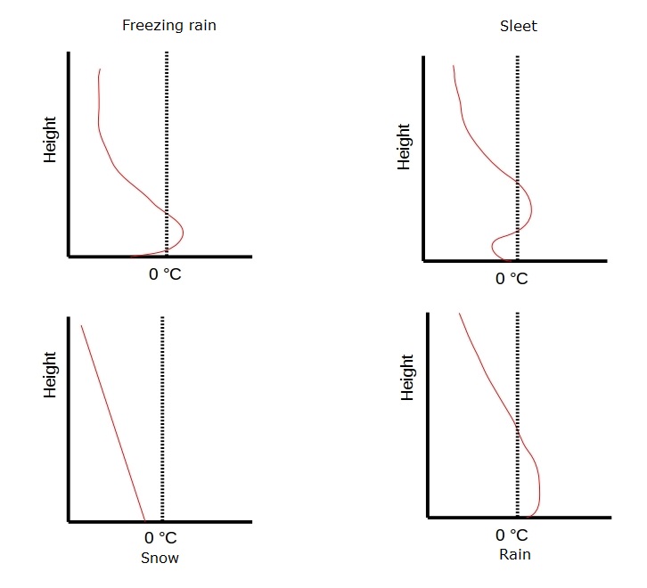
Figure 6: Precipitation type depends on the atmospheric temperature profile. For the freezing rain it is crucial to have a pocket of warm air where the snow crystals will melt and a thin cold layer for the drop to cool. The cold layer should be deep enough for the droplet to cool below 0 °C, but still not too deep, otherwise it will re-freeze and reach the ground as sleet.
Synoptic situation
January 29th
Surface analysis on January 29th shows two major systems affecting the weather in Europe. A strong high (Siberian high) over NE Europe and a deep low over north Atlantic and UK with a cyclonic field stretching towards the western Mediterranean. The lower levels over Slovenia and Croatia were influenced by the Siberian high from the northeast and a shallow low center in the Mediterranean from south.
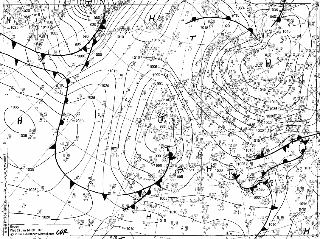
Figure 7: DWD Surface analysis on January 29th 00 UTC
In the upper levels, a deep through with a cut-off low over UK, was stretching from the north Atlantic to western Mediterranean. The layer of cold air was present from surface up to the higher levels and the precipitation over northwest part of Croatia was in a form of snow.
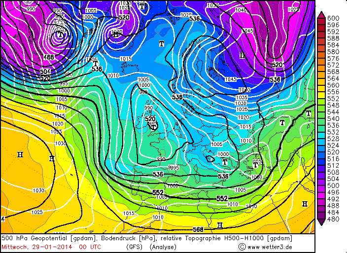
Figure 8: Geopotential height at 500 hPa with relative topography and surface level pressure on 29th 00 UTC
January 30th
On January 30th, a shallow secondary center in the western Mediterranean (Balearic Islands) moved towards the Apennine Peninsula. At the same time a southerly flow with a warm advection on the front side of the cyclone created a warm front across Italy to the middle Adriatic, which later shifted northwards approaching Slovenia and western parts of Croatia.
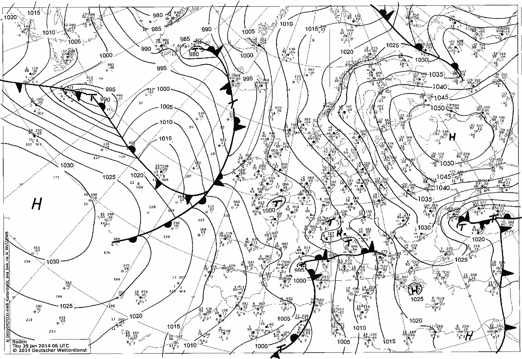
Figure 9: DWD Surface analysis on January 30th 06 UTC
The warm advection above cold PBL (planetary boundary layer) was very strong - for example, temperature at the meteorological station Zavižan (1594 m) in the mountainous part of W Croatia rose from -12 °C on January 29th (06 UTC) up to 0 °C on January 30th (06UTC).
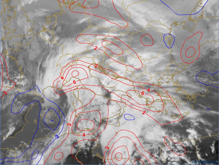
Figure 10: January 30th at 12UTC, IR 10.8 μm with temperature advection at 700hPa, e-Port.
As the front approached the Alps, it trapped a wedge of cold air along the mountainside. In the beginning precipitation was in a form of snow, then rain, freezing rain and sleet. To see how the type of precipitation changed through different days, click here.
January 31st
On January 31st and then again on February 2nd, new cyclonic centers moving from Africa to Italy intensified the warm front and prolonged the warm advection over the observed areas. Due to orographic blocking effect, the front remained quasistationary on the windward side of the Alps, while the cyclonic flow was bringing moist and relatively warm air over western parts of Croatia. Therefore freezing rain was most intense and most frequent during this period.
As the influence of the Siberian high was intensifying during February 4th, the cyclonic activity was weakening and receding.
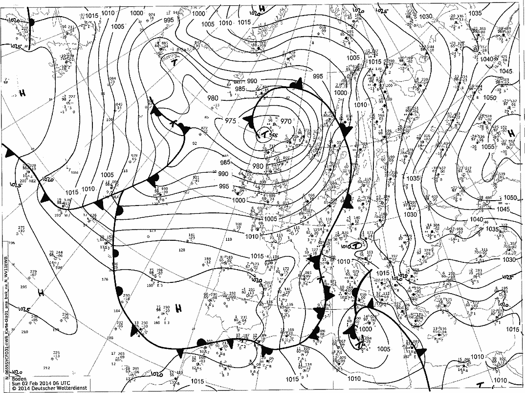
Figure 11: DWD Surface analysis on February 2nd 06 UTC
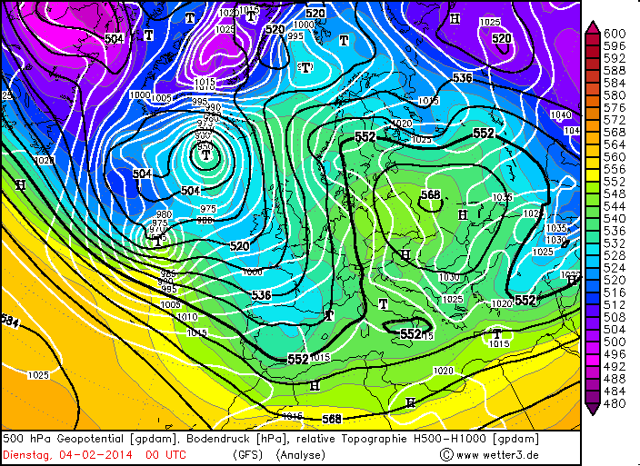
Figure 12: Strengthening of Syberian high at surface and the ridge in the upper level on February 4th 00 UTC
Warning and Meteoalarm
DHMZ (Croatian national weather service) is a part of European Meteoalarm. Therefore when the service issues a warning on a national level, it is automatically sent to Meteoalarm as well.
The meteorological service of Croatia issued the warning for severe weather - in the morning of January 30th forecaster issued the warning for winter weather conditions - orange for region A, and yellow for region C for that day, and later during the day for the next day (January 31st). (Meteoalarm has no freezing rain warning - warning specifications with freezing rain possibility were written in a text box).
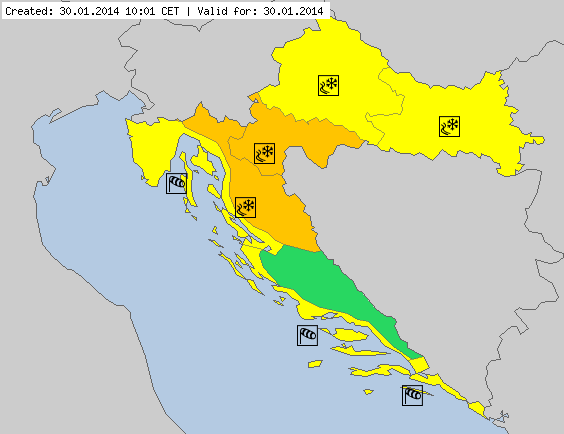
Figure 13: Issued winter weather warnings for January 30th
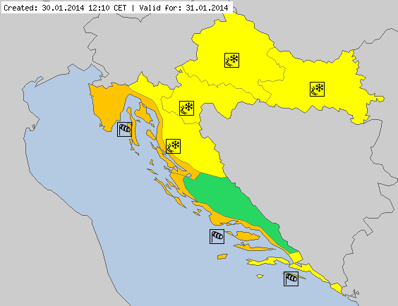
Figure 14: Issued winter weather warnings for January 31st
==================================================================
* TECHNICAL NOTE: For the best interactive experience throughout this module please use the most recent versions of Firefox or Internet Explorer browser!