Weather Events
| Parameter | Description |
| Precipitation |
|
| Temperature |
|
| Wind (incl. gusts) |
|
| Other relevant information |
|
|
|

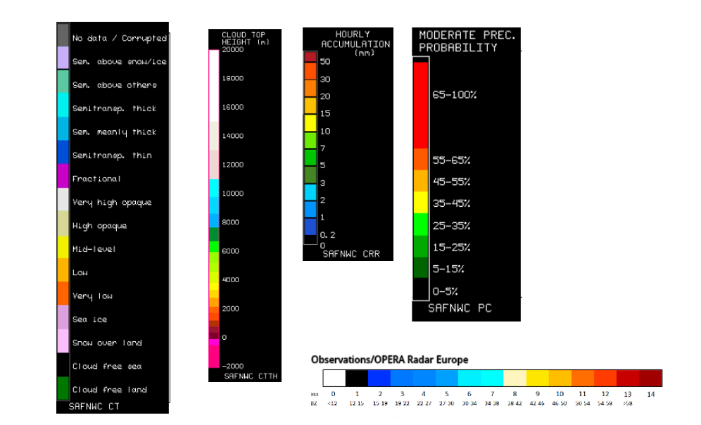
Legend:
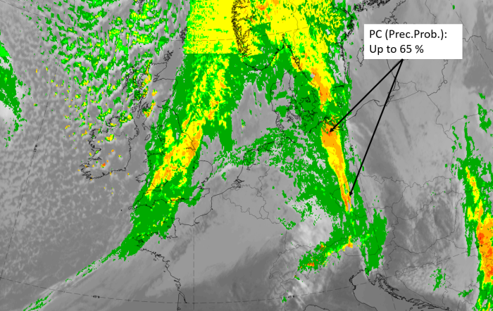
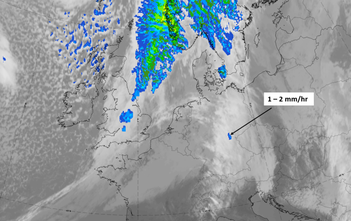
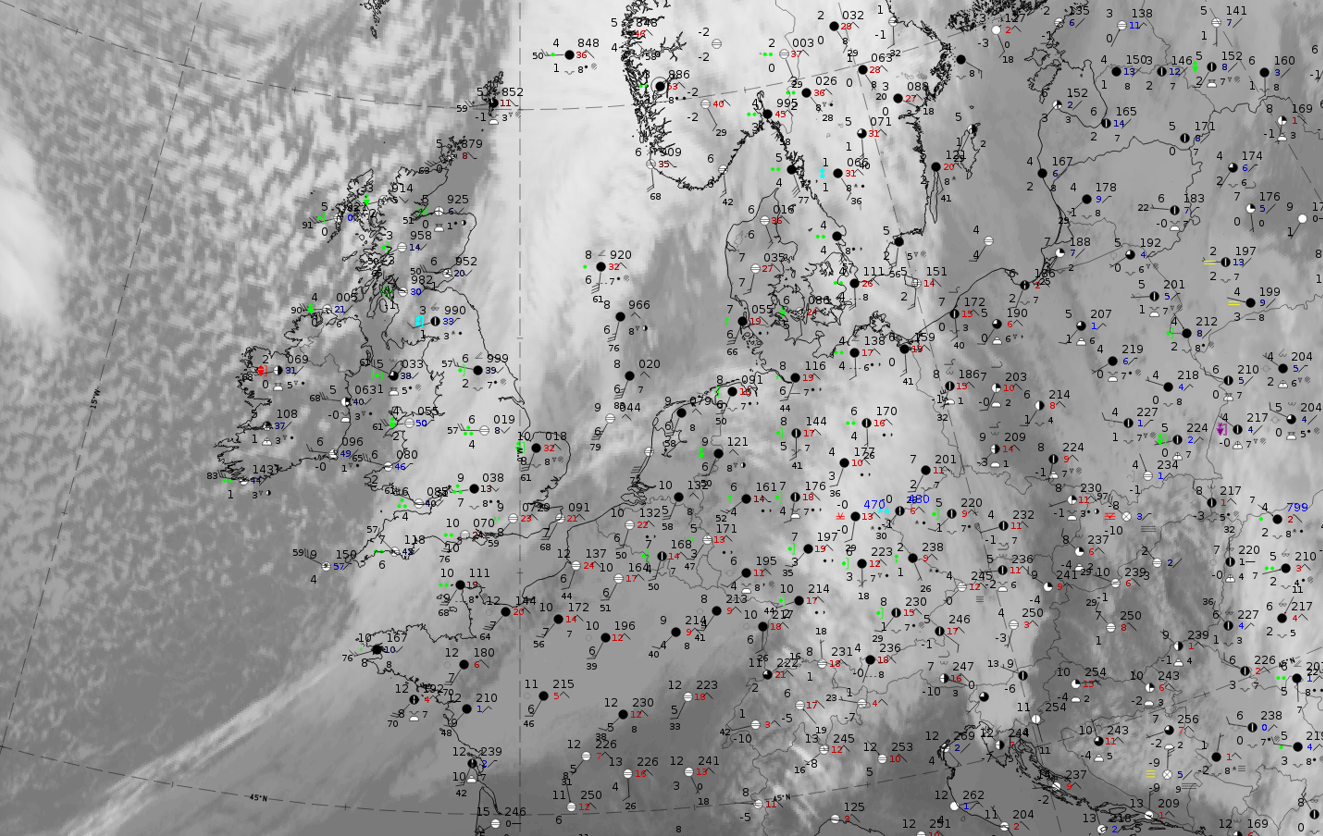
20 February 2020, 12UTC: l: IR + synoptic measurements (above) + probability of moderate rain (Precipitting clouds PC - NWCSAF).
Note: for a larger SYNOP image click this link.
The demonstration example from 20 February 2020 at 12 UTC shows widespread precipitation observations mainly with the rearward two-thirds of the cloud band, with the highest intensities in the centre. This area can also be identified in the image of probability of moderate precipitation image from the NWCSAF, where probabilities are up to about 60 %
|
|
|
|
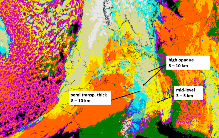
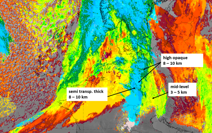
Legend:
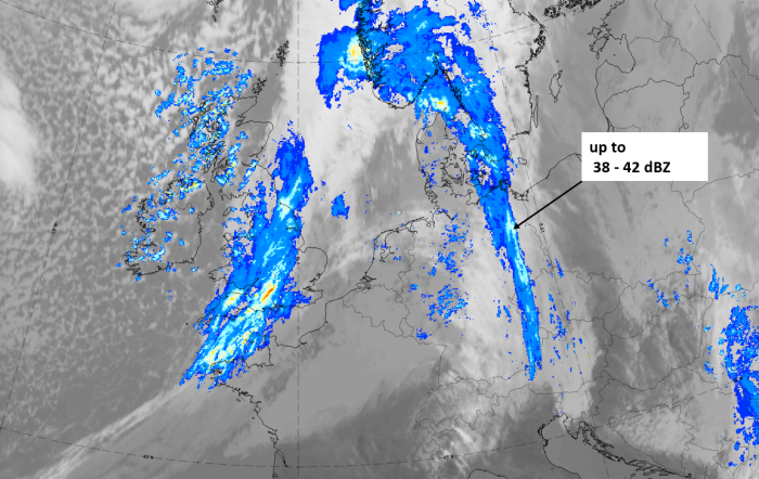
20 February 2012, 12 UTC, IR; with the following fields superimposed:
1st row: Cloud Type (CT NWCSAF) (above) + Cloud Top Height (CTTH - NWCSAF) (below); 2nd row: Convective Rainfall Rate (CRR NWCSAF) (above) + Radar intensities from Opera radar system (below).
For identifying values for Cloud type (CT), Cloud type height (CTTH), precipitating clouds (PC), and Opera radar for any pixel in the images look into the legends. (link)