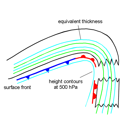
Key Parameters
- Equivalent thickness:
The cloud field of the Detached Warm Front is within the high gradient zone at the eastern branch of a pronounced ridge of the (equivalent) thickness. - Absolute topography at 500 hPa:
It is very similar to the (equivalent) thickness, therefore the cloudiness of the Detached Warm Front is also within the high gradient zone at the eastern branch of a pronounced ridge of absolute topography. - Warm advection (WA):
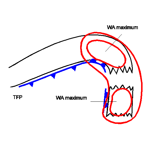
The cloudiness of the Detached Warm Front is superimposed upon a distinct WA maximum. But often two WA maxima can be observed. In this case the northern maximum is associated with the original Warm Front, and the southern one with the Detached Warm Front. - Wind Vectors at 500 hPa:
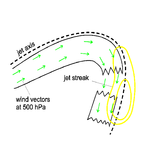
The wind field has, in the area of the cloud field of the Detached Warm Front, a more or less strong southern component, and blows normal to the displacement of the whole frontal system of the ridge and frontal zones. Consequently, cloud elements of the Detached Warm Front are moving quickly southward while the complete cloud configuration is displaced eastward, much more slowly. - Shear vorticity at 300 hPa:
The zero line coincides with the leading edge of the Warm Front cloud shield. - Isotachs at 300 hPa:
The leading edge of the Warm Front cloud shield is superimposed upon a jet streak with intensities varying from case to case.
|
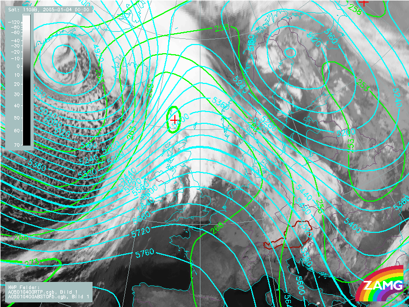
04 January 2005/00.00 UTC - Meteosat 8 IR 10.8 image; blue: geopotential height 500 hPa, green: equivalent
thickness 500/850 hPa
|
|
|
|
|
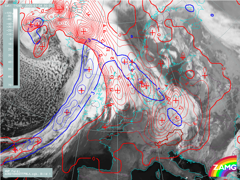
04 January 2005/00.00 UTC - Meteosat 8 IR 10.8 image; blue: thermal front parameter 500/850 hPa, red: temperature
advection 500/1000 hPa
|
|
|
|
|
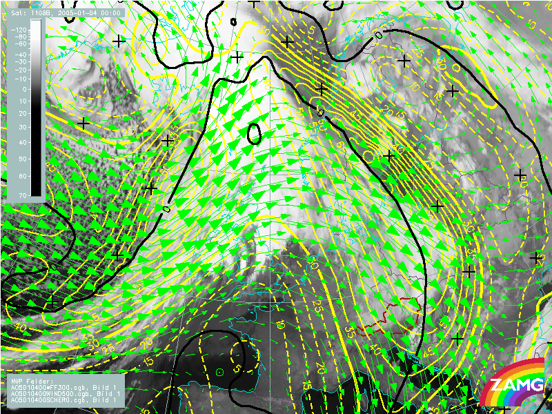
04 January 2005/00.00 UTC - Meteosat 8 IR 10.8 image; yellow: isotachs 300 hPa, black: zero line of shear vorticity 300 hPa
|
|
|
|
The parameter distribution is very similar to the ideal situation described above. If the wind vectors at 500 hPa (green arrows) are compared to the relative streams (see Meteorological Physical Background), differences in the directions can be observed at a height close to 500 hPa (296K isentrope). While the absolute winds are coming from a north-westerly direction the relative streams are coming from a more north-easterly direction, which is very close to the orientation of the cloud structure.