Cloud Structure in Satellite Images
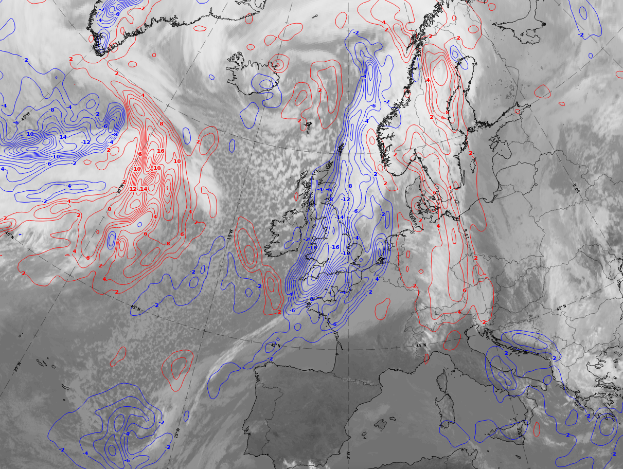
- The satellite image shows a meso- to synoptic scale multilayered cloud field, with a sharp edge along the cyclonic side.
- Typically, the cloud field associated with the Detached Warm Front can be found separated and downstream from the cloud associated with a classical frontal system.
Appearance in the basic channels:
- These configurations have height and thickness with pronounced ridges bound by zones with strong isoline gradients (see Key parameters).
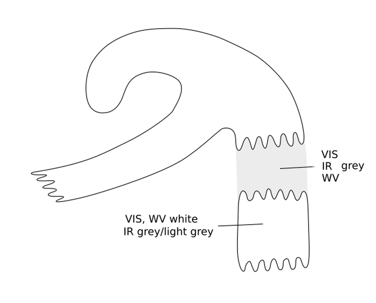
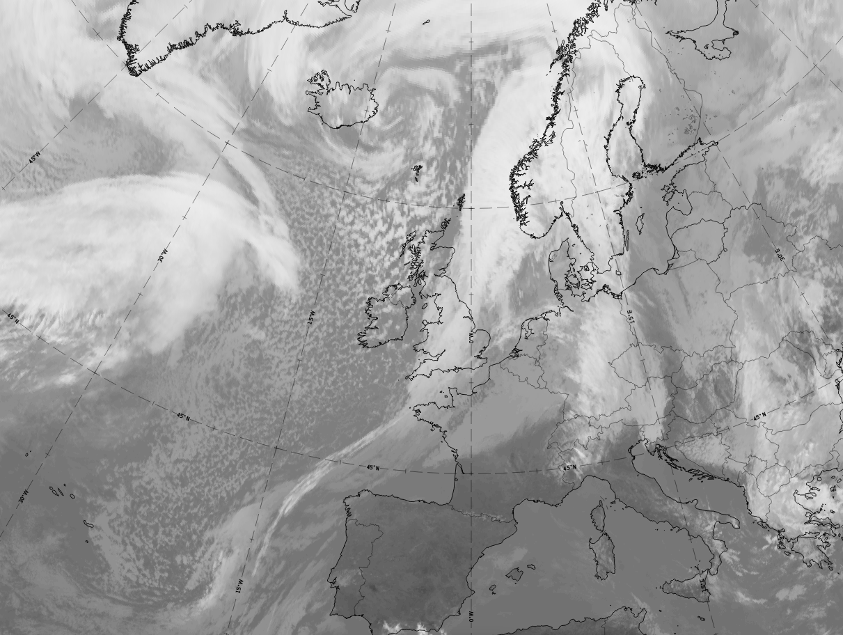
- In the VIS image the cloud field of the Detached Warm Front is white, indicating lower multi-layered cloud.
- In the IR image the grey shades typically vary between light grey and grey; high pixel values can mostly be found on the cold side of the thickness gradient (the leading area of the frontal cloudiness).
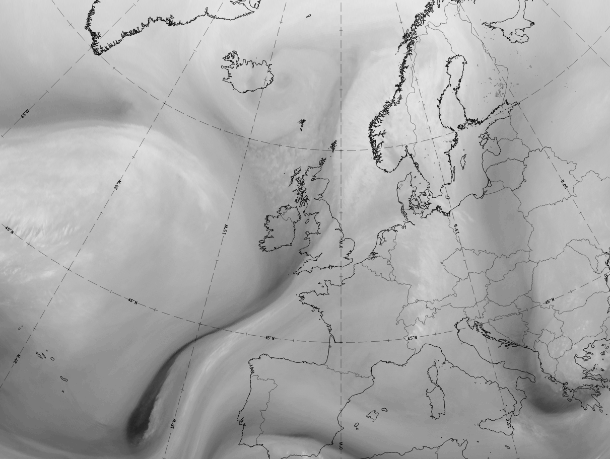
- The WV image shows a wide broad anticyclonic curved area with high WV pixel values, indicating high moisture
content within the high-gradient zones surrounding the equivalent thickness ridge.
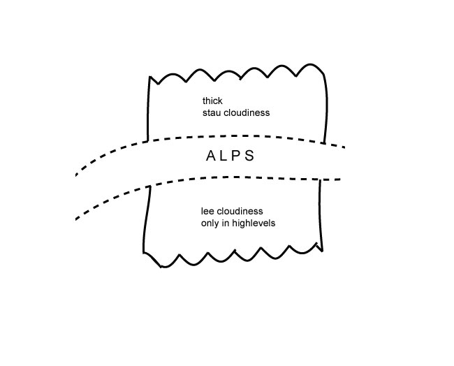
- Detached Warm Fronts typically occur on the windward side of the Alps, being accompanied by
increased weather activity (see Weather features events):
if the Detached Warm Front moves against mountains (for instance the Alps in central Europe), enhanced cloud amounts can be seen on the windward side (see Barrage Cloud ), as well as high Lee Cloudiness on the lee side (see Lee Cloudiness ). - Some features of the life cycle can be observed:
- Often the cloudiness of the Detached Warm Front cloud moves downstream from a classical Warm Front system and becomes an independent system.
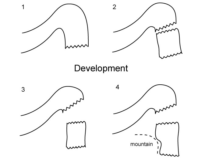
- It mostly propagates southward, leading to a movement against the Alps in central Europe.
- In the case of a Detached Warm Front on the windward side of the Alps, if the whole ridge system moves eastward then the following feature is typically observed: the high cloudiness of the Detached Warm Front reaching the eastern edge of the Alps propagates quickly southward while the rest of the cloud remains bounded by the mountain chain.
- During the life cycle, high-level cloud often dissolves so that IR grey shades become darker.
|
|
Appearance in the basic RGBs:
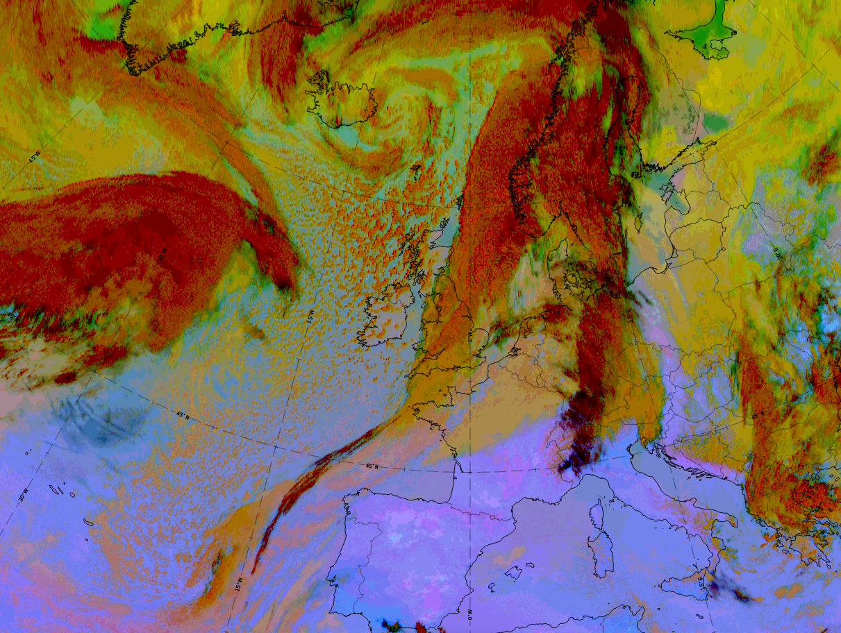
Airmass RGB:
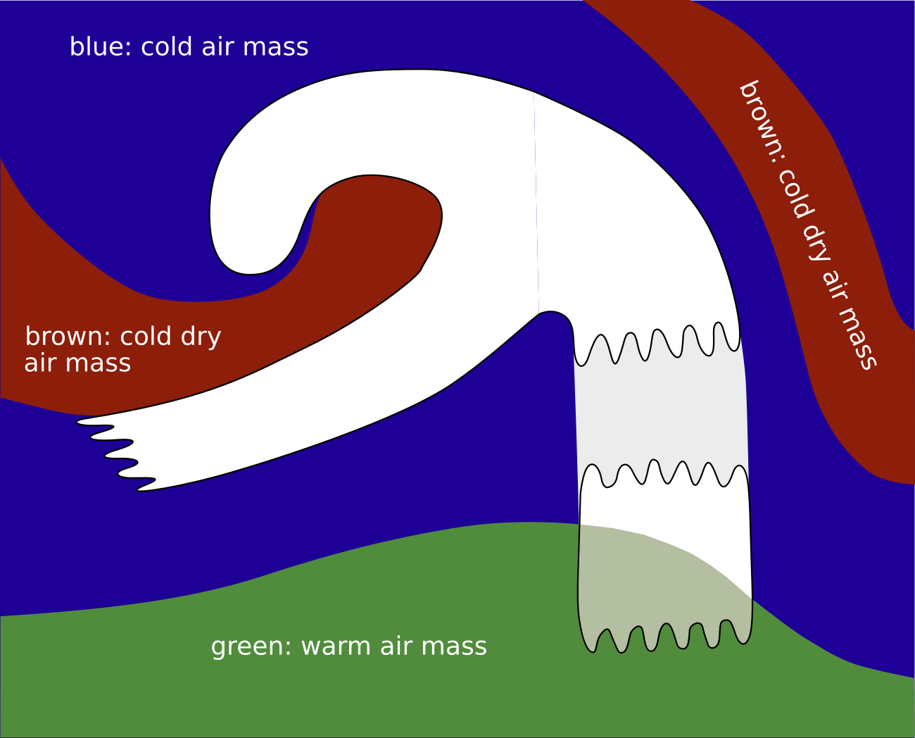
In front of the cloud band of the Detached Warm Front there is blue colour and, predominately, a dark brown stripe. Both belong to the rear side, the trough, of the preceding frontal system (to its rear). On the rear side, which is the area between the detached warm front and the consecutive cold front, greenish colours dominate, indicating the warmer air from the south and southwest.
The cloud band looks very similar to that in the IR image. However, there are often areas overlaid with the greenish colour, representing the approaching warmer air, adding a greenish shade to the white colours of the cloud.
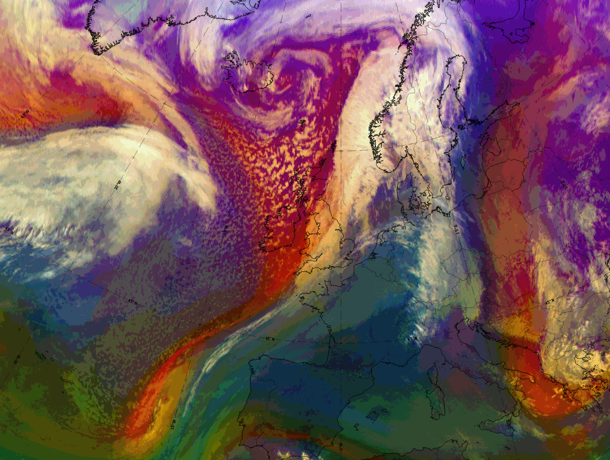
Dust RGB:
The surrounding area of the cloud band of the Detached Warm Front is blue or pinkish blue where there are no clouds, which is mostly in the south and southwest of the cloud band. Ochre colours indicate low cloud patches, which exist more often in the leading part of the cloud band.
The cloud band itself appears in ochre, overlaid by dark red cloud where there is thick ice cloud. However, black fibrous areas also occur, indicating thin translucent ice cloud. These black fibres are mostly at the leading edge, indicating the jet axis there, as well as extending to the south of the cloud band of the Detached Warm Front.
 |
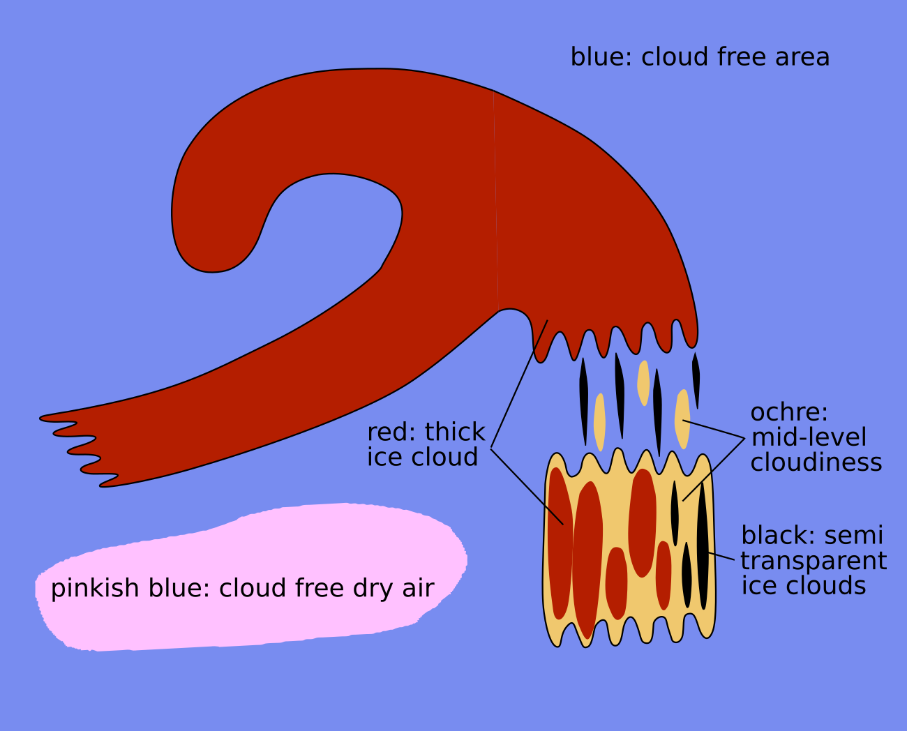 |
Legend: Basic RGBs schematics.
Left: Airmass RGB; right: Dust RGB
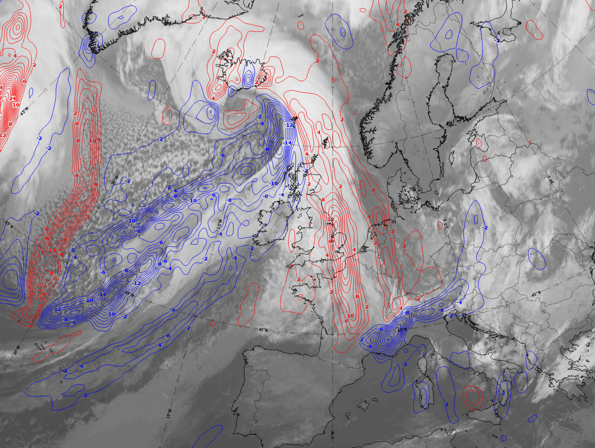
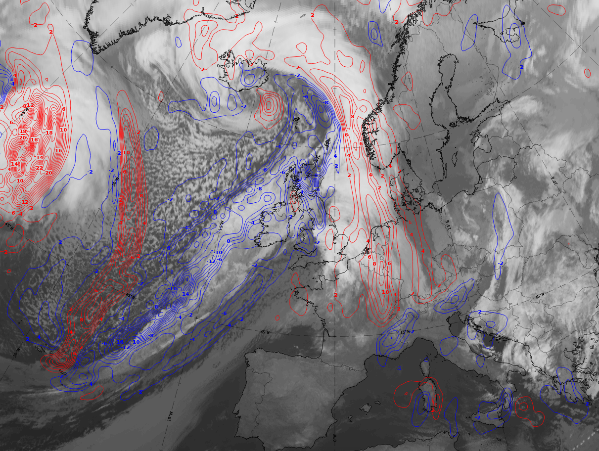
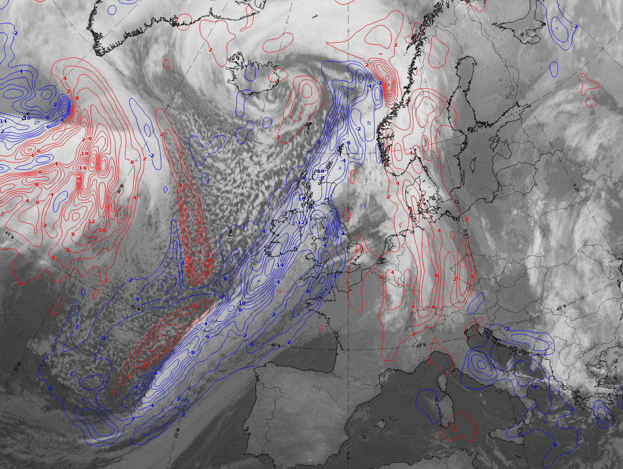
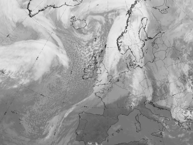
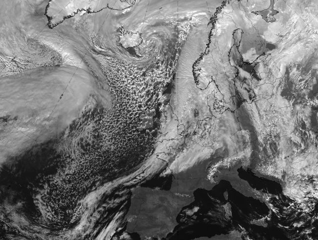
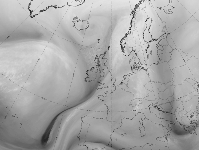
The following demonstration case is from 20 February 2020. It shows, in a 6-hourly sequence from 19 to 20 February, an eastward moving frontal system with cloud bands associated with a cold front and a warm front and a huge occlusion spiral. The warm front cloud is broad and at 18 UTC extends from 60 North southward to 45 North (first image). This band develops into two distinct areas, one in the north over southern Scandinavia, which is connected to the cold front cloud band, and a second in the south over Germany and the windward side of the Alps. This southern cloud area is on the warm side of the frontal surface and under a separate temperature advection maximum, and is therefore called the "Detached Warm Front".
 |
 |
 |
 |
Legend: Detached Warm Front.
19 - 20 February 2020; 6-hourly sequence; IR + temperature advection at 700 hPa superimposed.
U.l.: 19 February at 18 UTC; u.r.: 20 February at 00 UTC; l.l: 20 February at 06 UTC; l.r.: 20 February at 12 UTC.
*Note: click on the image to access the image gallery (navigate using arrows on keyboard)
|
|
|
|

Legend:
20 February 2020 at 12 UTC: 1st row: IR (above) + HRV (below); 2nd row: WV (above) + Airmass RGB (below); 3rd row: Dust RGB + image gallery.
*Note: click on the image to access the image gallery (navigate using arrows on keyboard)
| IR | Grey areas (especially in the eastern part of the cloud) indicate mid-level cloud; white areas (especially in the western part of cloud) indicate thick and layered cloud. |
| HRV | Bright smaller cloud patches below with grey fibres above. |
| WV | Wide light grey area with bright colours where the white cloud of the detached warm front occurs. |
| Airmass RGB | Greenish colours at the rear and above the white cloud of the detached warm front, changing the white colours of the cloud to a darker shade. A dark brown stripe in front of the WF belongs to the trough area of the preceding system. |
| Dust RGB | Ochre to dark red indicating both, mid-level water cloud and thick ice cloud. Black colours in the south indicate high ice cloud and represent the high lee cloud in the lee of the Alps. |
An older case from 3-4 January 2005 is a good demonstration of the movement and modification of a Detached Warm Front interacting with the Alps.
The IR loop shows the development of the Detached Warm Front. Special attention should be paid at the time when the Detached Warm Front reaches the Alps. As it then moves eastward, more cloud moves southward on the eastern edge of the Alps over Slovenia.
 Loop: 03 January 18.00 - 04 January 18.00 UTC, Meteosat 8 IR 10.8 hourly images