Table of Contents
Cloud Structure In Satellite Images
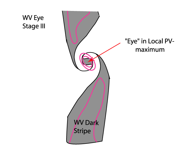
The typical satellite imagery features of this conceptual model can usually be seen only in the WV image; that means that this is a situation with little or no major cloudiness, but with distinct features in the water vapour field. Investigation of about 100 cases over a period of two years shows that a distinction can be made between different WV structures. The two prevailing structures are the so-called WV Eddies and WV Eyes.
Appearance in Meteosat imagery:
- WV Imagery:
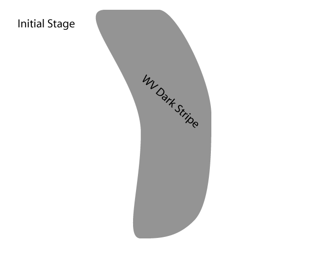
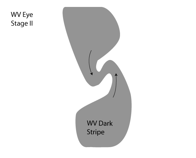
- Initial "old" Dark Stripe, associated with a former baroclinic zone. (compare Water Vapour Dark Stripes )
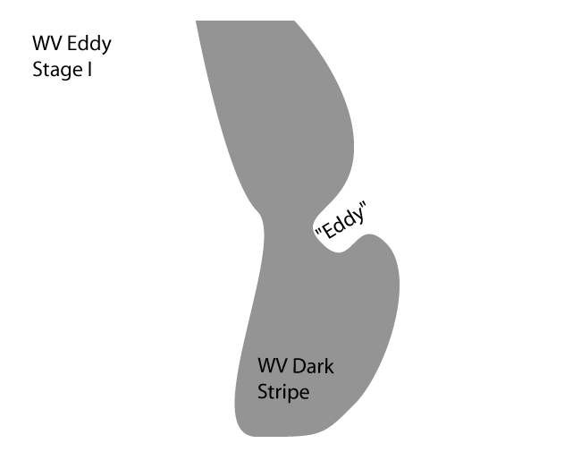
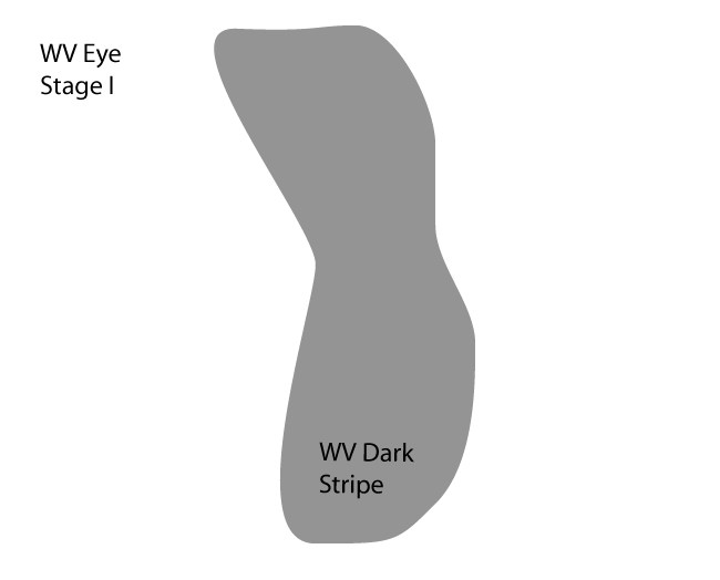
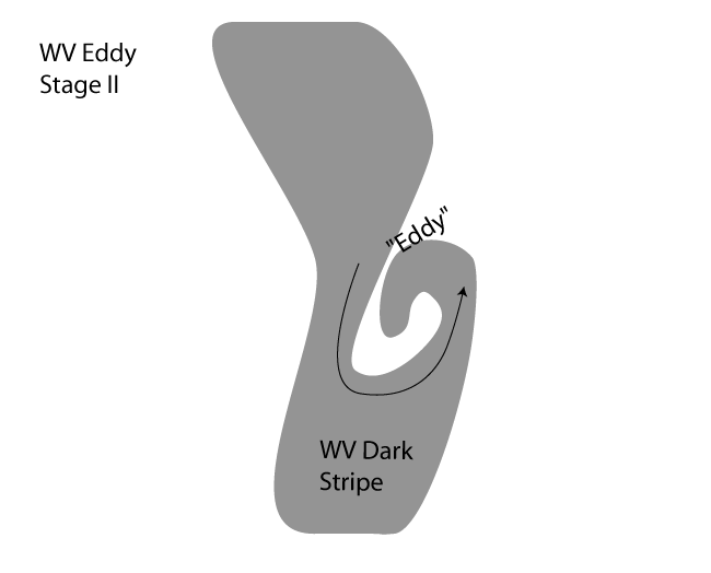
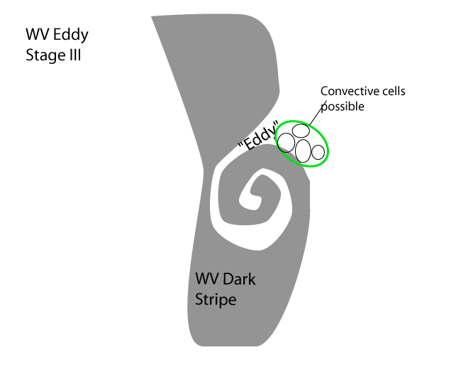
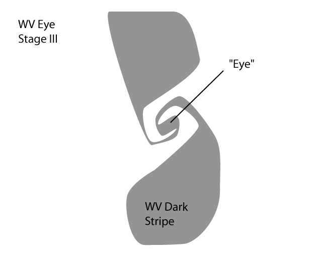
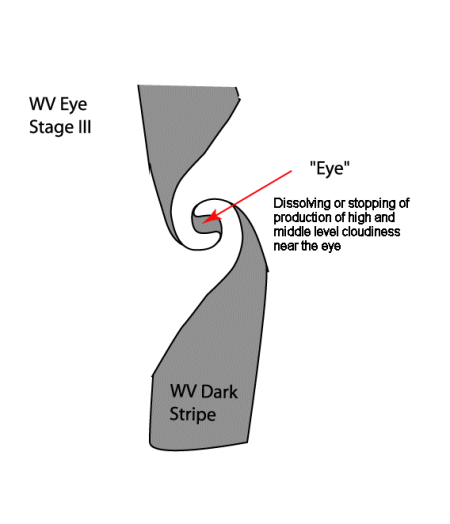
- During development a cyclonic structure forms. In the case of a WV Eddy, air with higher moisture content, spirals around drier air. In the case of a WV Eye, dry air is being surrounded by moist air and eventually a dark, round spot will be formed.
- IR/VIS Imagery:
- The main features of this conceptual model can only be seen in WV images. However, near the centre of a WV Eye cloud production can be suppressed, or clouds can dissolve.
|
|
|
|
|
|
|
|
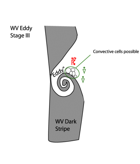
The main differences between the WV Eye and WV Eddy can be seen in the satellite imagery and are summarised in the schematics above and in the table below.
| WV Eddy | WV Eye |
| A mesoscale cyclonic spiral structure with wet and dry air masses forming the spiral | A dark, almost round spot which has been encapsulated by moister air |
| Developing due to the deformation of one edge of the Dark Stripe (see schematics above) | Developing due to the deformation of both edges of the Dark Stripe (see schematics above) |
| Some small cloud cells may exist in the leading part of the wet air stream, close to the transition zone between the high and low WV values. | No convection occurs. Significant drying out of middle and upper levels of the troposphere and even dissipation of lower cloudiness (clear spells). |
| End stage: Filling with moist air due to convection | End stage: Merging with other system, disturbed by mountains or disappearing by overrunning moist air |
| In some cases: a WV Eddy transforms into a WV Eye |
|
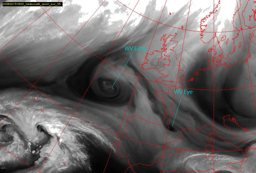
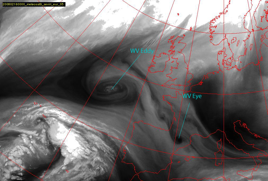
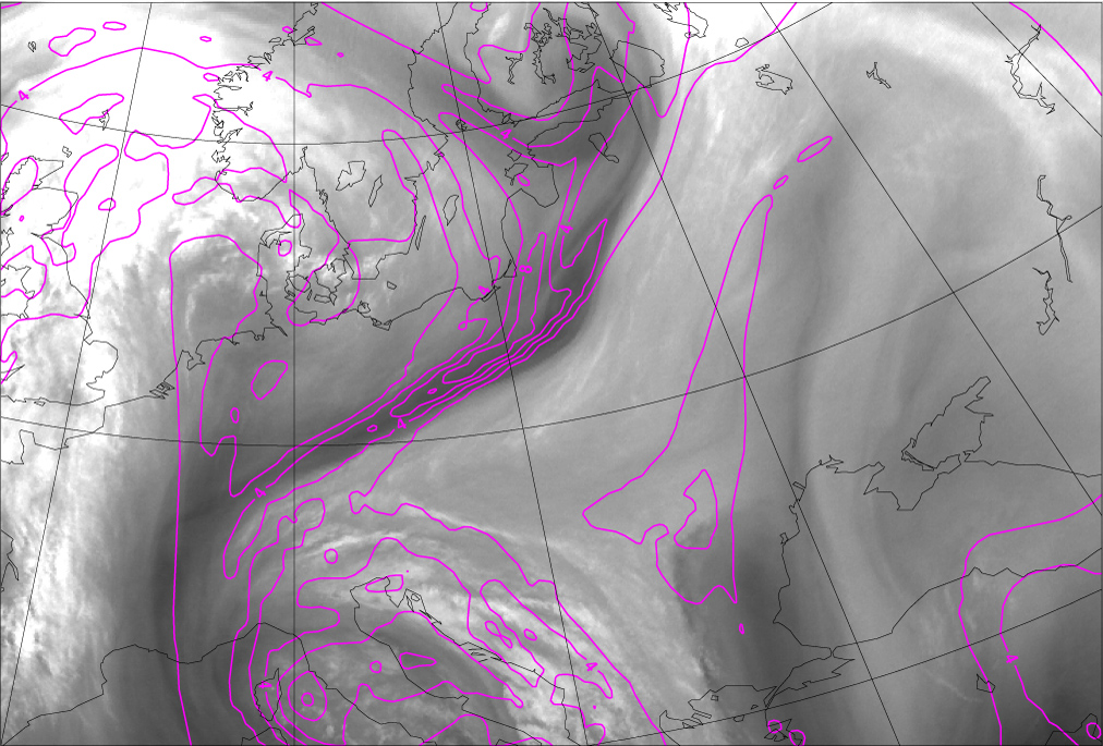
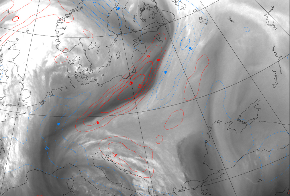
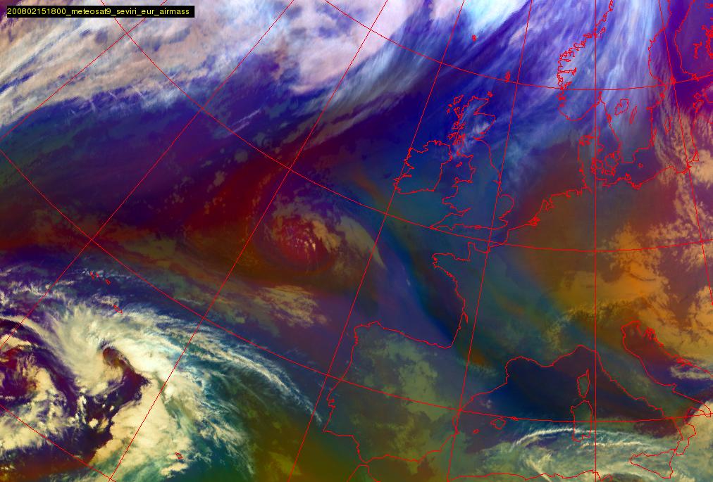
15 February 2008/18.00 UTC - Meteosat 9 WV 6.2 image
|
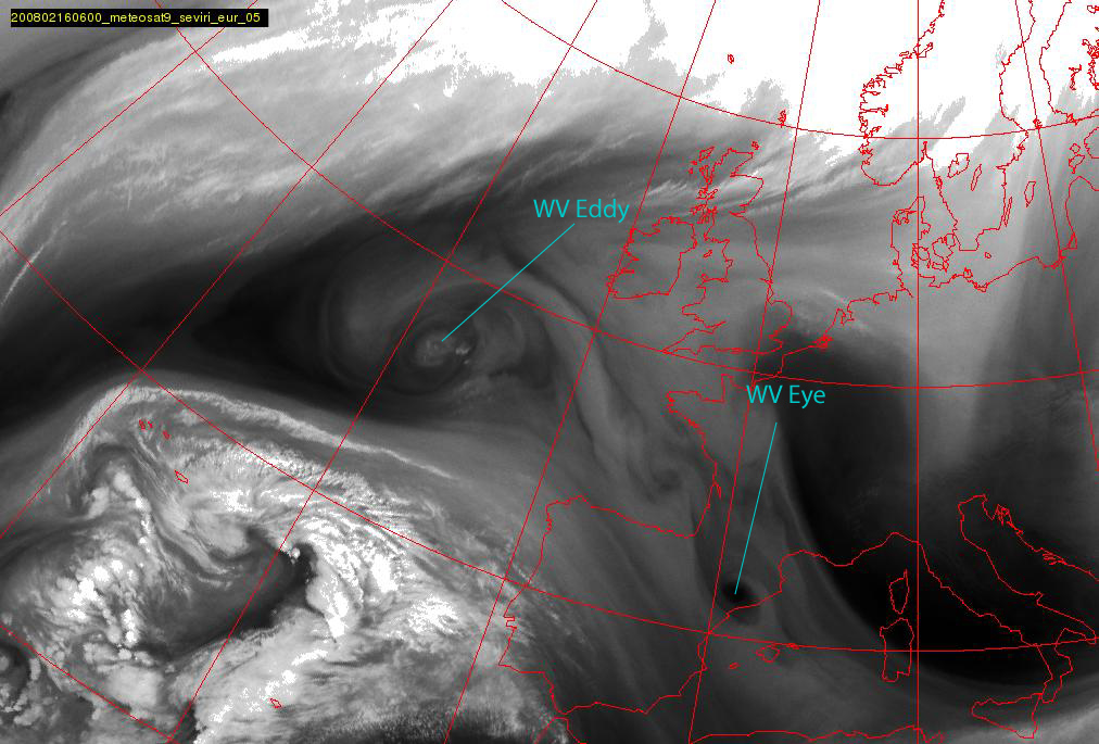
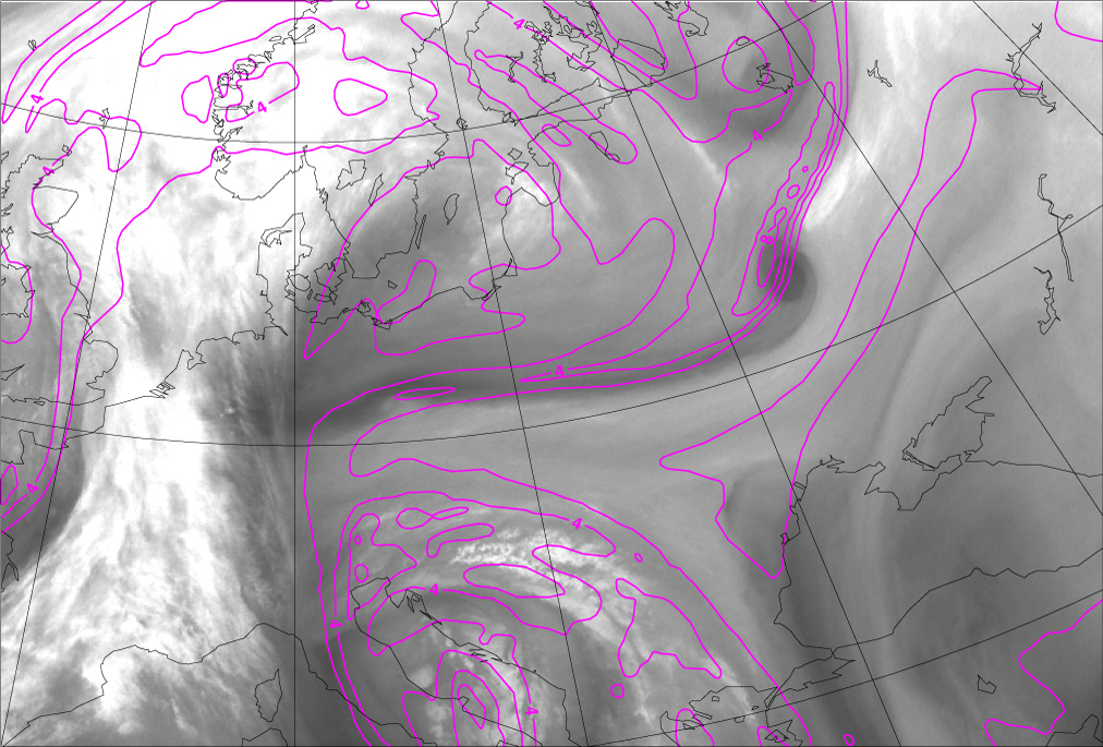
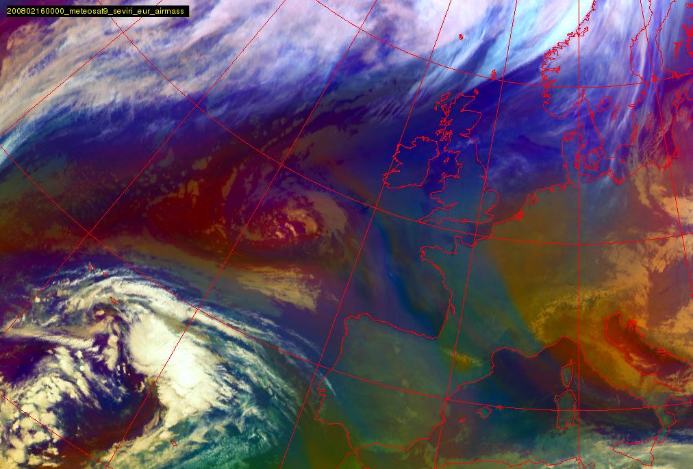
16 February 2008/00.00 UTC - Meteosat 9 WV 6.2 image
|
|
|
|
|
|
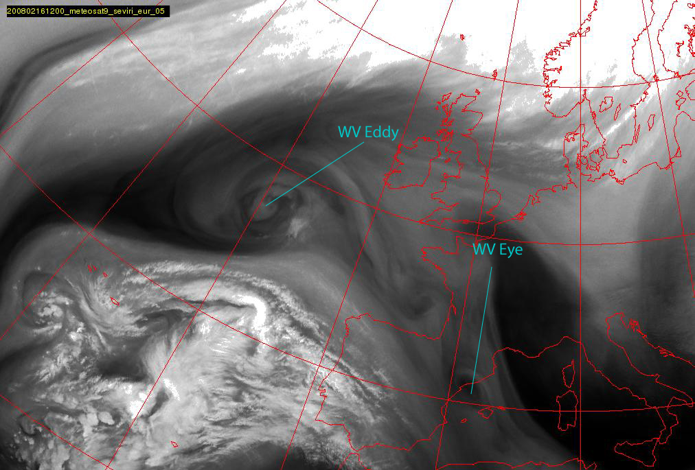
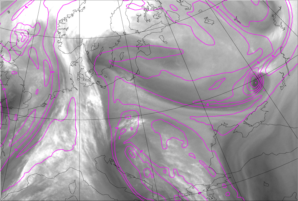
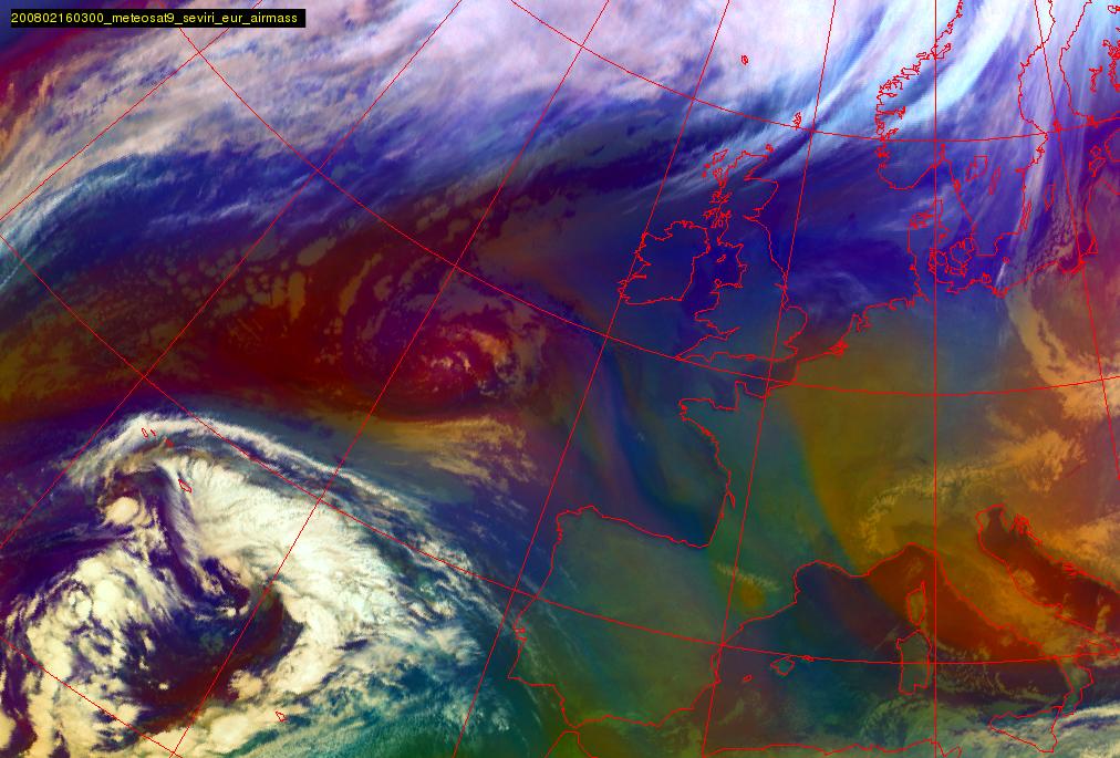
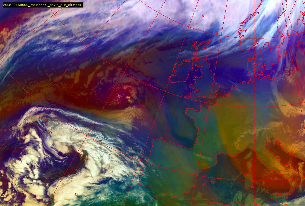
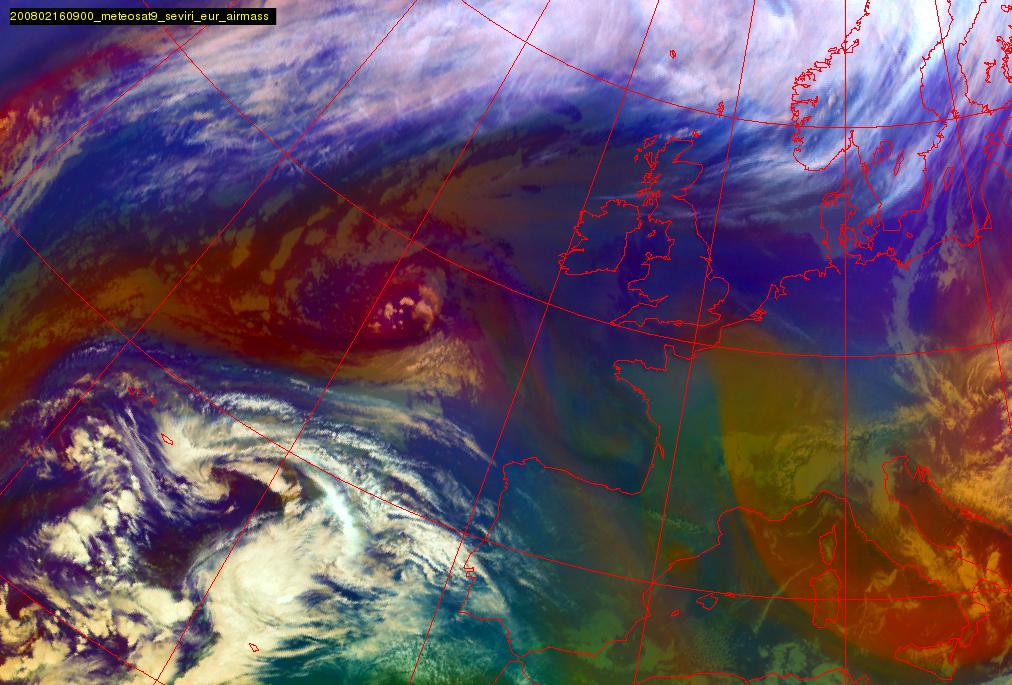
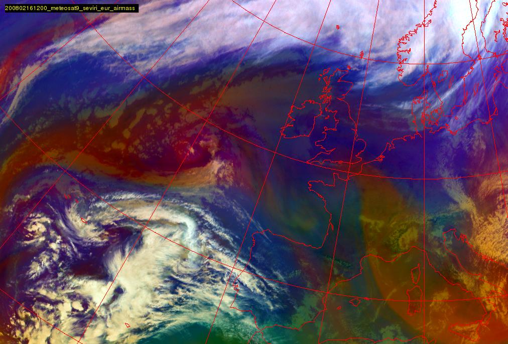
16 February 2008/06.00 UTC - Meteosat 9 WV 6.2 image
|
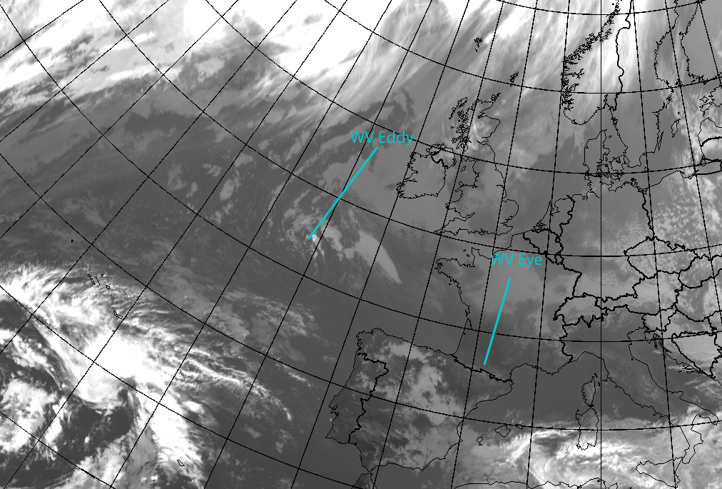
16 February 2008/12.00 UTC - Meteosat 9 WV 6.2 image
|
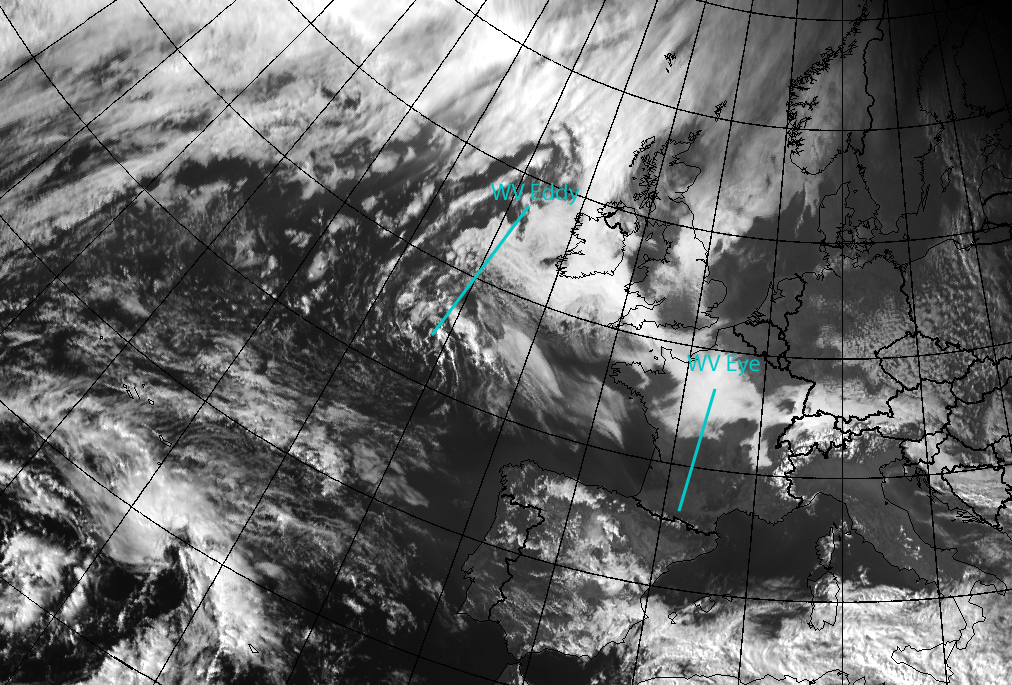
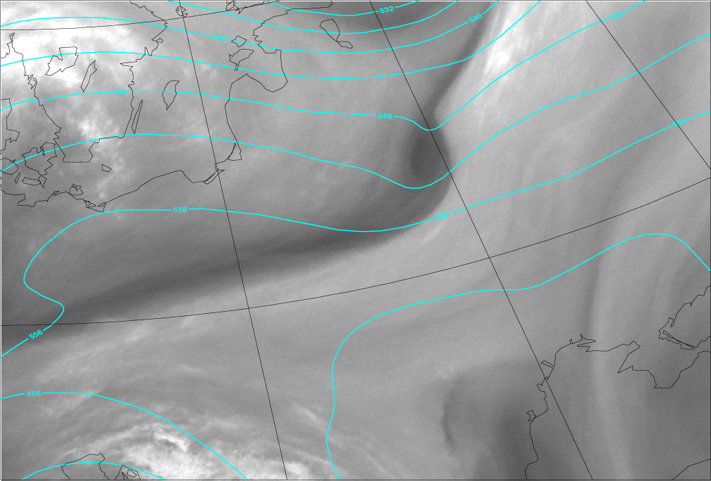
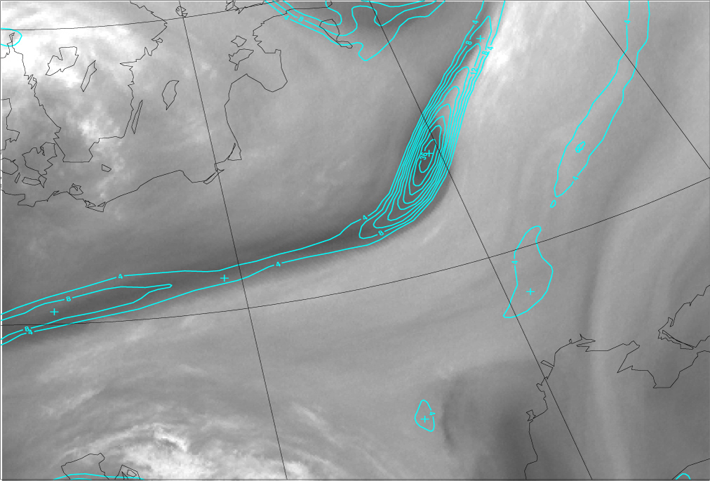
The WV images above show a nearly stationary WV Eddy south-west of Ireland and a WV Eye over the Pyrenees, slowly moving to southeast. The first impression of these vortices is that WV Eddy is clearly larger, whereas WV Eye has only a diameter in the order of a few hundred kilometres. Within the core of the WV Eddy, one can see some bright white spots, which indicate that convection is present.
WV Eyes can develop in series - also in this case one can see even one or two additional small-scale WV Vortices extending from the Bay of Biscay towards the Pyrenees.
In the VIS and IR imagery below, for WV Eddy a little bit of Stratocumulus Sheets can be seen and the convective cells near the Eddy centre can be seen in the VIS channel, but no defined cyclonically rotating cloud band exists. For WV Eye there is no associated cloudiness at all.
|
15 February 2008/15.00 UTC - Meteosat 9 IR 10.8 image
|
15 February 2008/15.00 UTC - Meteosat 9 VIS 0.6 image
|
|
|
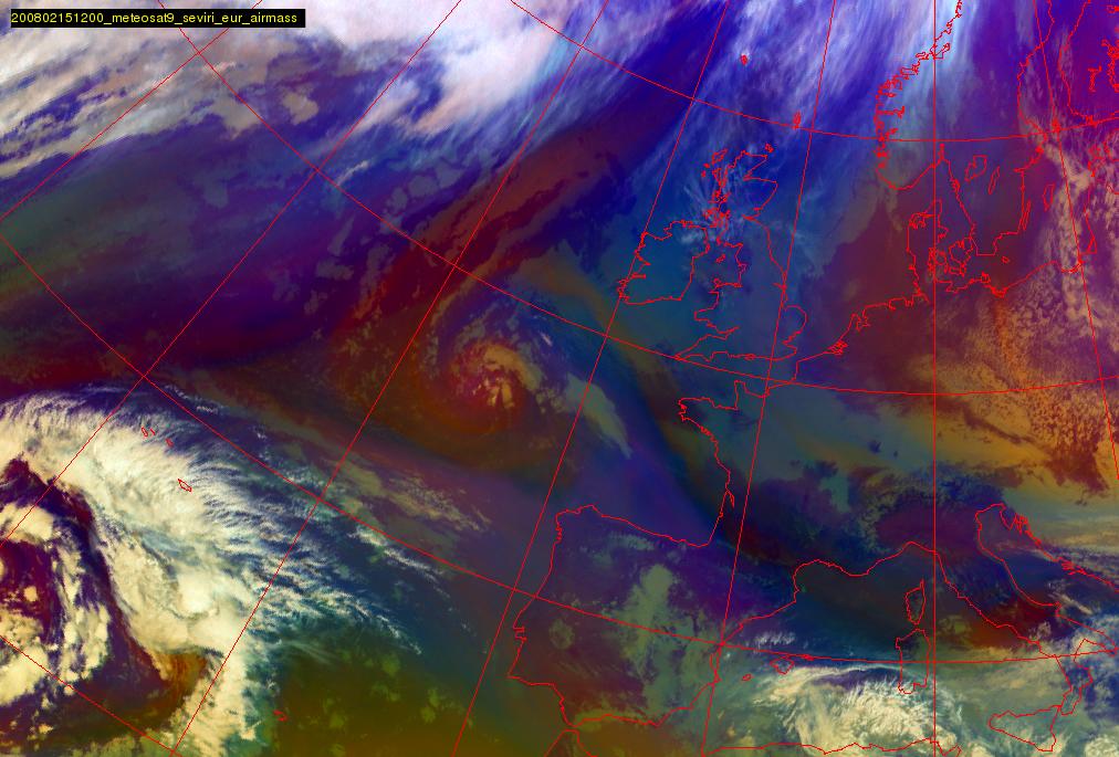
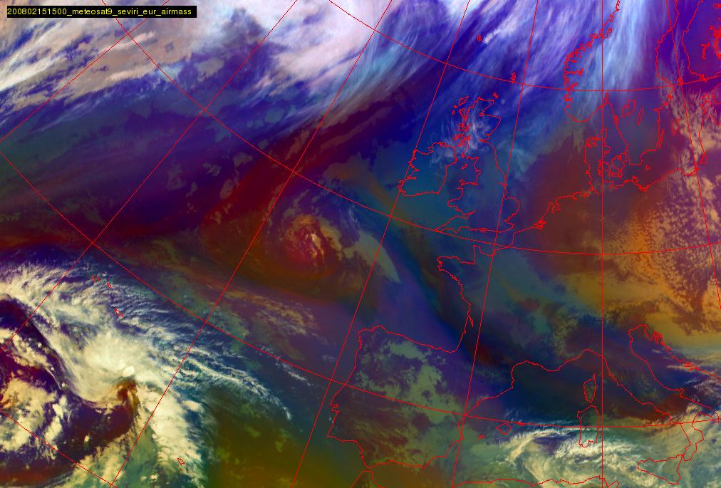
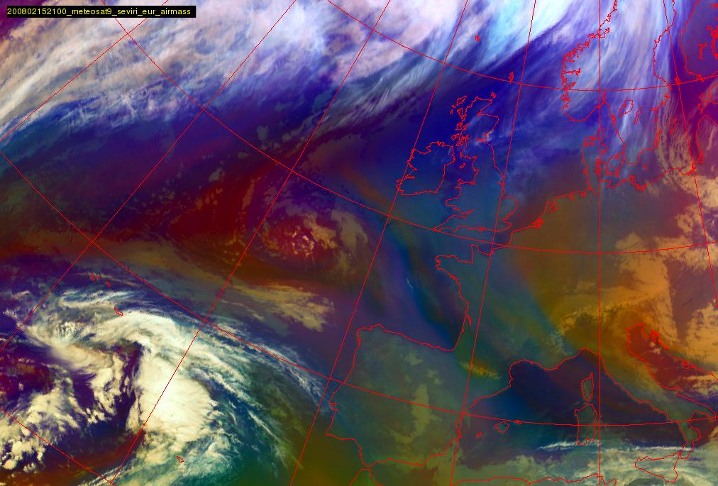
The Airmass RGB loop below shows the development of the WV Eddy and Eye in this situation. The reddish colours indicate dry air at the upper troposphere. For the WV Eddy the red area is large and clear, for the WV Eye in this case the red area is recognisable but much smaller.
|
15 February 2008/12.00 UTC - Meteosat 9 Airmass RGB image; 15 February 2008/12.00 UTC - 16 February 2008/12.00 UTC 3-hourly image
Loop
|
|
Meteorological Physical Background
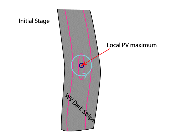
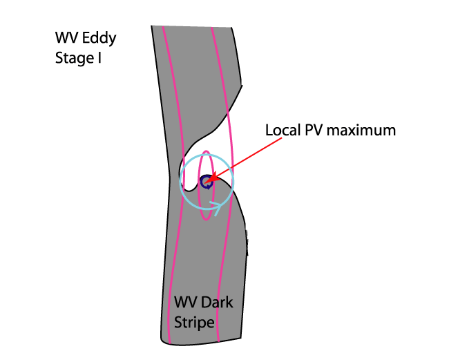
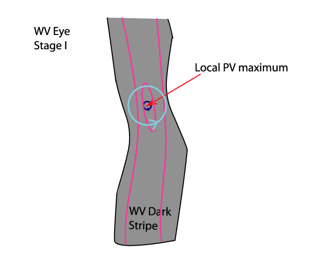
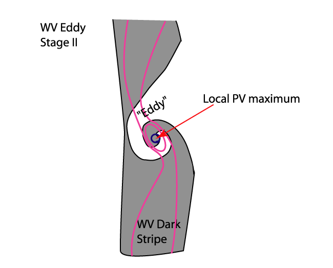
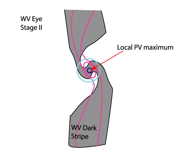
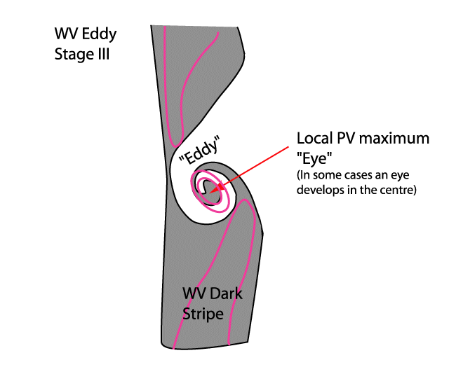
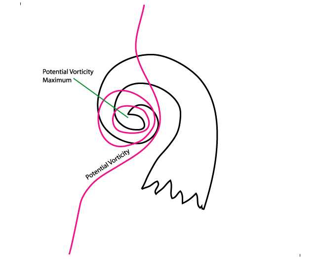
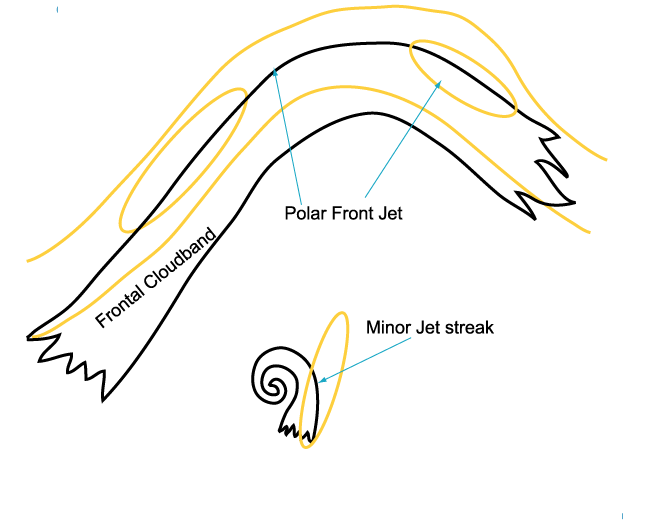
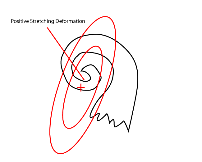
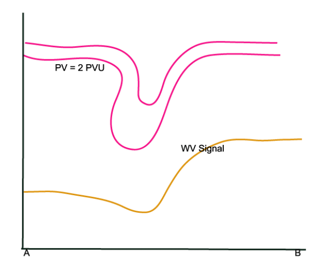
WV Vortices in the northern hemisphere are cyclonically rotating and therefore associated with a trough or low in the upper levels of the troposphere. This can also be seen in PV fields, which show high values near the centre of the vortex. High values of PV are related to low tropopause height, which explain the Dark Stripe in the WV image. (See Additional Parameters for the diagnosis of cloudiness - Potential vortcity and Water Vapour Dark Stripe ). The Dark Stripe implies that relatively dry stratospheric air is penetrating down into the higher levels of the troposphere. Within the Dark Stripe, a local maximum of PV can often be seen. Because of the local maximum, the cyclonic circulation is enhanced. (See schematics below). Therefore, the Dark Stripe is being deformed and the moister air spirals around the dryer air. This process either leads to the formation of a WV Eddy or a WV Eye.
|
|
|
|
|
|
|
|
|
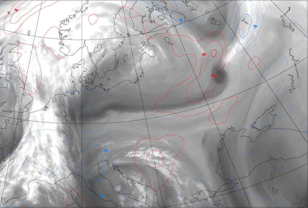
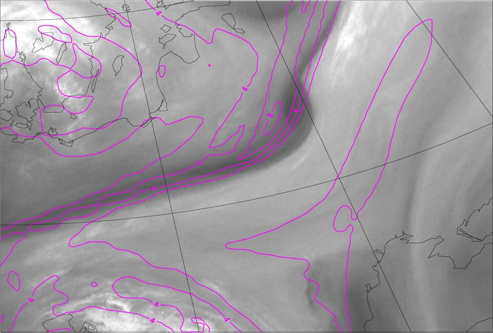
13 January 2008/12.00 UTC - Meteosat WV 6.2 image; magenta: potential vorticity 315K
|
14 January 2008/00.00 UTC - Meteosat WV 6.2 image; magenta: potential vorticity 315K
|
|
|
|
|
|
14 January 2008/12.00 UTC - Meteosat WV 6.2 image; magenta: potential vorticity 315K
|
|
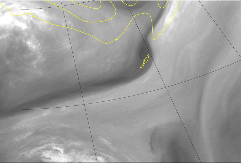
In the example above the development of an WV vortice can be seen clearly. The WV Eye is formed within a dark stripe east of Poland. During the following 24 hours it acquires a distinct round dark shape as it moves over Ukraine towards east-southeast. Note that the PV field is coinciding reasonably well with the Water Vapour Dark Stripe. The centre of upper tropospheric PV is not exactly over the centre of the WV Eye on 14 January at 00.00 and 12.00 UTC, but PV and WV are still very well connected.
Discussion
Research of numerous cases has shown that, based on the WV imagery, a distinction between two prevailing structures can be made: The WV Eddy
and the WV Eye. However, in the investigation a simple scientific reason for the different structures can't be given. There are some ideas
about the connection between the strength of the shear zone and the width and the angle of the PV-anomaly: To surround a dry area (eye) you
need a relative broad PV-trough. However, the spatial resolution of the model fields used is not high enough to confirm this hypothesis.
The model fields show similar characteristics for the two different structures. Therefore, in the next chapters, no distinction will be made
between the WV Eddy and the WV Eye.
WV Vortices often exist in front of frontal zones; consequently there are no distinct or intensive cloud structures. The reason that no other distinct cloud structures exist, is due to the fact that WV Vortices mainly develop in the upper levels of the troposphere. There is less cloud development in the lower levels because the lower parts of the troposphere often show a stable stratification, or insufficient moisture. This is one of the main differences with the conceptual model Upper Level Low. (See Upper Level Low and look at the table below). In the case of an Upper Level Low, the lower troposphere shows an unstable stratification and, as a consequence, clouds develop as convection occurs.
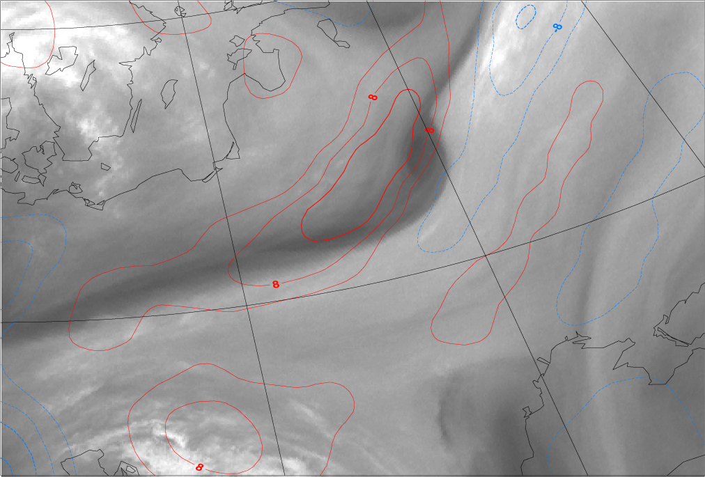
Weinand (2000) has considered possible reasons for formation of multiple mesoscale water vapour vortices (WV Eyes) and proposes three possible forcing mechanisms: a) Horizontal wind shear and jet streaks, b) barotropic instability and c) orography. Particularly the horizontal wind shear and the stretching deformation are promising hypotheses for the explanation of the formation of the eddies. Strongly positive values of stretching deformation implicate a region with strong horizontal wind shear in which the eddies can be maintained.
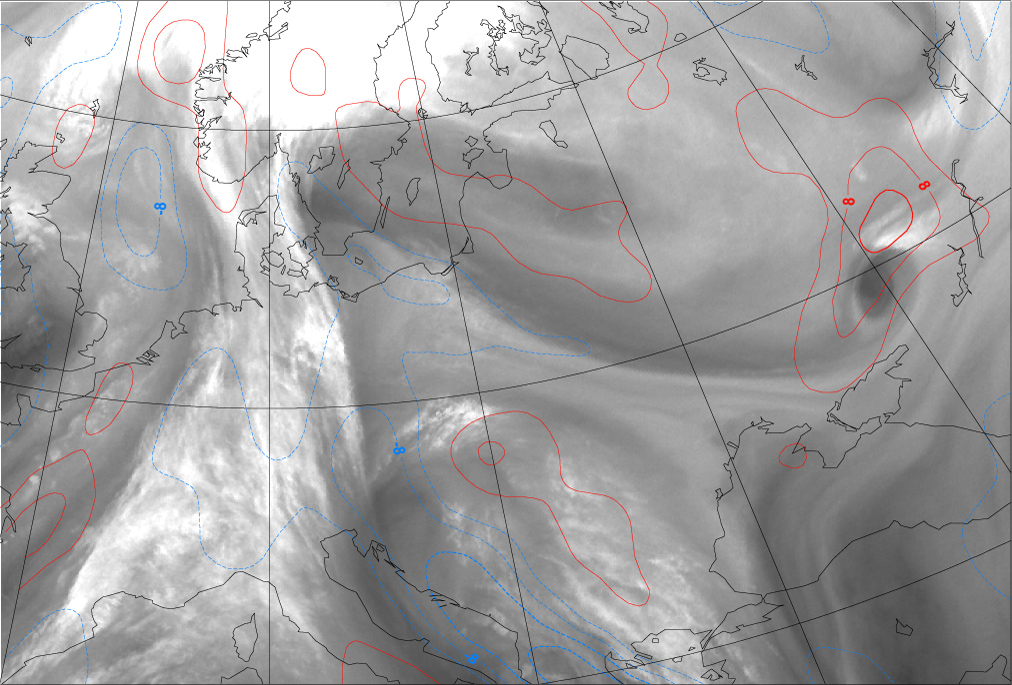
An example of the connection between stretching deformation and wv vortices is shown below. Very strongly positive values of stretching deformation (over 16 x 10-5 s-1 ) are closely associated with the onset of WV Eye formation east of Poland on 13 January 12.00 UTC. Later the absolute values of stretching deformation gradually decrease.
|
13 January 2008/12.00 UTC - Meteosat WV 6.2 image; stretching deformation, blue: negative, red: positive
|
14 January 2008/00.00 UTC - Meteosat WV 6.2 image; stretching deformation, blue: negative, red: positive
|
|
|
|
|
|
14 January 2008/12.00 UTC - Meteosat WV 6.2 image; stretching deformation, blue: negative, red: positive
|
|
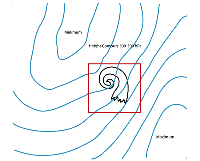
As already mentioned, a smaller scale trough is often superimposed on a large scale trough resulting in a small scale vortex. Smaller troughs
are mobile and therefore WV Vortices move with the general flow. The reason for the movement of small troughs can be explained relatively
simply.
From the geopotential tendency equation it can be seen that advection of vorticity can lead to the change of the geopotential height pattern.
This vorticity advection term consistst of two parts: Advection of relative vorticity, and advection of earth's vorticity.
The relative vorticity can be writen as:
where ζg is the relative (geostrophic) vorticity, f0Coriolis parameter, ∇2 Laplacian operator,
φ geopotential height.
From this equation it can be seen that the relative vorticity is proportional to the Laplacian of the geopotential height field. If we suppose
that the geopotential height field is a sinusoid it can be shown that:
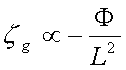
where L is the wavelength of the sinusoid.
The relative vorticity is inverse proportional to the square of the wavelength of the sinusoid. Note that the relative vorticity is inversely proportional to the square of the wavelength of the sinusoide. The shorter the sinusoidal wave, the stronger the vorticity will be. It can also be shown that the Earth's vorticity is inverse proportional to the wavelength of the sinusoid, therefore, relative vorticity will dominate the behaviour of short Waves and the earth's vorticity will dominate the long Waves. As a consequence, a WV Vortex, which is related to a short Wave, tends to move quickly. However, an Upper Level Low which is associated with a large scale trough, is stationary or may even retrograde.
The differences and similarities between a WV Vortex and an Upper Level Low are listed in the tables below.
| Differences | ||
| WV-vortex (Eye/Eddy) | Upper Level Low | |
| Process | Small upper level cyclonic circulation, often embedded in a large scale upper level trough | Cut-off process from a large scale Rossby Wave |
| Cloudiness | Can only be seen in WV imagery. Sometimes small convective cloud cells develop which can also be seen in IR and VIS imagery | Vigorous convective activity develops especially in the mature stage which can be clearly seen in all channels |
| Scale | Small scale/ Mesoscale system | Synoptical scale system |
| Velocity | Moving system, associated with a mobile trough | Associated with a quasi-stationary trough | Similarities |
| Timescale | Persistent, can last for several days | WV imagery | Both appear as a cyclonic circulation of dry and moist air streams. |
Key Parameters
- Potential Vorticity on an isentropic surface.
PV distribution shows a long narrow elongated zone of high PV values, associated with a Dark Stripe in the WV imagery. Local maxima occur in this elongated zone, connected to the cyclonic centre of the vortex. - Geopotential Height at 500/300 hPa
In the large scale geopotential height field a flow can often be seen which is non-zonal. The WV vortex is located in a region where a smaller trough is superimposed on the large scale trough. The geopotential height pattern at 500 hPa shows a small scale trough. At 300 hPa a small scale low can often be found with some enclosed contours. - Windspeed 300 hPa
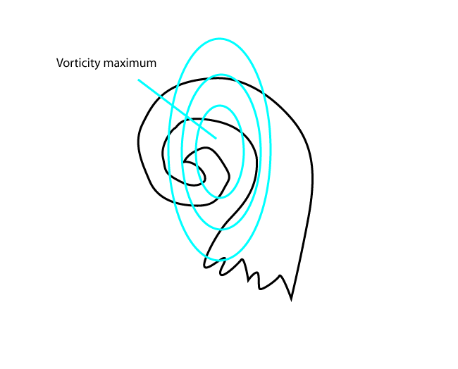
The WV Vortex is often located on the cyclonic side of a minor jetstreak, located on the southern (warm) side of the polar jet stream - Vorticity at 500/300 hPa
WV Vortex is accompanied by a distinct Relative Vorticity maximum at middle and upper troposphere. - Stretching Deformation
The WV vortex is often generated within an area of positive stretching deformation maximum.
Potential Vorticity on an isentropic surface
|
|
13 January 2008/18.00 UTC - Meteosat WV 6.2 image; magenta: potential vorticity 315K
|
|
|
Geopotential Height at 500 and 300 hPa
|
|
13 January 2008/18.00 UTC - Meteosat WV 6.2 image; cyan: geopotential height 500 hPa
|
|
|
Windspeed 300 and 250 hPa
|
|
13 January 2008/18.00 UTC - Meteosat WV 6.2 image; yellow: isotachs 300 hPa
|
|
|
Vorticity at 500 and 300 hPa
|
|
13 January 2008/18.00 UTC - Meteosat WV 6.2 image; cyan: relative vorticity 500 hPa
|
|
|
Stretching Deformation 500 and 300 hPa
|
|
13 January 2008/18.00 UTC - Meteosat WV 6.2 image; stretching deformation 500 hPa, red: positive, blue: negative
|
|
|
Typical Appearance In Vertical Cross Sections
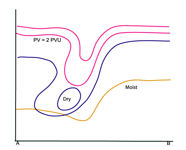
- Potential Vorticity (PV):
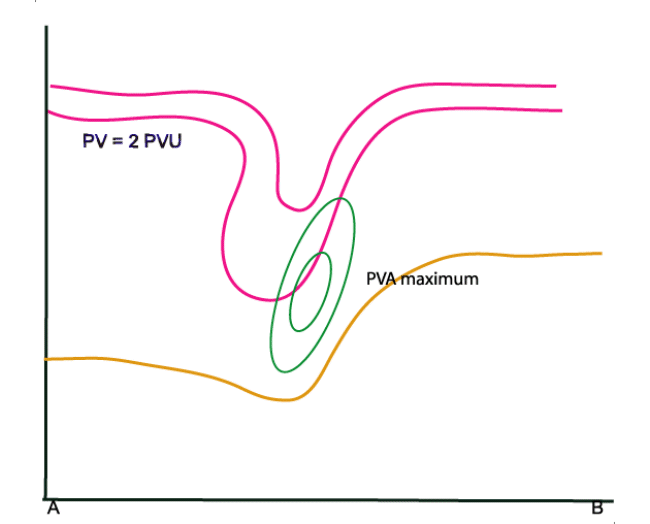
Distinct lowering of the PV=2 value to heights of 400-500 hPa. This lowering of the dynamical tropopause is regarded as the upper level PV anomaly (see Additional Parameters for indicative of the diagnosis of cloudiness - Potential Vorticity ). - Vorticity advection:
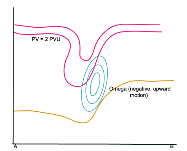
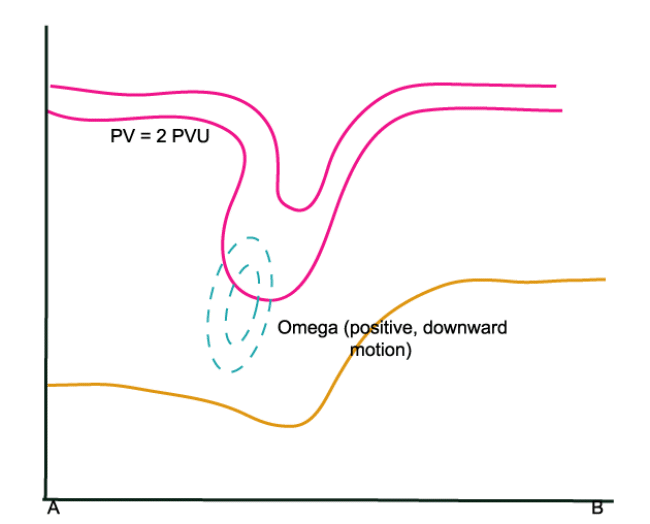
Ahead of the PV anomaly there is positive vorticity advection whilst to the rear there is negative vorticity advection. - Omega:
Vertical motion occurs due to the increase of vorticity advection with height. (See omega equation) It can be seen that there is only substantial upward motion in the upper layers of the troposphere, which inplies that cloud development only occurs at higher levels of the troposphere.
To the rear of the PV anomaly, downward motion occurs due to negative vorticity advection. - Relative Humidity:
As a result downward motion, dry stratospheric air is transported into the higher levels of the troposphere. This can also be seen in the WV image as a dark area (low pixel values).
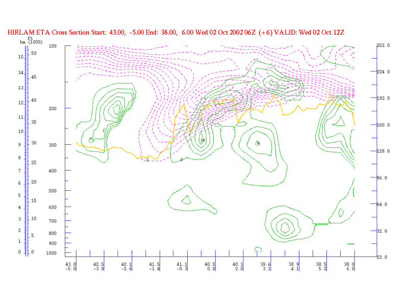
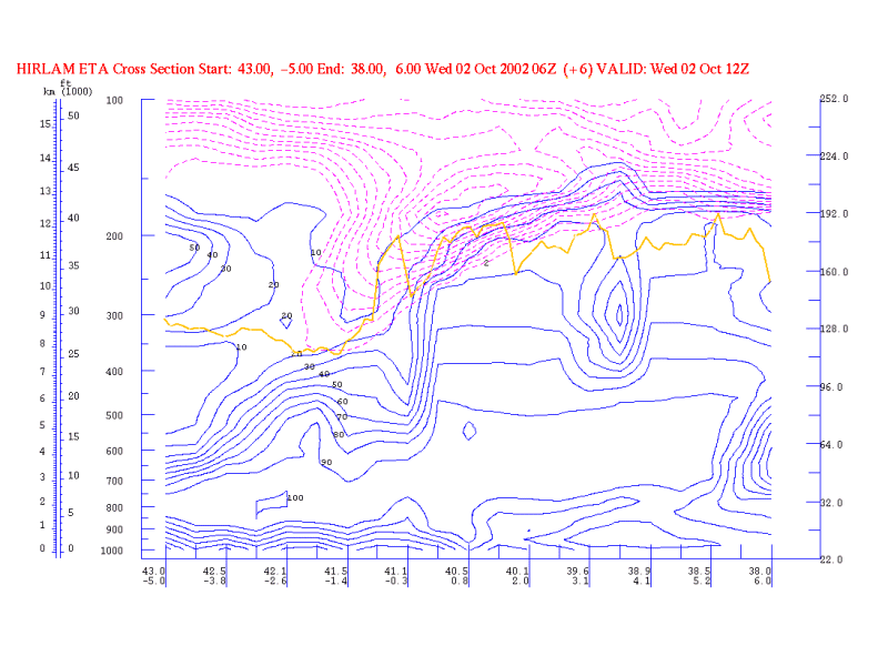
|
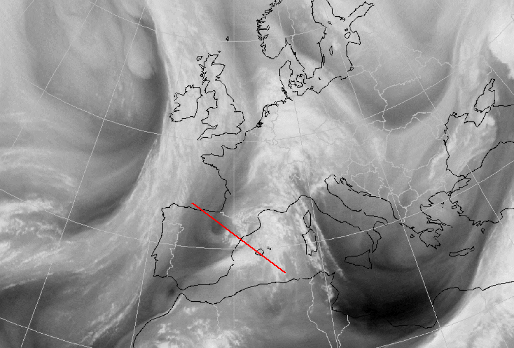
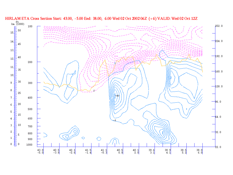
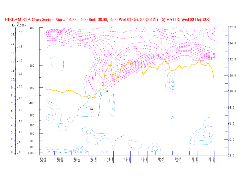
02 October 2002/12.00 UTC - Meteosat WV image; position of vertical cross section indicated
|
|
|
Potential Vorticity (PV)
|
|
02 October 2002/12.00 UTC - Vertical Cross Section; magenta: PV, yellow: WV pixel values
|
|
|
Vorticity advection
|
|
02 October 2002/12.00 UTC - Vertical Cross Section; magenta: PV, green: PVA, yellow: WV pixel values
|
|
|
Omega
|
|
02 October 2002/12.00 UTC - Vertical Cross Section; magenta: PV, cyan: Negative Omega, yellow: WV pixel values
|
|
|
|
|
|
|
02 October 2002/12.00 UTC - Vertical Cross Section; magenta: PV, cyan: Positive Omega, yellow: WV pixel values
|
Relative Humidity
|
|
02 October 2002/12.00 UTC - Vertical Cross Section; magenta: PV, blue: relative humidity, yellow: WV pixel values
|
|
|
Weather Events
| Parameter | Description |
| Precipitation |
|
| Temperature |
|
| Wind (incl. gusts) |
|
| Other relevant information |
|
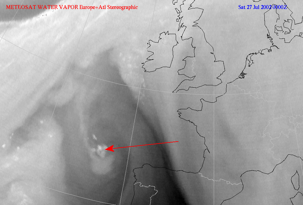
WV Eddy
|
|
27 July 2002/00.00 UTC - Meteosat WV image
|
|
|
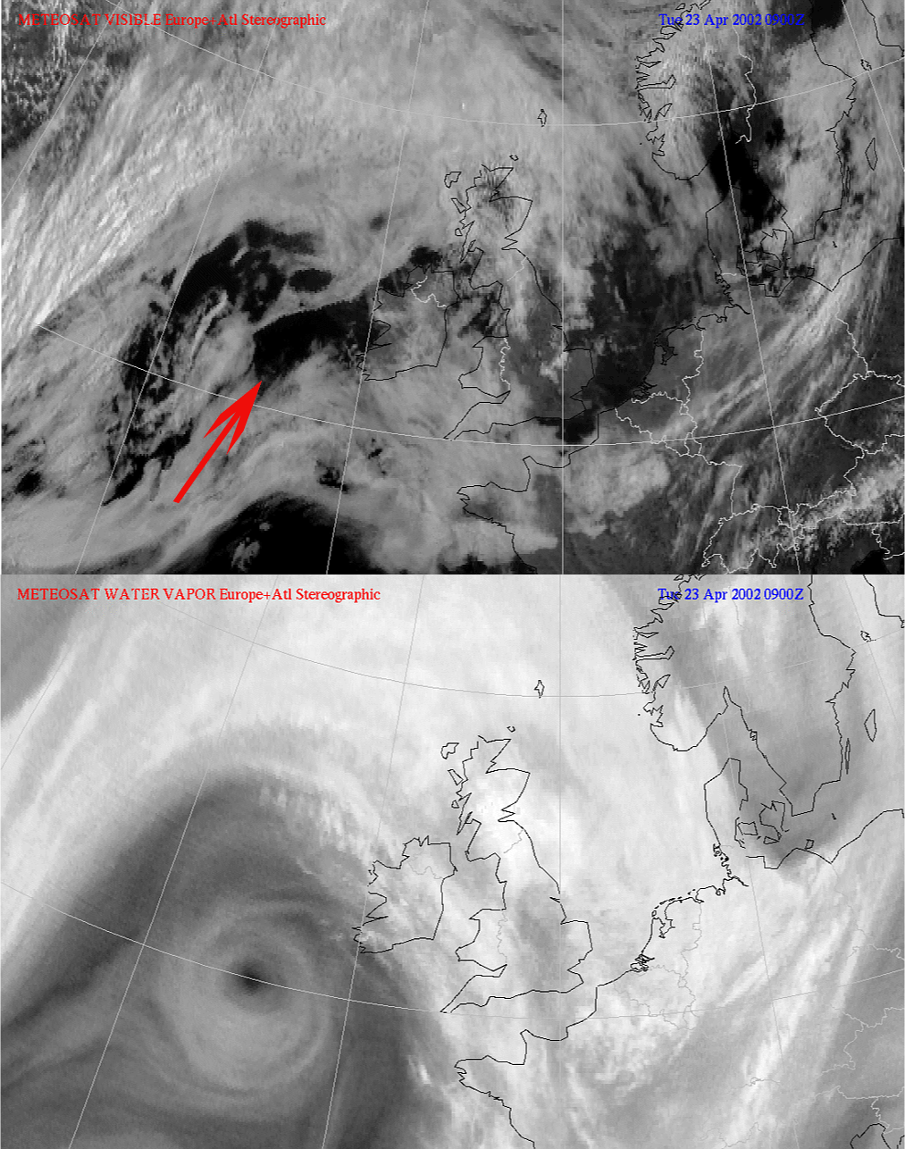
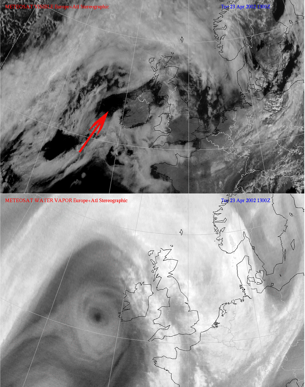
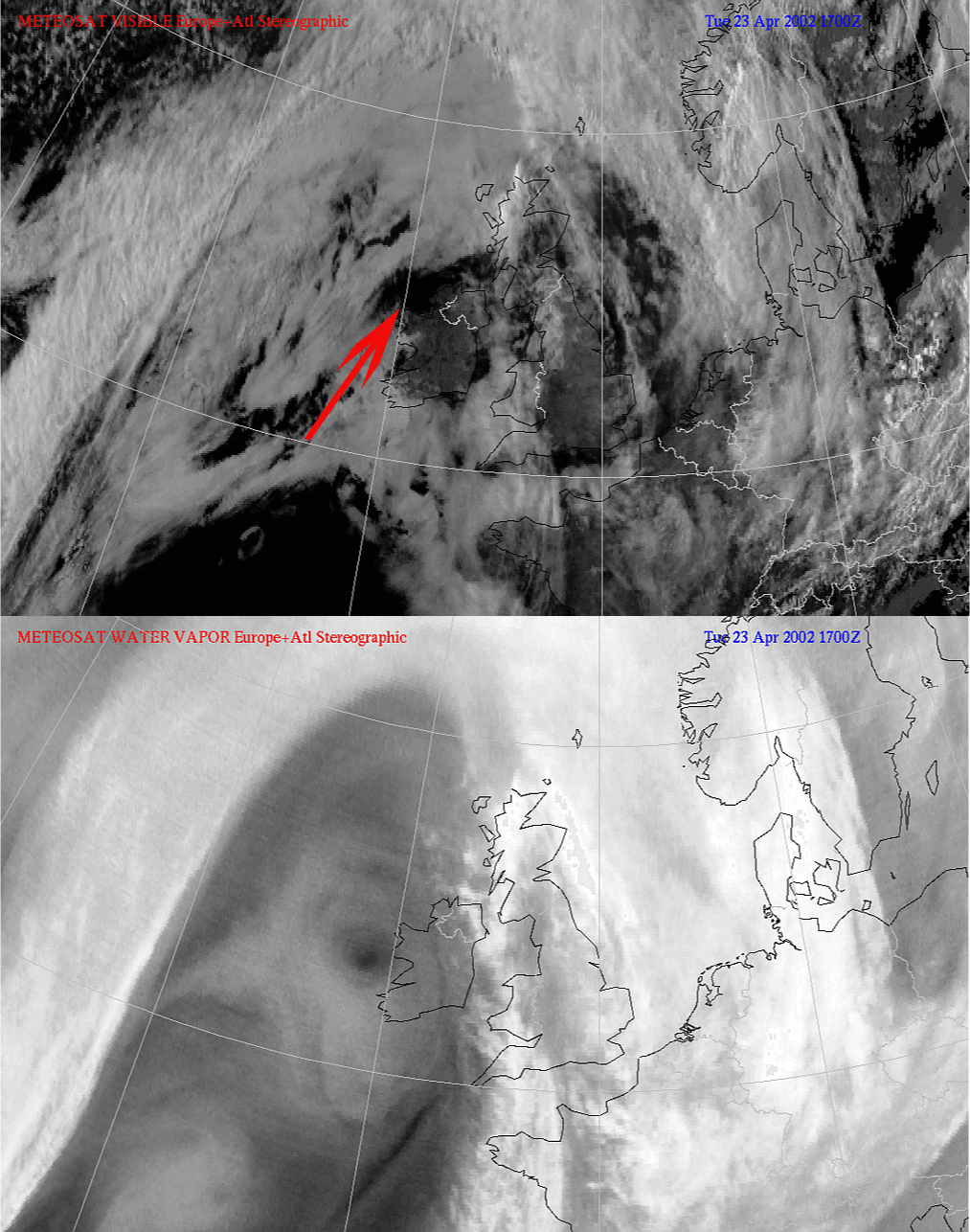
WV Eye
|
|
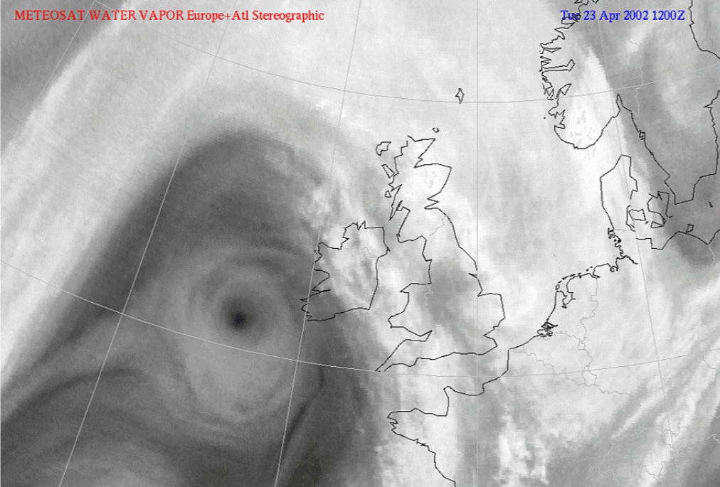
23 April 2002/12.00 UTC - Meteosat WV image
|
|
|
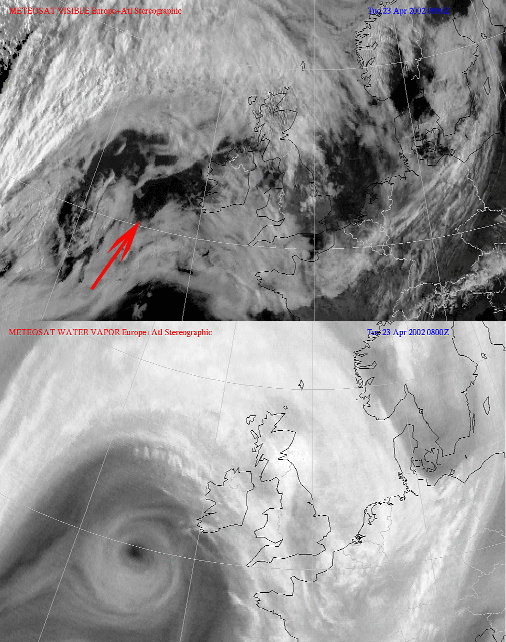
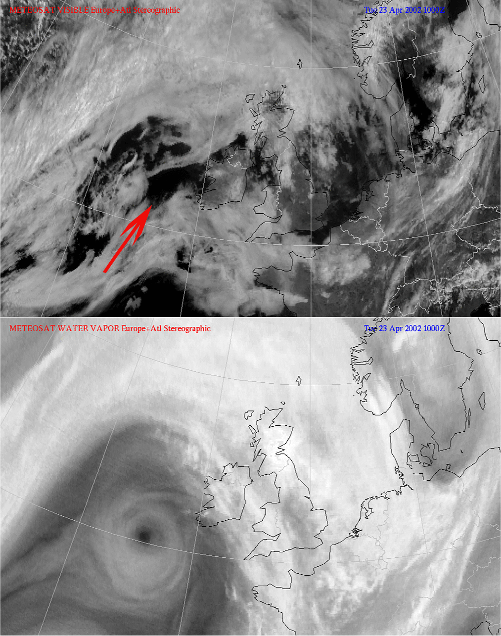
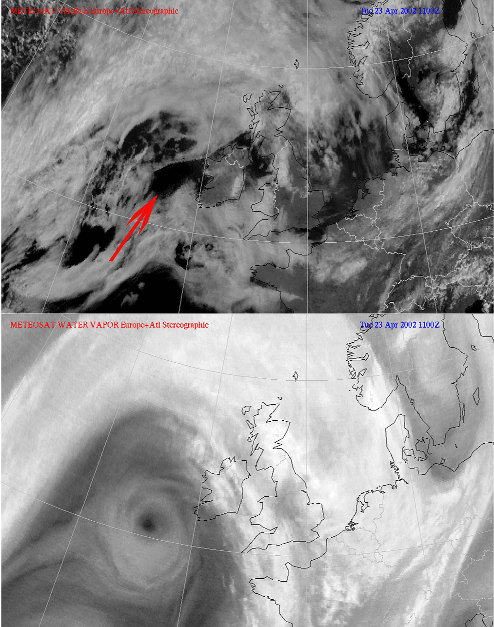
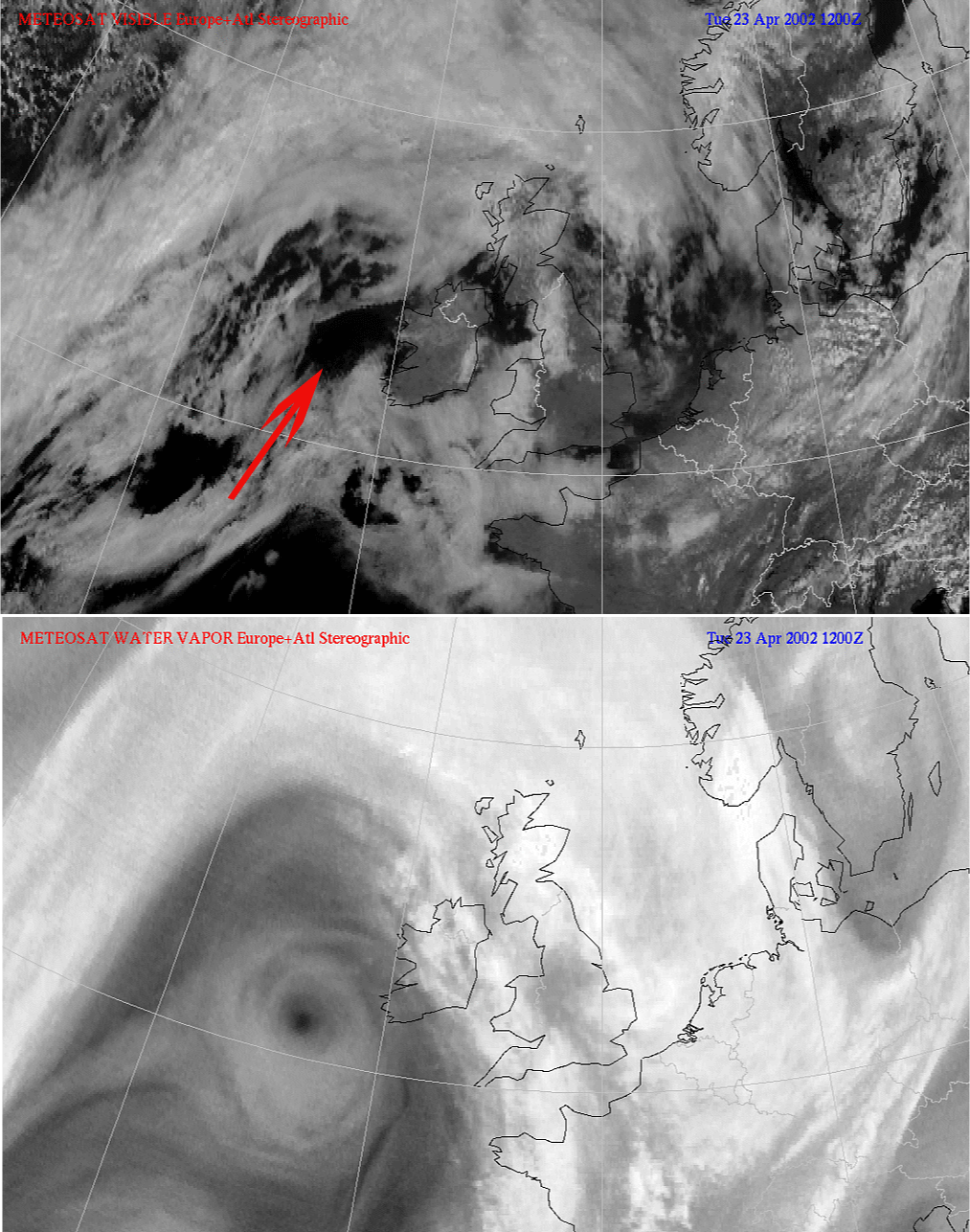
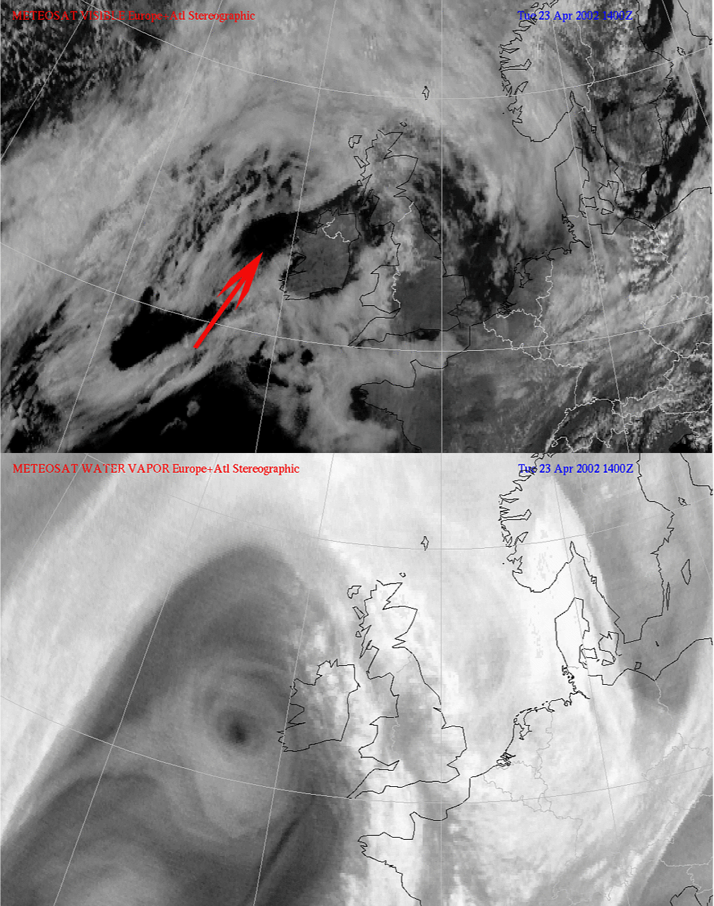
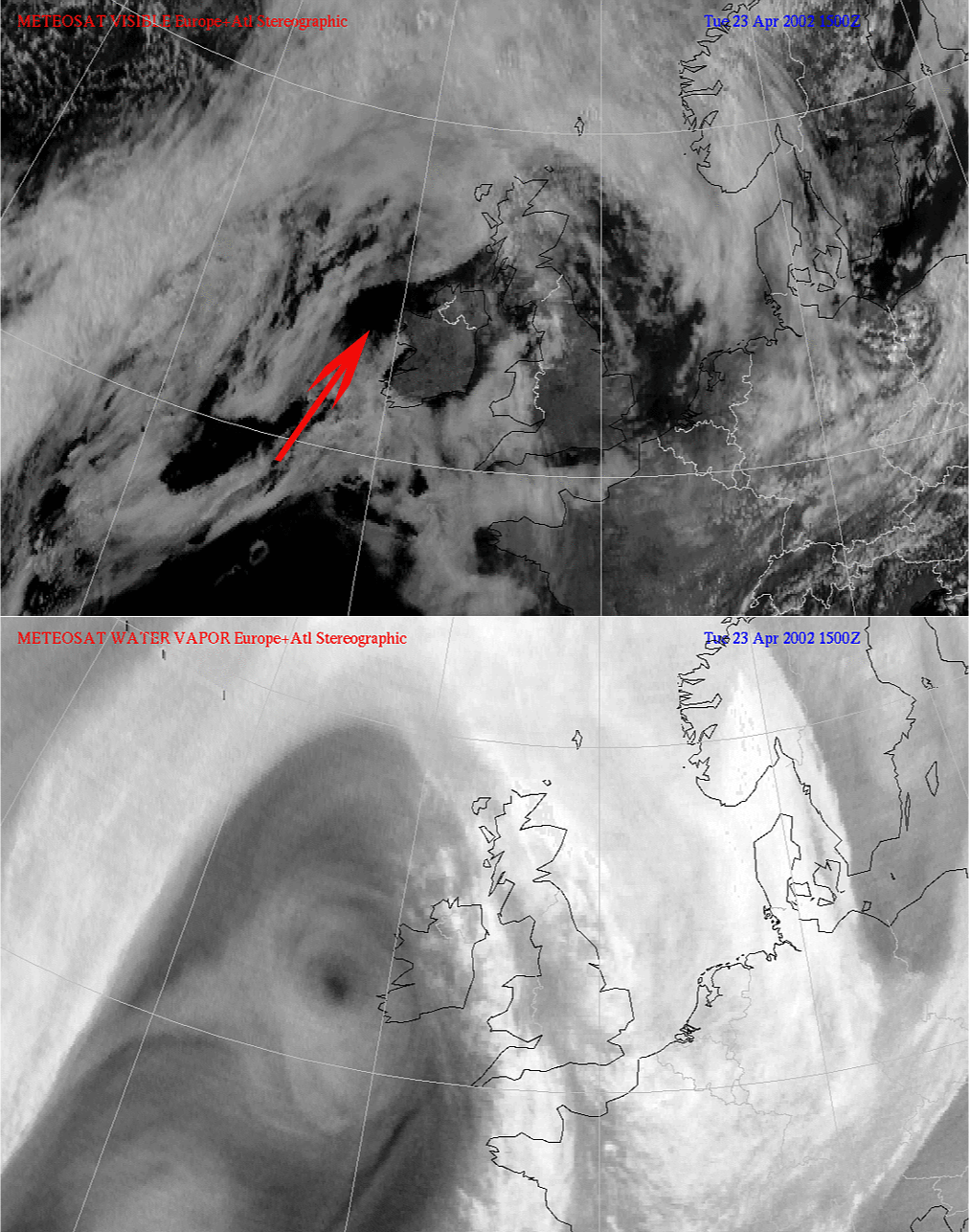
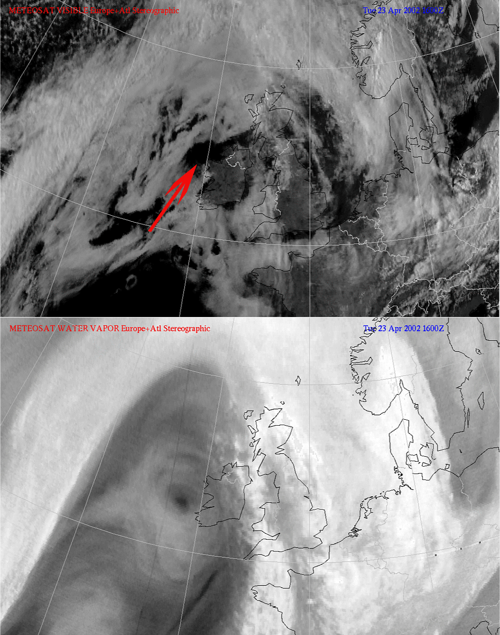
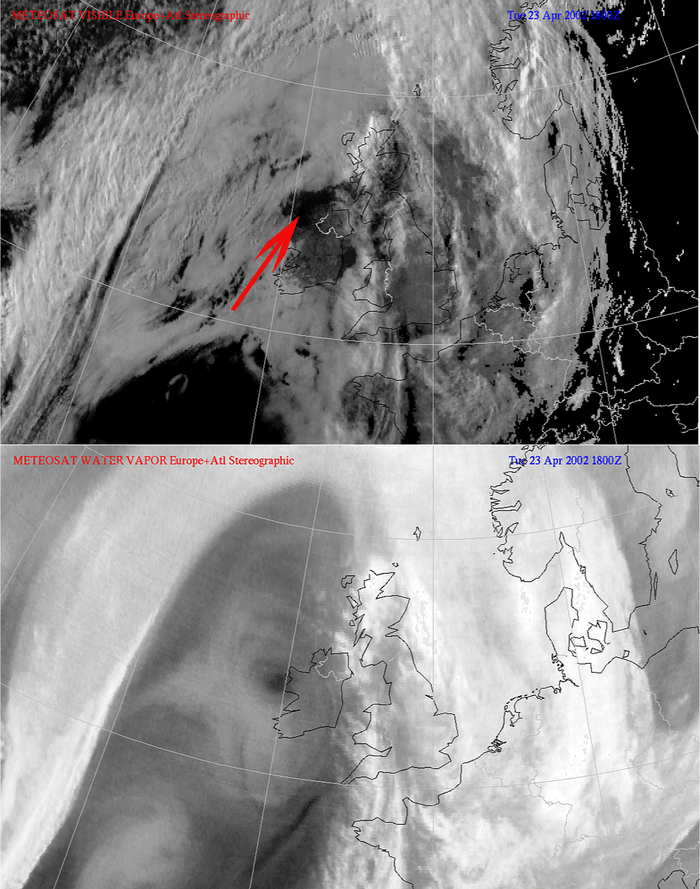
In the animation below the prevention of cloud production can be seen. (see clear spell in SC Sheets with arrow).
|
23 April 2002/08.00 UTC - Meteosat WV image
|
|
References
- DAVIS C.A., EMANUEL K.A. (1991): Potential Vorticity Diagnostics of Cyclogenesis; Monthly weather review, Vol 115, p1929-1953.
- HOSKINS B. J., MCINTYRE M. E. and ROBERTSON A. L. W. (1985): On the use and significance of isentropic potential vorticity maps; Quart. J. R. Meteor. Soc., Vol. 111, p. 877 - 946
- VERKLEY W. (1995): Een scherpere kijk op de atmosfeer. Potentiele vorticiteit; Meteorologica 3-95
- WEINAND B. J. (2000): Mesoscale Shear Eddies in the Upper Troposphere; Monnthly Weather Review, Vol. 128, p. 4126-4130.
- WELDON R.B. and HOLMES S.J. (1991): Water Vapor Imagery. Interpretation and applications to weather analysis and forecasting. NOAA Technical Report NESDIS 57.