Cloud Structure In Satellite Images
The typical satellite imagery features of this conceptual model can usually be seen only in the WV image; that means that this is a situation with little or no major cloudiness, but with distinct features in the water vapour field. Investigation of about 100 cases over a period of two years shows that a distinction can be made between different WV structures. The two prevailing structures are the so-called WV Eddies and WV Eyes.
Appearance in Meteosat imagery:
- WV Imagery:
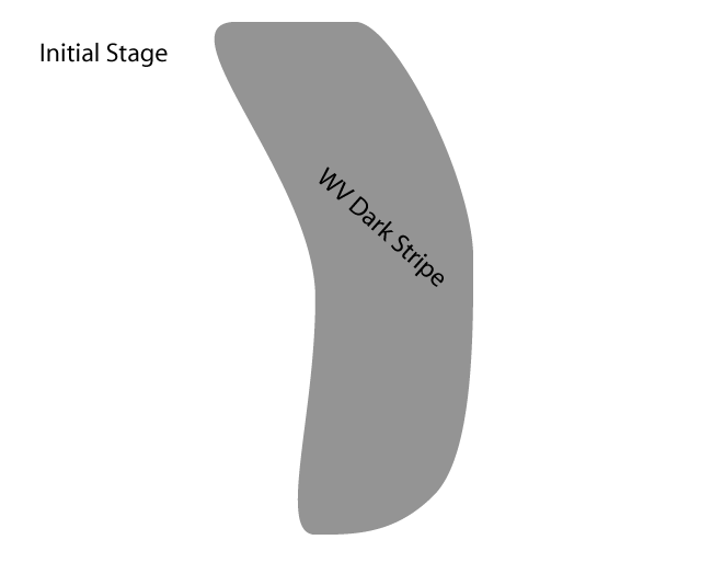
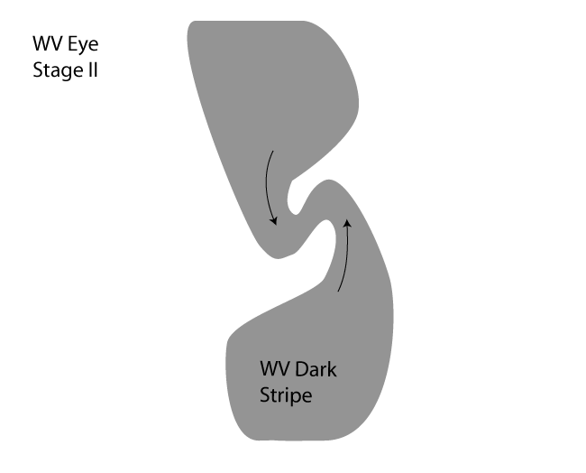
- Initial "old" Dark Stripe, associated with a former baroclinic zone. (compare Water Vapour Dark Stripes )
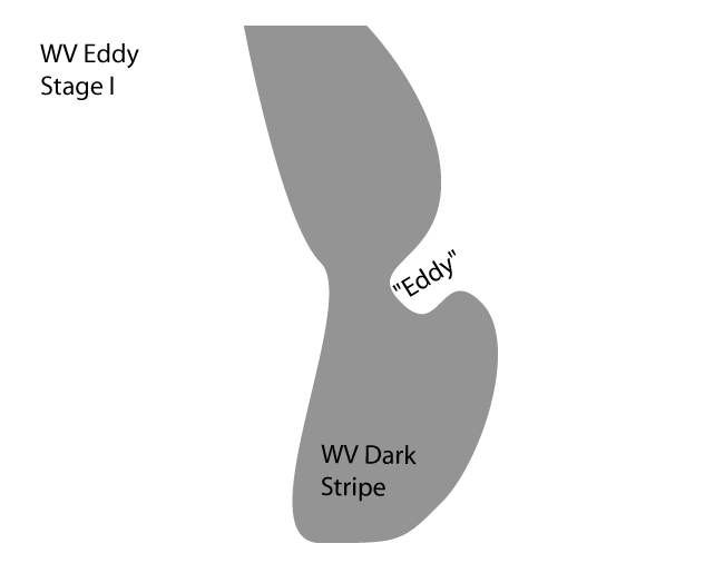
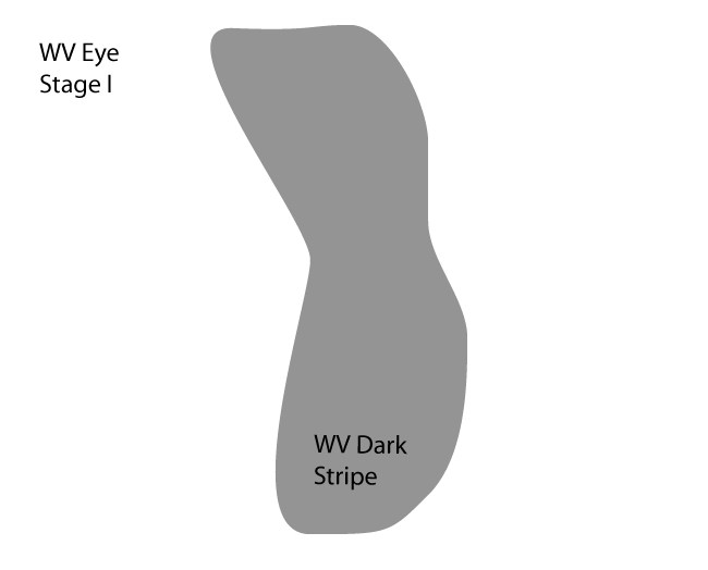
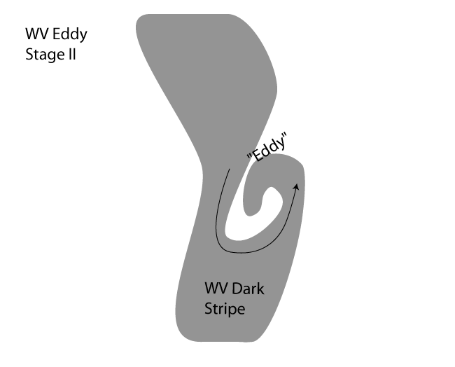
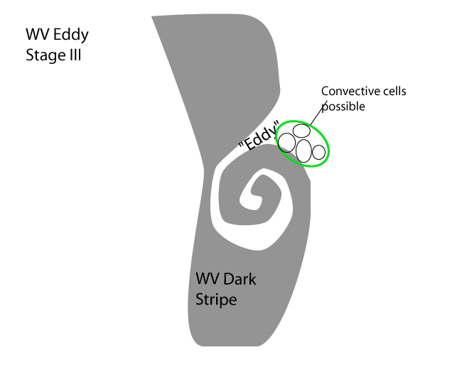
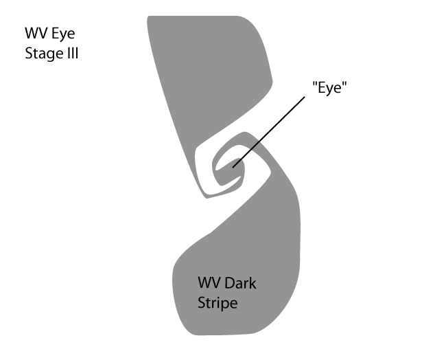
- During development a cyclonic structure forms. In the case of a WV Eddy, air with higher moisture content, spirals around drier air. In the case of a WV Eye, dry air is being surrounded by moist air and eventually a dark, round spot will be formed.
- IR/VIS Imagery:
- The main features of this conceptual model can only be seen in WV images. However, near the centre of a WV Eye cloud production can be suppressed, or clouds can dissolve.
|
|
|
|
|
|
|
|
The main differences between the WV Eye and WV Eddy can be seen in the satellite imagery and are summarised in the schematics above and in the table below.
| WV Eddy | WV Eye |
| A mesoscale cyclonic spiral structure with wet and dry air masses forming the spiral | A dark, almost round spot which has been encapsulated by moister air |
| Developing due to the deformation of one edge of the Dark Stripe (see schematics above) | Developing due to the deformation of both edges of the Dark Stripe (see schematics above) |
| Some small cloud cells may exist in the leading part of the wet air stream, close to the transition zone between the high and low WV values. | No convection occurs. Significant drying out of middle and upper levels of the troposphere and even dissipation of lower cloudiness (clear spells). |
| End stage: Filling with moist air due to convection | End stage: Merging with other system, disturbed by mountains or disappearing by overrunning moist air |
| In some cases: a WV Eddy transforms into a WV Eye |
|
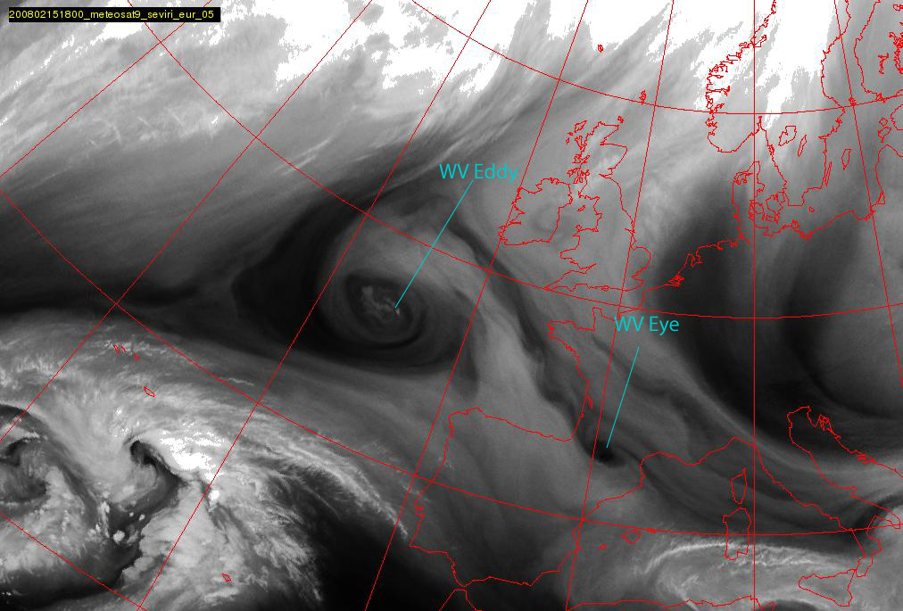
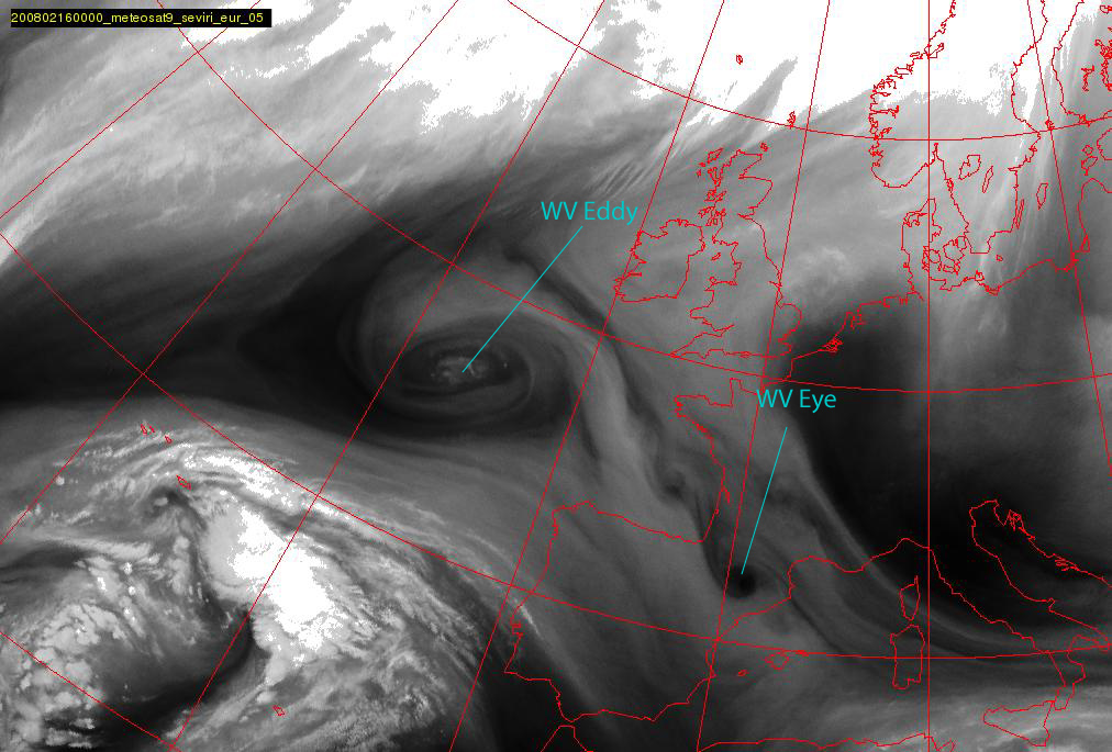
15 February 2008/18.00 UTC - Meteosat 9 WV 6.2 image
|
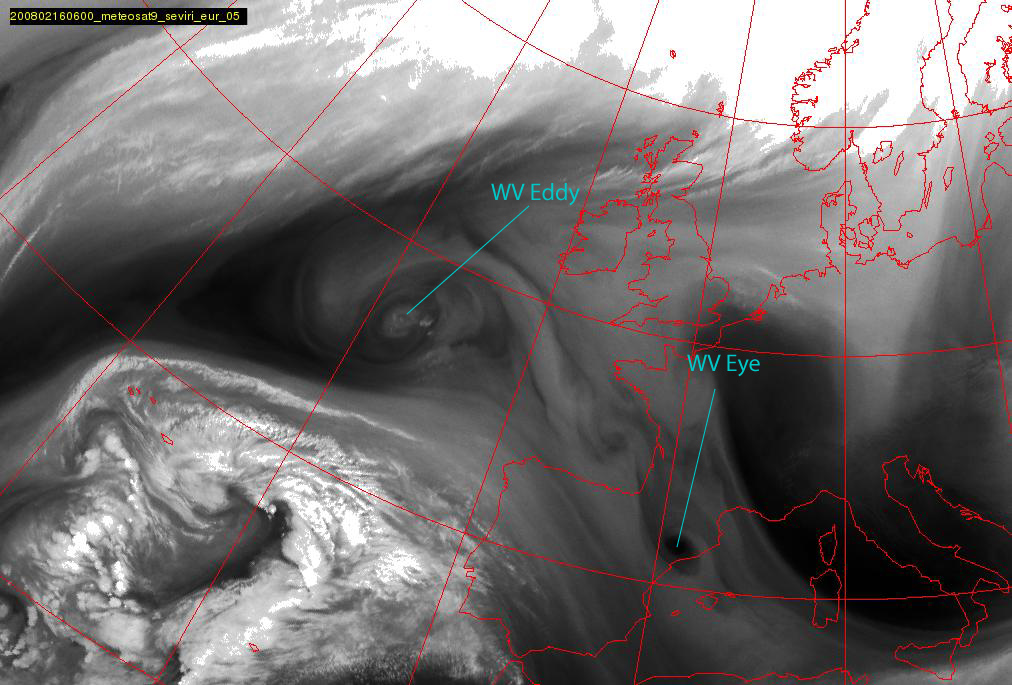
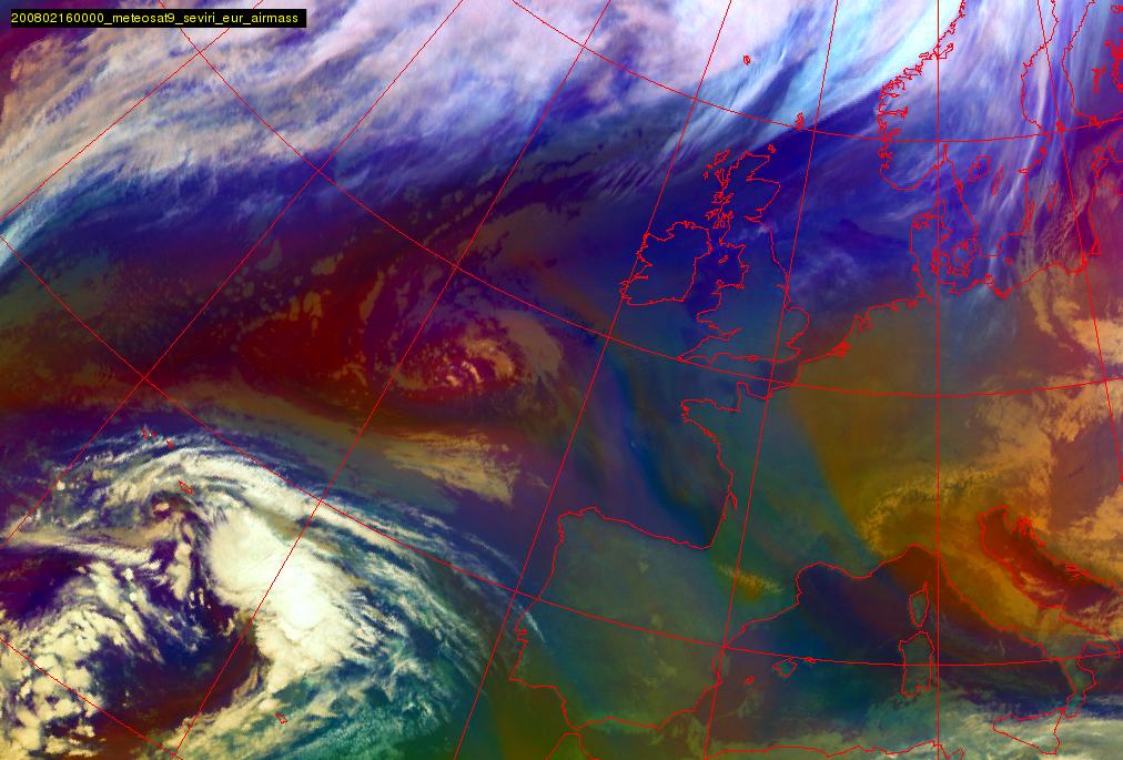
16 February 2008/00.00 UTC - Meteosat 9 WV 6.2 image
|
|
|
|
|
|
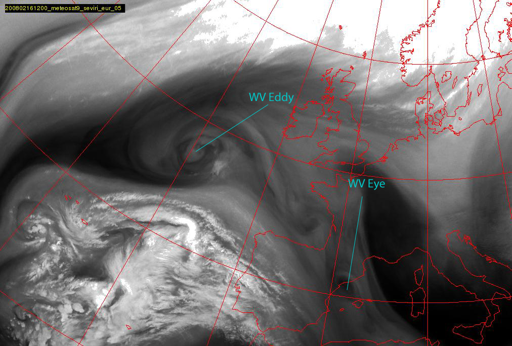
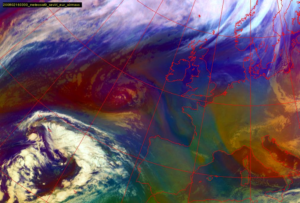
16 February 2008/06.00 UTC - Meteosat 9 WV 6.2 image
|
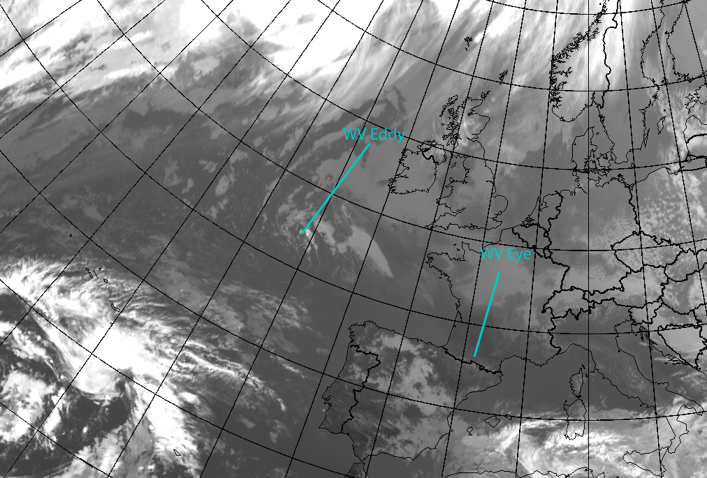
16 February 2008/12.00 UTC - Meteosat 9 WV 6.2 image
|
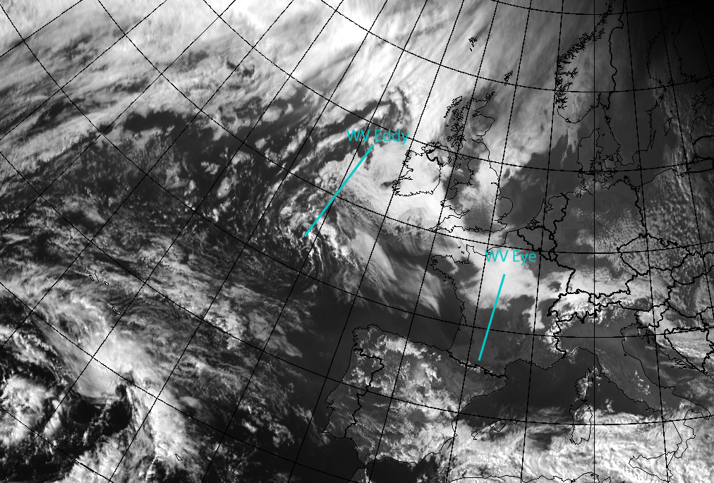
The WV images above show a nearly stationary WV Eddy south-west of Ireland and a WV Eye over the Pyrenees, slowly moving to southeast. The first impression of these vortices is that WV Eddy is clearly larger, whereas WV Eye has only a diameter in the order of a few hundred kilometres. Within the core of the WV Eddy, one can see some bright white spots, which indicate that convection is present.
WV Eyes can develop in series - also in this case one can see even one or two additional small-scale WV Vortices extending from the Bay of Biscay towards the Pyrenees.
In the VIS and IR imagery below, for WV Eddy a little bit of Stratocumulus Sheets can be seen and the convective cells near the Eddy centre can be seen in the VIS channel, but no defined cyclonically rotating cloud band exists. For WV Eye there is no associated cloudiness at all.
|
15 February 2008/15.00 UTC - Meteosat 9 IR 10.8 image
|
15 February 2008/15.00 UTC - Meteosat 9 VIS 0.6 image
|
|
|
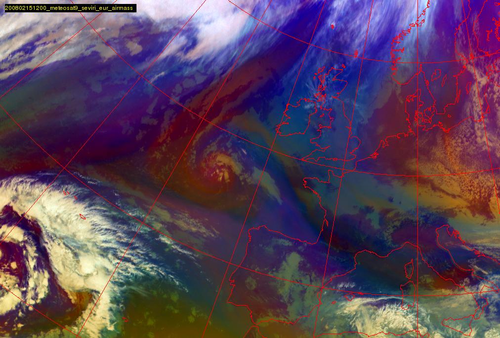
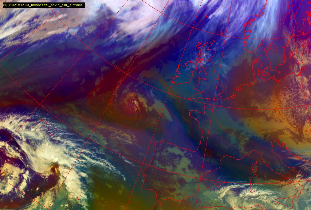
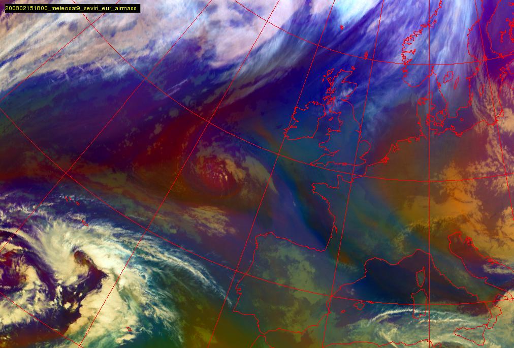
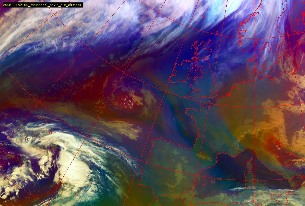
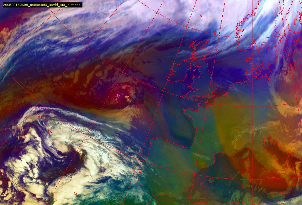
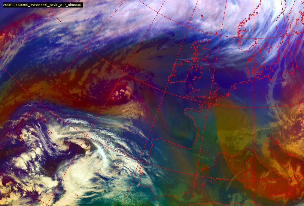
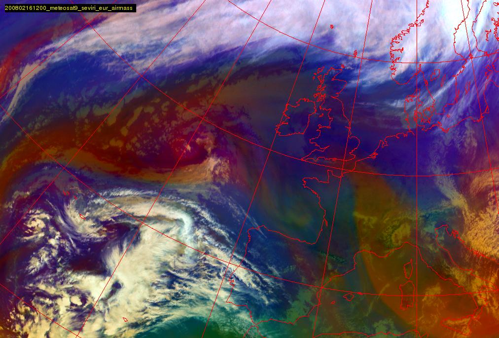
The Airmass RGB loop below shows the development of the WV Eddy and Eye in this situation. The reddish colours indicate dry air at the upper troposphere. For the WV Eddy the red area is large and clear, for the WV Eye in this case the red area is recognisable but much smaller.
|
15 February 2008/12.00 UTC - Meteosat 9 Airmass RGB image; 15 February 2008/12.00 UTC - 16 February 2008/12.00 UTC 3-hourly image
Loop
|
|