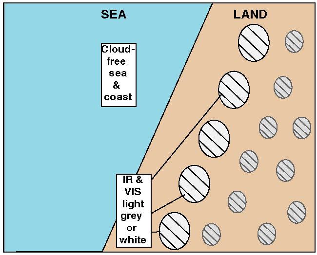
Cloud Structure In Satellite Images
A Sea-Breeze is a thermally driven circulation on the coastlines of sea and large lake areas. It is commonly observed during the spring and summer, when the temperature difference between sea and adjacent land areas is large.
- In satellite images a Sea-Breeze is characterized by a cloud-free area along a coastline of sea and large lake with cumuliform clouds, often present over land.
- The convective clouds, often in a line parallel to the coastline separating the cool and dry maritime air from the warm air over land is called the Sea-Breeze front.
- The detection of the boundary, separating the cloud-free and cumuliform clouds, is possible by using either VIS (cumuliform clouds appear as white pixel values), RGB - combinations like Natural Colour RGB and E-view RGB and IR (white to grey pixel values) channels.
- Water vapour imagery does not generally allow the detection of a Sea-Breeze, but in case with deeper convection the line of convective cells can be distinguished.
- The Sea-Breeze front may appear as an intensifying line of Cu or CB at the leading edge of the Sea-Breeze.
- Low RH in the boundary layer makes it difficult to detect the Sea-Breeze front on satellite imagery. One or two individual CU-clouds with short life time may develop.
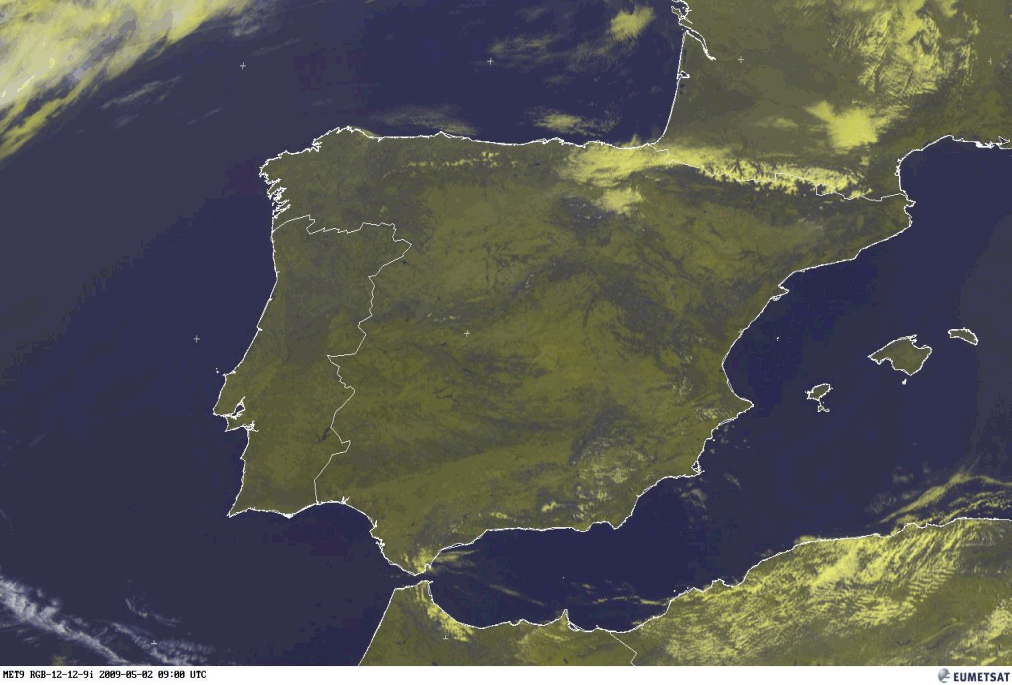
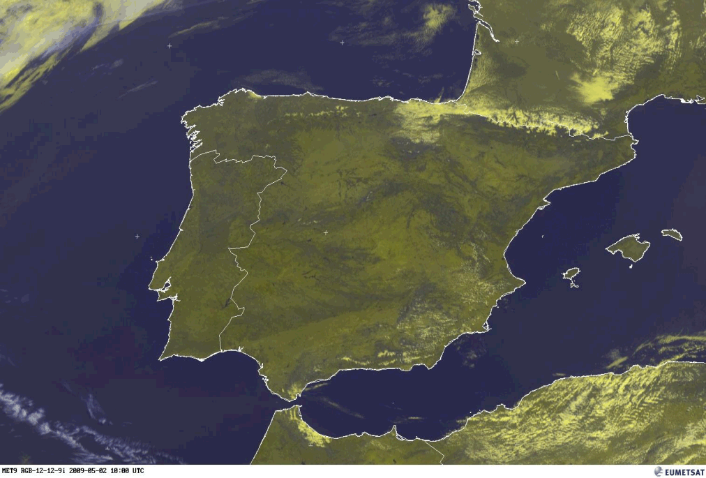
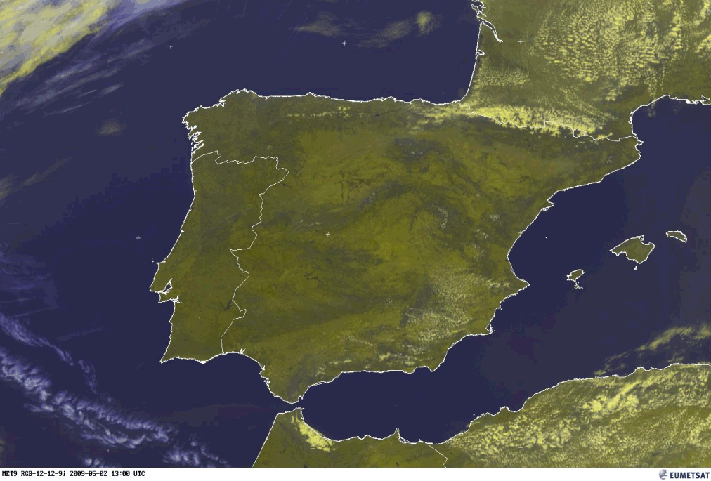
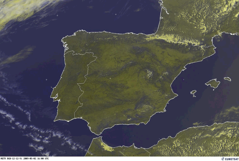
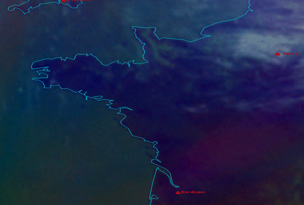
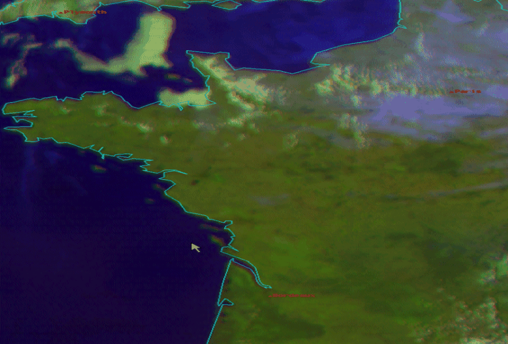
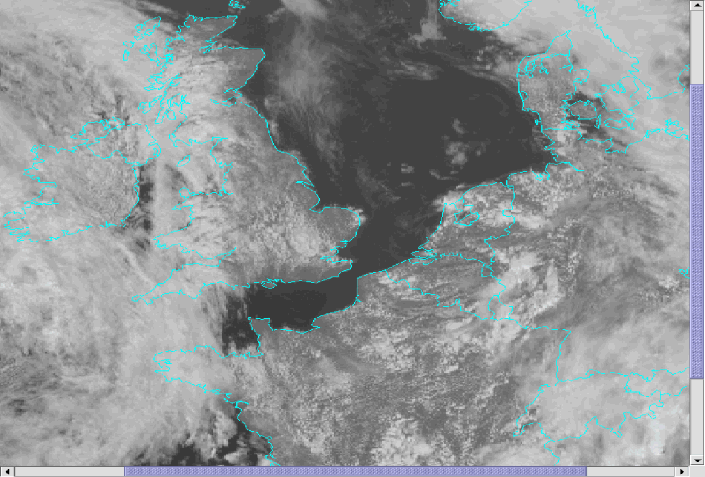
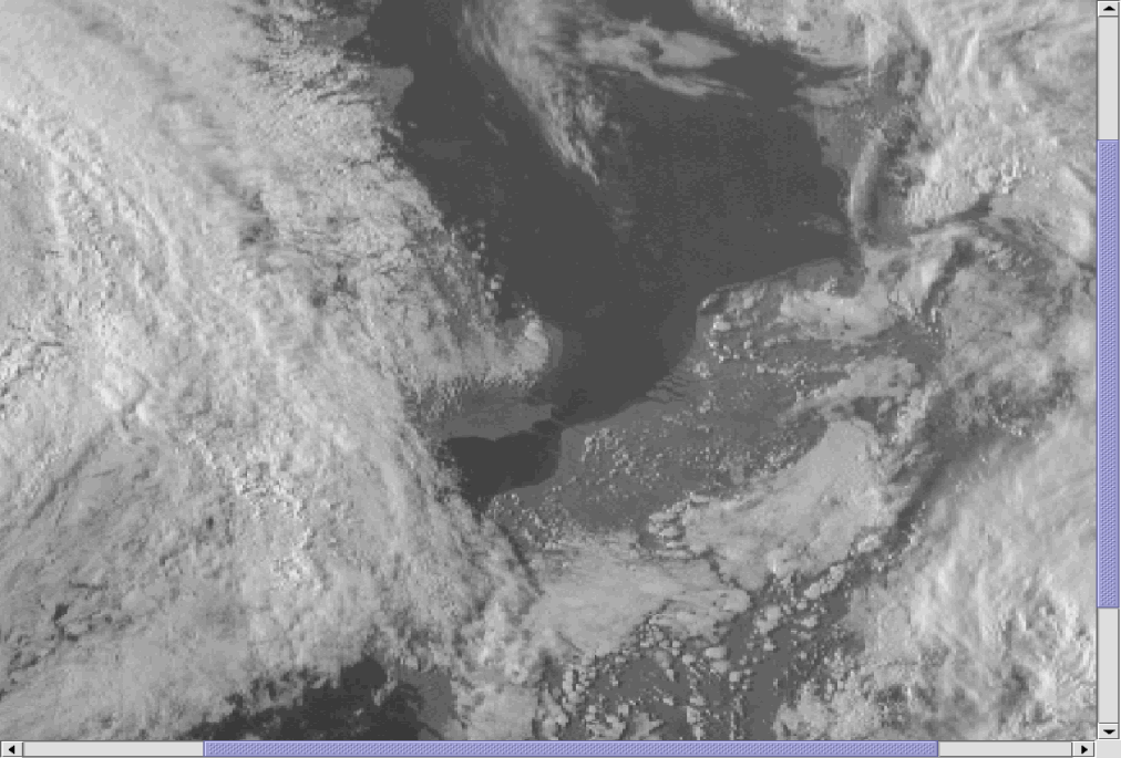
The first example below presents a lifecycle of a Sea-Breeze front in 4 successive images over the southwest coast of France and the southeast coast of Spain. In the E-view RGB (combination of HRV + IR10.8) the developing of the convective clouds can be observed. Especially over SW France the track of the Sea-Breeze front inland and the widening of the cloud free area are easy to detect. The convective clouds of the Sea-Breeze front over southern Spain develop at the southeast side of the mountains inland; the decaying at 16.00 UTC is evident.
|
02 May 2009/09.00 UTC - Meteosat 9 HRV/IR10.8 image
|
02 May 2009/10.00 UTC - Meteosat 9 HRV/IR 10.8 image
|
|
|
|
|
|
02 May 2009/13.00 UTC - Meteosat 9 HRV/IR 10.8 image
|
02 May 2009/16.00 UTC - Meteosat 9 HRV/IR 10.8 image
|
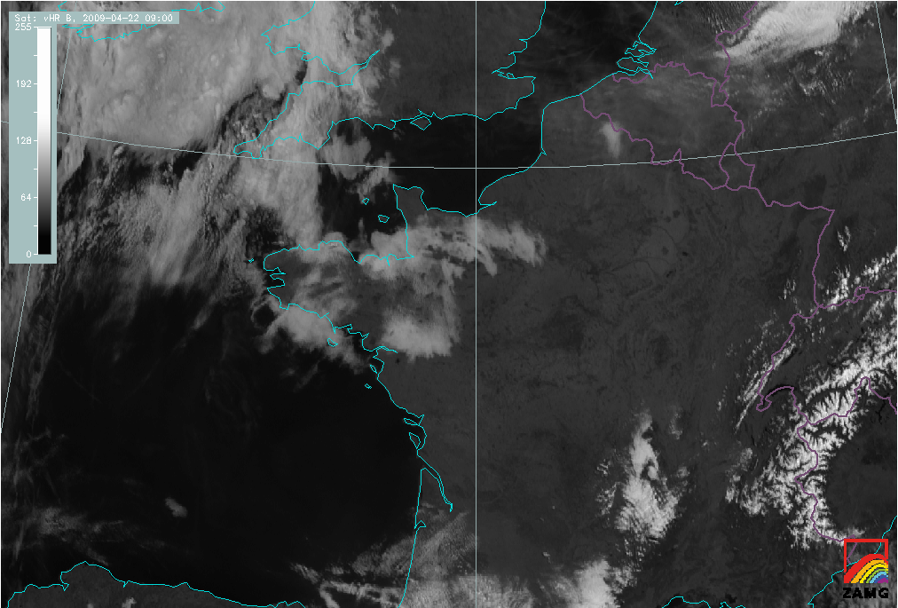
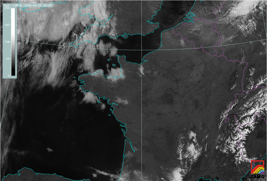
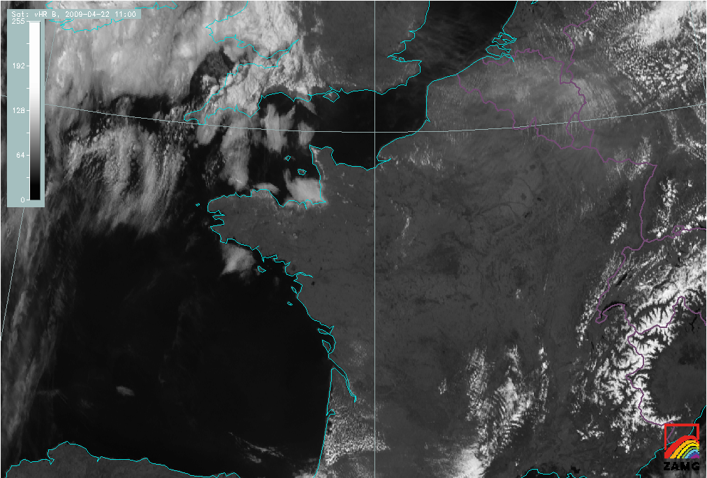
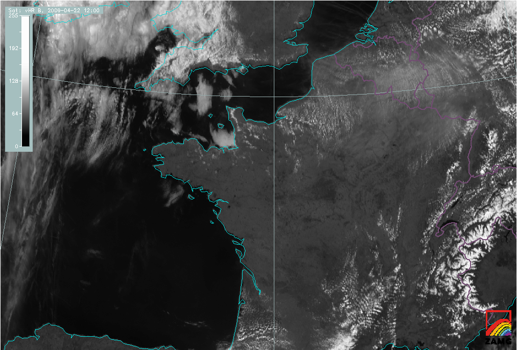
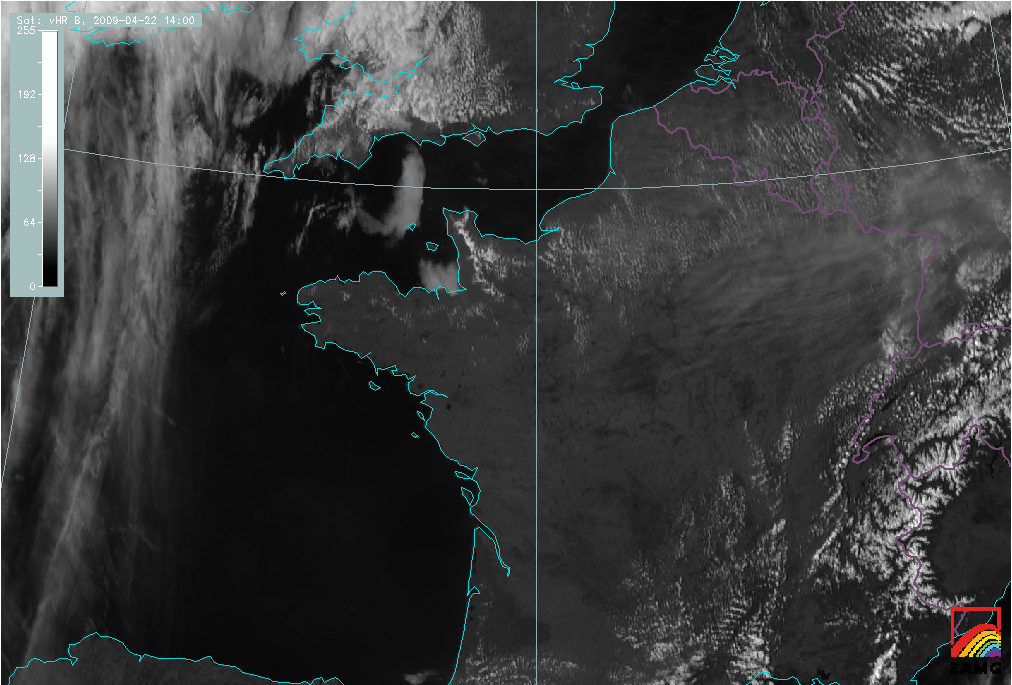
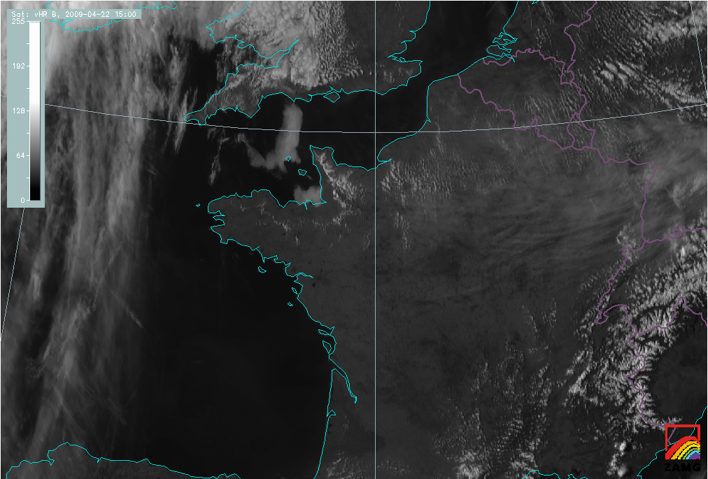
In the VIS image loop below, the development of the Sea-Breeze can be seen as rather rapid growth and spreading of cumulus cloudiness around local noon.
|
22 April 2009/14.00 UTC - Meteosat 9 HRV image
|
22 April 2009/09.00 - 15.00 UTC Meteosat 9 HRV image hourly image Loop
|
|
The images below are examples of the Airmass RGB, to the left, and the combination of a VIS(0.6), NIR(1.6) and IR(10.8) to the right. All channels, used in the Airmass RGB, are not applicable to the shallow convection in the Sea-Breeze front, unless of course in situations where the Sea Breeze front will act as a first trigger to deep convection, associated with upper air features. This is not the case in this example.
|
22 April 2009/14.00 UTC - Meteosat 9 WV6.2/WV7.3/IR 9.7/IR 10.8 (Airmass RGB) image
|
22 April 2009/14.00 UTC - Meteosat 9 0.6/1.6/10.8 image
|
|
|
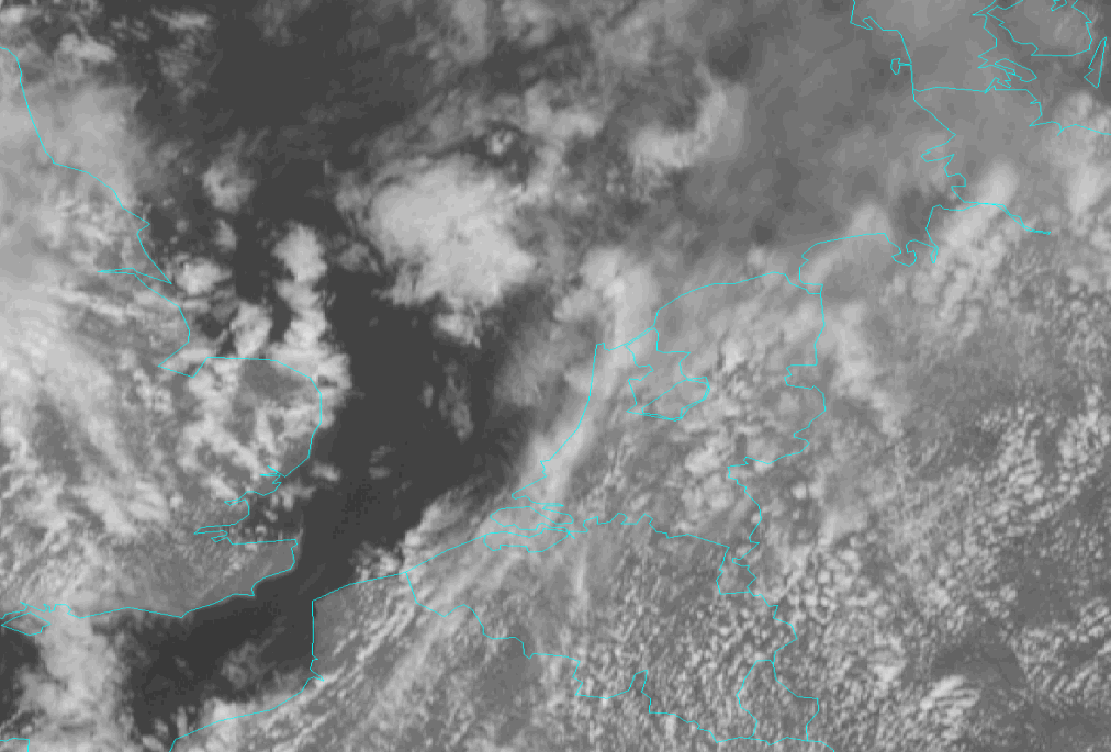
The image on the right hand side is an example of another RGB - combination. The difference in cloud structure between the convective clouds in the Sea-Breeze front over Normandy, the marine low level clouds over the British Channel and the remnants of low level clouds in the coastal districts southwest of Normandy are hardly to detect. Apparently a combination of 0.6 and 1.6 micrometre is not favourite for detection of this kind of different cloud types, but the superadded IR - channel makes it easy to distinguish the high level clouds more to the east over France.
|
19 May 2009/11.45 UTC - Meteosat 9 HRV image
|
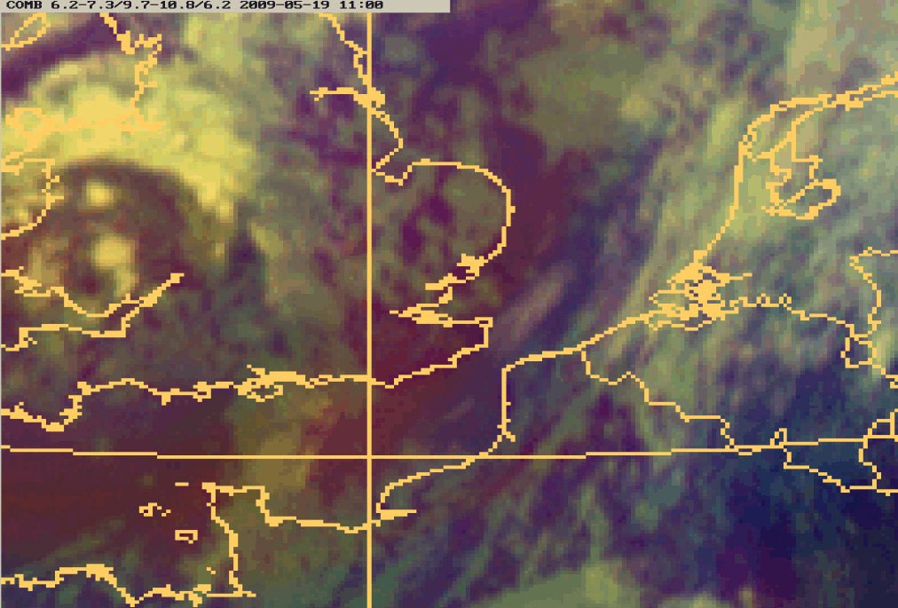
19 May 2009/11.00 UTC - Meteosat 9 (WV6.2-WV7.3)/(IR9.7-IR10.8)/WV6.2 (Airmass RGB) image
|
|
|
A second example on the use of Airmass RGB and HRV is presented in the images above. The bluish colour over the south part of the North Sea, The Netherlands and the north part of France clearly indicates the Sea Breeze development is in the same, polar air mass. Over the United Kingdom and The Channel Islands the bluish colour changes into reddish : dry descending stratospheric air above the original polar air. High level clouds appear as white clouds in the Airmass RGB, the lower convective clouds, associated with the Sea Breeze front well depicted over the north west part of France in the HRV - image right, are hardly recognizable. Unfortunately the high level clouds over the west part of The Netherlands make the identification of the Sea Breeze difficult.
|
19 May 2009/11.00 UTC - Meteosat 9 (WV6.2-WV7.3)/(IR9.7-IR10.8)/WV6.2 (Airmass RGB) image
|
19 May 2009/11.45 UTC - Meteosat 9 HRV image
|
|
|
The images above show an evolution of a Sea-Breeze front over The Netherlands. More information of this specific situation is available in the next chapters.
Appearance in AVHRR images
AVHRR images help to locate the Sea-Breeze more accurately over land because of the better spatial resolution. Even quite small cumulus clouds
can be seen.
The diurnal variation of Sea-Breeze cloudiness and the track of the Sea-Breeze front can be studied by using consecutive AVHRR images.
|
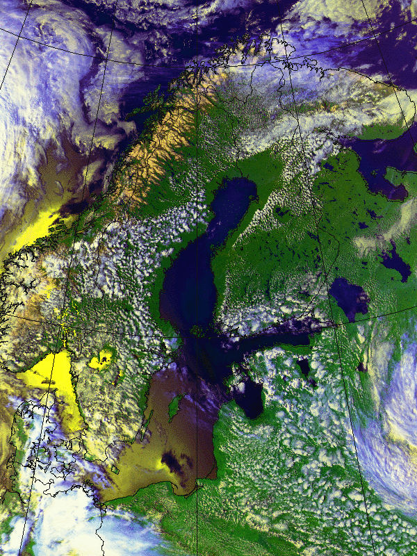
31 May 2001/14.08 UTC - NOAA RGB image (channel 1, 2 and 4)
|
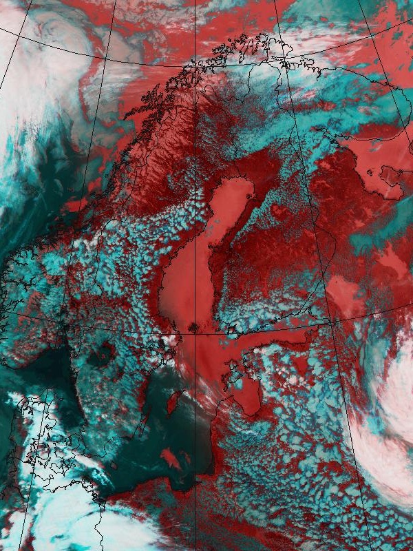
31 May 2001/14.08 UTC - NOAA RGB image (channel 3, 4 and 5)
|
|
|
In the images above the Sea-Breeze on the Scandinavian coasts are the cloud-free areas more or less following the shape of coastline.
Cumuliform cloudiness marking the Sea-Breeze boundary appear as lumps of white - bluish clouds over land.
In western Finland, along the Gulf of Botnia, the convective clouds of the Sea-Breeze front form a line almost parallel to the coast.
The extension of the Sea-Breeze inland, although the RH of the air mass further inland is too low to support any cumulus development, is clear.