Cloud Structure In Satellite Images
Medicanes (from MEDIterranean hurriCANES) are rare (~ 1-2 per year) intense and destructive warm-core cyclones occasionally generated in Mediterranean Basin.
Medicanes appear in three stages. Stage one, or the formation stage, is characterized by rapid intensification of the system and occurs before the formation of a clear eye. In the mature stage the system develops clear cyclonic rotation and a circular eye. The final, decay stage is when the storm loses its strength and structure.
Appearance in the basic channels
When viewed in visible (VIS), infrared (IR) and water vapor (WV) images, we can see that medicanes show several common features on all three channels throughout the three stages (Figure 1).
- In the formation stage CB clusters are generally white in VIS, IR and WV images, which is an indication of clouds that are cold and thick and spread through the whole troposphere. Some lower clouds in IR and WV imagery are grey.
WV6.2 imagery
- One of the most important parameters for medicane development is the atmosphere's water content. It can be observed with the WV6.2 channel, which shows water vapor in the higher layers of the troposphere in shades of grey. The brighter the colors are, the more water vapor is contained within the air. Bright areas show convective development. The dark areas are dry stratospheric air, which is often engaged in the development of a medicane. Dry intrusions are an important mid-latitude atmospheric phenomenon within the upper troposphere and lower stratosphere. It is often found to be related to cyclogenesis, rainstorms, as well as convection generation and precipitation enhancement.
VIS0.6 imagery
- In VIS images even some thicker lower clouds appear white, making these channels the best choice to identify the location of the eye, due to the clear contrast between clouds and the surface.
IR10.8 imagery
- In IR images the grey shades can vary between grey and white. Since it is sensitive to high cirrus clouds with low temperatures, and is good in differentiating lower and higher clouds, it is better than VIS channels for showing the beginning of cyclonic curvature in the convective cloudiness.
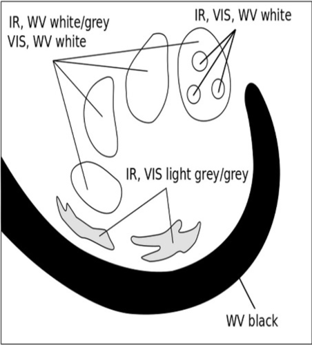
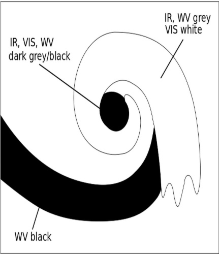
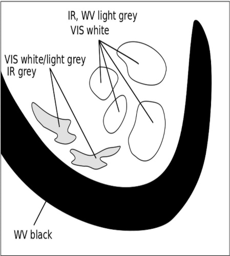
Figure 1: Schematics of the development stages of a medicane as depicted in the SEVIRI channels IR10.8 µm, WV6.2 µm and HR-VIS.
Appearance in standard RGBs
The RGB that exhibits medicane development the best is the Airmass RGB
In this composite, reddish contours indicate dry, sinking, cold, stratospheric air, and show areas with high potential vorticity. Since high PV values are crucial in the generation of vorticity in cyclogenesis, a PV intrusion feeds cyclonic development and the further evolution of the medicane.
In all three stages the presence of a reddish stripe along and at the rear of the cloud band can be observed (Figure 2). In the initial stage there is mostly only a stripe extending from northwest to east. During the development of the system a round area appears in the center of a developing cloud spiral. This development makes the acceleration of the cyclogenesis clearly visible. From the advanced to the mature stage, very intensive dark-brown colors fill the whole area within the spiral.
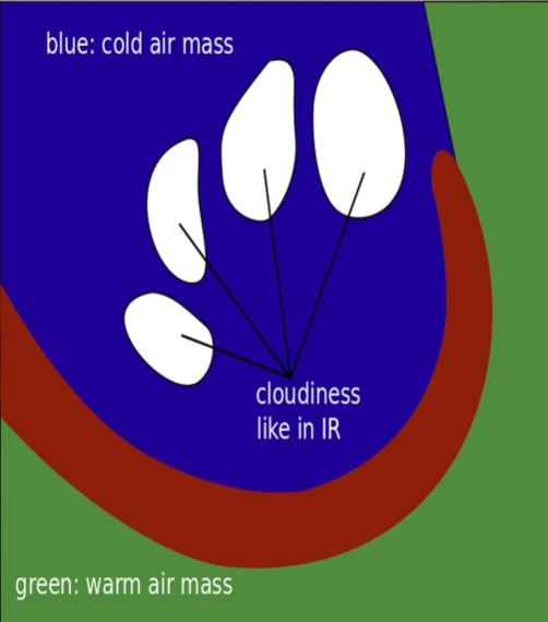
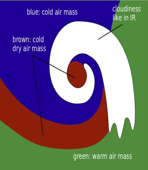
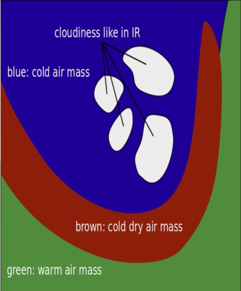
Figure 2: Schematics of the development stages of medicane as depicted in the Airmass RGB.
Formation stage
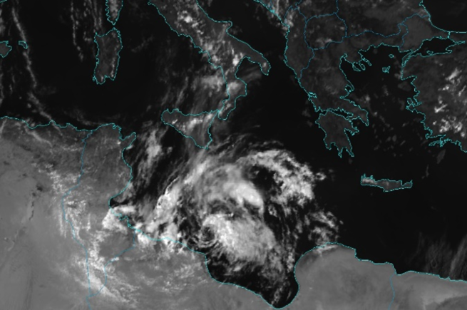
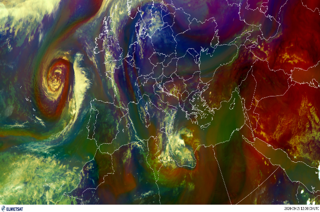
Figure 3: Formation stage in SEVIRI channels IR 10.8 µm, HR-VIS, WV 6.2 µm and airmass RGB. Medicane Ianos (15.9.2020. 12 UTC.)
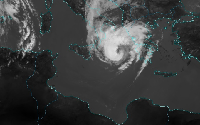
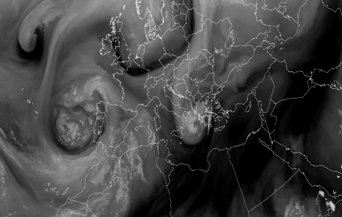
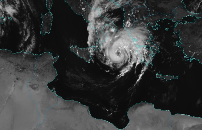
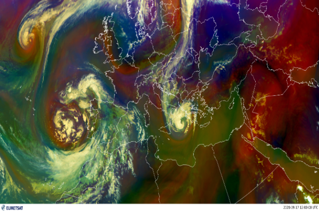
Figure 4: Mature stage in SEVIRI channels IR 10.8 µm, HR-VIS, WV 6.2 µm and airmass RGB. Medicane Ianos 17.9.2020. 12 UTC
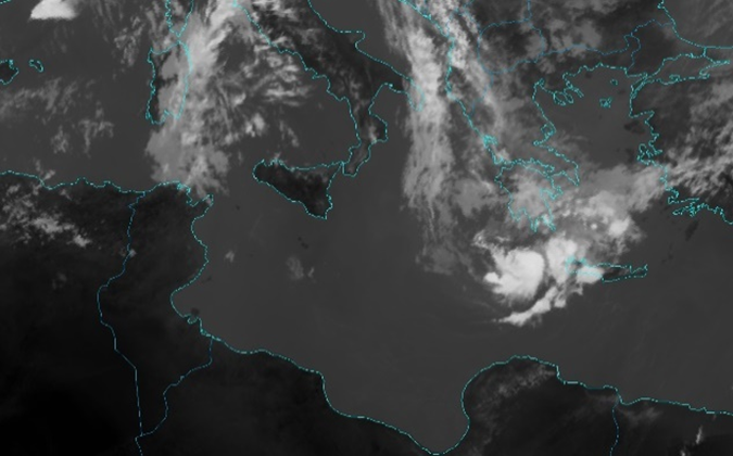
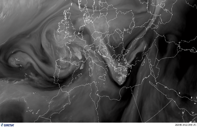
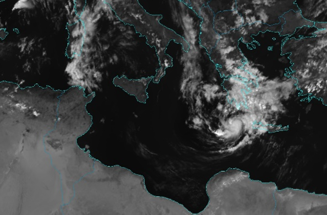
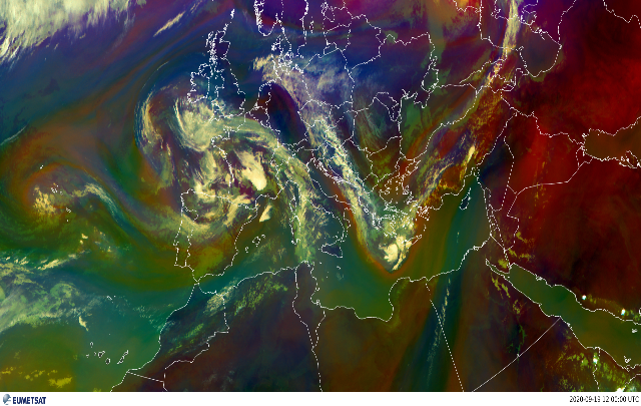
Figure 5: Decay stage in SEVIRI channels IR 10.8 µm, HR-VIS, WV 6.2 µm and airmass RGB. Medicane Ianos (19.9.2020. 12 UTC)
Airmass RGB
South of the system, there is a warm tropical airmass with low clouds, seen in hues of green, a cold airmass found to the north of the system, indicated by shades of blue, while thick high-level clouds are bright white.
The vortex-like appearance of the clouds, a well-defined central region of low pressure, a clear eye-like feature and spiral bands of thunderstorms are all characteristic of medicanes and clearly observed in the mature stage.
Development of water vapour convection, indicated by bright colors, and the dry intrusion from the south side of the system are clearly visible. Consistent with tropical cyclones, water vapor advection around the cyclone center is a crucial factor for the initiation and continuance of precipitation in the formation stage.
VIS0.6
The ring around the medicane's 'eye' in the mature stage has high reflectivity values. The cloud development is strongest on the southern side, where it reaches heights up to 11 km, and weakest on the southeastern side. There is a clear cloud-free area with a diameter of approximately 50 km.
IR
Thin cirrus clouds forming cyclonic curvature southward of the convection are clearly seen in this channel. The cyclonic curvature of cirrus clouds indicates the presence of a low-pressure system and the potential for storm formation. When the cirrus clouds form in a spiral pattern around a low-pressure center, it is a sign that the system is becoming more organized and may develop into a stronger storm.
Additional information can be gained from considering other important products.
IR10.8 color enhanced
The enhanced IR10.8. channel (Figure 6) is especially useful with convective cloud systems. It uses IR images that show cloud top temperatures, with different colors assigned to specific temperature ranges. In this stage the cloud top temperatures reach -60 °C on several occasions, which is usually related to deep convective clouds and probability of lightning. During the second stage the cloud tops near the center of the cyclone again break the tropopause barrier, which can be seen from the values of the IR brightness temperature differences being negative, or at best barely positive.
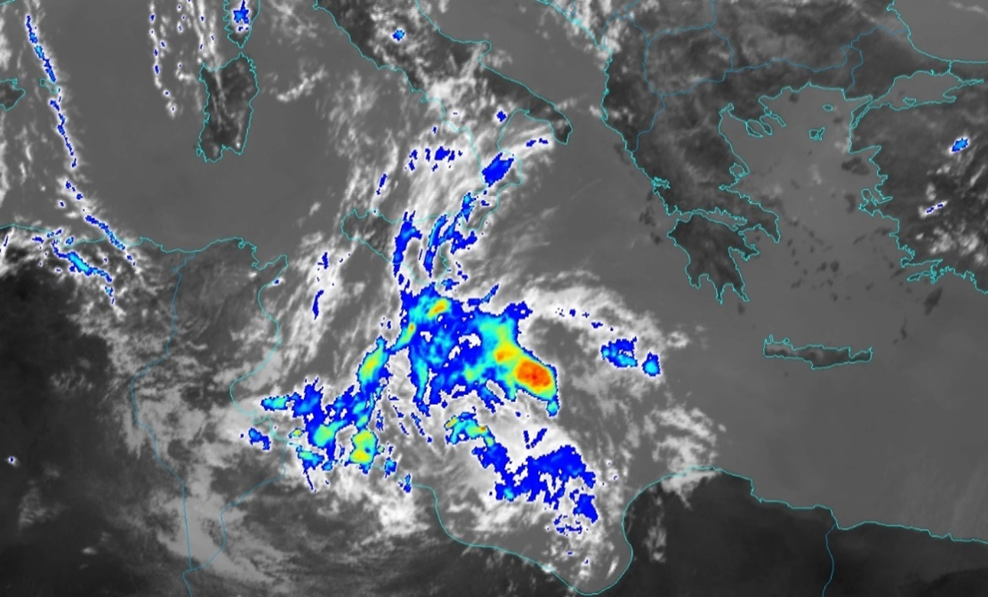
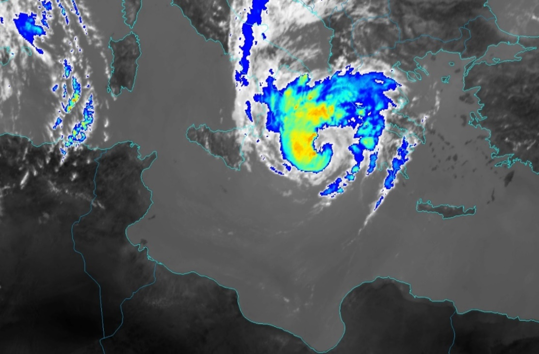
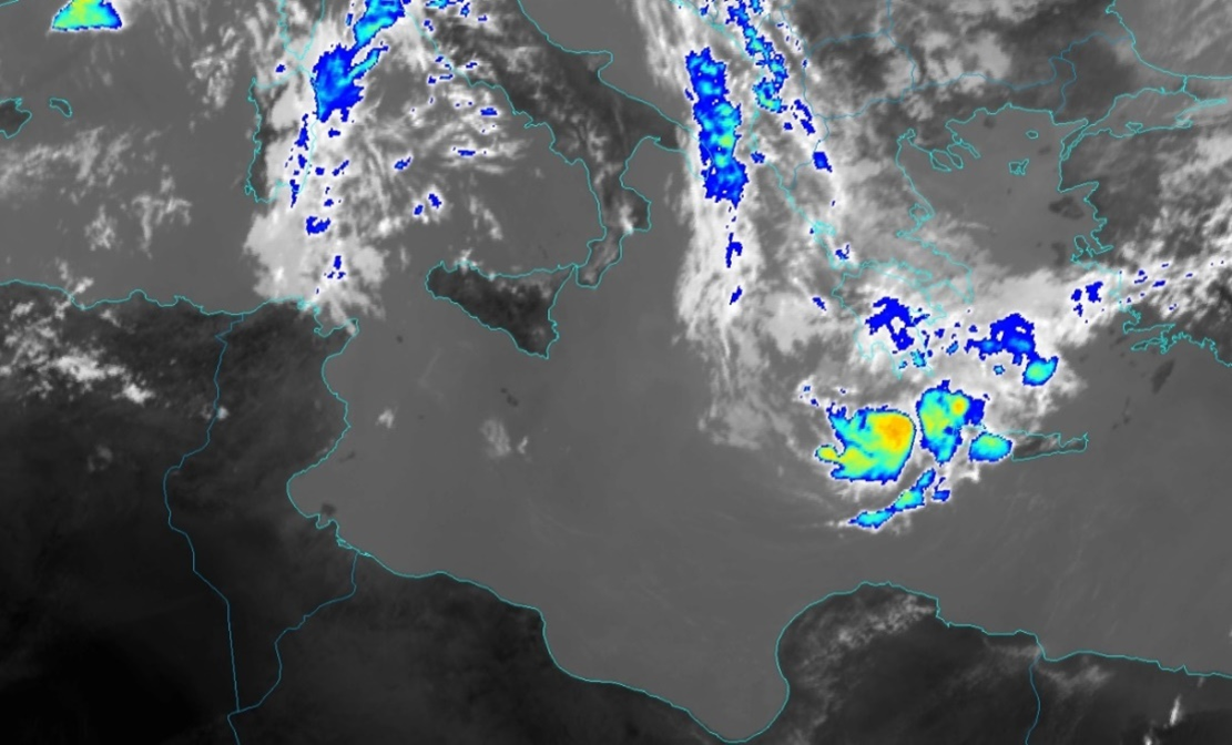
Figure 6: Formation, mature and decay stage in the enhanced IR 10.8 µm channel. Medicane Ianos (15., 17., and 19.9.2020. 12 UTC)
Severe storm
Since the formation stage is best characterized by development of strong convective cloudiness and precipitation it is also useful to examine the Severe Storm RGB. Highest convective activity can be seen during the formation stage. At that time Ianos had not yet lost its extratropical characteristics, but was characterized by high convective activity on the western side of the cyclone center which is indicated by bright yellow spots that indicate thick ice cloud with small ice crystals on the top. Convection in the mature stage is, as expected, weaker than previously. It remains strongest on the western side of the medicane.
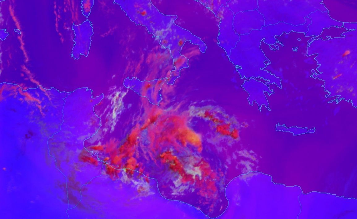
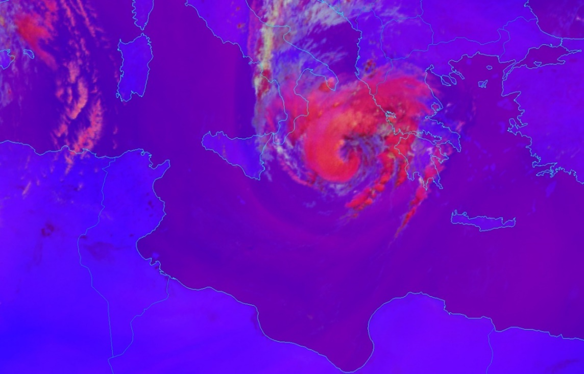
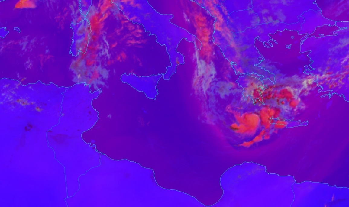
Figure 7: Formation, mature and decay stage in the severe storm RGB. Medicane Ianos (15., 17., and 19.9.2020. 12 UTC)