Weather Events
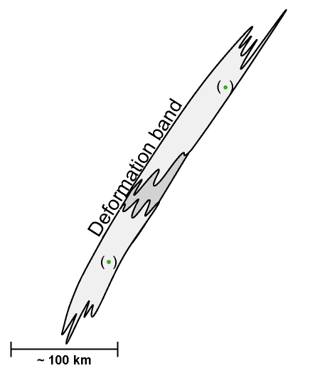
A Deformation Band occurs when there is deformation of the cloudiness at middle or upper levels in the troposphere. There are no surface weather features associated with a Deformation Band. The example below shows a Deformation Band over Western Europe.
| Parameter | Description |
| Precipitation |
|
| Temperature |
|
| Wind (incl. gusts) |
|
| Other relevant information |
|
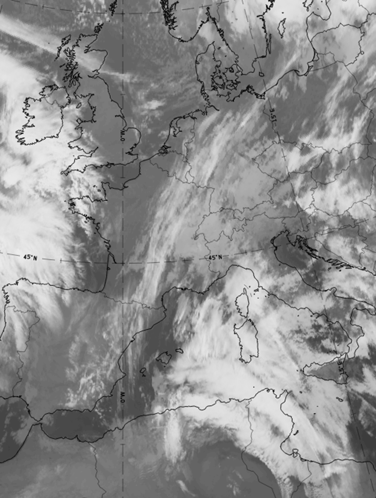
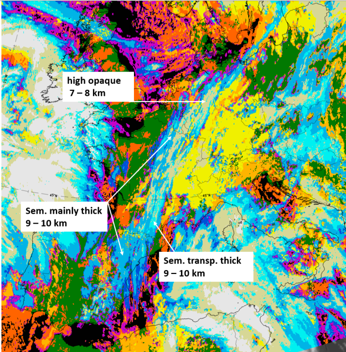
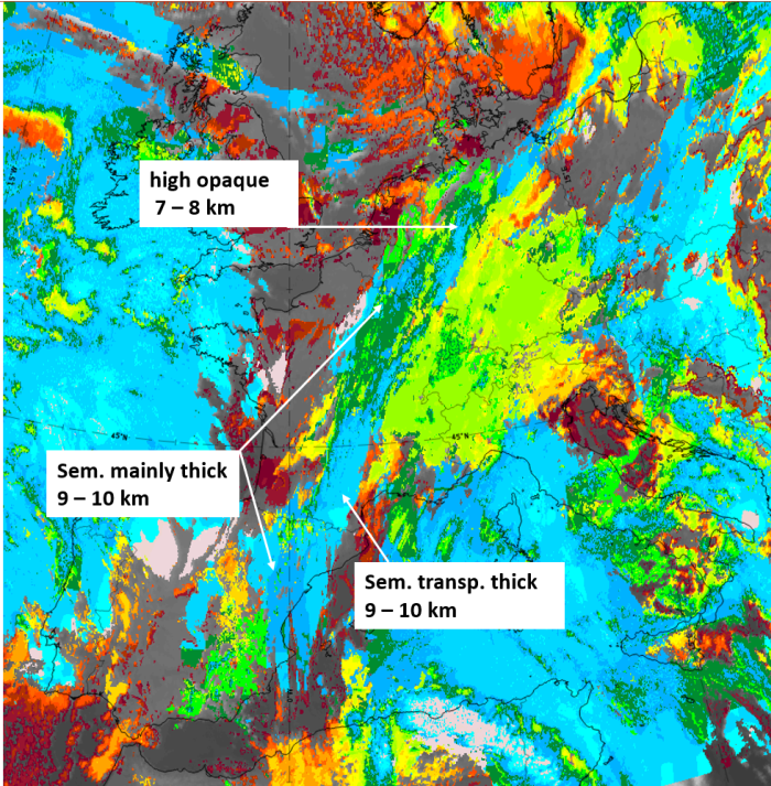
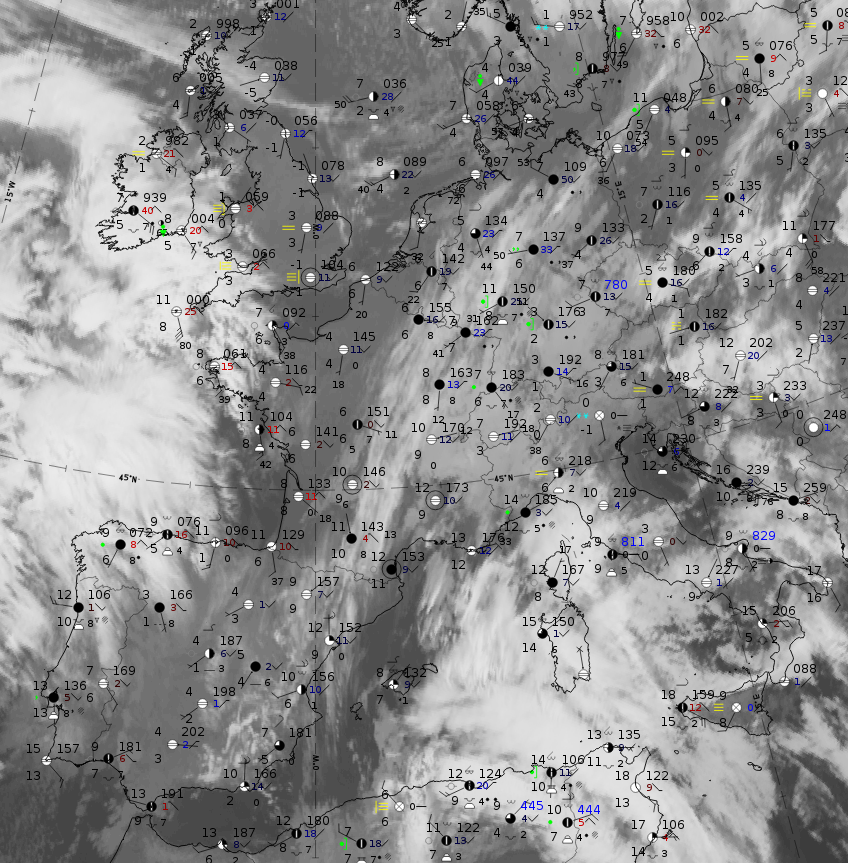
To demonstrate the typical weather features, a case from 18 December 2019 at 06 UTC has been chosen. A deformation band stretches from the Pyrenees northward to northern Germany and southward into the Mediterranean.
 |
 |
|
|
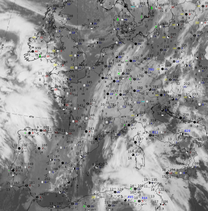
18 December 2019, 06UTC: IR + synoptic measurements (above) + probability of moderate rain (Precipitting clouds PC - NWCSAF).
Note: for a larger SYNOP image click this link.
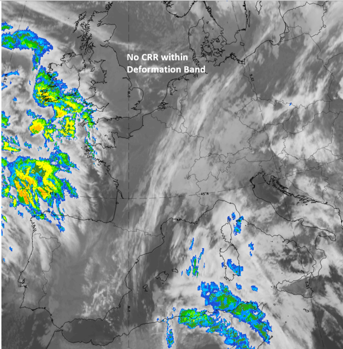
There are no precipitation reports within the deformation band and the probability of rain is lower than 15 %.
|
|
|
|
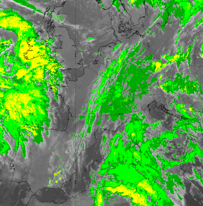
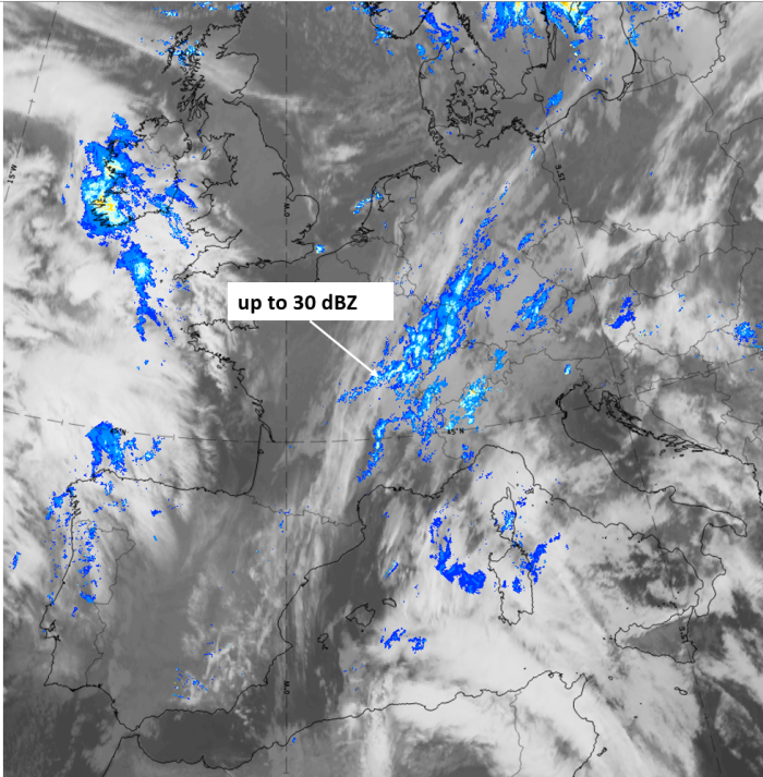
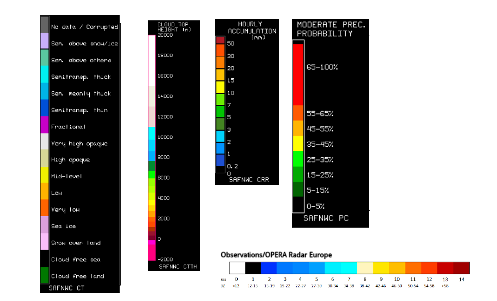
18 December 2019, 06 UTC, IR; superimposed:
1st row: Cloud Type (CT NWCSAF) (above) + Cloud Top Height (CTTH - NWCSAF) (below); 2nd row: Convective Rainfall Rate (CRR NWCSAF) (above) + Radar intensities from Opera radar system (below).
For identifying values for Cloud type (CT), Cloud type height (CTTH), precipitating clouds (PC), and Opera radar for any pixel in the images look into the legends. (link)