Dark Stripes and extreme Weather Events
In WV imagery, convection is sometimes considerably enhanced just ahead of narrow elongated Black Stripes. Heavy thunderstorms can develop in this area in the case where there is a warm and moist lower troposphere.
When there is high windspeed in the lower part of the troposphere, strong gusts can be observed in the transition area from light to dark WV image values. This is the area were potential instability is at his highest levels in the area of the front (Cold Front or Occlusion).
Frontal convergence causes strong negative omega anomalies. This is a trigger for convection and the resulting mixing of wind from higher levels in the troposphere.
|
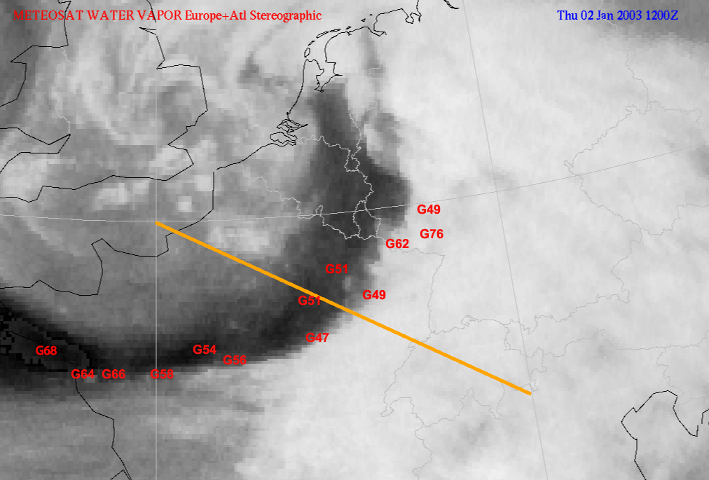
02 January 2003/12.00 UTC - Meteosat WV image; red: highest wind gusts in knots (11 - 12 UTC), position of vertical cross section
indicated
|
|
|
|
|
|
|
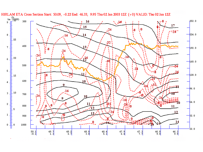
02 January 2003/06.00 UTC - Vertical cross section; black: isentropes (ThetaW), red: vertical motion (omega), orange: WV pixel
values
|
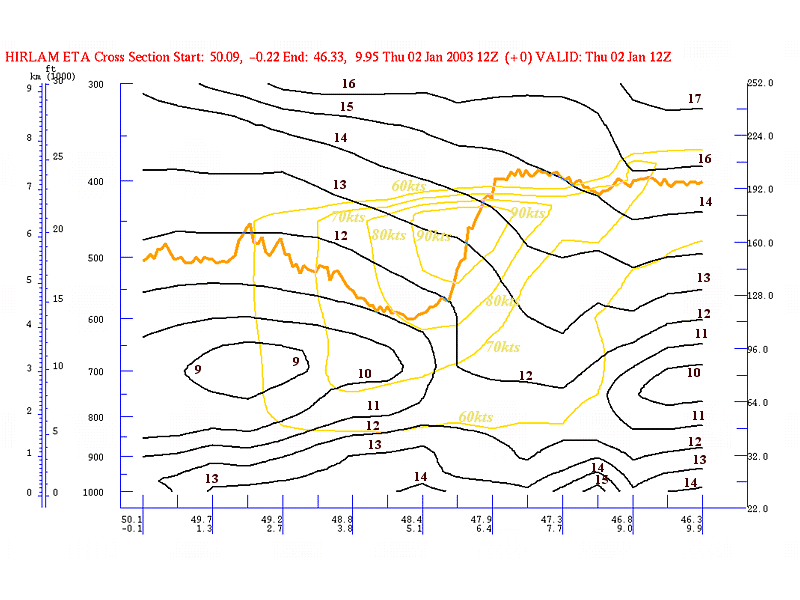
02 January 2003/06.00 UTC - Vertical cross section; black: isentropes (ThetaW), yellow: isotachs, orange: WV pixel values
|
The Cold Front over Southern Germany and France has a Kata - or even a Split Front character.
The sharp gradient from white to black in the WV image corresponds to the area of a distinct omega minimum and also an area were the potential instability is high (ThetaW values are decreasing up to 700 hPa). This is also the area were high wind speed values can be found low in the atmosphere (e.g. 60 kts below 800 hPa)
|
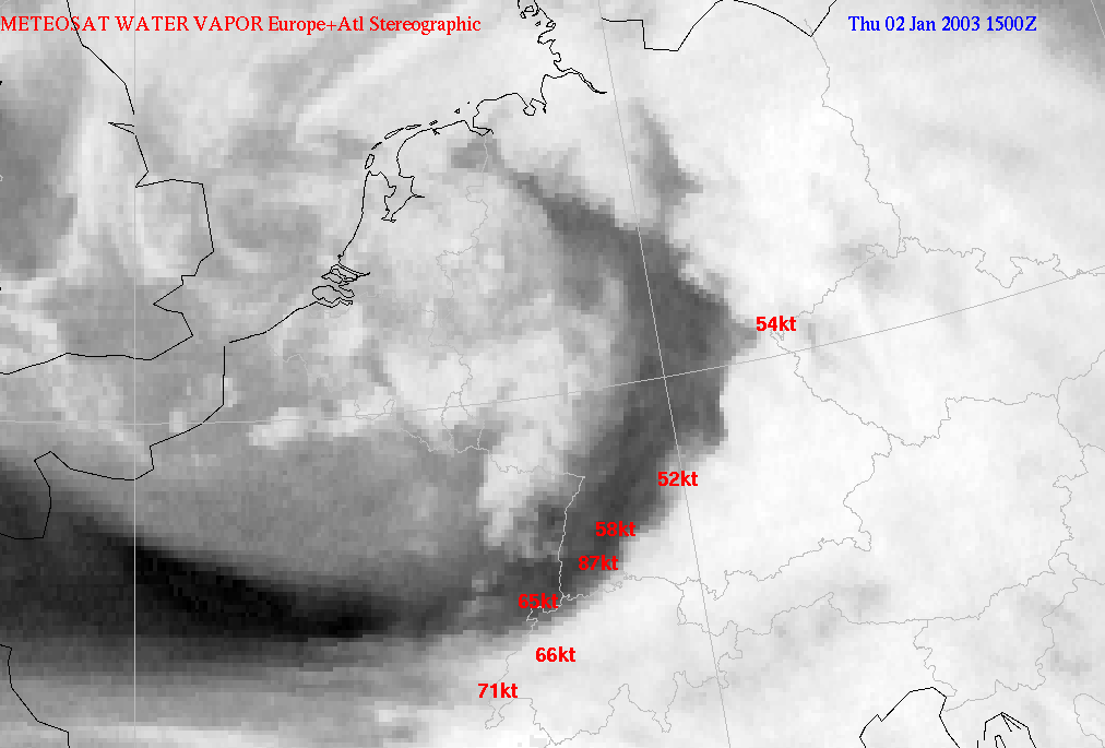
02 January 2003/15.00 UTC - Meteosat WV image; red: highest wind gusts in knots (14 - 15 UTC)
|
|
|