Weather Events
The Convergence Cloudiness CM represents a quasi-frontal situation, in effect, attached to the end of an occlusion. Therefore weather events are frontal in character.
| Parameter | Description |
| Precipitation |
|
| Temperature |
|
| Wind (incl. gusts) |
|
| Other relevant information | None |
As the first case of 22 May 2020 represents type1, but unfortunately it exists completely over the ocean. The second case of 30 May 2020 represents type 2 and is chosen for demonstrating the weather typically associated with Convergence Clouds features.
|
|
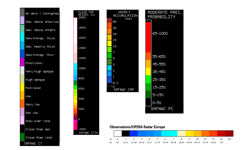
Legend:
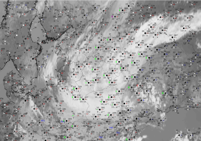
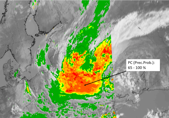
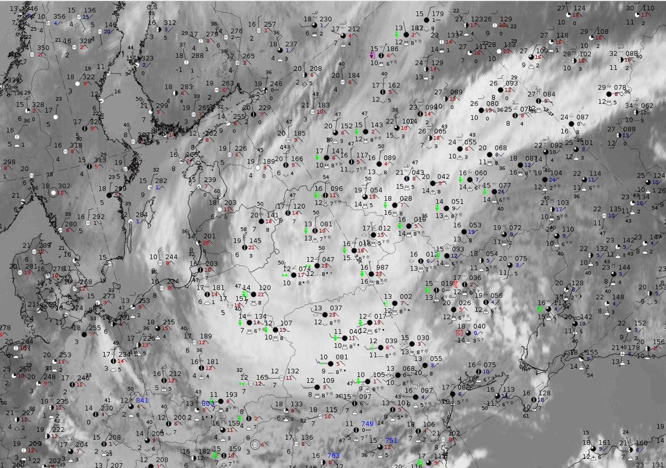
30 May 2020 at 12UTC: IR + synoptic measurements (above) + probability of moderate rain (Precipitting clouds PC - NWCSAF).
Note: for a larger SYNOP image click this link.
In all three cloud systems there are wide spread precipitation reports and most of them are in shower form. This is in agreement with the observation that Convergence Clouds are active in respect to precipitation, but contradicts the statement that convective observations are rather unlikely. These observations are further supported by the high probabilities in the NWCSAF PC parameter (precipitating clouds) which indicates that precipitation not in shower form. The region of convergence clouds shows up clearly with very high (up to 100%) probabilities of rain.
|
|
|
|
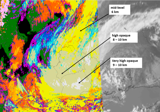
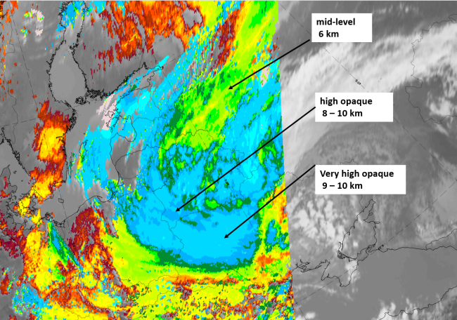
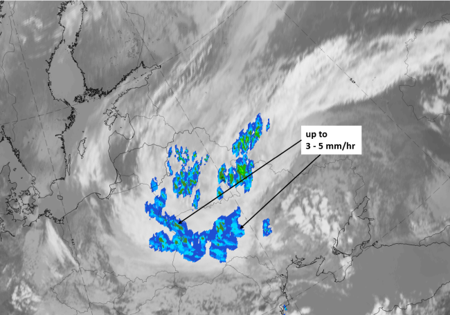
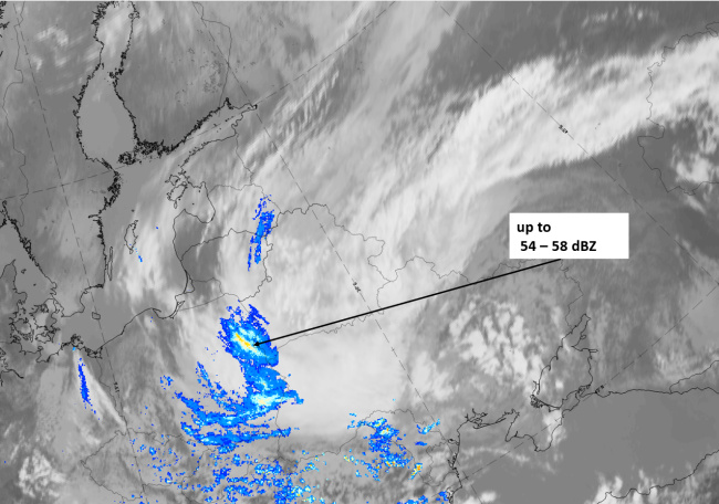
Legend:
30 May 2020 at 12 UTC, IR; with the following fields superimposed:
1st row: Cloud Type (CT NWCSAF) (above) + Cloud Top Height (CTTH - NWCSAF) (below); 2nd row: Convective Rainfall Rate (CRR NWCSAF) (above) + Radar intensities from Opera radar system (below).
For identifying values for Cloud type (CT), Cloud type height (CTTH), precipitating clouds (PC), and Opera radar for any pixel in the images look into the legends. (link)