Cloud Structure In Satellite Images
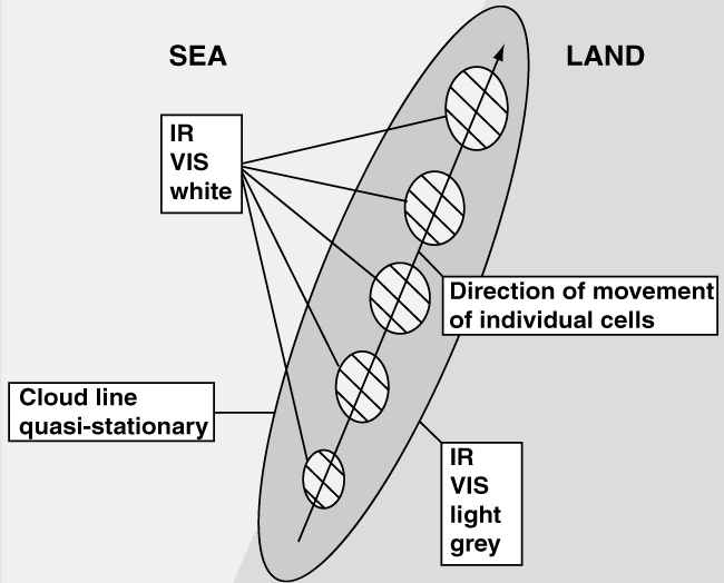
- Coastal Convergence clouds generally appear as of elongated, relatively narrow cloud lines or bands oriented approximately parallel to the coastline.
- Cloud lines can be located either slightly offshore or onshore depending on the wind flow across the coastline.
- Cloud lines are mostly convective in nature, with individual cells often travelling along the coast with the gradient wind, but the whole cloud band appears quasi-stationary for a relatively long period of time.
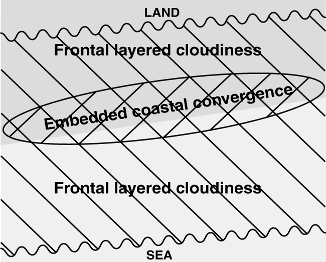
- The enhancement of cloudiness by Coastal Convergence may at times be difficult to detect if embedded in larger-scale frontal cloud systems.
|
|
|
|
|
|
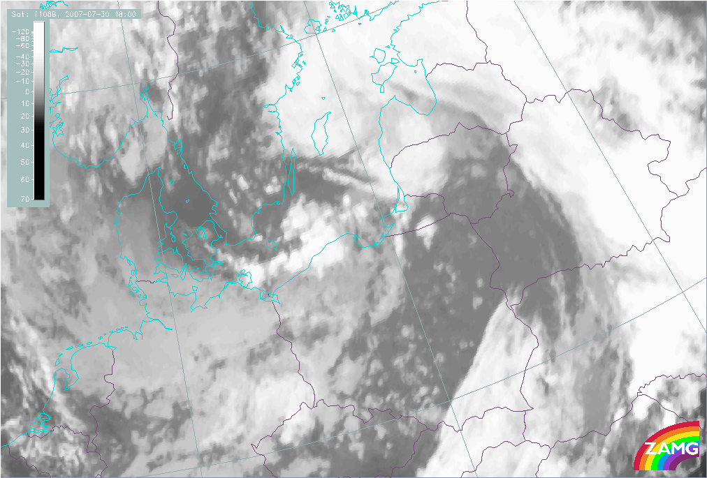
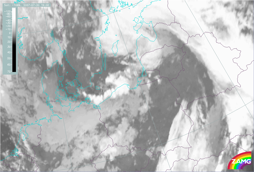
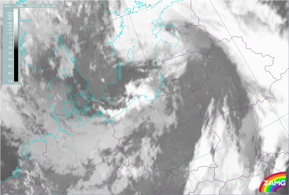
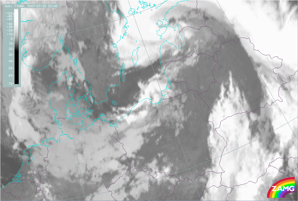
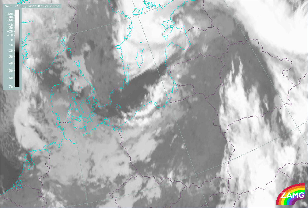
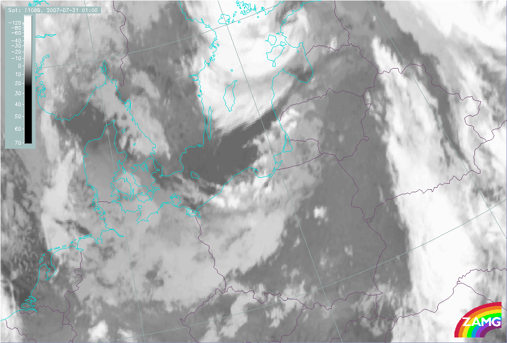
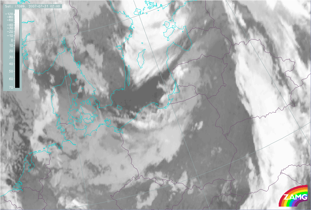
30 July 2007/18.00 UTC - Meteosat 9 IR10.8 image; 30/18.00 UTC - 31/03.00 UTC hourly image loop
|
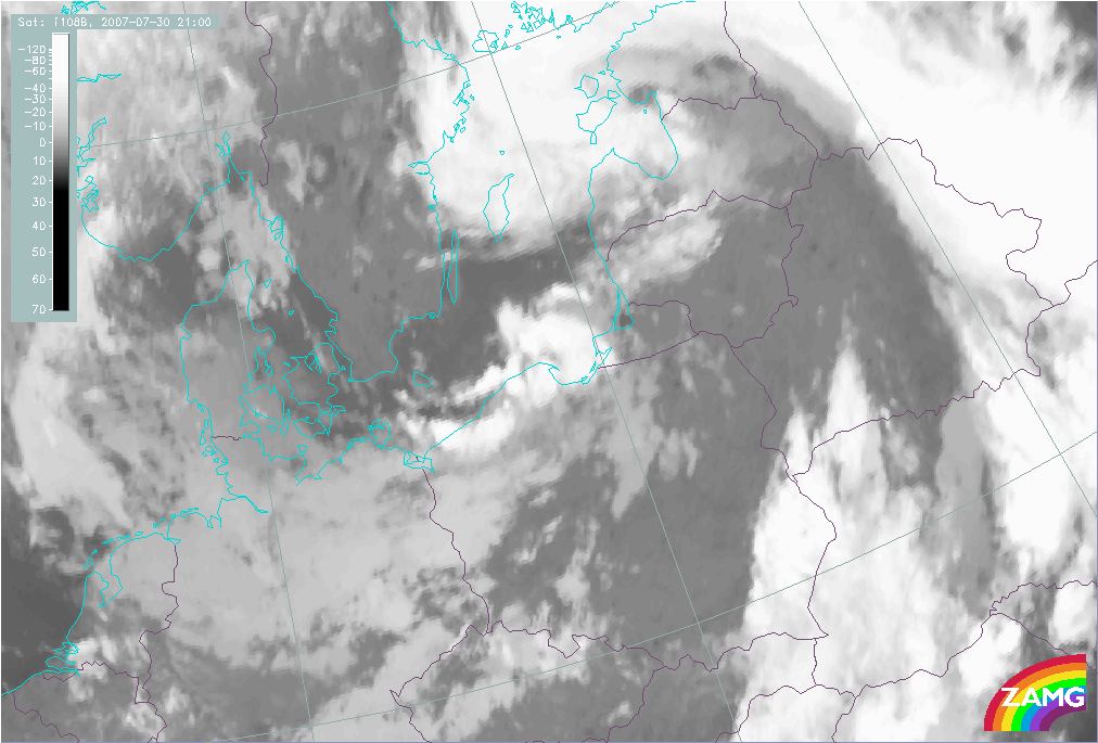
30 July 2007/21.00 UTC - Meteosat 9 IR10.8 image
|
|
|
|
|
|
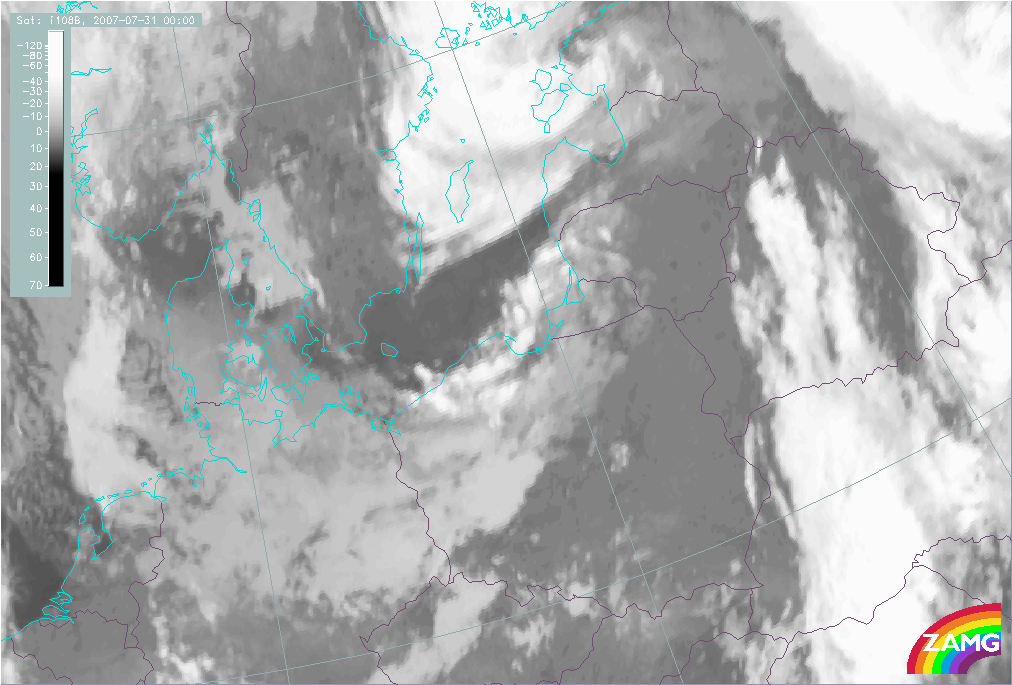
31 July 2007/00.00 UTC - Meteosat 9 IR10.8 image
|
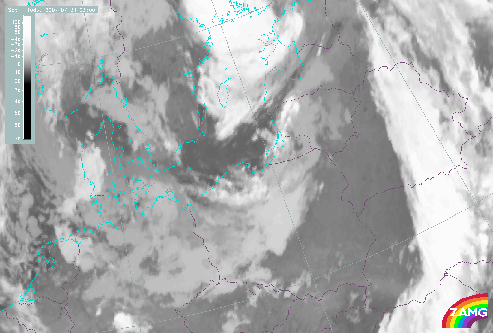
31 July 2007/03.00 UTC - Meteosat 9 IR10.8 image
|
The IR images above show a case of Coastal Convergence along the coast of Poland, Kaliningrad and Lithuania. The cloud band is clearly parallel to the coastline. During the night between 30 and 31 July 2007 the cloud band remains almost stationary, but individual cells can be seen moving within the cloud band from west-southwest to east-northeast. The cells are characterized by higher pixel values indicating higher (cold) cloud tops.