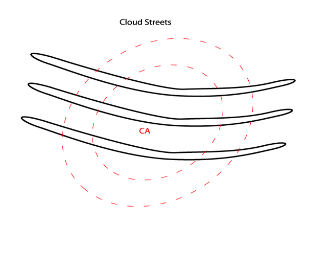
Key Parameters
- Surface Wind
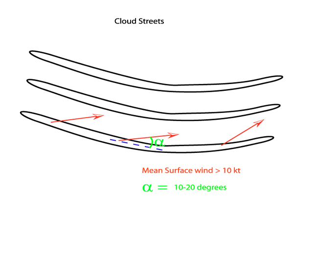
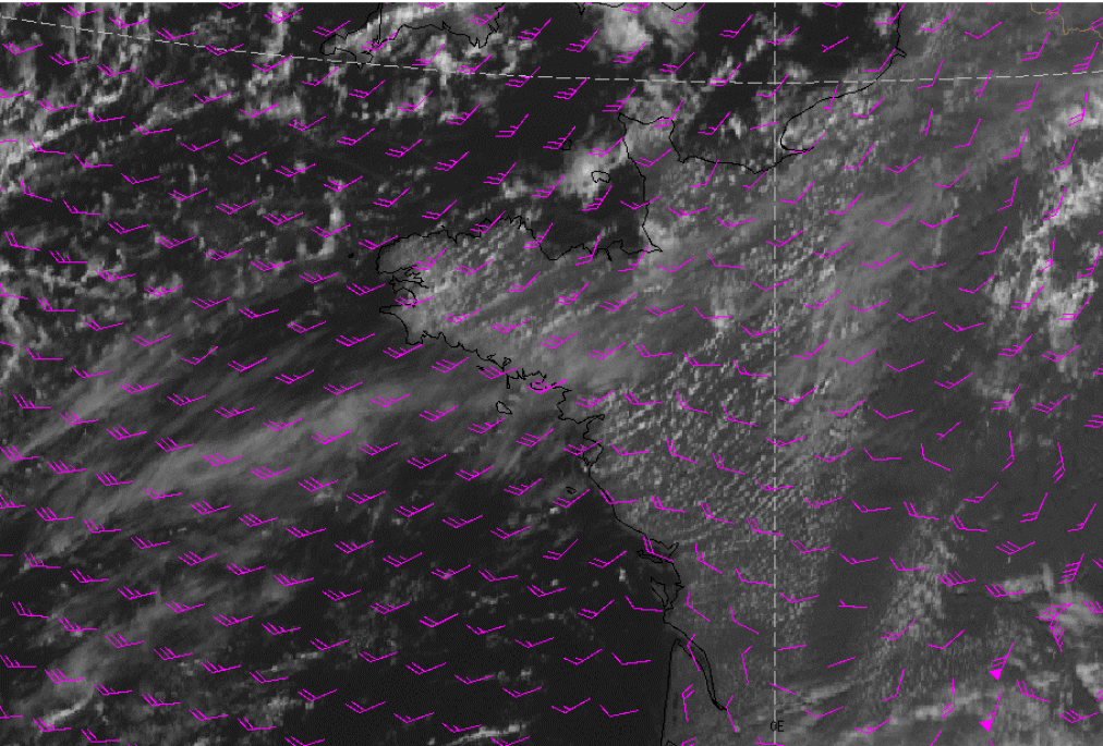
Surface winds have to be moderate to strong, in all cases the surface winds are between 10-20 kt. Furthermore, the surface wind is aligned with the left hand side of the Cloud Streets. - Height Contours 1000 hPa/Geostrophic wind
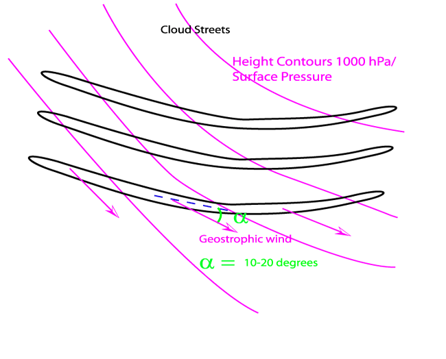
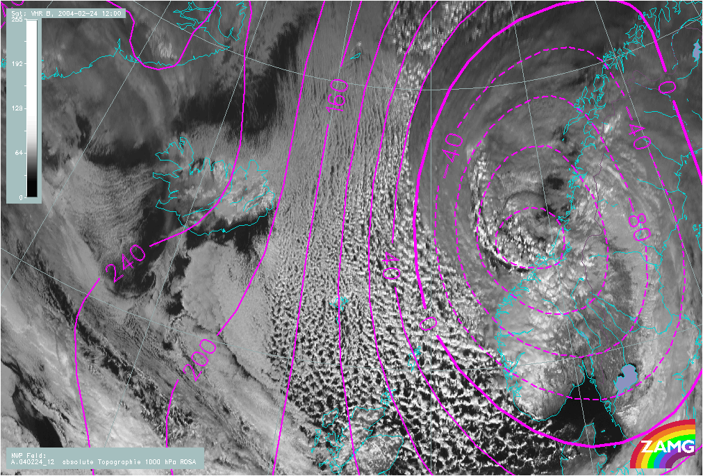
The geostrophic wind is usually aligned with the right hand side of the Cloud Streets, this can also be shown by the height contours at 1000 hPa because the geostrophic wind is orientated parallel to the height contours. - Instability/laps rate
In the layer in which the Cloud Streets form the whole profile has an unstable character - Height of the Unstable Layer
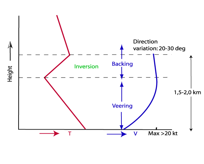
Generally, the depth of the unstable layer has a height of 1.5-2.0 km, and is usually capped by a sharp inversion. The best way to identify this is by using radiosonde plots. - Wind profile in unstable layer
The wind direction often shows a curved profile: in the lowest part of the unstable layer the winds are veering, from the mid-level the winds are backing again. The variation in direction is, however, not very large and usually the winds in the unstable layer vary no more than 20-30 degrees. The wind speed should increase with height to a maximum of at least 20 kt in the middle or upper part of the convection layer. Above these levels the wind may decrease or increase. Numerical prediction models do not represent this small scale variation of the wind well because of their coarser resolution. - Temperature Advection 1000/850 hPa
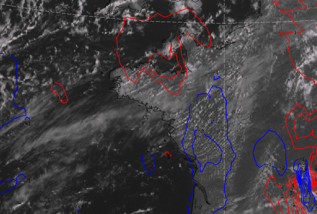
Cloud Streets usually develop under slight cold advection, which often occurs to the rear of a Cold Front. Usually the advection shows a maximum near the middle of the unstable layer. - Height Contours
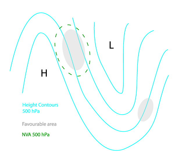
Usually the height contours are rather straight or slightly anticyclonically curved. In cases over the sea, the most developed and extensive area of Cloud Streets are located upstream from the upper-level trough. - NVA 500 hPa
In most cases, because of the influence of a building or approaching upper ridge, NVA is found.
Surface Wind
|
|
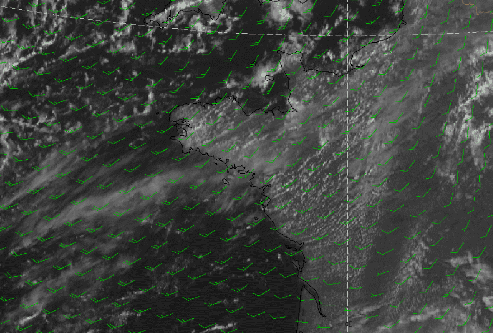
23 August 2004/21.00 UTC - Meteosat Hires VIS image; green: surface wind
|
|
|
|
|
|
|
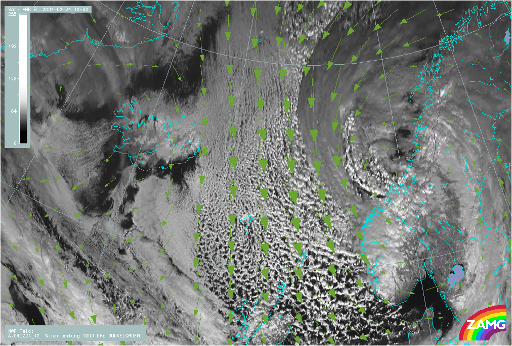
24 February 2004/12.00 UTC - Meteosat 8 Hires VIS image; green: surface wind
|
|
|
23 August 2004/12.00 UTC - Meteosat 8 Hires VIS image; magenta: geostrophic wind
|
|
|
|
|
|
|
24 February 2004/12.00 UTC - Meteosat 8 Hires VIS image; magenta: Height Contours 1000 hPa
|
|
|
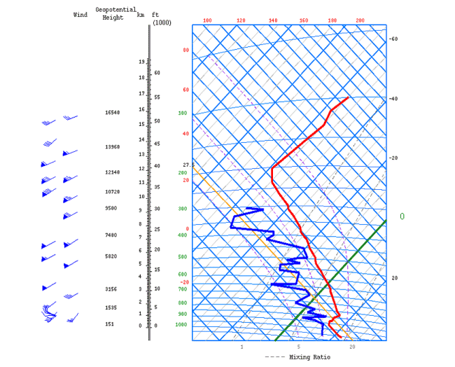
23 August /12.00 UTC - Tephigram Bordeaux
|
|
|
| Height (hPa) | Wind direction (Deg) | Wind speed (kt) |
| 1012 | 285 | 10 |
| 1000 | 295 | 11 |
| 925 | 300 | 12 |
| 910 | 290 | 13 |
| 890 | 265 | 20 |
| 850 | 220 | 25 |
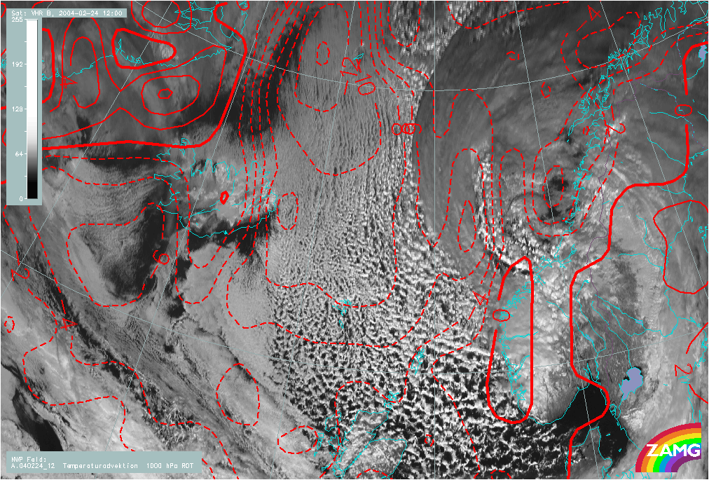
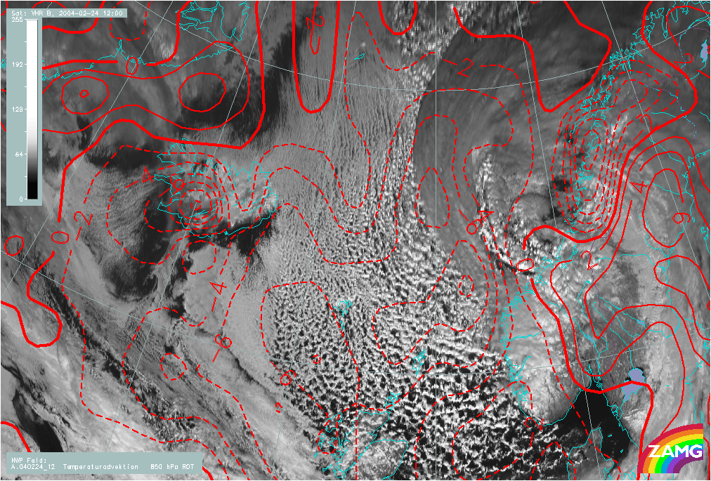
Temperature Advection 1000/850 hPa
|
|
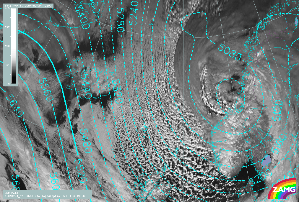
24 February 2004/12.00 UTC - Meteosat 8 Hires VIS image; blue: Height Contours 500 hPa
|
|
|
|
|
Height Contours and NVA
|
|
23 August 2004/12.00 UTC - Meteosat 8 Hires VIS image; blue: Negative temperature advection 1000-500 hPa
|
|
|
|
|
|
|
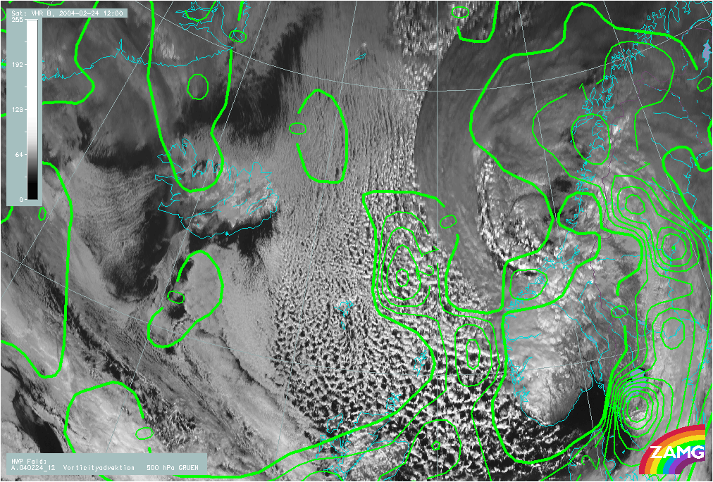
24 February 2004/12.00 UTC - Meteosat 8 Hires VIS image; green: PVA
|