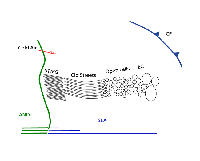
Cloud Structure In Satellite Images
Cold Air Cloudiness is the result of mesoscale shallow convection (1-2 km deep) and has distinctive appearances: Linear and Hexagonal. The
former is called Cloud Streets, which will be discussed more deeply and can be roughly regarded as 2-dimensional convection. The latter,
generally called in the literature Mesoscale Cellular Convection, is characterized by 3-dimensional convection which can be divided in two
types: Open and Closed Cells.
A distinct life-cycle can be seen from Stratus/Sea-Fog to Cloud Streets, especially over sea surfaces during Cold Air Outbreaks from
neighbouring continents, most frequently ending up as Open Cells.
|
|
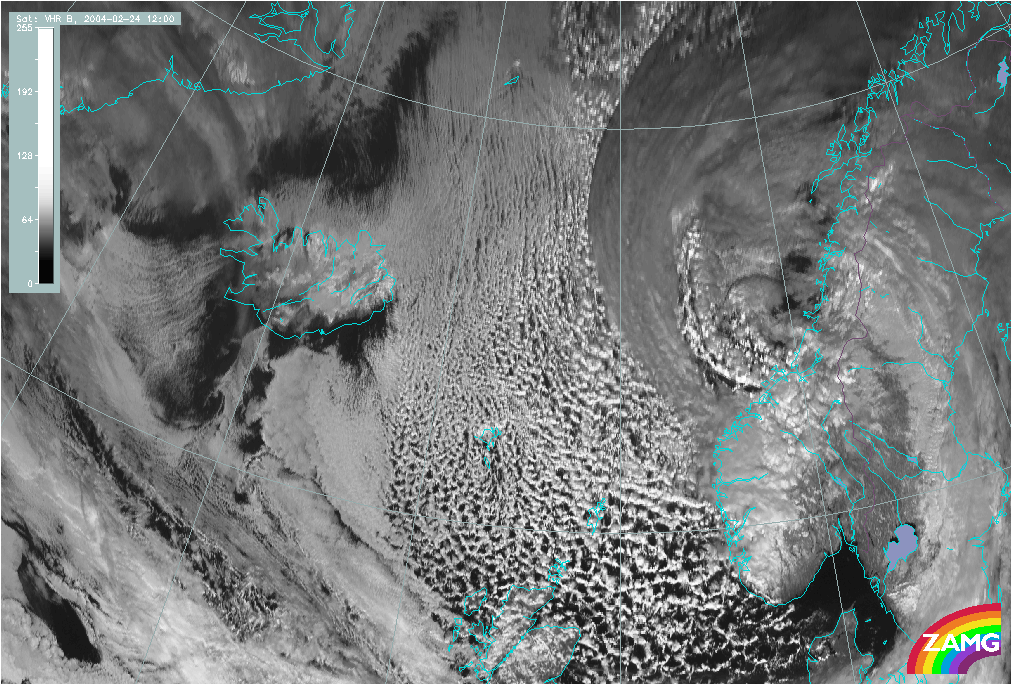
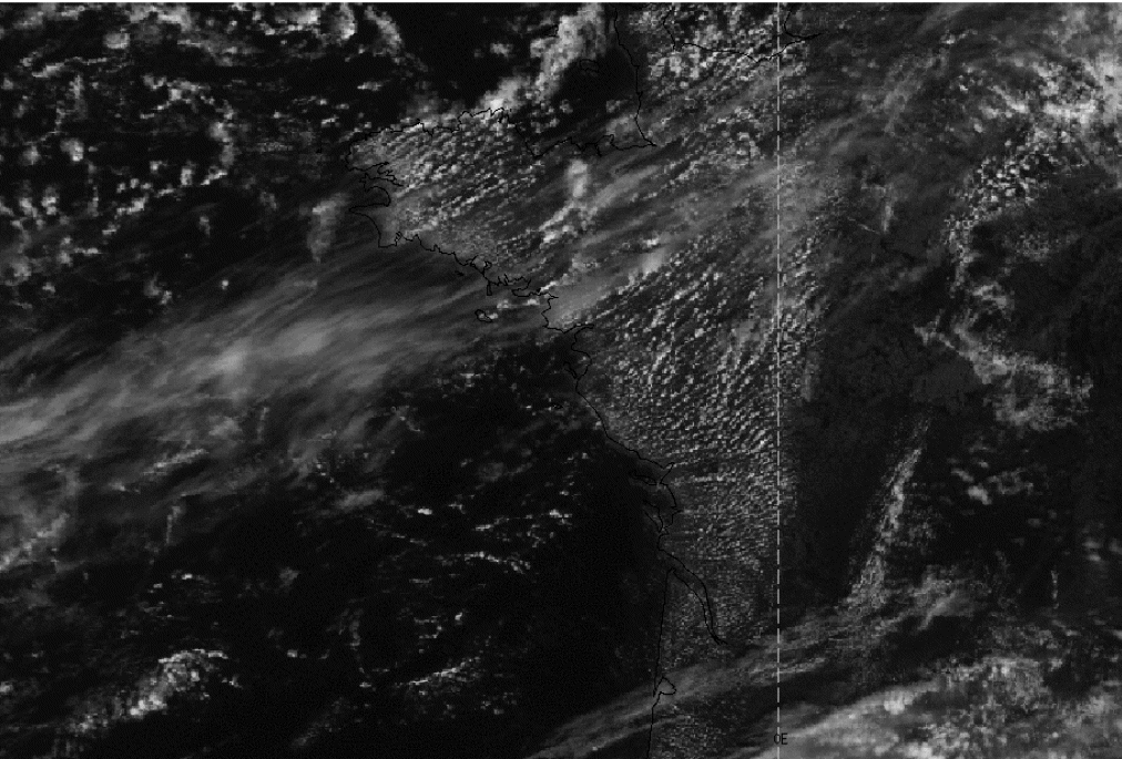
24 February 2004/12.00 UTC - Meteosat Hires VIS image
|
|
|
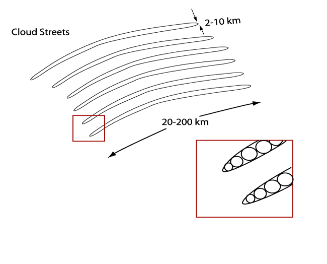
Cloud Streets occur over both water and land surfaces. The satellite image shows several parallel cloudbands with a length of 20-200 km and width of 2-10 km. Especially over the sea, the streets become wider with increasing distance from shore. The cloud bands consist of individual cumuli which are lined up like pearls on a string.
Appearance in Meteosat images:
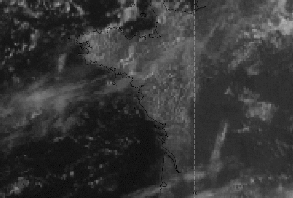
- Cloud Streets can be detected in Meteosat7 VIS imagery, but because of the rather course resolution, the detailed structure isn't easily seen. In Meteosat 7 IR imagery Cloud Streets can't be easily seen because the convection is limited to the lower levels of the troposphere. In Meteosat WV imagery Cloud Streets cannot be seen at all, again because of the latter reason. In Meteosat 8 HiresVIS imagery they can clearly be seen as parallel white cloudbands, because of the better resolution of this new imagery
|
23 August 2004/11.00 UTC - Meteosat VIS
|
23 August 2004/11.00 UTC - Meteosat Hires VIS
|
|

|
|
|
|
23 August 2004/11.00 UTC - NOAA Ch1 image
|
|
The NOAA AVHRR examples above show Cloud Streets over SW France, in Meteosat 7 imagery the indiviual streets cannot be distinguished. In NOAA and Meteosat 8 (HiresVis) imagery, the detailed structure can be observed well.
|
19 February 2004/12.29 UTC - NOAA RGB image
|
|

|