Typical Appearance In Vertical Cross Sections
A cross section of the typical environment for the development of MCSs within the warm sector ahead of a frontal zone is characterised by the following (typical) features:
- The isentropes of equivalent potential temperature show a super adiabatic behaviour at mid-levels of the troposphere. A colder air mass overruns the lower warm air mass, resulting in unstable stratification.
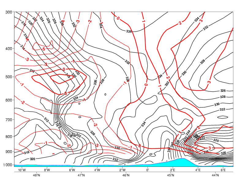
- The vertical distribution of temperature advection is clearly characterised by warm advection at low and mid-levels of the troposphere and cold advection above.
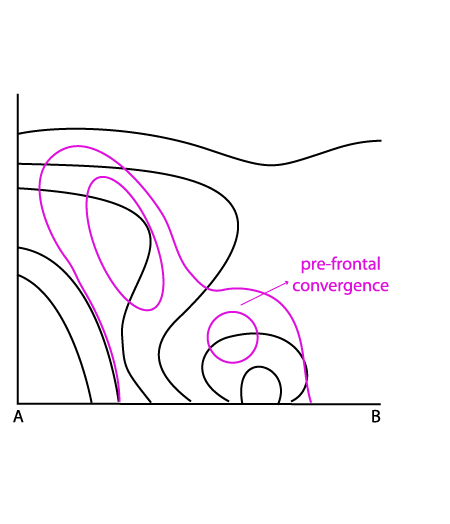
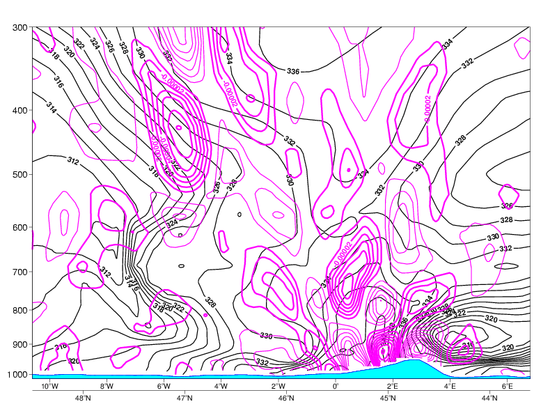
- In the field of divergence, there is typically a convergence maximum at lower levels ahead of the frontal gradient of isentropes.
|
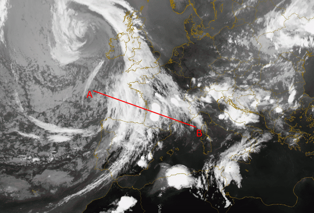
08 August 2004/18.00 UTC - Meteosat 8 IR 10.8 image; position of vertical cross section indicated
|
|
|
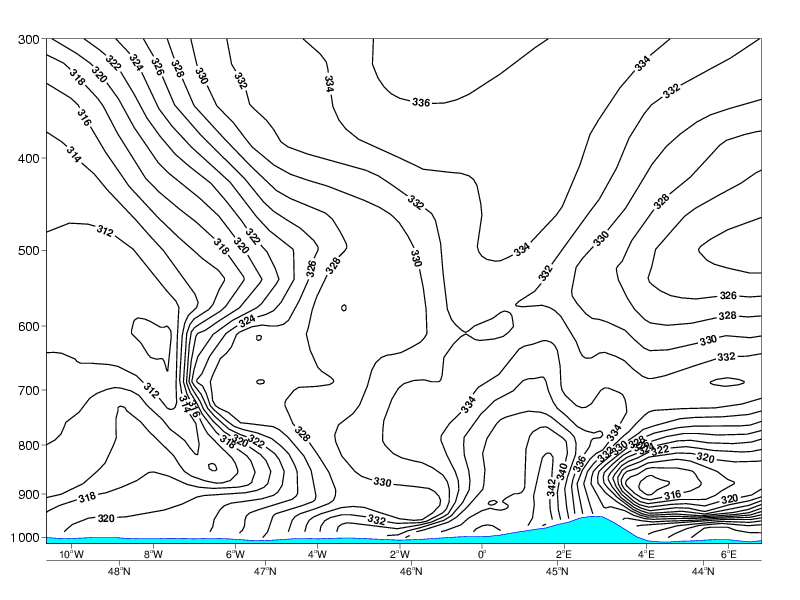
Isentropes
|
|
08 August 2004/18.00 UTC - Vertical cross section; lines: black: isentropes (ThetaE)
|
|
|
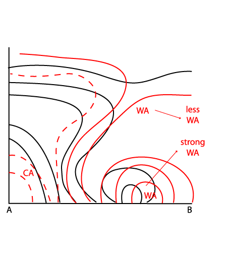
Temperature Advection
|
|
08 August 2004/18.00 UTC - Vertical cross section; lines: black: isentropes (ThetaE), red: temperature advection
|
|
|
Divergence
|
|
08 August 2004/18.00 UTC - Vertical cross section; lines: black: isentropes (ThetaE), magenta thin: divergence/convergence
|
|
|
The diagrams above show a vertical cross section across the frontal cloud band and the MCSs which have developed ahead of it. In the cross
section the MCSs are characterised by an unstable stratification seen ahead of the frontal system around 44N/4E. These unstable stratified
isentropes (decreasing values of equivalent potential temperature with height) reach the lower layers of the troposphere, up to approximately
700 hPa.
WA is associated to the MCSs and will contribute slightly to the upward motions. Not surprising, WA is found ahead and aloft of the Cold Front
in the area of the Warm sector.
In the divergence field a pronounced maxima of convergence can be seen near the surface in the area of the warm sector. Aloft there is divergence causing outflow of air.