Divergence
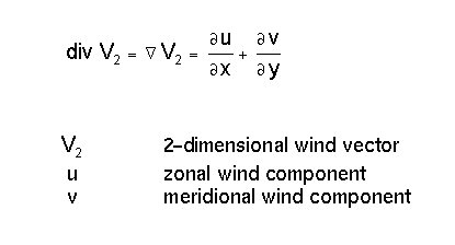
Divergence is a property of the flow field. There is a connection to vertical motion through the Richardson equation:
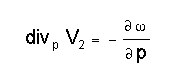
A very simple model describing an ideal situation leads to the following considerations: If there is the assumption of convergence existing at the surface level, upward motion results in the levels above up to the tropopause; at this barrier air cannot rise further and consequently has to diverge there. Therefore a circulation cell is created and cloudiness may develop in the upward motion.
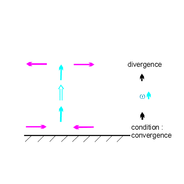
A good example for such a situation is, for instance, frontal cloudiness which can be discused in a test case from 11 February 1997/06.00 UTC.
|
11 February 1997/06.00 UTC - Meteosat IR image; SatRep overlay: names of conceptual models
|
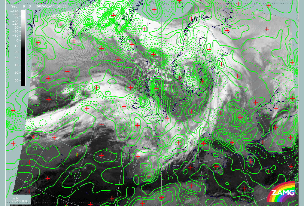
11 February 1997/06.00 UTC - Meteosat IR image; green solid: divergence 1000 hPa, green dashed: convergence 1000 hPa
|
|
|
|
|
|
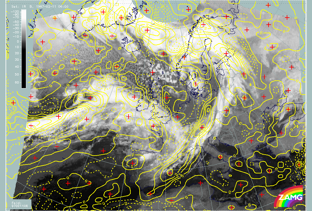
11 February 1997/06.00 UTC - Meteosat IR image; yellow solid: divergence 300 hPa, yellow dashed: convergence 300 hPa
|
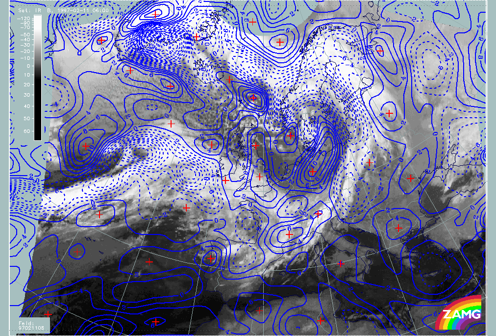
11 February 1997/06.00 UTC - Meteosat IR image; blue dashed: vertical motion (omega) - upward motion 700 hPa, blue solid: vertical motion (omega) - downward motion 700 hPa
|
On the right image top the field of divergence at 1000 hPa is superimposed; on the left image bottom divergence at 300 hPa; dashed lines represent convergence, solid lines divergence. The right image bottom contains upward motion at 700 hPa with the dashed lines representing upward, the solid lines downward motion.
There are several big convergence areas at the surface level representing the lower boundary of the circulation cell; they are connected with the following cloud systems (left image top):
- The Cold Front cloud band named "KF" over the Atlantic;
- The Warm Front cloud band named "WF Band" over the Atlantic and the British Isles containing a double structure;
- The Cold Front cloud band named "KF" reaching from E. Austria to the Baltic states and called further the Central Europe Cold Front;
- The Enhanced Cumuli area named EC(i) over Denmark and south Sweden;
- The sequence of cloud bands and cloud spirals between Greenland and Norway;
- The cloud spiral in an area of Rapid Cyclogenesis (named Rapid Cyclogenesis).
Compared to the divergence field at 300 hPa (left image bottom) representing the upper level of the circulation cell the following results can be summarized: All the cloud systems just mentioned are accompanied by divergence at this high level. So in the frontal areas as well as in the area of the EC, convergence occurs at low levels and divergence at high levels.
The vertical motion field (lower image) completes the ideas of a circulation cell in these areas:
- Both Cold Front zones show distinct rising;
- In the Warm Front cloud shield only the part west of the British Isles undergoes rising while there is sinking in the eastern parts; this will be discussed in more detail below;
- Very intensive rising appears in the main part of the "Rapid Cyclogenesis".
Looking again at the surface level (right image top) several big areas are accompanied by divergence indicated by the solid lines; they are connected with the following cloud systems (left image top):
- The area over Germany and Poland representing the cold air behind the Cold Front which contains only little cloudiness;
- The wide area of cold air cloud cells over the Atlantic north and west of the "Rapid Cyclogensis";
- The easternmost part of the warm front over south-east England and France;
- A big part of the cloud head of the "Rapid Cyclogenesis".
Compared to the 300 hPa level (left image bottom) nearly all areas just mentioned are areas of convergence at high and divergence at low levels. This can be interpreted as a reverse circulation cell with downward motion in the troposphere between these two boundaries.
The vertical motion image (low panel) supports this idea with the solid lines representing downward motion.
- This is in best agreement with the basic concept of downward motion in the cold air streams behind the frontal zones.
- The eastern part of the Warm Front cloudiness over south-east England and France shows a change of cloudiness from this to the next images which show that only high cloudiness is left.
- The situation in the cloud head area of the "Rapid Cyclogensis" cannot be interpreted so easily and needs deeper investigation; maybe for the highest clouds in the cloud head vertical motion at 700 hPa is not representative.
|
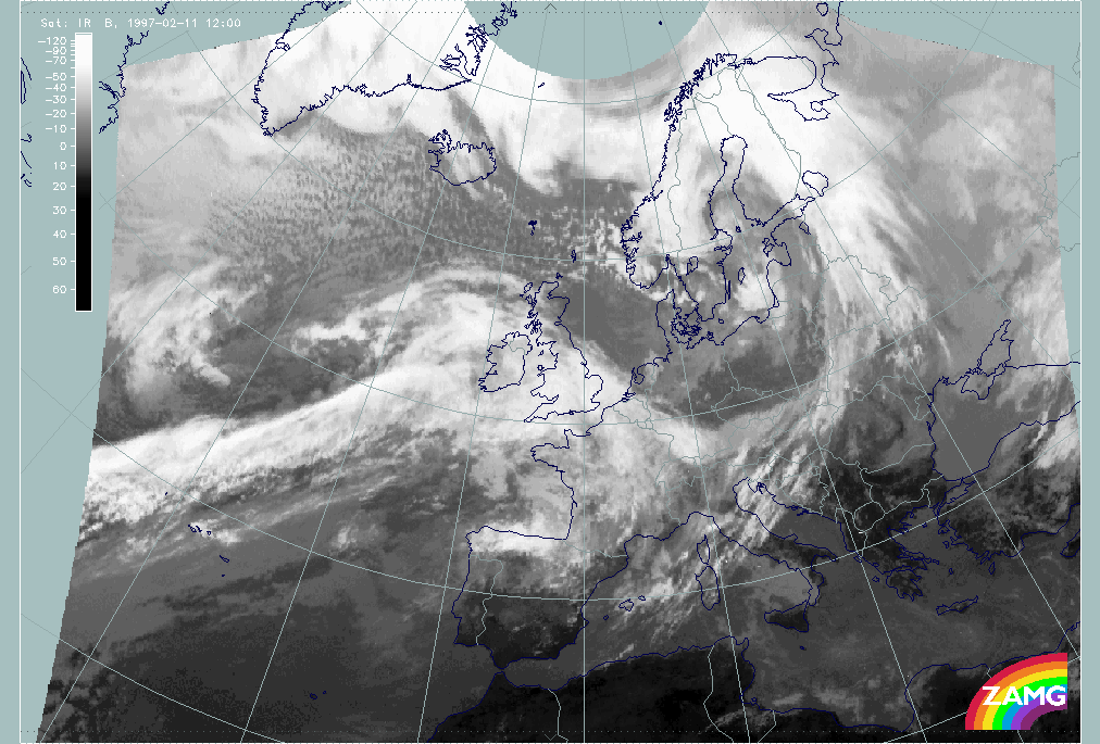
11 February 1997/12.00 UTC - Meteosat IR image
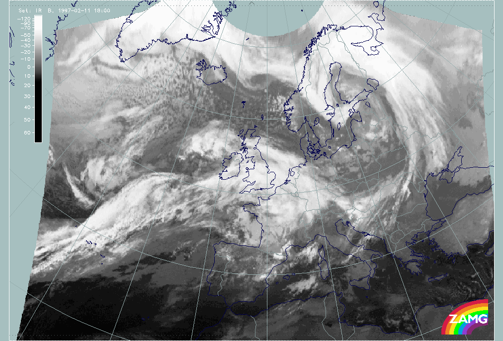
|
11 February 1997/18.00 UTC - Meteosat IR image
|
|
|