Chapter I: Introduction
Table of Contents
- Chapter I: Introduction
- Introduction
Introduction

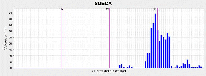
On 23 September 2008 in Spain (more precisely in Valencia and Alicante provinces) records of rainfall intensity were recorded:
- 326 mm in 3 hours, from 14:30 to 17:30 UTC (144 mm in 1 hour!) in Sueca (Valencia)
- 140 mm in less than 30 minutes in Elche (Alicante)
Both of these records were registered in the respective rain gauges, the first one was official, and the second one was registered by a meteorology fan and reported by a weather man from a local radio channel, and also by meteoelche, but it can not be considered as official as the first record.
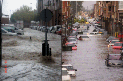
Also involved in the situation some damaging winds and hail (not severe). The event included a non tornadic isolated supercell system (clearly documented by doppler radar signatures and with peaks of reflectivity nearly up to 70 dbZ) that produced flash flooding and damaging winds and a stationary multicelular re-generative small system (the one that produced the highest acumulated precip)
The numerous cells depiciting the convection are well seen over the Iberian Peninsula:
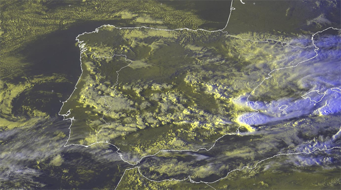
The small system north from the supercell was the one that produced the highest precipitation. Amazingly, The Elche event lasted only about 20 minutes, because the core of the supercell travelled relatively fast.