3. Why does the slanted viewing angle at high latitudes matter?
Optical path refers to the path that light or other electromagnetic radiation takes as it travels from the Earth's surface to a satellite sensor. At high latitudes, this path is longer and more slanted due to the curvature of the Earth and the position of geostationary satellites over the equator (Figure 6). As a result, the signal passes through a thicker layer of the atmosphere, leading to increased attenuation of the signal due to absorption and scattering. Moreover, the longer optical path increases the likelihood of encountering semi-transparent clouds, aerosols, and other atmospheric particles that can distort the signal, leading to difficulties in interpreting the data for critical parameters such as cloud top temperature. This chapter discusses the main phenomena and challenges associated with longer optical paths at high latitudes.
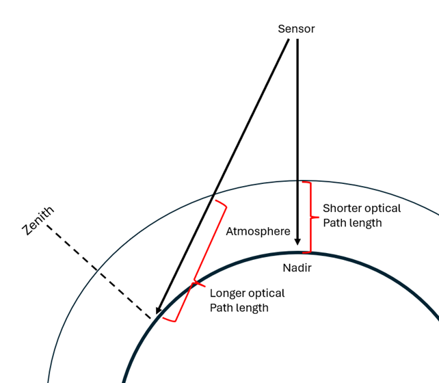
Figure 6: Illustration of the optical path from a GEO-satellite sensor.