Lee Waves
Lee waves are characterized by a periodic change of pressure, temperature and height of an idealized air parcel in an atmospheric air current. Lee waves were discovered in 1933 by German glider pilots. Glider pilots use the upwind area of lee waves to gain height. Other parts of lee clouds such as rotor clouds present a considerable threat for aircraft (areas with severe turbulence). In meteorology a difference is made between two major types of lee waves: trapped lee waves and vertically propagating lee waves.
Trapped And Vertically Propagating Lee Waves
Trapped lee waves have horizontal wavelengths of 5 - 35 km. They are trapped in a layer with high static stability and moderate wind speeds, usually in the lowest 1-5 km of the troposphere. Trapped waves occur when wind speed above the mountain increases sharply with height and when stability decreases in the layer just above the mountain top. As the wave energy is trapped within the stable layer, these waves can propagate far downwind of the mountain crest. The image below shows a schematic of trapped lee waves.
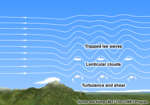
Figure 1: Schematic of clouds related to trapped lee waves. © COMET Program
For vertically propagating waves, the wave energy propagates in the vertically and not horizontally as with trapped waves. They occur when static stability increases above the mountain peak and when the wind speed does not increase significantly with height. They typically extend vertically up to the higher troposphere and are tilted backwards with height towards the mountain chain (figure 2). Due to their greater vertical extension, the wave energy dissipates more rapidly downstream compared to trapped lee waves, which leads to a smaller overall horizontal extension of the wave pattern. Vertically propagating waves are often accompanied by strong downslope winds (e.g. Foehn and Bora) especially when there is a "cloud gap" visible between the mountain chain and the first lee clouds.
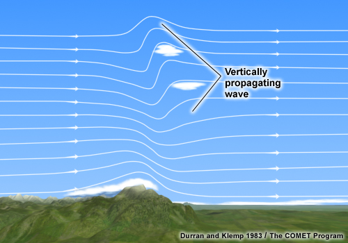
Figure 2: Schematic of clouds related to vertically propagating lee waves. © COMET Program
The Day Microphysical RGB below (figure 3) shows trapped lee waves over southern France, Sardinia and Tunisia (whitish-blue), and vertically propagating lee waves over the Alps (orange-red). While the former consist of water drops, the latter are composed of small ice crystals in higher atmospheric levels. As the ice crystals do not sublimate in the wave trough once they are formed, they remain visible as a homogenous shield of small ice crystals.
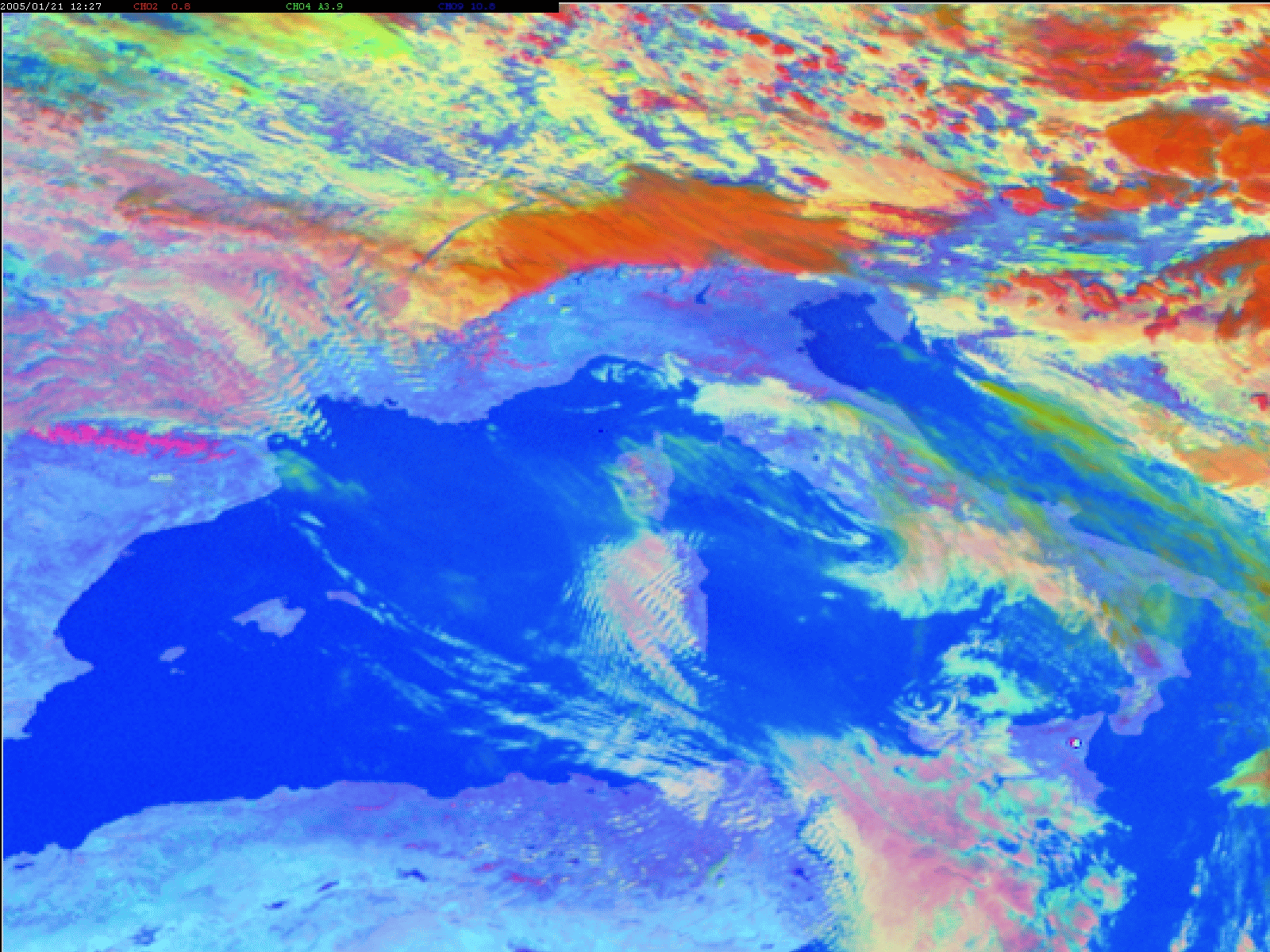
Figure 3: Day Microphysical RGB (MSG) from 21 January, 2005 at 12:00 UTC.