IR and WV Imagery (Meteosat 8 channel 10.8, 6.2, 7.3) and MSLP
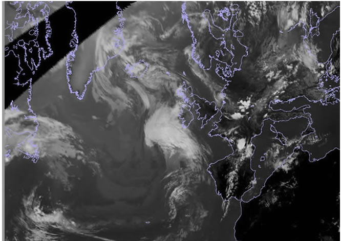
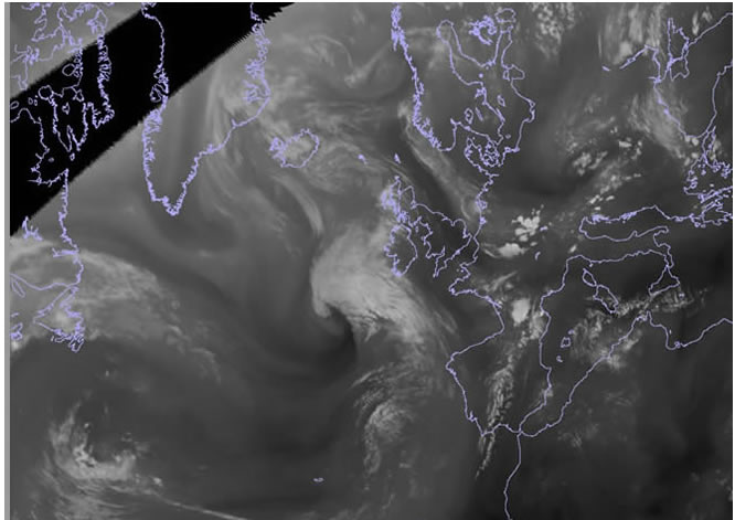
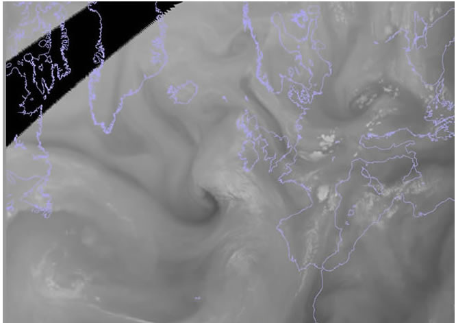
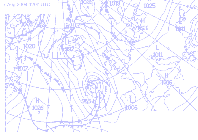
7th August 2004: 12UTC
As the upper trough to the west of ex-hurricane Alex extends and sharpens the depression begins to re-intensify. On all the MSG channels shown here a developing cloud head can be seen and on both water vapour channels a very distinct dark grey shape can be seen to the west of the upper cloud.