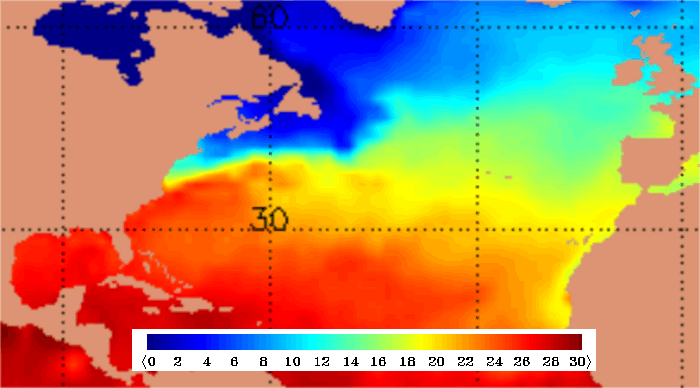
SST Analysis DEG C 20/05/04
|
Hurricanes form over tropical waters (between 8° and 20° latitude) in areas of high humidity, light winds, and warm sea surface temperatures (typically 26.5°C [80°F] or greater). These conditions usually prevail in the summer and early autumn months of the tropical North Atlantic and North Pacific Oceans and for this reason, hurricane "season" in the northern hemisphere runs from June through to November.
The occurrence of un-seasonally high sea temperatures during 2004 meant that Hurricane Alex formed further north and earlier in the year at 30.6N 78.6W, approximately 500 KM east of the Georgian coast and with a central pressure of 1010 hPa.
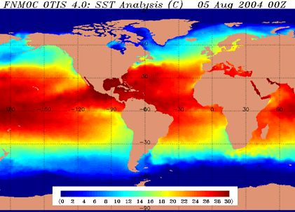
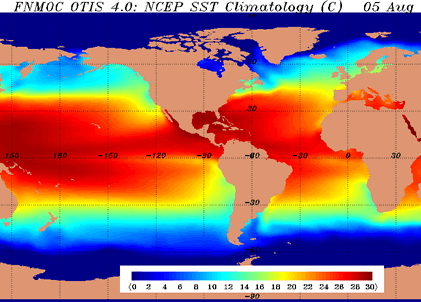
Below is a comparison of the seasonal averages and the sea temperatures for 2004.
Sea Temperature Analysis__________________________Sea Temperature Climatology
The overall changes in sea surface temperatures can be seen in the anomaly chart.
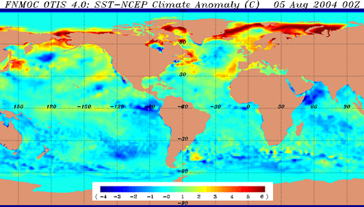
The brighter colours indicate where the sea temperature was above the climatological mean. It is interesting to note that during 2004 the sea temperatures over the western atlantic where hurricane Alex first formed saw sea temperatures up to 5 degrees warmer than the climatological mean.
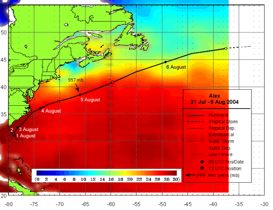
The above image shows an overlay of the track of hurricane Alex. Note how the hurricane moves northeast and keeps to the warm side of the marked temperature gradient in the western Atlantic.