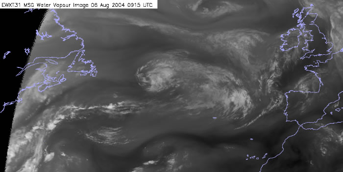
MET0SAT8 Water Vapour 2004/08/06 0915 UTC
As ex-hurricane Alex moved eastwards across the Atlantic, you can observe the cirrus shield has now decayed. The shield of upper cloud is driven southeast and into the right exit region of the jet stream. However the lower level high humidity, warm tropical air continues to move north-eastwards and engages the left exit region of the jet stream.
A large PVA maximum is present in the location of the left exit region of the jet. This maximum is shown in the imagery as a darkening close to the forming depression. As the loop progresses the feature darkens, this darkening in the image signifies that high PV dry stratospheric air is being engaged within the development. As the development increases and high PV air is engaged the subsequent PVA maximum is increased, this further enhances the development as feedback occurs.
Once the tropical air moves into this development zone, rapid deepening occurs as the low level baroclinic zone is engaged.
By the end of the sequence a mature depression is centered to the southwest of Ireland.