Weather Events
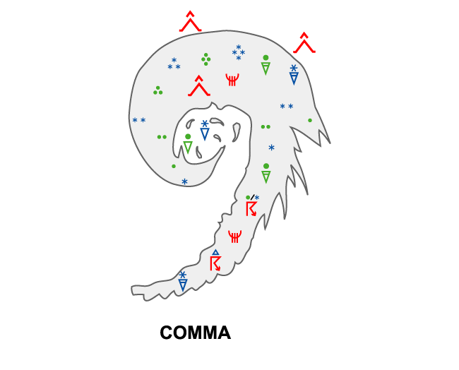
Commas can be split into a head and a tail, whereby the head clouds are layered, with dynamical precipitation and the tail clouds are more convective, with showery precipitation.
| Parameter | Description |
| Precipitation (incl. thunder) |
|
| Temperature |
|
| Wind (incl. gusts) |
|
| Other relevant information |
|
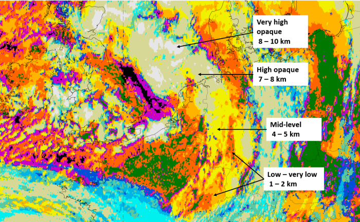
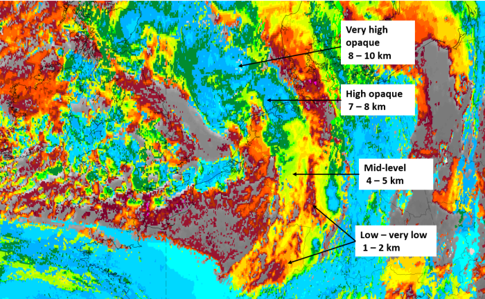
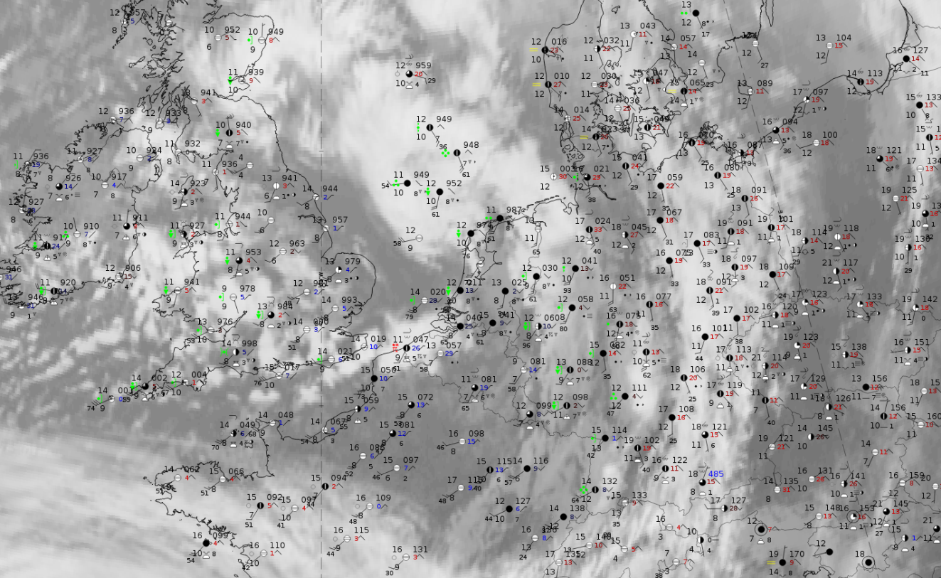
These features are best illustrated using data from 18 October 2019 at 12 UTC, when a huge comma occurred, with its head over the North Sea and its tail extending from the Netherlands into France. The comma head shows with the dark red colour thick ice cloud with a lumpy structure in dark red, while the tail consists mostly of mid-level cloud represented by the ochre colours.
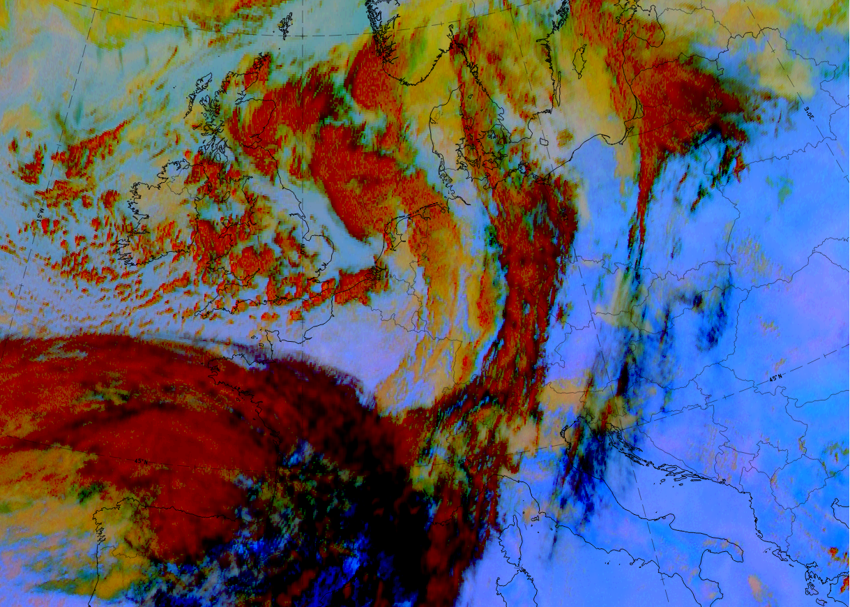
18 October 2019,12 UTC; Dust RGB.
|
|
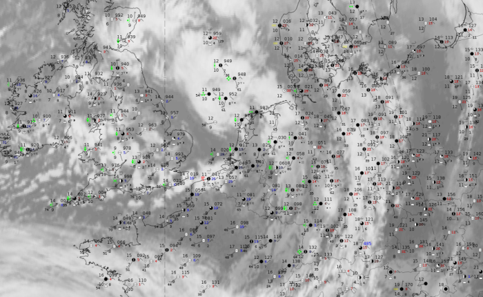
18 October 2019, 12UTC: IR + synoptic measurements (above) + probability of moderate rain (Precipitting clouds PC - NWCSAF).
Note: for a larger SYNOP image click this link.
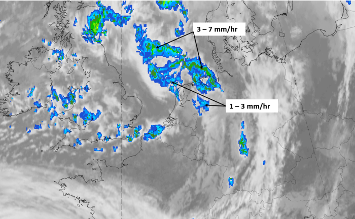
There where wide-spread precipitation reports based on the synoptic measurements, with more intensity in the comma head than in the comma tail. The probabilities of precipitation from the NWCSAF show values of more than 55-65 % represented by orange and red colours in parts of the comma head.
|
|
|
|
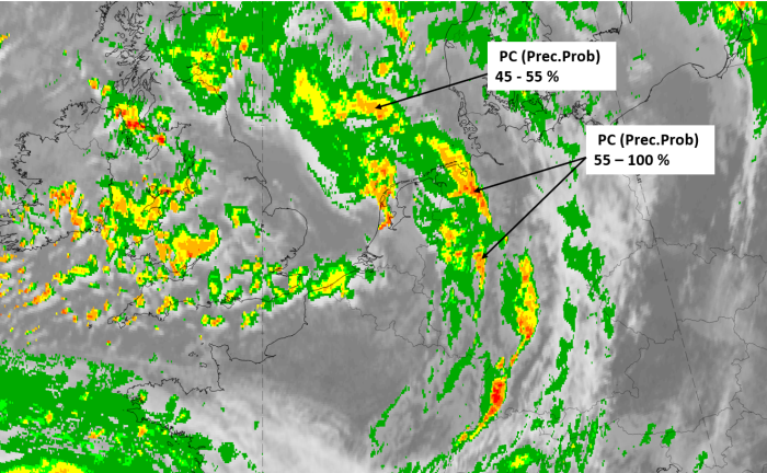
18 October 2019, 12 UTC, IR; superimposed:
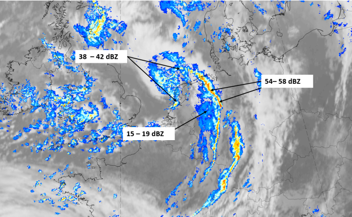
1st row: Cloud Type (CT NWCSAF) (above) + Cloud Top Height (CTTH - NWCSAF) (below); 2nd row: Convective Rainfall Rate (CRR NWCSAF) (above) + Radar intensities from Opera radar system (below).
For identifying values for Cloud type (CT), Cloud type height (CTTH), precipitating clouds (PC), and Opera radar for any pixel in the images look into the legends. (link)