Weather Events
| Parameter | Description |
| Precipitation (incl. thunder) |
|
| Temperature |
|
| Wind (incl. gusts) |
|
| Other relevant information |
|
|
|
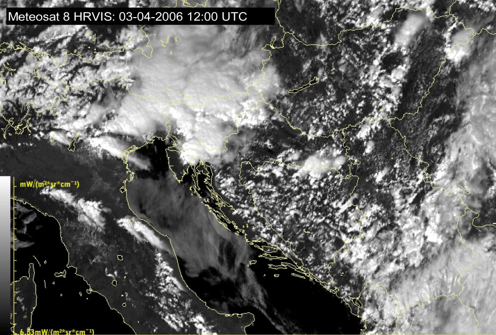
03 April 2006/12.00 UTC - Meteosat 8 HRVIS image
|
03 April 2006/12.00 UTC - Synop observations in the area of interest
|
|

|
|

|
|
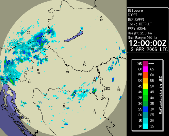
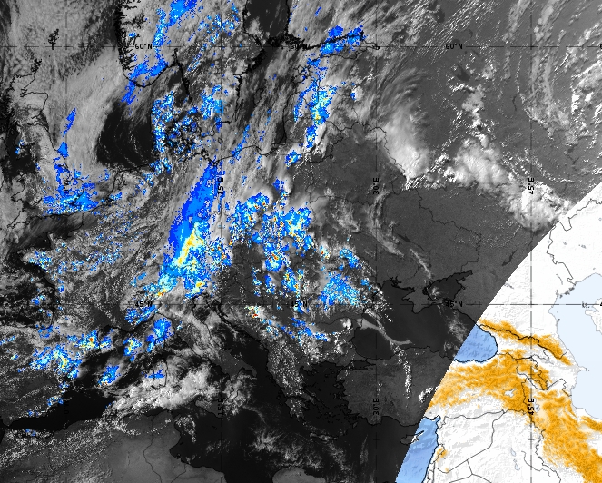
03 April 2006/12.00 UTC - Radar image, reflectivity in dBz
|
03 April 2006/12.00 UTC - Radar image, Rain hourly accumulated precipitation in mm
|
The Sandwich Product combines a high-resolution visible band with a colour-enhanced infrared image. The visible band contributes the "morphology", and hence 3D structure, to the product. The infrared image adds cloud top temperature distribution information (through the colour enhancement) and enables an estimation of the maturity and severity of a storm. Of course, not only convection is colour enhanced, but also any cloud that is cold enough: this could also include the thick cold clouds of a front, or jet stream cirrus clouds. Unfortunately, the Sandwich product is only available during daytime (visible channel), but this disadvantage is relatively small, because most convective activity occurs during the daytime, especially over land.
Sandwich Product from 07 June 2020, 15 UTC
The Convective Rainfall Rate product demonstrates the potential rainfall rate due to convection. This product emphasizes high-ranging buoyancy and shows the highest rainfall rates where the clouds are highest and thickest (strongest updrafts).
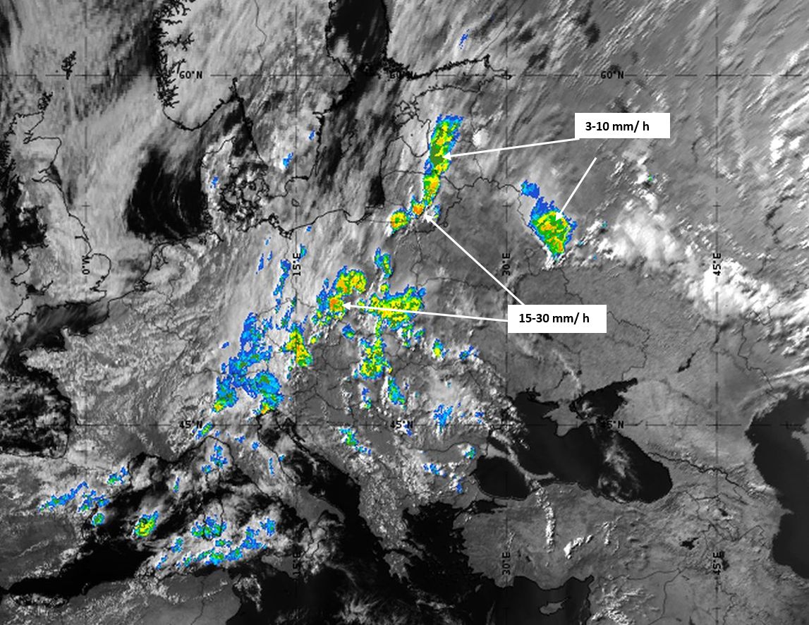
Convective Rainfall Rate from 07 June 2020, 15 UTC
Products that show the cloud optical thickness (Optimal Cloud Analysis (OCA) Cloud Optical Thickness product and Cloud Optical Thickness product) are a useful tool for emphasizing the cellular structure of convective systems.
|
|
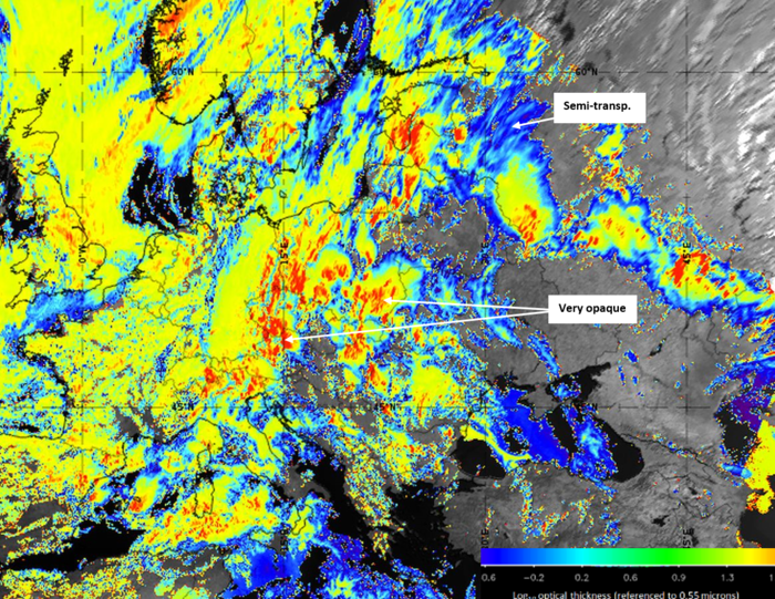
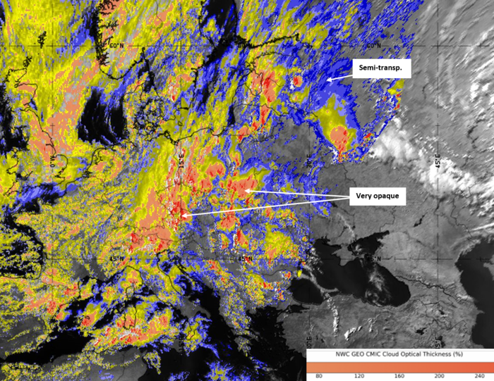
OCA Cloud Optical Thickness product (left) and Cloud Optical Thickness product (right) from 07 June 2020, 15 UTC
The Cloud Top Height product is a good instrument to filter the highest regions and cloud tops within a cluster:
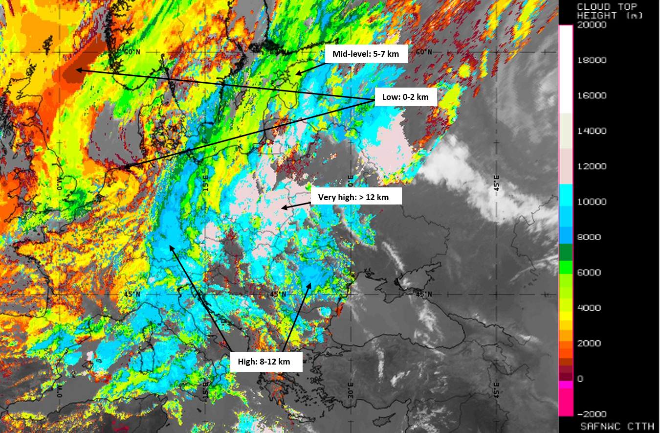
Cloud Top Height product from 07 June 2020, 15 UTC
Opera Radar Observation from 07 June 2020, 15 UTC
The actual radar scan measurement shows high reflectivity values where clouds are opaque and dense and where the Convective Rainfall Rate product shows strong signals.