Cloud Structure In Satellite Images
Arctic Fronts form in the Arctic region, and move southwards. When they reach northern Europe, they have usually travelled over an open sea, and convective clouds have developed. The appearance of an Arctic Cold Fronts is, then, essentially the same as that of a shallow Cold Front.
Arctic Cold Fronts are usually so far north that Meteosat images alone are inadequate to recognize them. Moreover, the following conceptual models may look like Arctic Cold Fronts: polar Cold Front, Polar Low and Comma. The final check is best made using a loop of AVHRR images with the help of numerical model parameter fields.
Appearance in the basic channels:
- light grey to white band in IR and VIS images
- light grey to grey band in WV images
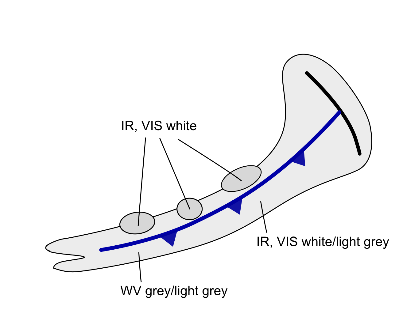
|
Appearance in the basic RGBs:
For this kind of front the rear side of the cloud band is of particular interest.
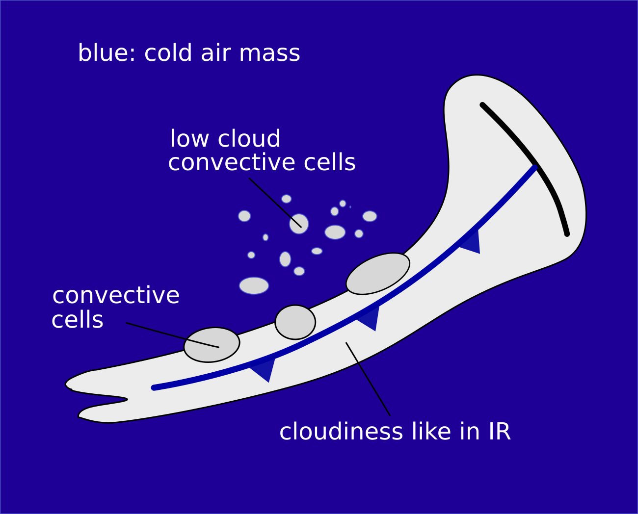
Airmass RGB:
At the rear side of an Arctic Front, arctic cold air protrudes southward. Consequently, most of the cases show dark blue colours. Occasionally dark brown colours also occur, indicating very dry air.
The cloud band itself appears very similar to that in the IR image.
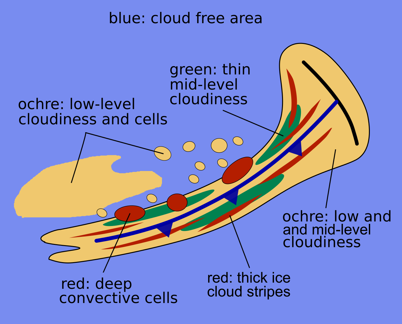
Dust RGB:
At the rear side of an arctic front, green and yellowish colours predominate. The yellowish colours represent extended low water cloud and the green colours represent semi-transparent mid-level cloud.
Dark red colours indicate areas with thick ice cloud; they mostly appear as small lines above ochre colours, which indicate the lower cloud. There is quite often no visible boundary between the low cloud of the frontal band and the low cloud at the rear.
 |
 |
Legend: basic RGBs schematics. Left: Airmass RGB; right: Dust RGB.
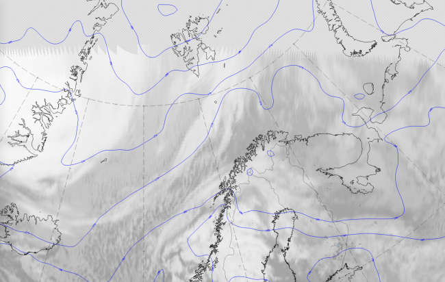
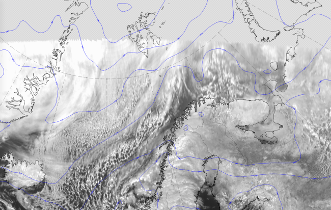
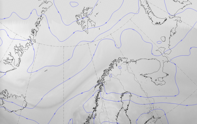
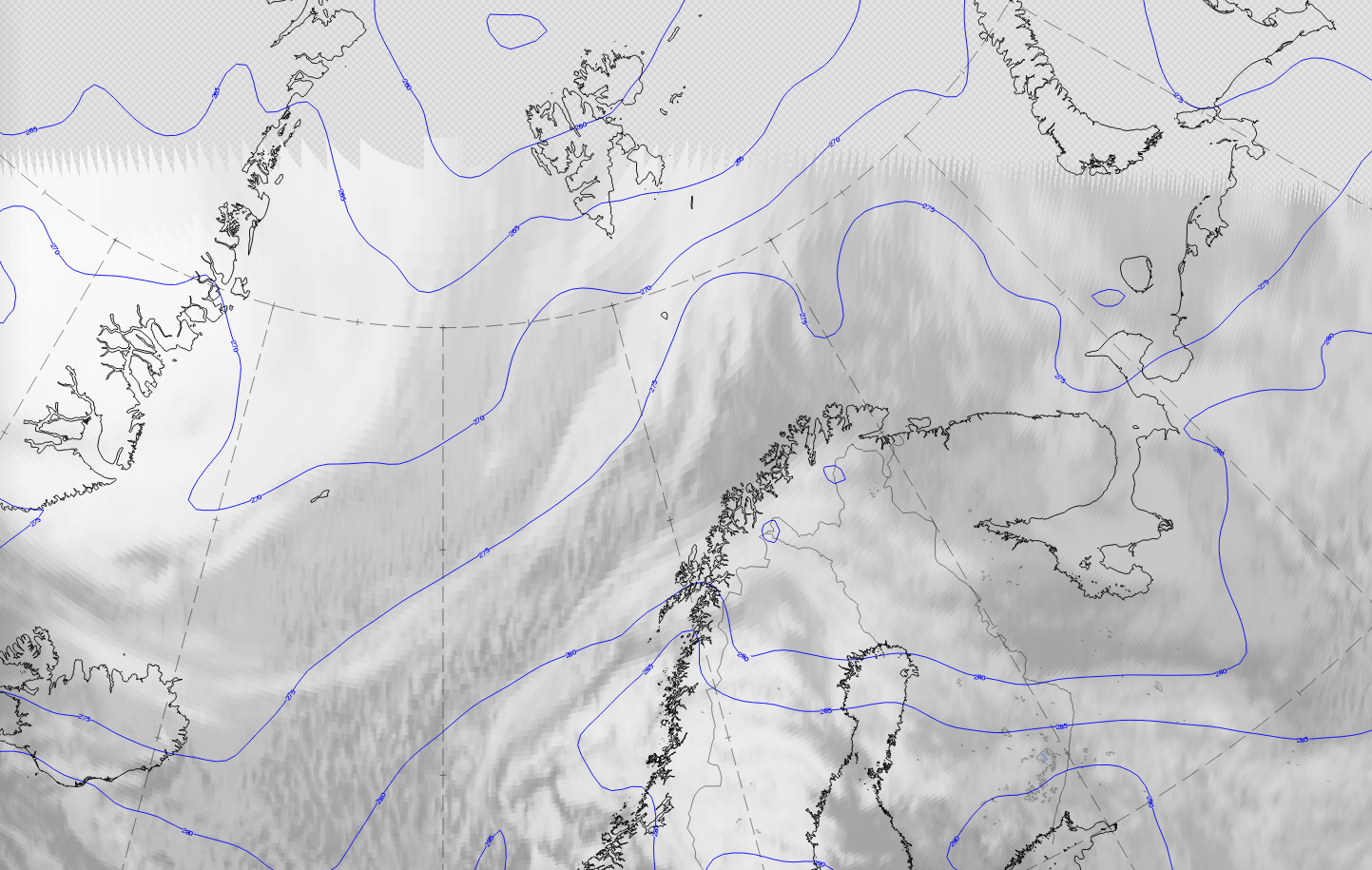
The case from 2 April 2020 at 12 UTC is a good example of an Arctic front at the leading side of a polar cold air outbreak. Such a polar outbreak is a very important condition for an Arctic cold front, so isolines of equivalent potential temperature (Theta E) at 850 hPa are superimposed as blue lines. The cloud band of the Arctic front is in front of a cold air trough with its centre north of Svalbard extending across the Arctic ocean south-westward to about 70 N.
|
|
|
|
Legend:
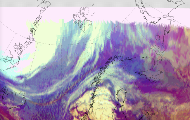
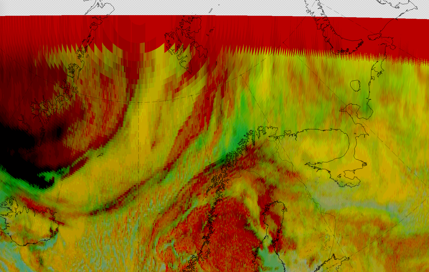
2 April 2020, 12UTC: 1st row: IR (above) + HRV (below); 2nd row: WV (above) + Airmass RGB (below); 3rd row: Dust RGB + image gallery.
*Note: click on the image to access the image gallery (navigate using arrows on keyboard)
| IR | Grey colours with a dark grey area behind. This is typical for mid-level cloud. |
| HRV | Dark grey colours, partly translucent. |
| WV | Broad dark grey area. |
| Airmass RGB | Blue colours in front of and behind the cloud band. This represents cold air. |
| Dust RGB | Dark red cyclonically curved band, partly fibrous. This reflects the areas with higher ice cloud. In front of and behind the cold front band, ochre and green colours prevail. The ochre represents the mid-level cloud, the green represents translucent mid-level clouds. |